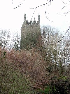
Old Kea is a hamlet in Cornwall, England, United Kingdom. It is situated on the west bank of the Truro River approximately two miles (3 km) south of Truro.

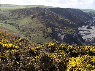
Crackington Haven is a coastal village in Cornwall, England, United Kingdom. It is in the civil parish of St Gennys at grid reference SX140972 at the head of a cove on the Atlantic coast. The village is seven miles (11 km) south-southwest of Bude and four miles (7 km) north-northeast of Boscastle.

Lanreath is a civil parish and a village in southeast Cornwall, England, United Kingdom. The village is situated five miles (8 km) west-northwest of Looe. The name Lanreath means 'church (Lann) of Raydhogh' and it has been known variously as Lanreythow, Lanrathew, or Lanrethou. The village is mentioned in the Domesday Book as Lanredoch.

Tregony, sometimes in the past Tregoney, is a village and former civil parish, now in the parish of Tregony with Cuby, in Cornwall, England, United Kingdom. It lies on the River Fal. In the village there is a post office, shop, a sports and social club and two churches. Tregony has bus links to the nearest city, Truro. Cornelly parish was united with Tregony in 1934. On 1 April 2021 the parish was abolished and merged with Cuby to form "Tregony with Cuby". Tregony was once a port, but clay mining upriver in St Austell has caused the river to become silted over. The population was 768 in 2011 with nearly 15% claiming Cornish identity.

St Mabyn is a civil parish and village in Cornwall, England, United Kingdom. The village is situated three miles (5 km) east of Wadebridge. The parish includes a hamlet called Longstone to the east and many small manor houses, including Tregarden, Tredethy, Helligan Barton and Colquite, all built in the 16th and 17th centuries. The area of the parish is 4,101 acres (16.60 km2).

Marhamchurch is a civil parish and village in north Cornwall, England, United Kingdom.

Polyphant, recorded as Polefant c. 1170, is a village in east Cornwall, England, United Kingdom. It is north of the civil parish of Lewannick, five miles (8 km) west of the town of Launceston near the convergence of the River Inny and Penpont Water.

Treverbyn is a civil parish and village in mid-Cornwall, England, United Kingdom.

Whitstone is a village and civil parish in east Cornwall, United Kingdom. It is roughly halfway between the towns of Bude and Launceston. The population at the 2011 census was 590.
Philleigh is a civil parish and village in Cornwall, England, in the United Kingdom; one of the four in the Roseland Peninsula.

St Veep is a civil parish in Cornwall, England, United Kingdom, situated above the east bank of the River Fowey about three miles (5 km) south-east of Lostwithiel. It is bordered by the parishes of St Winnow to the north-west, Boconnoc to the north, Lanreath to the east Polperro to the south-east and Lanteglos to the south. The River Fowey forms its western boundary. The parish is named after Saint Veep of whom little is known.

Sithney is a village and civil parish in West Cornwall, England, United Kingdom. Sithney is north of Porthleven. The population including Boscadjack and Crowntown at the 2011 census was 841.

St Juliot is a civil parish in north-east Cornwall, England, United Kingdom. The parish is entirely rural and the settlements within it are the hamlets of Beeny and Tresparrett. - plus a part of the adjacent village of Marshgate. The parish population at the 2011 census was 328.
Tregardock is a coastal hamlet and beach in the civil parish of Delabole in north Cornwall, England, United Kingdom. It is situated between Trebarwith Strand and Port Gaverne. The small beach is accessed by climbing down the cliffs near the settlement of Tregardock.

St Martin-by-Looe is a coastal civil parish in south Cornwall, England, United Kingdom. The parish is immediately east of the town and parish of Looe, seven miles (11 km) south of Liskeard. The parish is in the Liskeard Registration District and the population in the 2001 census was 321, which had increased to 429 at the 2011 census.

Trewint is a hamlet in the civil parish of Altarnun, east Cornwall, England, UK. Trewint is on the A30 main road west of the village of Altarnun. Trewint Downs, part of Bodmin Moor, are further west.
Cold Northcott is a hamlet in Cornwall, England, UK. It is on the A395 road two miles southeast of Hallworthy. It is in the civil parish of St Clether.
Downinney is a hamlet in the civil parish of Warbstow, Cornwall, England. Downinney was recorded in the Domesday Book, 1086: there was land for 12 ploughs with 40 households. There was pasture of one square league and its value was reduced to 40 shillings per year.

Trenance is a hamlet adjoining Mawgan Porth in Cornwall, England, United Kingdom. Trenance Point is a headland nearby.
