Killona is a census-designated place (CDP) in St. Charles Parish, Louisiana, United States. The population was 724 in 2020. On December 14, 2022, the town was hit by a destructive and deadly EF2 tornado that damaged or destroyed numerous structures, killed one person, and injured eight others.
Montz is a census-designated place (CDP) in St. Charles Parish, Louisiana, United States. It first appeared in the 2000 census with a population of 1,120. The 2020 census indicates a population of 2,106.

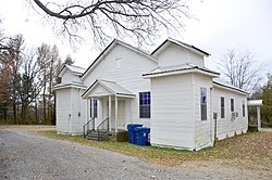
Taft is a census-designated place (CDP) in St. Charles Parish, Louisiana, United States, located on the west bank of the Mississippi River.

Falcon is a town in Quitman County, Mississippi. The population was 116 at the 2020 census.

Sledge is a town located in Quitman County, Mississippi, United States. As of the 2020 census, the town had a total population of 368.
Mississippi State is a census-designated place in Oktibbeha County, Mississippi, United States. It is the official designated name for the area encompassing Mississippi State University, which lies partly in the nearby incorporated municipality of Starkville. The population at the 2020 census was 4,968.

Triumph is an unincorporated community and census-designated place in Plaquemines Parish, Louisiana, United States. It is located on the south bank of the Mississippi River. As of the 2020 census, its population was 268.
St. James is a census-designated place in St. James Parish, Louisiana, United States on the west bank of the Mississippi River. It is part of the New Orleans Metropolitan Area. Its population was 828 as of the 2010 census.

Modest Town is a census-designated place (CDP) in Accomack County, Virginia, United States. Per the 2020 census, the population was 120.

Farrell is an unincorporated community and census-designated place in Coahoma County, Mississippi, United States. Per the 2020 census, the population was 200. Farrell is located approximately 4 miles (6 km) south of Stovall and 4 miles (6 km) north of Sherard on Mississippi Highway 1. It is approximately 9 miles (14 km) northwest of Clarksdale, the county seat.

White Oak is a census-designated place located on Mississippi Highway 4 in Tunica County, Mississippi. White Oak is approximately 2 miles (3.2 km) east of Evansville and approximately 8 miles (13 km) west of Savage. The population at the 2020 census was 692.
Lemannville is an unincorporated community and census-designated place in Ascension and St. James parishes, Louisiana, United States. It was first listed as a CDP in the 2010 Census. Per the 2020 census, the population was 695.
Morgantown is a census-designated place (CDP) in Adams County, Mississippi, United States, located to the northeast of the city of Natchez. As of the 2020 census, it had a population of 1,334.
Cloverdale is a census-designated place (CDP) in Adams County, Mississippi, United States, located to the south of the city of Natchez. As of the 2020 census, it had a population of 557.
Beechwood is a census-designated place (CDP) in Warren County, Mississippi, United States. The population was 3,469 at the 2020 census.
Mississippi Valley State University is a census-designated place in Leflore County, Mississippi, United States. The population at the 2020 census was 805. It is the location of Mississippi Valley State University and is adjacent to Itta Bena.
Arnold Line is an unincorporated area and census-designated place (CDP) in Lamar County, Mississippi, United States. As of the 2020 census it had a population of 2,333. It is part of the Hattiesburg Metropolitan Statistical Area.
Union is an unincorporated community and census-designated place in St. James Parish, Louisiana, United States. The community is located along Louisiana Highway 44 on the east bank of the Mississippi River.
Cleary is an unincorporated community and census-designated place in Rankin County, Mississippi, United States. Per the 2020 census, the population was 1,688.
Robinhood is an unincorporated community and census-designated place in Rankin County, Mississippi, United States. Per the 2020 census, the population was 1,491.