Dedrick | |
|---|---|
| Coordinates: 40°51′46″N123°02′12″W / 40.86278°N 123.03667°W | |
| Country | United States |
| State | California |
| County | Trinity |
| Elevation | 2,526 ft (770 m) |
| GNIS feature ID | 1655959 [1] |
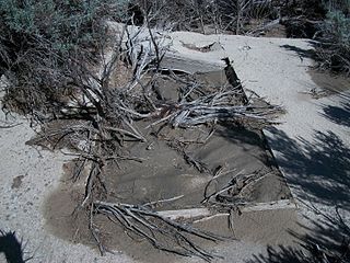
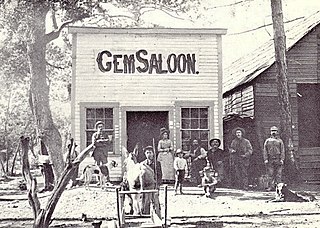
Dedrick is a ghost town in Trinity County, California. [1] [2]
Dedrick | |
|---|---|
| Coordinates: 40°51′46″N123°02′12″W / 40.86278°N 123.03667°W | |
| Country | United States |
| State | California |
| County | Trinity |
| Elevation | 2,526 ft (770 m) |
| GNIS feature ID | 1655959 [1] |
Dedrick is a ghost town in Trinity County, California. [1] [2]
Dedrick had a post office from 1891 to 1941. [3]
The Globe Mine near Dedrick was in operation from 1890 until 1918. The mine, reported as being among the highest in the state, was located at about 7000 feet and used a two mile long aerial tramway and a 20-stamp mill. [4] In 1912, it was reported that one hundred men were on the payroll. [5]
In 1903, Dedrick was referred to as a mining camp with the Chloride-Bailey mine in operation along with Dibble's Saloon. [6]
A historical marker was erected in 1994 by Leonard Morris Family and E Clampus Vitus, Trinitarianus Chapter #62. [7]

Bodie is a ghost town in the Bodie Hills east of the Sierra Nevada mountain range in Mono County, California, United States. It is about 75 miles (121 km) southeast of Lake Tahoe, and 12 mi (19 km) east-southeast of Bridgeport, at an elevation of 8,379 feet (2554 m). Bodie became a boom town in 1876 after the discovery of a profitable vein of gold; by 1879 it had established 2,000 structures with a population of roughly 8,000 people.

Cherokee is an unincorporated community and census-designated place in Butte County, California. It is an area inhabited by Maidu Indians prior to the gold rush, but that takes its name from a band of Cherokee prospectors who perfected a mining claim on the site. The population was 69 at the 2010 census. It lies at an elevation of 1306 feet.

New Almaden, known in Spanish as Nueva Almadén, is a historic community and former mercury mine in the Capitancillos Hills of San Jose, California, located at the southwestern point of Almaden Valley in South San Jose. New Almaden is divided into two parts: the mines and much of their immediate surroundings, including historic ghost town settlements in the Capintancillas, which together form the Almaden Quicksilver County Park, and the largely residential historic district surrounding the Casa Grande.

Silver Peak is an unincorporated community and census-designated place (CDP) in Esmeralda County, Nevada, United States. It lies along State Route 265, 20 miles (32 km) south of U.S. Route 6 and 30 miles (48 km) west of Goldfield, the county seat of Esmeralda County. It has a post office, with the ZIP code of 89047. The population of Silver Peak was 142 as of 2019.
Belleville, Nevada, in Mineral County, Nevada, United States, was a mining town that rose up around the milling of ore shipped in from nearby mines. Today it is a ghost town.
Blair, Nevada is a mining ghost town in Esmeralda County, Nevada.

Cleator, formerly Turkey Creek or Turkey, is a near ghost town and small community in Yavapai County, Arizona, in the Southwestern United States.

Bodie is a ghost town in Okanogan County, Washington, United States.

Manganese is a ghost town and former mining community in the U.S. state of Minnesota that was inhabited between 1912 and 1960. It was built in Crow Wing County on the Cuyuna Iron Range in sections 23 and 28 of Wolford Township, about 2 miles (3 km) north of Trommald, Minnesota. After its formal dissolution, Manganese was absorbed by Wolford Township; the former town site is located between Coles Lake and Flynn Lake. First appearing in the U.S. Census of 1920 with an already dwindling population of 183, the village was abandoned by 1960.
Maybert was a mining town in Nevada County, California. It was located on the south side of the South Yuba River, about 6 miles east of the town of Washington, at an elevation of 3,245 ft (989 m). Fall Creek empties into the South Yuba slightly to the northwest of the town site.
Grub Gulch is a former settlement in Madera County, California. The town's name was earned by its lucky reputation that prospectors could count on panning enough gold to "grubstake themselves into better times." It was located 10.5 miles (17 km) northeast of Raymond on present day Road 600.
Poeville, also known as Peavine until 1863, is the site of a historical mining town, established in 1864. John Poe, a professional promoter from Michigan allegedly related to Edgar Allan Poe, discovered rich gold and silver veins in 1862 on the slopes of Peavine Mountain. After the discovery of ore, Poe announced that the veins comprised the next Comstock Lode; he presented extracted ore at the state fair of 1864 as rich in content. As a result, the former mining camp, called Poe City (Poeville) or Podunk (Poedunk), grew to 200 people by 1864. Ore production in the mining district and population peaked around 1873-1874 with several hundred people living in town, supported by three hotels and a post office. The post office, named "Poeville", operated between September 1, 1874, and March 24, 1878. As of 2010 the population of the community is 0.

Peerless is a ghost town in Carbon County, Utah, United States. It is located just 3 miles (4.8 km) west of Helper.
Mooney Flat was an important mining and transportation hub in western Nevada County, California, just east of the Yuba County line. It was situated on modern Mooney Flat Road, about 1 mile north of modern Highway 20, at an elevation of about 800 ft.

The Mineral Park mine is a large open pit copper mine located in the Cerbat Mountains 14 miles northwest of Kingman, Arizona, in the southwestern United States. A 2013 report said that Mineral Park has an estimated reserves of 389 million tonnes of ore grading 0.14% copper and 31 million oz of silver.
Eagleville is a former populated place in Mineral County, Nevada, that is now a ghost town.

Manchester was a mining town in the Los Burros Mining District in the southern Big Sur region of Monterey County, California from about 1875 to 1895. The town was reached by a 20 miles (32 km) road from King City to Jolon. From Jolon travelers could ride or take a stage or wagon to the Wagon Caves, followed by a difficult 14 miles (23 km) trail over the steep Santa Lucia Mountains to the site, about 4 miles (6.4 km) inland of Cape San Martin. Prospecting began in the area in the 1850s.

Berwind is a ghost town in Las Animas County, Colorado, nestled in Berwind Canyon 3.1 miles (5.0 km) southwest of Ludlow and 15 miles (24 km) northwest of Trinidad. The settlement was founded in 1888 as a company town for the Colorado Coal & Iron Company and, from 1892, was operated by the Colorado Fuel & Iron Company. It was a battle site in October 1913 and April 1914 during the Colorado Coalfield War, housing a Colorado National Guard encampment during the latter stages of the conflict.

Ludwig, Nevada is a ghost town in Lyon County, Nevada, United States. Mining for gypsum at the site resumed in 2013.