Deer Creek, Illinois

Last updated
Deer Creek
Woodford County Illinois Incorporated and Unincorporated areas Deer Creek Highlighted.svg
Location of Deer Creek in Woodford County, Illinois.
Illinois in United States (US48).svg
Location of Illinois in the United States
Coordinates: 40°37′45″N89°19′54″W / 40.62917°N 89.33167°W / 40.62917; -89.33167 Coordinates: 40°37′45″N89°19′54″W / 40.62917°N 89.33167°W / 40.62917; -89.33167 [1]
CountryUnited States
StateIllinois
County Tazewell
Area
[2]
  Total0.55 sq mi (1.41 km2)
  Land0.54 sq mi (1.39 km2)
  Water0.01 sq mi (0.03 km2)
Elevation
[1]
758 ft (231 m)
Population
 (2020)
  Total667
  Density1,246.73/sq mi (481.56/km2)
Time zone UTC-6 (CST)
  Summer (DST) UTC-5 (CDT)
ZIP Code(s)
61733
Area code 309
FIPS code 17-18940
GNIS feature ID2398702 [1]
Wikimedia CommonsDeer Creek, Illinois
Website deercreekillinois.org

Deer Creek is a village in Tazewell and Woodford counties in the U.S. state of Illinois. The population was 667 at the 2020 census. Deer Creek is part of the Peoria, Illinois Metropolitan Statistical Area.

Contents

History

Deer Creek was founded in 1830. [3] Deer Creek received its name from the creek that ran through the northwest part of the village and the red deer that roamed the woods and came to the creek for water. [3] In the late 1830s, Abraham Chaffer started the first business in Deer Creek at Chaffer's Corner, which was located in the center of Deer Creek Township. [3] The location of Deer Creek has moved three times since 1830, from Chaffer's Corner to New Castle, from New Castle to Belmont, and from Belmont to the present site of Village of Deer Creek. [3]

Government

The Village of Deer Creek is governed by the Village President and Board of Trustees. [4]

Elected Village Board Members: [4]

Geography

According to the 2010 census, Deer Creek has a total area of 0.569 square miles (1.47 km2), of which 0.56 square miles (1.45 km2) (or 98.42%) is land and 0.009 square miles (0.02 km2) (or 1.58%) is water. [5]

Demographics

Historical population
CensusPop.Note
1890 125
1900 298138.4%
1910 33211.4%
1920 3443.6%
1930 290−15.7%
1940 46961.7%
1950 5016.8%
1960 58316.4%
1970 64711.0%
1980 6886.3%
1990 630−8.4%
2000 605−4.0%
2010 70416.4%
2020 667−5.3%
U.S. Decennial Census [6]

As of the census [7] of 2010, there were 704 people, 294 households, and 193 families residing in the village. [8] The population density was 1,924.2 inhabitants per square mile (742.9/km2). There were 243 housing units at an average density of 772.8 per square mile (298.4/km2). The racial makeup of the village was 98.84% White, 0.50% Asian, 0.17% from other races, and 0.50% from two or more races. Hispanic or Latino of any race were 0.17% of the population.

There were 227 households, out of which 37.0% had children under the age of 18 living with them, 62.1% were married couples living together, 7.9% had a female householder with no husband present, and 26.9% were non-families. 21.6% of all households were made up of individuals, and 7.9% had someone living alone who was 65 years of age or older. The average household size was 2.67 and the average family size was 3.13.

In the village, the population was spread out, with 27.8% under the age of 18, 8.4% from 18 to 24, 30.4% from 25 to 44, 21.3% from 45 to 64, and 12.1% who were 65 years of age or older. The median age was 35 years. For every 100 females, there were 105.8 males. For every 100 females age 18 and over, there were 106.1 males.

The median income for a household in the village was $38,542, and the median income for a family was $43,750. Males had a median income of $31,985 versus $25,278 for females. The per capita income for the village was $17,578. About 6.6% of families and 5.5% of the population were below the poverty line, including 8.3% of those under age 18 and 3.9% of those age 65 or over.

Schools

Notable person

Related Research Articles

<span class="mw-page-title-main">Tazewell County, Illinois</span> County in Illinois, United States

Tazewell County is a county in the U.S. state of Illinois. According to the 2010 census, it had a population of 135,394. Its county seat and largest city is Pekin. It is pronounced with a short "a", to rhyme with "razz" rather than "raze."

<span class="mw-page-title-main">Blackshear, Georgia</span> City in Georgia, United States

The city of Blackshear is the county seat of Pierce County, Georgia, United States. As of the 2020 census, the city had a population of 3,506.

<span class="mw-page-title-main">Deer Park, Illinois</span> Village in Illinois, United States

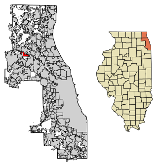
Deer Park is a village in Lake and Cook Counties, Illinois. Per the 2020 census, the population was 3,681. The village is one of the few left in the Chicago area that enjoy a green belt which is bordered by two large natural areas providing outdoor recreation and open space. The village is home to popular shopping and dining destinations: Deer Park Town Center and the Town Center Promenade. The town is also home to the Vehe Farm, an Illinois Centennial Farm.

<span class="mw-page-title-main">Mackinaw, Illinois</span> Village in Illinois, United States

Mackinaw is a village in Tazewell County, Illinois, United States, and is part of the Peoria, Illinois Metropolitan Statistical Area. Its population was 1,950 at the 2010 census. Local businesses include Area 52 Paintball, and Mackinaw Valley Vineyard. The Mack-Ca-Fest Farm Days Festival is held each June in the village.

<span class="mw-page-title-main">Rockton, Illinois</span> Village in Illinois, United States

Rockton is a village in Winnebago County, Illinois. It is located in the Rock River Valley and is part of the Rockford metropolitan area. The population was 7,685 at the time of the 2010 census, up from 5,296 at the time of the 2000 census.

<span class="mw-page-title-main">Roscoe, Illinois</span> Village in Illinois, United States

Roscoe is a village in Winnebago County, Illinois, along the Rock River. It is in a suburban area of the Rockford, Illinois Metropolitan Statistical Area. As of the 2010 census, the village population was 10,785, up from 6,244 at the 2000 census. The area has been undergoing a period of rapid growth. There have been numerous border disputes with its neighbor to the west, Rockton, Illinois, and development and annexations continue by both villages. Recent growth has included the Promontory Ridge and Hidden Creek custom home subdivisions east of the Illinois Tollway, I-39/I-90.

<span class="mw-page-title-main">Mackinaw Township, Michigan</span> Civil township in Michigan, United States

Mackinaw Township is a civil township of Cheboygan County in the U.S. state of Michigan. The population was 539 at the 2010 census.

<span class="mw-page-title-main">Alanson, Michigan</span> Village in Michigan, United States

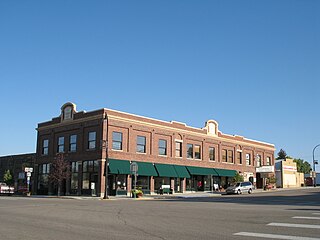
Alanson is a village in Emmet County in the U.S. state of Michigan. The population was 778 at the 2020 census.

<span class="mw-page-title-main">Bear Creek Township, Michigan</span> Civil township in Michigan, United States

Bear Creek Township is a civil township of Emmet County in the U.S. state of Michigan. As of the 2020 census, the township population was 6,542, making it the most populous municipality in Emmet County.

<span class="mw-page-title-main">Wawatam Township, Michigan</span> Civil township in Michigan, United States

Wawatam Township is a civil township of Emmet County in the U.S. state of Michigan. As of the 2010 census, the township population was 661.

<span class="mw-page-title-main">Deer Creek Township, Otter Tail County, Minnesota</span> Township in Minnesota, United States

Deer Creek Township is a township in Otter Tail County, Minnesota, United States. The population was 348 at the 2000 census.

<span class="mw-page-title-main">Sterling, Nebraska</span> Village in Nebraska, United States

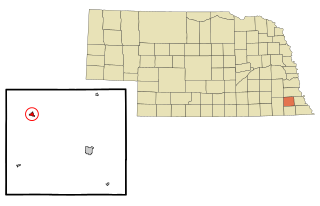
Sterling is a village in Johnson County, Nebraska, United States. The population was 482 at the 2020 census.

<span class="mw-page-title-main">Rock Creek, Ohio</span> Village in Ohio, United States

Rock Creek is a village in Ashtabula County, Ohio, United States. The population was 667 at the 2020 census. It is part of the Ashtabula micropolitan area, 45 miles (72 km) northeast of Cleveland.

<span class="mw-page-title-main">Summitville, Ohio</span> Village in Ohio, United States

Summitville is a village in southwestern Columbiana County, Ohio, United States. The population was 110 at the 2020 census. It is part of the Salem micropolitan area, 27 miles (43 km) miles southeast of Canton and 32 miles (51 km) southwest of Youngstown.

<span class="mw-page-title-main">Deer Creek, Oklahoma</span> Town in Oklahoma, United States

Deer Creek is a town in Grant County, Oklahoma, United States. The population was 130 at the 2010 census, an 11.6 percent decrease from the figure of 147 in 2000. It was named for a nearby stream, which is a tributary of the Salt Fork of the Arkansas River.

<span class="mw-page-title-main">Tarentum, Pennsylvania</span> Borough in Pennsylvania, United States

Tarentum is a borough in Allegheny County in the U.S. state of Pennsylvania. It is 22 miles (35 km) northeast of Downtown Pittsburgh, along the Allegheny River. Tarentum was an industrial center where plate glass and bottles were manufactured; bricks, lumber, steel and iron novelties, steel billets and sheets, sack and wrapping paper were also produced.

<span class="mw-page-title-main">Deer Creek, Outagamie County, Wisconsin</span> Town in Wisconsin, United States

Deer Creek is a town in Outagamie County, Wisconsin, United States. The population was 682 at the 2000 census. Area of the village is 35.5 sq mi

<span class="mw-page-title-main">Glenrock, Wyoming</span> Town in Wyoming, United States

Glenrock is a town in Converse County, Wyoming, United States. The population was 2,576 at the 2010 census.

<span class="mw-page-title-main">Mackinaw City, Michigan</span> Village in Michigan, United States

Mackinaw City is a village at the northernmost point of the Lower Peninsula of Michigan. Divided between Cheboygan and Emmet counties, Mackinaw City is the located at the southern end of the Mackinac Bridge, which carries Interstate 75 over the Straits of Mackinac to the Upper Peninsula. Mackinaw City, along with St. Ignace, serves as an access point to Mackinac Island. For these reasons, Mackinaw City is considered one of Michigan's most popular tourist attractions.

<span class="mw-page-title-main">Deerfield Township, Livingston County, Michigan</span> Civil township in Michigan, United States

Deerfield Township is a civil township of Livingston County in the U.S. state of Michigan. The population was 4,170 at the 2010 census.

References

  1. 1 2 3 U.S. Geological Survey Geographic Names Information System: Deer Creek, Illinois
  2. "2020 U.S. Gazetteer Files". United States Census Bureau. Retrieved March 15, 2022.
  3. 1 2 3 4 "History". Welcome to the Village of Deer Creek. Retrieved 2019-03-26.
  4. 1 2 "Government". Welcome to the Village of Deer Creek. Retrieved 2019-03-26.
  5. "G001 - Geographic Identifiers - 2010 Census Summary File 1". United States Census Bureau. Archived from the original on 2020-02-13. Retrieved 2015-08-02.
  6. "Census of Population and Housing". Census.gov. Retrieved June 4, 2015.
  7. "U.S. Census website". United States Census Bureau . Retrieved 2008-01-31.
  8. "US Census 2010 data". USA.com. Retrieved 2013-10-26.
  9. 1 2 3 "School page". www.mackinawillinois.org. Archived from the original on 2018-05-08. Retrieved 2019-03-25.
  10. "DEER CREEK MACKINAW DISTRICT 701". mackinawillinois.org. Archived from the original on 2018-05-08. Retrieved 2013-10-26.
  11. "Summary Bibliography: Wilson Tucker". www.isfdb.org. Retrieved 2019-03-26.