El Paso, Illinois

Last updated

El Paso, Illinois
El Paso Illinois Post Office.JPG
El Paso Post Office
Woodford County Illinois Incorporated and Unincorporated areas El Paso Highlighted.svg
Location in Woodford County, Illinois
Usa edcp location map.svg
Red pog.svg
Chenoa
Location in the United States
Coordinates: 40°44′26″N89°01′06″W / 40.74056°N 89.01833°W / 40.74056; -89.01833
CountryUnited States
StateIllinois
Counties Woodford, McLean
Townships El Paso, Gridley
Government
  MayorJW Price
Area
[1]
  Total2.15 sq mi (5.56 km2)
  Land2.15 sq mi (5.56 km2)
  Water0.00 sq mi (0.00 km2)
Elevation
[2]
748 ft (228 m)
Population
 (2020) [3]
  Total2,756
  Density1,284.85/sq mi (496.04/km2)
Time zone UTC-6 (CST)
  Summer (DST) UTC-5 (CDT)
ZIP code
61738
Area code 309
FIPS code 17-23737
FIPS code 17-23737
GNIS ID2394632 [2]
Wikimedia CommonsEl Paso, Illinois
Website www.elpasoil.org

El Paso is a city in Woodford and McLean counties in the U.S. state of Illinois. The population was 2,756 at the 2020 census. [3] The Woodford County portion of El Paso is part of the Peoria Metropolitan Statistical Area.

Contents

El Paso is a small community in central Illinois that took on more characteristics of a highway community after the construction of Interstate 39, which supplanted the older alignment of U.S. Highway 51.[ citation needed ]

History

El Paso was founded by George Gibson and James Wathen. Gibson gave it the Spanish name El Paso, either after El Paso, Texas, [4] or because of a nearby railroad junction. [5]

Geography

El Paso is located in southeastern Woodford County at 40°44′20″N89°0′58″W / 40.73889°N 89.01611°W / 40.73889; -89.01611 (40.738800, -89.016034). [6] A small portion of the city limits extends east along U.S. Route 24 into northern McLean County. US 24 leads east 15 miles (24 km) to Interstate 55 in Chenoa and west 32 miles (51 km) to Peoria. Interstate 39 crosses the west side of El Paso, with access from Exit 14 (US 24); the Interstate highway leads south 14 miles (23 km) to Interstate 55 in Normal and north 45 miles (72 km) to La Salle. Illinois Route 251 follows the former alignment of U.S. Route 51 through the center of El Paso, leading north 11 miles (18 km) to Minonk and south 5 miles (8 km) to Kappa.

According to the U.S. Census Bureau, El Paso has a total area of 2.15 square miles (5.57 km2), all land. [1] The city sits on high ground that drains north to the East Branch of Panther Creek and south to the headwaters of Wolf Creek. Both creek systems are south-flowing tributaries of the Mackinaw River and part of the Illinois River watershed.

Demographics

Historical population
CensusPop.Note
1860 890
1870 1,56475.7%
1880 1,390−11.1%
1890 1,353−2.7%
1900 1,4416.5%
1910 1,4702.0%
1920 1,63811.4%
1930 1,578−3.7%
1940 1,6212.7%
1950 1,81812.2%
1960 1,9648.0%
1970 2,29116.6%
1980 2,67616.8%
1990 2,499−6.6%
2000 2,6957.8%
2010 2,8104.3%
2020 2,756−1.9%
U.S. Decennial Census [7]

As of the 2000 United States Census, [8] there were 2,695 people, 980 households, and 686 families residing in the city. The population density was 1,743.9 inhabitants per square mile (673.3/km2). There were 1,022 housing units at an average density of 661.3 per square mile (255.3/km2). The racial makeup of the city was 98.89% White, 0.15% African American, 0.15% Native American, 0.22% Asian, 0.22% from other races, and 0.37% from two or more races. Hispanic or Latino of any race were 0.71% of the population.

There were 980 households, out of which 35.9% had children under the age of 18 living with them, 57.9% were married couples living together, 8.6% had a female householder with no husband present, and 29.9% were non-families. 25.2% of all households were made up of individuals, and 13.1% had someone living alone who was 65 years of age or older. The average household size was 2.58 and the average family size was 3.12.

In the city, the population was spread out, with 26.6% under the age of 18, 8.6% from 18 to 24, 28.7% from 25 to 44, 19.8% from 45 to 64, and 16.3% who were 65 years of age or older. The median age was 36 years. For every 100 females, there were 92.1 males. For every 100 females age 18 and over, there were 87.7 males.

The median income for a household in the city was $47,745, and the median income for a family was $55,286. Males had a median income of $36,406 versus $25,174 for females. The per capita income for the city was $21,730. About 1.6% of families and 3.2% of the population were below the poverty line, including 2.1% of those under age 18 and 6.6% of those age 65 or over.

Culture

El Paso Public Library El Paso Public Library from southeast.jpg
El Paso Public Library

Attractions

Notable people

Education

El Paso's school district, CUSD #11, [15] is the product of a consolidation with the school district of Gridley, IL. CUSD #11's schools are split between El Paso and Gridley: [16]

Related Research Articles

<span class="mw-page-title-main">Woodford County, Illinois</span> County in Illinois, United States

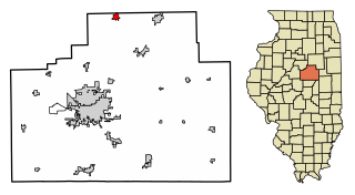
Woodford County is a county located in the state of Illinois. The 2020 United States Census listed its population at 38,467. Its county seat is Eureka. Woodford County is part of the Peoria, IL, Metropolitan Statistical Area. Its name comes from General William Woodford, an officer of the American Revolutionary War who served at the brutal military encampment at Valley Forge, Pennsylvania.

<span class="mw-page-title-main">Peoria County, Illinois</span> County in Illinois, United States

Peoria County is located in the U.S. state of Illinois. The 2020 United States Census listed its population at 181,830. Its county seat is Peoria. Peoria County is part of the Peoria, IL Metropolitan Statistical Area.

<span class="mw-page-title-main">McLean County, Illinois</span> County in Illinois, United States

McLean County is the largest county by land area in the U.S. state of Illinois. According to the 2020 Census, it had a population of 170,954. Its county seat is Bloomington. McLean County is included in the Bloomington–Normal, IL Metropolitan Statistical Area.

<span class="mw-page-title-main">Fulton, Arkansas</span> Town in Arkansas, United States

Fulton is a town in Hempstead County, Arkansas, United States. The population was 201 at the 2010 census. It is part of the Hope Micropolitan Statistical Area. The community is named after steamboat inventor Robert Fulton.

<span class="mw-page-title-main">Cuba, Illinois</span> City in Illinois, United States

Cuba is a city in Fulton County, Illinois, United States. The population was 1,184 at the 2020 census.

<span class="mw-page-title-main">Farmington, Illinois</span> City in Illinois, United States

Farmington is a city in Fulton County & Peoria County, Illinois, United States. It is north of Canton, west of Peoria, southeast of Galesburg, and northeast of Macomb. The population was 2,389 at the 2020 census. The public school system is Farmington Central Community Unit School District 265, which includes Farmington Central High School. Because it is in Fulton County & Peoria County, it is a part of the Canton Micropolitan Area and the wider Peoria Consolidated Statistical Area.

<span class="mw-page-title-main">London Mills, Illinois</span> Village in Illinois, United States

London Mills is a village in Fulton and Knox counties in the U.S. state of Illinois. The population was 350 at the 2020 census.

<span class="mw-page-title-main">Elkville, Illinois</span> Village in Illinois, United States

Elkville is a village in Jackson County, Illinois, United States. The population was 928 at the 2010 census, down from 1,001 at the 2000 census. As of 2018 the estimated population was 871.

<span class="mw-page-title-main">Abingdon, Illinois</span> City in Illinois, United States

Abingdon is a city in Knox County, Illinois, United States, 50 miles (80 km) west of Peoria. It is part of the Galesburg Micropolitan Statistical Area. The city was first settled in 1828 and was incorporated in 1857. In june of 1907, the patent for the common spring-loaded mousetrap was awarded to William Hooker William Armstrong and Knox Mark of Abingdon. The population was 3,319 at the 2010 census, down from 3,612 at the 2000 census.

<span class="mw-page-title-main">Forrest, Illinois</span> Village in Illinois, United States

Forrest is a village in Livingston County, Illinois, United States. The population was 1,220 at the 2010 census.

<span class="mw-page-title-main">Benld, Illinois</span> City in Illinois, United States

Benld is a city in Macoupin County, Illinois, United States. The population was 1,464 at the 2020 census, down from 1,556 in 2010. It is located in the Metro-East portion of the Greater St. Louis metropolitan area.

<span class="mw-page-title-main">Maryville, Illinois</span> Village in Illinois, United States

Maryville is a village in Madison County, Illinois, United States. The population was 8,221 at the 2020 census, up from 7,487 in 2010.

<span class="mw-page-title-main">Henry, Illinois</span> City in Illinois, United States

Henry is a city in Marshall County, Illinois, United States. The population was 2,320 at the 2020 census. It is part of the Peoria Metropolitan Statistical Area.

<span class="mw-page-title-main">Washburn, Illinois</span> Village in Illinois, United States

Washburn is a village mostly in Woodford County, with a small northerly portion in Marshall County, Illinois, United States. The population was 1,032 at the 2020 census. It is part of the Peoria Metropolitan Statistical Area.

<span class="mw-page-title-main">Gridley, Illinois</span> Village in Illinois, United States

Gridley is a village in McLean County, Illinois, United States. The population was 1,456 at the 2020 census. It is part of the Bloomington–Normal Metropolitan Statistical Area.

<span class="mw-page-title-main">Farmersville, Illinois</span> Village in Illinois, United States

Farmersville is a village in Montgomery County, Illinois, United States. The population was 689 at the 2020 census.

<span class="mw-page-title-main">Raymond, Illinois</span> Village in Illinois, United States

Raymond is a village in Montgomery County, Illinois, United States. The population was 949 at the 2020 census.

<span class="mw-page-title-main">O'Fallon, Illinois</span> City in Illinois, United States

O'Fallon is a city in St. Clair County, Illinois, United States. The 2020 census listed the population at 32,289. The city is the second largest city in the Metro East region of the St. Louis metropolitan area and Southern Illinois. It sits 5 miles (8.0 km) from Scott Air Force Base and 18 miles (29 km) from Downtown St. Louis.

<span class="mw-page-title-main">Panola, Illinois</span> Village in Illinois, United States

Panola is a village in Woodford County, Illinois, United States. The population was 45 at the 2010 census. It is part of the Peoria, Illinois Metropolitan Statistical Area.

<span class="mw-page-title-main">Secor, Illinois</span> Village in Illinois, United States

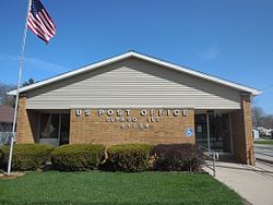
Secor is a village in Clayton Township, Woodford County, Illinois, United States. The population was 373 at the 2010 census. It is part of the Peoria, Illinois Metropolitan Statistical Area. Secor is located just off U.S. Route 24 between El Paso and Eureka.

References

  1. 1 2 "2022 U.S. Gazetteer Files: Illinois". United States Census Bureau. Retrieved March 7, 2023.
  2. 1 2 U.S. Geological Survey Geographic Names Information System: El Paso, Illinois
  3. 1 2 "P1. Race – El Paso city, Illinois: 2020 DEC Redistricting Data (PL 94-171)". U.S. Census Bureau. Retrieved March 7, 2023.
  4. Illinois Central Magazine. Illinois Central Railroad Company. 1922. p. 43.
  5. Gannett, Henry (1905). The Origin of Certain Place Names in the United States. Govt. Print. Off. p. 118.
  6. "US Gazetteer files: 2010, 2000, and 1990". United States Census Bureau. February 12, 2011. Retrieved April 23, 2011.
  7. "Census of Population and Housing". Census.gov. Retrieved June 4, 2015.
  8. "U.S. Census website". United States Census Bureau . Retrieved January 31, 2008.
  9. "El Paso Public Library - National Register of Historic Places Registration Form" (PDF). June 29, 1994. Archived from the original (PDF) on October 5, 2016. Retrieved October 4, 2016.
  10. Vlahos, Nick. "Two museums tell the tale of Archbishop Fulton J. Sheen" . Retrieved October 4, 2016.
  11. "El Paso Golf Club - Home Page". www.elpasogolfclub.com. Retrieved October 4, 2016.
  12. "George 'Chick' Evans Bio". Northern Illinois University . Retrieved March 5, 2020.
  13. Patricia A. Kossmann, "Remembering Fulton Sheen," America: The National Catholic Review, Dec. 6, 2004.
  14. 'Illinois Blue Book 1933-1934,' Biographical Sketch of Clifford J. Vogelsang, pg. 194-195, 219
  15. "El Paso - Gridley CUSD #11". www.unit11.org. Retrieved October 4, 2016.
  16. "District Information". www.unit11.org. Retrieved May 18, 2022.