Shirley, Illinois | |
|---|---|
 Shirley  Shirley | |
| Coordinates: 40°24′27″N89°03′51″W / 40.40750°N 89.06417°W [1] | |
| Country | United States |
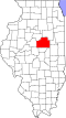
| State | Illinois |
| County | McLean |
| Township | Dale |
| Founded | 1854 |
| Area | |
• Total | 0.09 sq mi (0.23 km2) |
| • Land | 0.09 sq mi (0.23 km2) |
| • Water | 0.0 sq mi (0 km2) |
| Elevation | 768 ft (234 m) |
| Population (2020) [3] | |
• Total | 135 |
| • Density | 1,500/sq mi (580/km2) |
| Time zone | UTC-6 (CST) |
| • Summer (DST) | UTC-5 (CDT) |
| ZIP Code | 61772 |
| Area code | 309 |
| GNIS ID | 2804092 [1] |
| FIPS code | 17-69628 |
Shirley is an unincorporated community and census-designated place (CDP) in southwestern McLean County, Illinois, United States, just off Interstate 55. It was founded in 1854. As of the 2020 census, the population of the CDP was 135. [3] Shirley is home to the Funk Prairie Home & Rock Museum.