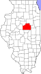
Lexington, Illinois

Last updated

Lexington
Flag of Lexington, Illinois.png
Seal of Lexington, Illinois.png
Logo of Lexington, Illinois.png
McLean County Illinois Incorporated and Unincorporated areas Lexington Highlighted.svg
Location of Lexington in McLean County, Illinois.
Illinois in United States (US48).svg
Location of Illinois in the United States
Coordinates: 40°38′49″N88°47′03″W / 40.64694°N 88.78417°W / 40.64694; -88.78417 [1]
CountryUnited States
StateIllinois
County McLean
Townships Lexington, Money Creek
Government
  MayorSpencer Johansen
Area
[2]
  Total2.05 sq mi (5.30 km2)
  Land2.05 sq mi (5.30 km2)
  Water0.00 sq mi (0.00 km2)
Elevation
[1]
748 ft (228 m)
Population
 (2020)
  Total2,090
  Density1,021.01/sq mi (394.20/km2)
Time zone UTC-6 (CST)
  Summer (DST) UTC-5 (CDT)
ZIP Code(s)
61753
Area code 309
FIPS code 17-43094
GNIS ID2395695 [1]
Wikimedia CommonsLexington, Illinois
Website www.lexingtonillinois.org

Lexington is a city in McLean County, Illinois, United States. The population was 2,090 at the 2020 census. There are two theories regarding the etymology of the city name. One says it was named for the Battle of Lexington, where General Gridley's father fought. [3] and the other that it was named for the home town of James Brown, the town's co-founder. [4]

Contents

History

Origin and original town design

Lexington was laid out on 4 January 1836 by Asahel Gridley (1810–1881) and James Brown (c. 1802- ?). Gridley was a lawyer and banker from Bloomington who would eventually become the richest man in McLean County; Brown was born in Lexington, Kentucky, and Lexington, Illinois, seems to have been his only attempt at founding a town. [5] Its founding was part of a great real estate boom that swept across the nation. Within a few months of the founding of the town seven other new towns were laid out in McLean County: Concord (now Danvers), Hudson, Le Roy, Livingston, Lytleville, Mt. Hope and Wilksborough. In common with other towns founded during the 1836 boom, and unlike many later towns, Lexington was designed around a central public square with streets running true north-south and east-west. [6] In the case of Lexington, the original town consisted of 36 blocks, each containing six lots. Like most of the towns of the 1836 era the town was built along the line that divided woodland from prairie; the southeast corner of the town was just within the limits of timber. [7] Like most Mackinaw River towns, Lexington was laid out on higher ground some distance from the river itself.

First advertisement and sale of town lots

Gridley and Brown first offered lots in the town for sale at a public auction on 30 April 1836 at 10:00 in the morning. They began their printed advertisement for the sale by telling readers that the town was on the main road from Springfield, via Bloomington, to Chicago and that their new town was a mile from the Mackinaw River. They wrote that Lexington "is located on the margin of a fine rolling prairie, near a large and inexhaustible body of the best timber the country affords, sufficient to justify the immense settlement already being made." They told potential buyers that there were two saw mills and a fulling mill nearby. Moreover, they added, building had already begun. For those with good security, one twelve months credit was available. [8]

The pre-railroad era

Between 1837 and 1854 the survival of Lexington was in doubt. The great land rush that peaked in 1836 gave way to a severe lengthy national depression. True to their word, Gridley and Brown had begun some construction. Their first structure was used as a store, but in less than a year the business had failed and the building was hauled away to Bloomington. The first house was briefly occupied, but it was soon moved to the rival town of Clarksville, which was located a few miles downstream. No one was certain exactly what route the Springfield-to-Chicago road would take. Clarksville tried to attract the road by building a bridge across the Mackinaw River and the 1840 town of Pleasant Hill, which had been established just upstream from Lexington, was doing its best to attract traffic. [9] The county began to demand taxes on the large number of unsold lots in the town; by the early 1850s over 300 Lexington lots were offered for sale to satisfy unpaid taxes. [10] The town square was used for grazing cattle. Yet some continued to believe in the new town. Jacob Spawr (1802–1902) had moved into Lexington a year after the store had departed. He built a house of a type known as a double log pen, a dog trot, or sometimes two-pens-and-a-passage: essentially it was nothing more than two log cabins facing each other with a common roof. This building served as dwelling, post office and tavern. Because Lexington was halfway between the county seats of Pontiac and Bloomington, Spawr's house provided a convenient stopping place: Abraham Lincoln and Stephen Douglas were frequent guests. In the 1850 United States Census Spawr's occupation is listed as "landlord". By 1854 it was estimated that there were only about a dozen families in Lexington. [11]

The railroad comes to Lexington

On 4 July 1854 the railroad, which would soon be known as the Chicago and Alton, reached Lexington. Suddenly everything changed. A grain warehouse which had been built by Thomas Kincaid was hauled across the tracks, given a passenger platform, and put to use as a railroad station. Dawson and McCurdy built a grain elevator. Three denominations erected churches. [12] The town formed its own government; their first act was to buy up the stock of the two local whiskey sellers and pour the contents of the bottles into the mud of Main Street. [13] The Mahan brothers built a downtown windmill. [14] A new hotel was built. Lexington boomed. By 1865 the first brick block had been erected. [15] On 21 November 1860, the train brought Abraham Lincoln to Lexington, where he spoke a few words of goodbye to his old friends; on 2 May 1865, just before noon, another train passed through Lexington, this one holding Lincoln's body.

People v. Chicago and Alton Railroad Company

The town of Lexington soon became the focus of a case that would change American legal history. Soon after railroads began servicing the Midwest, it became evident that, if a railroad could unilaterally set its own freight rates, it could soon drain most of the wealth from nearby farmers. The result, in Illinois, was a new state constitution that in 1870 gave the government a role in setting railroad and warehouse rates; the wording and legal arguments behind this part of the new constitution was the work of Bloomington lawyer Ruben M. Benjamin (1833–1917). A test case was needed, and Benjamin settled on Lexington. The Chicago and Alton Railroad only charged four dollars and thirty five cents to ship 1,000 board feet (2 m3) of lumber from Chicago to Bloomington, but asked for five dollars to ship the same amount of lumber the shorter distance from Chicago to Lexington. In 1871 Benjamin brought suit against the railroad. The railroad responded that it was forced to charge less to ship lumber to Bloomington because there was more competition there than at Lexington. The case worked its way up to the United States Supreme Court where People v. The Chicago and Alton Railroad Company became part of the celebrated Granger Cases, named for the Granges of the Patrons of Husbandry, a group that had argued for rate regulation. These cases, at least for a time, established the right of governments to regulate corporations. [16]

President Roosevelt comes to Lexington

Of all the events in the history of Lexington, perhaps the best remembered was the day President Theodore Roosevelt came to town. By the afternoon of 15 July 1902, a crowd of twenty thousand people had gathered near the Chicago and Alton tracks. A long grandstand had been erected and covered in red, white and blue. The Chief Executive and hero of San Juan Hill shook hands with the reception committee, but declined to leave the train. Roosevelt gave a brief but rousing talk from the observation platform at the back of the train. The crowd roared its approval. It was the only time a sitting president had visited the town. [17]

Lexington and Route 66

Transportation was always the key to the success of Lexington. The city got its start as a rest stop on the Chicago Trail, which was part of the larger Pontiac Trail between Chicago and St. Louis. The very first mention of Lexington's name in the press in 1836 included mention of the town's location on the stagecoach road between Springfield and Chicago. Lexington's success as a town was later assured when it became a railroad station between Springfield and Chicago. During the twentieth century, rail traffic slowly declined and was replaced by road traffic. By World War II, only two trains a day stopped at Lexington, and all passenger traffic by rail ended in 1946.

In 1915, a paved road along the former stagecoach route, which almost exactly paralleled the Chicago and Alton Railroad rail line, reached Lexington. This paved road was known as State Bond Route 4 or SBI 4, and it followed the Pontiac Trail between Chicago and St. Louis. In November 1926, there was a general renumbering of state highways following the creation of the U.S. Route System, and Route 4 became Route 66. For the next 50 years, Lexington was a popular stopping point on this famous American road. In 1955, U.S. Route 66 was locally widened to four lanes, as a partially divided highway with a grass median between the northbound and southbound lanes along much of its stretch. U.S. Route 66 served the community until 1978, when Interstate 55, which also closely paralleled the old highway, was opened to traffic and Route 66 was thereafter decertified. However, near Lexington, much of the old highway may still be driven, as the 1955 roadbed of the southbound lanes was retained as a two-lane county road (the disused northbound lanes remain nearby). [18]

Schools and sports

John Patton Log Cabin and the Lexington Community Unit School District 7 campus, including Lexington High School, are located in Lexington

Geography

According to the 2010 census, Lexington has a total area of 1.33 square miles (3.44 km2), all land. [19]

Demographics

Historical population
CensusPop.Note
1880 1,254
1890 1,187−5.3%
1900 1,41519.2%
1910 1,318−6.9%
1920 1,301−1.3%
1930 1,292−0.7%
1940 1,284−0.6%
1950 1,181−8.0%
1960 1,2445.3%
1970 1,61529.8%
1980 1,80611.8%
1990 1,8090.2%
2000 1,9125.7%
2010 2,0607.7%
2020 2,0901.5%
Decennial US Census

As of the census [20] of 2000, there were 1,912 people, 760 households, and 550 families residing in the city. The population density was 1,820.3 inhabitants per square mile (702.8/km2). There were 803 housing units at an average density of 764.5 per square mile (295.2/km2). The racial makeup of the city was 98.95% White, 0.10% African American, 0.21% Native American, and 0.73% from two or more races. Hispanic or Latino of any race were 0.42% of the population.

There were 760 households, out of which 35.7% had children under the age of 18 living with them, 58.4% were married couples living together, 11.1% had a female householder with no husband present, and 27.6% were non-families. 24.6% of all households were made up of individuals, and 10.3% had someone living alone who was 65 years of age or older. The average household size was 2.52 and the average family size was 3.00.

In the city, the population was spread out, with 26.9% under the age of 18, 7.5% from 18 to 24, 29.0% from 25 to 44, 24.3% from 45 to 64, and 12.3% who were 65 years of age or older. The median age was 37 years. For every 100 females, there were 96.3 males. For every 100 females age 18 and over, there were 92.0 males.

The median income for a household in the city was $46,146, and the median income for a family was $54,336. Males had a median income of $40,031 versus $24,917 for females. The per capita income for the city was $20,898. About 3.1% of families and 4.4% of the population were below the poverty line, including 6.6% of those under age 18 and 5.1% of those age 65 or over.

Lexington was laid out on 4 January 1836 By Asahel Gridley and James Brown.

Notable people

Related Research Articles

<span class="mw-page-title-main">McLean County, Illinois</span> County in Illinois, United States

McLean County is the largest county by land area in the U.S. state of Illinois. According to the 2020 Census, it had a population of 170,954. Its county seat is Bloomington. McLean County is included in the Bloomington–Normal, IL Metropolitan Statistical Area.

<span class="mw-page-title-main">Dwight, Illinois</span> Village in Illinois, United States

Dwight is a village located mainly in Livingston County, Illinois, with a small portion in Grundy County. The population was 4,032 at the 2020 census. Dwight contains an original stretch of U.S. Route 66, and from 1892 until 2016 continuously used a railroad station designed in 1891 by Henry Ives Cobb. Interstate 55 bypasses the village to the north and west.

<span class="mw-page-title-main">Odell, Illinois</span> Village in Illinois, United States

Odell is a village in Livingston County, Illinois, United States. The population was 1,046 at the 2010 census.

<span class="mw-page-title-main">Anchor, Illinois</span> Village in Illinois, United States

Anchor is a village in McLean County, Illinois, United States. The population was 163 at the 2020 census. It is part of the Bloomington–Normal Metropolitan Statistical Area.

<span class="mw-page-title-main">Bellflower, Illinois</span> Village in Illinois, United States

Bellflower is a village in McLean County, Illinois, United States. The population was 346 at the 2020 census. It is part of the Bloomington–Normal Metropolitan Statistical Area.

<span class="mw-page-title-main">Carlock, Illinois</span> Village in Illinois, United States

Carlock is a village in McLean County, Illinois, United States. The population was 548 at the 2020 census. It is part of the Bloomington–Normal Metropolitan Statistical Area.

<span class="mw-page-title-main">Chenoa, Illinois</span> City in Illinois, United States

Chenoa is a city in McLean County, Illinois, United States. The population was 1,695 at the 2020 census. The city is located at the intersections of Interstate 55, Historic Route 66, and U.S. Route 24. Founded in 1854 by Mathew T. Scott, Chenoa was created to provide a retail and trade center for his farm tenants as well as a grain shipping facility. The Chenoa Centennial was celebrated in 1954. The town is situated in a highly productive agricultural area. The town school system closed at the end of the 2004 school year, consolidating with the nearby Prairie Central school district. A well attended July 4 celebration is held in Chenoa each year.

<span class="mw-page-title-main">Colfax, Illinois</span> Village in Illinois, United States

Colfax is a village in McLean County, Illinois, United States. The population was 996 at the 2020 census. It is part of the Bloomington–Normal Metropolitan Statistical Area.

<span class="mw-page-title-main">Cooksville, Illinois</span> Village in Illinois, United States

Cooksville is a village in McLean County, Illinois, United States. The population was 157 at the 2020 census. It is part of the Bloomington–Normal Metropolitan Statistical Area.

<span class="mw-page-title-main">Danvers, Illinois</span> Village in Illinois, United States

Danvers is a village in McLean County, Illinois, United States. The population was 1,089 as of the 2020 census. It is part of the Bloomington–Normal Metropolitan Statistical Area.

<span class="mw-page-title-main">Gridley, Illinois</span> Village in Illinois, United States

Gridley is a village in McLean County, Illinois, United States. The population was 1,456 at the 2020 census. It is part of the Bloomington–Normal Metropolitan Statistical Area.

<span class="mw-page-title-main">Le Roy, Illinois</span> City in Illinois, United States

Le Roy is a city in McLean County, Illinois, United States. The population was 3,512 at the 2020 census.

<span class="mw-page-title-main">McLean, Illinois</span> Village in Illinois, United States

McLean is a village in McLean County, Illinois, United States. The population was 743 at the 2020 census, down from 830 in 2010. It is part of the Bloomington–Normal Metropolitan Statistical Area. McLean is the home of the Dixie Travel Plaza.

<span class="mw-page-title-main">Stanford, Illinois</span> Village in Illinois, United States

Stanford is a village in McLean County, Illinois, United States. The population was 600 at the 2020 census. It is part of the Bloomington–Normal Metropolitan Statistical Area.

<span class="mw-page-title-main">Towanda, Illinois</span> Village in Illinois, United States

Towanda is a village in McLean County, Illinois, United States. The population was 431 at the 2020 census. It is part of the Bloomington–Normal Metropolitan Statistical Area.

<span class="mw-page-title-main">Jesse W. Fell</span> American businessman and land owner

Jesse W. Fell was an American businessman and landowner. He was instrumental in the founding of Illinois State University as well as Normal, Pontiac, Clinton, Towanda, Dwight, DeWitt County and Livingston County in Central Illinois. He was also the founder of the newspaper The Pantagraph. As a close friend of Abraham Lincoln, it was Fell who urged him to challenge his opponent, Stephen A. Douglas, to their famous series of debates.

<span class="mw-page-title-main">Alton Railroad</span> Railroad in the midwestern United States

The Alton Railroad was the final name of a railroad linking Chicago to Alton, Illinois; St. Louis, Missouri; and Kansas City, Missouri. Its predecessor, the Chicago and Alton Railroad, was purchased by the Baltimore and Ohio Railroad in 1931 and was controlled until 1942 when the Alton was released to the courts. On May 31, 1947, the Alton Railroad was merged into the Gulf, Mobile and Ohio Railroad. Jacob Bunn had been one of the founding reorganizers of the Chicago & Alton Railroad Company during the 1860s.

<span class="mw-page-title-main">U.S. Route 66 in Illinois</span> Historic highway in Illinois

U.S. Route 66 was a United States Numbered Highway in Illinois that connected St. Louis, Missouri, and Chicago, Illinois. The historic Route 66, the Mother Road or Main Street of America, took long distance automobile travelers from Chicago to Southern California. The highway had previously been Illinois Route 4 and the road has now been largely replaced with Interstate 55 (I-55). Parts of the road still carry traffic and six separate portions of the roadbed have been listed on the National Register of Historic Places.

The LaFayette, Muncie and Bloomington Railroad (LM&B) was a railroad company incorporated in Indiana on July 13, 1869. It operated in Indiana and eastern Illinois until its sale on April 28, 1879, to the Lake Erie and Western Railroad. The LM&B line was so named because it ran from the city of Muncie west through Lafayette toward Bloomington. Four of the railroad's directors were from New York City, one was from Springfield, Illinois. Several others were from local towns along the route. The initial president was Ashal Gridley of Bloomington, Illinois. The road was to be financed almost entirely by bonds issued by the cities and townships along the route. Howard and Weston were chosen as contractors and Richard Price Morgan as chief engineer.

<span class="mw-page-title-main">Asahel Gridley</span> American politician

Asahel Gridley was an American politician, lawyer, merchant, and banker. Born in New York, Gridley moved to Bloomington, Illinois, when he was twenty-one. He served as a brigadier general in the Black Hawk War and was elected to three terms in the Illinois General Assembly. There, he lobbied to have the Illinois Central and Chicago and Alton Railroads pass near Bloomington. Abraham Lincoln once defended Gridley during a slander trial and was a frequent collaborator or opponent in the courts. Gridley is also the namesake of Gridley, Illinois, and platted two other McLean County towns.

References

  1. 1 2 3 U.S. Geological Survey Geographic Names Information System: Lexington, Illinois
  2. "2020 U.S. Gazetteer Files". United States Census Bureau. Retrieved March 15, 2022.
  3. Pierson, A. V. (March 1914). "How Lexington Was Named". Lexington Unit-Journal (Souvenir ed.). Retrieved November 1, 2008.
  4. Lexington, Illinois: 150 Years (Lexington: The Lexington Sesquientennial Committee, 2007). pp. 4-5.
  5. History of McLean County, Illinois (Chicago: William LeBaron, 1879). pp. 190-191.
  6. Sublett, Michael D., William D. Walters, Jr. and Sotherd Modry. Commentary on a Cornbelt Countryside (Bloomington: Illinois State University Department of Geography-Geology, 1973). pp. 105-107
  7. McLean County Combined Atlases, 1856-1914 (Bloomington: McLean County Historical Society and McLean County, Genealogical Society, 2006)) iv-vi, 2-3, 113
  8. Sangamo Journal (Springfield, Illinois) 16 April 1836, p.3.
  9. History of McLean County, 1879, p. 489.
  10. Pantagraph (Bloomington, Illinois) 15 January 1851
  11. History of McLean County, 1879, p.490.
  12. Lexington, Illinois, 150 years (Lexington: Sesquicentennial Committee, 2007) pp. 34-35.
  13. Hasbrouck, Jacob, History of McLean County, Illinois (Topeka and Indianapolis: Historical Publishing Company, 1924). 2:108.
  14. Architectural Historical Tour: Lexington, Illinois (McLean County Arts Council, 1979). no page numbers.
  15. History of McLean County (1879). pp. 34-35.
  16. Solan Justice Buck. The Granger Movement (Cambridge: Harvard University Press, 1913). p.141.
  17. Lexington Illinois, 2007, p.31.
  18. Lexington, Illinois, 2007, 35-37.
  19. "G001 - Geographic Identifiers - 2010 Census Summary File 1". United States Census Bureau. Archived from the original on February 13, 2020. Retrieved December 27, 2015.
  20. "U.S. Census website". United States Census Bureau . Retrieved January 31, 2008.
  21. 'Illinois Blue Book 1977-1978,' Biographical Sketch of Gilbert L. Deavers, pg. 155
  22. Davis, Henry Blaine Jr. (1998). Generals in Khaki. Raleigh, NC: Pentland Press, Inc. p. 188. ISBN   1571970886.
  23. 'Official Directory of the Forty-Second General Assembly of Illinois-1901,' Talbott & Hamann Press, Springfield, Illinois: 1901, Biographical Sketch of Arthur Judson Scorgin, pg. 46
  24. "11/02/2007 - Birthday Anniversary of Founder Joseph L. Settles". Indianapolis, Indiana: Tau Kappa Epsilon . Retrieved November 13, 2008.

Further reading