Kappa, Illinois

Last updated

Kappa
Kappa, IL, village hall.jpg
Kappa village hall
Woodford County Illinois Incorporated and Unincorporated areas Kappa Highlighted.svg
Location of Kappa in Woodford County, Illinois.
Illinois in United States (US48).svg
Location of Illinois in the United States
Coordinates: 40°40′35″N89°0′34″W / 40.67639°N 89.00944°W / 40.67639; -89.00944
CountryUnited States
StateIllinois
County Woodford
Area
[1]
  Total0.36 sq mi (0.93 km2)
  Land0.36 sq mi (0.93 km2)
  Water0.00 sq mi (0.00 km2)
Elevation
729 ft (222 m)
Population
 (2020)
  Total229
  Density641.46/sq mi (247.55/km2)
Time zone UTC-6 (CST)
  Summer (DST) UTC-5 (CDT)
ZIP Code(s)
61738
Area code 309
FIPS code 17-39038
Wikimedia CommonsKappa, Illinois

Kappa is a village in Woodford County, Illinois, United States. The population was 227 at the 2010 census, up from 170 in 2000. It is part of the Peoria, Illinois Metropolitan Statistical Area.

Contents

In 1833 Thomas Dixon became the first settler in the Kappa area. Over the next few years, other settlers moved in around the area, and eventually a railroad was built through the area. On May 23, 1853, rail service began, and postal service began. The first postmaster, William Jones, appointed the name Montrose, but the Illinois Central Railroad preferred Kappa. Kappa is the tenth letter in the Greek alphabet, and was applied to the town because it was the tenth town between Dunleith (modern-day East Dubuque, Illinois) and Bloomington.

Kappa sits on the north side of the Mackinaw River. Approximately five miles to the southeast is Lake Bloomington, while five miles to the southwest is Evergreen Lake.

Since its inception, the railroad line from East Dubuque to Bloomington has been decommissioned. In the early 1900s, SBI Route 2 was founded, and then changed to U.S. Route 51. U.S. 51 now bypasses the town to the west, leaving Illinois Route 251 as the main north–south road through town.
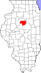
Geography

Kappa is located at 40°40′35″N89°0′34″W / 40.67639°N 89.00944°W / 40.67639; -89.00944 (40.676439, -89.009349). [2]

According to the 2010 census, Kappa has a total area of 0.34 square miles (0.88 km2), all land. [3]

Demographics

Historical population
CensusPop.Note
1900 175
1910 142−18.9%
1920 1494.9%
1930 123−17.4%
1940 14114.6%
1950 125−11.3%
1960 119−4.8%
1970 13110.1%
1980 17029.8%
1990 134−21.2%
2000 17026.9%
2010 22733.5%
2020 2290.9%
U.S. Decennial Census [4]

As of the census [5] of 2000, there were 170 people, 63 households, and 48 families residing in the village. The population density was 747.1 inhabitants per square mile (288.5/km2). There were 67 housing units at an average density of 294.5 units per square mile (113.7 units/km2). The racial makeup of the village was 97.06% White, 1.18% Native American, 1.76% from other races. Hispanic or Latino of any race were 2.35% of the population.

There were 63 households, out of which 47.6% had children under the age of 18 living with them, 58.7% were married couples living together, 9.5% had a female householder with no husband present, and 23.8% were non-families. 20.6% of all households were made up of individuals, and 6.3% had someone living alone who was 65 years of age or older. The average household size was 2.70 and the average family size was 3.08.

In the village, the population was spread out, with 32.4% under the age of 18, 5.9% from 18 to 24, 34.1% from 25 to 44, 19.4% from 45 to 64, and 8.2% who were 65 years of age or older. The median age was 32 years. For every 100 females, there were 97.7 males. For every 100 females age 18 and over, there were 94.9 males.

The median income for a household in the village was $46,786, and the median income for a family was $50,417. Males had a median income of $35,417 versus $21,250 for females. The per capita income for the village was $17,451. About 6.0% of families and 9.6% of the population were below the poverty line, including 14.6% of those under the age of eighteen and 12.5% of those 65 or over.

Attractions

Recreation and entertainment

The small village's main attraction is the Kappa Gentlemen's Club, a strip club that has been the subject of multiple legal cases, including a prostitution bust as part of an undercover sting operation in 2008. [6] [7] [8]

Related Research Articles

<span class="mw-page-title-main">Bureau Junction, Illinois</span> Village in Illinois, United States

Bureau Junction, usually called Bureau, is a village in Bureau County, Illinois, United States. The population was 281 at the 2020 census. The village name is shown as both "Bureau Junction" and "Bureau" on federal maps, and is commonly called "Bureau", including by phone companies and the United States Post Office. It is part of the Ottawa Micropolitan Statistical Area. Bureau Junction was the point where the Rock Island Line railroad's branch line to Peoria split. Track west and south of Bureau is operated by Iowa Interstate, while tracks east to Chicago were formerly operated by CSX but are currently leased to Iowa Interstate.

<span class="mw-page-title-main">Menominee, Illinois</span> Village in Illinois, United States

Menominee is a village in Jo Daviess County, Illinois, United States. The population was 248 at the 2010 census, up from 237 in 2000. The village is located on the Little Menominee River near East Dubuque and Galena.

<span class="mw-page-title-main">Washburn, Illinois</span> Village in Illinois, United States

Washburn is a village mostly in Woodford County, with a small northerly portion in Marshall County, Illinois, United States. The population was 1,032 at the 2020 census. It is part of the Peoria Metropolitan Statistical Area.

<span class="mw-page-title-main">Carlock, Illinois</span> Village in Illinois, United States

Carlock is a village in McLean County, Illinois, United States. The population was 548 at the 2020 census. It is part of the Bloomington–Normal Metropolitan Statistical Area.

<span class="mw-page-title-main">El Paso, Illinois</span> City in Illinois, United States

El Paso is a city in Woodford and McLean counties in the U.S. state of Illinois. The population was 2,756 at the 2020 census. The Woodford County portion of El Paso is part of the Peoria Metropolitan Statistical Area.

<span class="mw-page-title-main">Bellevue, Illinois</span> Village in Illinois, United States

Bellevue is a village in Peoria County, Illinois, United States. The population was 1,978 at the 2010 census. Bellevue is a suburb of Peoria and is part of the Peoria, Illinois Metropolitan Statistical Area.

<span class="mw-page-title-main">Chillicothe, Illinois</span> City in Illinois, United States

Chillicothe is a city on the Illinois River in Peoria County, Illinois, United States. The population was 6,097 at the 2010 census. Chillicothe is just north of the city of Peoria and is part of the Peoria Metropolitan Statistical Area.

<span class="mw-page-title-main">Glasford, Illinois</span> Village in Illinois, United States

Glasford is a village in Peoria County, Illinois, United States. The population was 866 at the 2020 census. Glasford is part of the Peoria, Illinois Metropolitan Statistical Area.

<span class="mw-page-title-main">Mapleton, Illinois</span> Village in Illinois, United States

Mapleton is a small village in Peoria County, Illinois, United States. The population was 227 at the 2000 census. Mapleton is part of the Peoria, Illinois Metropolitan Statistical Area. There are four different plants in Mapleton, all located along U.S. Route 24: an Evonik chemical plant, a Lonza Group plant, a Caterpillar Inc. foundry, and an Ingredion facility; together, the large industrial complex forms one of Mapleton's most significant employers and a good source of skilled employees and good jobs.

<span class="mw-page-title-main">Norwood, Illinois</span> Village in Illinois, United States

Norwood is a village in Peoria County, Illinois, United States. The population was 478 at the 2010 census. Norwood, just outside Peoria, is part of the Peoria, Illinois Metropolitan Statistical Area.

<span class="mw-page-title-main">Peoria Heights, Illinois</span> Village in Illinois, United States

Peoria Heights is a village lying in Peoria County in the U.S. state of Illinois. The population was 6,156 at the 2010 census, down from 6,635 in 2000. Peoria Heights is a suburb of Peoria, is sometimes referred to as Uptown, and is surrounded by the city except for its eastern boundary on Peoria Lake, a relatively wider section of the Illinois River. It is part of the Peoria, Illinois Metropolitan Statistical Area.

<span class="mw-page-title-main">La Fayette, Illinois</span> Village in Illinois, United States

La Fayette is a village in Stark County, Illinois. It is located south of Kewanee off Route 78 on Route 17|IL-17. The population was 223 at the 2010 census, down from 227 in 2000. It is part of the Peoria, Illinois Metropolitan Statistical Area. Once a prominent strip coal mine and farming village with; a general store, high school(until 1970), hotel, bank, grain elevator, train depot, and many other features and amenities. Once the coal mines shut down and railroad was removed in the early 1980s, it slowly became a low income and high poverty village with many people moving away and it eventually diminished to the hollow shell of what it once was.

<span class="mw-page-title-main">Bay View Gardens, Illinois</span> Village in Illinois, United States

Bay View Gardens is a village in Woodford County, Illinois, United States. The population was 378 at the 2010 census, up from 366 in 2000. The village is part of the Peoria, Illinois Metropolitan Statistical Area.

<span class="mw-page-title-main">Benson, Illinois</span> Village in Illinois, United States

Benson is a village in Woodford County, Illinois, United States. The population was 423 at the 2010 census, up from 408 in 2000. It is part of the Peoria, Illinois Metropolitan Statistical Area.

<span class="mw-page-title-main">Congerville, Illinois</span> Village in Illinois, United States

Congerville is a village in Woodford County, Illinois, United States. The population was 474 as of the 2010 census, up from 466 in 2000. Congerville is part of the Peoria, Illinois Metropolitan Statistical Area.

<span class="mw-page-title-main">Germantown Hills, Illinois</span> Village in Illinois, United States

Germantown Hills is a village in Woodford County, Illinois, approximately 8 miles (13 km) northeast of Peoria. Germantown Hills is the only incorporated community in Worth Township. As of the 2010 census, the village had a total population of 3,438. Largely an agricultural community until its incorporation in 1954, Germantown Hills is now a growing bedroom community in the Peoria Metropolitan Area.

<span class="mw-page-title-main">Minonk, Illinois</span> City in Illinois, United States

Minonk is a city in Minonk Township, Woodford County, Illinois. The population was 2,078 at the 2010 census, down from 2,168 in 2000. The city is part of the Peoria, Illinois, metropolitan area.

<span class="mw-page-title-main">Panola, Illinois</span> Village in Illinois, United States

Panola is a village in Woodford County, Illinois, United States. The population was 45 at the 2010 census. It is part of the Peoria, Illinois Metropolitan Statistical Area.

<span class="mw-page-title-main">Roanoke, Illinois</span> Village in Illinois, United States

Roanoke is a village in Roanoke Township, Woodford County, Illinois, United States. The population was 1,960 at the 2020 census. It is part of the Peoria, Illinois Metropolitan Statistical Area.

<span class="mw-page-title-main">Secor, Illinois</span> Village in Illinois, United States

Secor is a village in Clayton Township, Woodford County, Illinois, United States. The population was 373 at the 2010 census. It is part of the Peoria, Illinois Metropolitan Statistical Area. Secor is located just off U.S. Route 24 between El Paso and Eureka.

References

  1. "2020 U.S. Gazetteer Files". United States Census Bureau. Retrieved March 15, 2022.
  2. "US Gazetteer files: 2010, 2000, and 1990". United States Census Bureau. February 12, 2011. Retrieved April 23, 2011.
  3. "G001 - Geographic Identifiers - 2010 Census Summary File 1". United States Census Bureau. Archived from the original on February 13, 2020. Retrieved August 4, 2015.
  4. "Census of Population and Housing". Census.gov. Retrieved June 4, 2015.
  5. "U.S. Census website". United States Census Bureau . Retrieved January 31, 2008.
  6. Shepherd, Check (May 6, 1999). "News of the Weird". Chicago Reader . Retrieved March 22, 2018. Mark Kent, 28, filed assault charges against the Kappa Kabana club in Kappa, Illinois, after a dancer tried to wrap her legs around his neck while holding on to a pole onstage, causing Kent to fall off his bar stool and injure his head and elbow
  7. Luciano, Phil (January 1, 2017). "Man found dead inside house that burns down next to strip joint in Woodford County". Peoria Journal Star (online ed.). Retrieved March 22, 2018.
  8. "Worker at Kappa strip club accused of prostitution attempt". The Pantagraph (online ed.). Bloomington, Illinois. May 28, 2008. Retrieved March 22, 2018.