Panola, Illinois

Last updated

Panola
Woodford County Illinois Incorporated and Unincorporated areas Panola Highlighted.svg
Location of Panola in Woodford County, Illinois.
Illinois in United States (US48).svg
Location of Illinois in the United States
Coordinates: 40°47′6″N89°1′15″W / 40.78500°N 89.02083°W / 40.78500; -89.02083
CountryUnited States
StateIllinois
County Woodford
Area
[1]
  Total0.43 sq mi (1.11 km2)
  Land0.43 sq mi (1.11 km2)
  Water0.00 sq mi (0.00 km2)
Elevation
737 ft (225 m)
Population
 (2020)
  Total47
  Density109.56/sq mi (42.27/km2)
Time zone UTC-6 (CST)
  Summer (DST) UTC-5 (CDT)
ZIP Code(s)
61738
Area code 309
FIPS code 17-57524
Wikimedia CommonsPanola, Illinois

Panola is a village in Woodford County, Illinois, United States. The population was 45 at the 2010 census. It is part of the Peoria, Illinois Metropolitan Statistical Area.

Contents

Panola is one of the smallest communities in Illinois today. It is located about 2 miles (3.2 km) north of El Paso, along Illinois Route 251 (next to U.S. 51).

History

Some sources, including Stewart, pg. 362, as well as several Woodford County history books claim the name Panola was fabricated by J.B. Calhoun, land commissioner of the Illinois Central Railroad, by arbitrarily combining single consonants and vowels. However, the 1954 El Paso Story correctly records that while Panola was assigned by an official of the Illinois Central Railroad, it simply duplicates the name of Panola County, Mississippi as well as several municipalities in the southern U.S. named Panola. Panola is a Native American word for cotton.

Because of its aging population and apparent lack of enthusiasm for others to be involved in operation of the local government, in 2004 the village board of Panola attempted to unincorporate the town. Only one other town in Illinois had successfully unincorporated previously. Of the 33 residents at the time, 27 had voting rights. The measure failed 16 to 11. It needed a majority to pass.

Geography

Panola is located at 40°47′6″N89°1′15″W / 40.78500°N 89.02083°W / 40.78500; -89.02083 (40.785072, -89.020942). [2]

According to the 2010 census, Panola has a total area of 0.2 square miles (0.52 km2), all land. [3]

Demographics

Historical population
CensusPop.Note
1880 127
1890 1323.9%
1900 14812.1%
1910 108−27.0%
1920 98−9.3%
1930 82−16.3%
1940 51−37.8%
1950 522.0%
1960 43−17.3%
1970 30−30.2%
1980 313.3%
1990 4338.7%
2000 33−23.3%
2010 4536.4%
2020 474.4%
U.S. Decennial Census [4]

As of the 2010 census there were 45 residents of Panola. The median age of the population was 44. 1 resident reported being both black and white and one resident reported being Hispanic or Latino, while the remaining 42 residents were non-Hispanic whites. [5]

As of the census [6] of 2000, there were 33 people, 13 households, and 11 families residing in the village. The population density was 163.5 inhabitants per square mile (63.1/km2). There were 14 housing units at an average density of 69.4 units per square mile (26.8 units/km2). The racial makeup of the village was 93.94% White, and 6.06% Asian.

There were 13 households, out of which 23.1% had children under the age of 18 living with them, 84.6% were married couples living together, 7.7% had a female householder with no husband present, and 7.7% were non-families. No households were made up of individuals, and none had someone living alone who was 65 years of age or older. The average household size was 2.54 and the average family size was 2.58.

In the village, the population was spread out, with 15.2% under the age of 18, 3.0% from 18 to 24, 27.3% from 25 to 44, 30.3% from 45 to 64, and 24.2% who were 65 years of age or older. The median age was 46 years. For every 100 females, there were 94.1 males. For every 100 females age 18 and over, there were 100.0 males.

The median income for a household in the village was $41,875, and the median income for a family was $40,625. Males had a median income of $47,500 versus $26,250 for females. The per capita income for the village was $24,259. None of the population and none of the families were below the poverty line.

Related Research Articles

<span class="mw-page-title-main">Peoria County, Illinois</span> County in Illinois, United States

Peoria County is located in the U.S. state of Illinois. The 2020 United States Census listed its population at 181,830. Its county seat is Peoria. Peoria County is part of the Peoria, IL Metropolitan Statistical Area.

<span class="mw-page-title-main">London Mills, Illinois</span> Village in Illinois, United States

London Mills is a village in Fulton and Knox counties in the U.S. state of Illinois. The population was 350 at the 2020 census.

<span class="mw-page-title-main">Hooppole, Illinois</span> Village in Illinois, United States

Hooppole is a village in Henry County, Illinois, United States. The population was 204 at the 2010 census, up from 162 in 2000. As of 2018, the population has grown to an estimated 236.

<span class="mw-page-title-main">La Rose, Illinois</span> Village in Illinois, United States

La Rose is a village in Bell Plain Township, Marshall County, Illinois, United States. The population was 98 at the 2020 census, down from 144 in 2010. It is part of the Peoria Metropolitan Statistical Area.
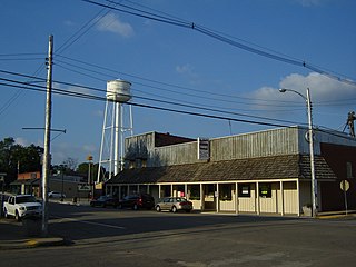
<span class="mw-page-title-main">Washburn, Illinois</span> Village in Illinois, United States

Washburn is a village mostly in Woodford County, with a small northerly portion in Marshall County, Illinois, United States. The population was 1,032 at the 2020 census. It is part of the Peoria Metropolitan Statistical Area.

<span class="mw-page-title-main">El Paso, Illinois</span> City in Illinois, United States

El Paso is a city in Woodford and McLean counties in the U.S. state of Illinois. The population was 2,756 at the 2020 census. The Woodford County portion of El Paso is part of the Peoria Metropolitan Statistical Area.

<span class="mw-page-title-main">Bartonville, Illinois</span> Village in Illinois, United States

Bartonville is a village in Peoria County, Illinois, United States. The population was 6,471 at the 2010 census. Bartonville is a suburb of Peoria and is part of the Peoria, Illinois Metropolitan Statistical Area.
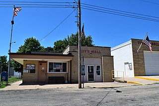
<span class="mw-page-title-main">Kingston Mines, Illinois</span> Village in Illinois, United States

Kingston Mines is a village in Peoria County, Illinois, United States. The population was 259 at the 2000 census. It is part of the Peoria, Illinois Metropolitan Statistical Area. Located on the Illinois River, it was a shipping port, loading coal from the nearby mines.

<span class="mw-page-title-main">Mapleton, Illinois</span> Village in Illinois, United States

Mapleton is a small village in Peoria County, Illinois, United States. The population was 227 at the 2000 census. Mapleton is part of the Peoria, Illinois Metropolitan Statistical Area. There are four different plants in Mapleton, all located along U.S. Route 24: an Evonik chemical plant, a Lonza Group plant, a Caterpillar Inc. foundry, and an Ingredion facility; together, the large industrial complex forms one of Mapleton's most significant employers and a good source of skilled employees and good jobs.

<span class="mw-page-title-main">Norwood, Illinois</span> Village in Illinois, United States

Norwood is a village in Peoria County, Illinois, United States. The population was 478 at the 2010 census. Norwood, just outside Peoria, is part of the Peoria, Illinois Metropolitan Statistical Area.

<span class="mw-page-title-main">Peoria Heights, Illinois</span> Village in Illinois, United States

Peoria Heights is a village lying in Peoria County in the U.S. state of Illinois. The population was 6,156 at the 2010 census, down from 6,635 in 2000. Peoria Heights is a suburb of Peoria, is sometimes referred to as Uptown, and is surrounded by the city except for its eastern boundary on Peoria Lake, a relatively wider section of the Illinois River. It is part of the Peoria, Illinois Metropolitan Statistical Area.

<span class="mw-page-title-main">Bay View Gardens, Illinois</span> Village in Illinois, United States

Bay View Gardens is a village in Woodford County, Illinois, United States. The population was 378 at the 2010 census, up from 366 in 2000. The village is part of the Peoria, Illinois Metropolitan Statistical Area.

<span class="mw-page-title-main">Benson, Illinois</span> Village in Illinois, United States

Benson is a village in Woodford County, Illinois, United States. The population was 423 at the 2010 census, up from 408 in 2000. It is part of the Peoria, Illinois Metropolitan Statistical Area.

<span class="mw-page-title-main">Congerville, Illinois</span> Village in Illinois, United States

Congerville is a village in Woodford County, Illinois, United States. The population was 474 as of the 2010 census, up from 466 in 2000. Congerville is part of the Peoria, Illinois Metropolitan Statistical Area.

<span class="mw-page-title-main">Eureka, Illinois</span> City in Illinois, United States

Eureka is a city and the county seat of Woodford County, Illinois. The population was 5,295 at the 2010 census. Eureka is part of the Peoria, Illinois Metropolitan Statistical Area.

<span class="mw-page-title-main">Kappa, Illinois</span> Village in Illinois, United States

Kappa is a village in Woodford County, Illinois, United States. The population was 227 at the 2010 census, up from 170 in 2000. It is part of the Peoria, Illinois Metropolitan Statistical Area.

<span class="mw-page-title-main">Metamora, Illinois</span> Village in Illinois, United States

Metamora is a village in Metamora Township, Woodford County, Illinois, United States. The population was 3,636 at the 2010 census. Metamora is a growing suburb of Peoria and is part of the Peoria, Illinois Metropolitan Statistical Area.

<span class="mw-page-title-main">Roanoke, Illinois</span> Village in Illinois, United States

Roanoke is a village in Roanoke Township, Woodford County, Illinois, United States. The population was 1,960 at the 2020 census. It is part of the Peoria, Illinois Metropolitan Statistical Area.

<span class="mw-page-title-main">Secor, Illinois</span> Village in Illinois, United States

Secor is a village in Clayton Township, Woodford County, Illinois, United States. The population was 373 at the 2010 census. It is part of the Peoria, Illinois Metropolitan Statistical Area. Secor is located just off U.S. Route 24 between El Paso and Eureka.
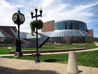
<span class="mw-page-title-main">Peoria, Illinois, metropolitan area</span> Geographic area around Peoria, Illinois

The Peoria Metropolitan Statistical Area, as defined by the United States Census Bureau, is an area consisting of six counties in Central Illinois, anchored by the city of Peoria. As of the 2020 census, the area had a population of 402,391. The City of Peoria, according to the 2020 US Census Bureau, has 113,150 people.

References

  1. "2020 U.S. Gazetteer Files". United States Census Bureau. Retrieved March 15, 2022.
  2. "US Gazetteer files: 2010, 2000, and 1990". United States Census Bureau. February 12, 2011. Retrieved April 23, 2011.
  3. "G001 - Geographic Identifiers - 2010 Census Summary File 1". United States Census Bureau. Archived from the original on February 13, 2020. Retrieved December 25, 2015.
  4. "Census of Population and Housing". Census.gov. Retrieved June 4, 2015.
  5. 2010 general profile of population and housing characteristics of Panola from the United States census
  6. "U.S. Census website". United States Census Bureau . Retrieved January 31, 2008.