
Drumheller is a town on the Red Deer River in the badlands of east-central Alberta, Canada. It is located 110 kilometres (68 mi) northeast of Calgary and 97 kilometres (60 mi) south of Stettler. The Drumheller portion of the Red Deer River valley, often referred to as Dinosaur Valley, has an approximate width of 2 kilometres (1.2 mi) and an approximate length of 28 kilometres (17 mi).
Alberta Provincial Highway No. 2, commonly referred to as Highway 2 or the Queen Elizabeth II Highway, is a major highway in Alberta that stretches from the Canada–United States border through Calgary and Edmonton to Grande Prairie. Running primarily north to south for approximately 1,273 kilometres (791 mi), it is the longest and busiest highway in the province carrying more than 170,000 vehicles per day near Downtown Calgary. The Fort Macleod—Edmonton section forms a portion of the CANAMEX Corridor that links Alaska to Mexico. More than half of Alberta's 4 million residents live in the Calgary–Edmonton Corridor created by Highway 2.
Alberta Provincial Highway No. 2A is the designation of six alternate routes off Highway 2 in Alberta, Canada. In general, these are original sections of Highway 2, such as the southern portion of Macleod Trail in Calgary. They passed through communities before limited-access freeways were built to shorten driving distance, accommodate heavier volumes and to bypass city traffic. Portions of the alignment of Highway 2A follow the route of the former Calgary and Edmonton Trail.

Alberta Provincial Highway No. 11, commonly referred to as Highway 11 and officially named the David Thompson Highway, is a provincial highway in central Alberta, Canada. It runs for 318 km (198 mi) from Highway 93 at Saskatchewan River Crossing near Mount Sarbach in Banff National Park east to Highway 12 near Nevis. It passes by Nordegg and through Rocky Mountain House, Sylvan Lake and Red Deer along its course. The highway is named after David Thompson, a British-Canadian fur trader, surveyor, and map-maker who explored the area between Rocky Mountain House and Kootenae House through Howse Pass.

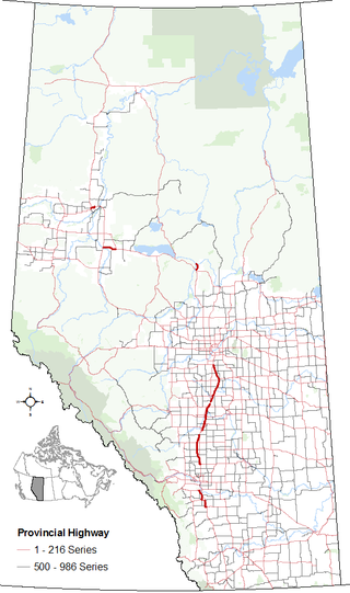
Alberta Provincial Highway No. 9, commonly referred to as Highway 9, is a highway in south-central Alberta, Canada, which together with Saskatchewan Highway 7 connects Calgary to Saskatoon, Saskatchewan via Drumheller. It is designated as a core route of the National Highway System, forming a portion of an interprovincial corridor. Highway 9 spans approximately 324 km (201 mi) from the Trans-Canada Highway east of Calgary to Alberta's border with Saskatchewan.

Alberta Provincial Highway No. 10, commonly referred to as Highway 10, is a 22 km (14 mi) highway in southern Alberta, Canada that forms a part of Hoo Doo Trail. It is located wholly within the Town of Drumheller as a result of the former City of Drumheller's amalgamation with the Municipal District of Badlands No. 7 on January 1, 1998. It begins at Highway 9 in the heart of Drumheller and extends southeast along the Red Deer River where it passes through Rosedale, then crosses Highway 56 and travels through East Coulee. It ends by splitting off into Highways 570, 564, and 569.

Alberta Provincial Highway No. 11A is the designation of two routes that connect to Highway 11 in Alberta, Canada. The Rocky Mountain House section is referred to as 11A:02 by Alberta Transportation, while 11A:06 runs from Sylvan Lake to Red Deer.

Midland Provincial Park is a provincial park located in Alberta, Canada.
Alberta Provincial Highway No. 575, commonly referred to as Highway 575, is the designation of an east-west highway in central Alberta, Canada. It runs from the Highway 791, through Acme and Carbon, to Highway 9 and Highway 56 in Drumheller. The section between Highway 837 and Drumheller is part of the Dinosaur Trail.
Alberta Provincial Highway No. 837, commonly referred to as Highway 837, is a short north–south highway in central Alberta, Canada. It runs from the Highway 575 to Highway 27 in Kneehill County along the west bank of the Red Deer River in the Canadian badlands; it does not pass through any communities. The section between Highway 575 and Highway 838 is part of the Dinosaur Trail.
Alberta Provincial Highway No. 838, commonly referred to as Highway 838, is a short highway in central Alberta, Canada. It runs from Highway 837 across the Red Deer River on the free, cable-operated Bleriot Ferry to Highway 9 / Highway 56 in Drumheller. Outside of Drumheller, Highway 838 does not pass through any communities. All of Highway 838 is part of the Dinosaur Trail and is known as North Dinosaur Trail.

The Bleriot Ferry is a cable ferry in Alberta, Canada. It links the two sections of the North Dinosaur Trail as it crosses the Red Deer River from Kneehill County on the west, to Starland County on the east.
Nacmine is a community within the Town of Drumheller, Alberta, Canada. It was previously a hamlet within the former Municipal District (MD) of Badlands No. 7 prior to the MD's amalgamation with the former City of Drumheller on January 1, 1998.

Midlandvale is a community within the Town of Drumheller, Alberta, Canada. It was previously a hamlet within the former Municipal District of Badlands No. 7 prior to being annexed by Drumheller in 1972. Now referred to as Midland by the Town of Drumheller, the community is located within the Red Deer River valley on North Dinosaur Trail, approximately 3 km (1.9 mi) west of Drumheller's main townsite.
Newcastle is a community within the Town of Drumheller, Alberta, Canada. It held village status for eight years between 1923 and 1931, and was recognized as a hamlet prior to annexation by Drumheller in 1967. The community is located within the Red Deer River valley on South Dinosaur Trail, approximately 2 km (1.2 mi) west of Drumheller's main townsite. The former hamlet of Midlandvale is located across the river to the north.
North Drumheller is a community within the Town of Drumheller, Alberta, Canada. It was previously a hamlet within the former Municipal District of Badlands No. 7 prior to being annexed by Drumheller in 1967. The community is located within the Red Deer River valley at the intersection of Highway 9 and North Dinosaur Trail on the north side of the river across from Drumheller's main townsite.
Bankview is a community within the Town of Drumheller, Alberta, Canada. It was previously a hamlet within the former Municipal District of Badlands No. 7 prior to being annexed by Drumheller in 1964. The community is located within the Red Deer River valley to the south of Drumheller's main townsite across Highway 9.

Horsethief Canyon is found 16 kilometres (9.9 mi) northwest of the town of Drumheller, in Starland County in the province of Alberta, Canada. It is on the east bank of the Red Deer River, along Highway 838. Both Horsethief Canyon and Horseshoe Canyon are distinctive features of the surrounding badlands of central Alberta. Although the two canyons look similar, they are separated by several kilometres and were created by different tributaries of the Red Deer River.
Calgary Trail and Gateway Boulevard are a pair of major arterial roadways in Edmonton, Alberta. Gateway Boulevard carries northbound traffic while Calgary Trail carries southbound traffic. From south of 31 Avenue, they form a two-way freeway separated by a median; for this portion, the roadway maintains the separate names for northbound and southbound traffic. Near 31 Avenue, Calgary Trail and Gateway Boulevard separate and become parallel one-way arterial roadways to Saskatchewan Drive, at the edge of the North Saskatchewan River valley. Designated as part of Highway 2 south of Whitemud Drive, it is Edmonton's main southern entrance and is both a major commuter route, connecting to the Edmonton International Airport and Leduc, as well as a regional connection to Red Deer and Calgary.

