Abersychan is a town and community north of Pontypool in Torfaen, Wales, and lies within the boundaries of the historic county of Monmouthshire and the preserved county of Gwent.

Cwmbran is a town in the county borough of Torfaen in South Wales.

Newport City Council is the governing body for Newport, one of the Principal Areas of Wales. It consists of 51 councillors, who represent the city's 20 wards.

Torfaen is a county borough in the south-east of Wales. Torfaen is bordered by the county of Monmouthshire to the east, the city of Newport to the south, and the county boroughs of Caerphilly and Blaenau Gwent to the south-west and north-west. It is within the boundaries of the historic county of Monmouthshire, and between 1974 and 1996 was a district of Gwent, until it was reconstituted as a principal area in 1996.

Blaenau Gwent is a county borough in the south-east of Wales. It borders the unitary authority areas of Monmouthshire and Torfaen to the east, Caerphilly to the west and Powys to the north. Its main towns are Abertillery, Brynmawr, Ebbw Vale and Tredegar. Its highest point is Coity Mountain at 1,896 feet (578 m).

Monmouthshire is a county in the south-east of Wales. The name derives from the historic county of the same name; the modern county covers the eastern three-fifths of the historic county. The largest town is Abergavenny, with other towns and large villages being: Caldicot, Chepstow, Monmouth, Magor and Usk. It borders Torfaen, Newport and Blaenau Gwent to the west; Herefordshire and Gloucestershire to the east; and Powys to the north.

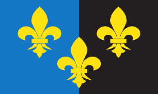
Monmouthshire, also known as the County of Monmouth, is one of thirteen historic counties of Wales and a former administrative county. It corresponds approximately to the present principal areas of Monmouthshire, Blaenau Gwent, Newport and Torfaen, and those parts of Caerphilly and Cardiff east of the Rhymney River.

Pontypool is a town and the administrative centre of the county borough of Torfaen, within the historic boundaries of Monmouthshire in South Wales. It has a population of 28,970.

The Borough of Islwyn was one of five local government districts of Gwent from 1974 to 1996.

Monmouth is a county constituency of the House of Commons of the Parliament of the United Kingdom. The seat was created for the 1918 general election. Since 2005 the Member of Parliament (MP) has been David Davies of the Conservative Party.

The Folly Tower is a folly located within the grounds of a working farm, close to Pontypool Park, Torfaen, South Wales. It is a prominent local landmark above the A4042 Pontypool to Abergavenny road and overlooks Pontypool to the west and rural Monmouthshire to the east.

Trevethin is a suburb of Pontypool and a community in Torfaen, Wales. It includes two electoral wards for Torfaen County Borough Council. It is in the historic county of Monmouthshire.

The Borough of Brecknock was one of the three local government districts of the county of Powys, Wales from 1974 until 1996. It covered the majority of the former administrative county of Brecknockshire. The borough was abolished in 1996, with Powys County Council taking over its functions.

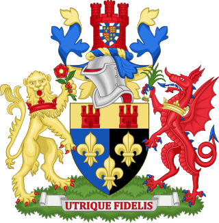
Monmouthshire County Council is the governing body for the Monmouthshire principal area – one of the unitary authorities of Wales.

Gwent is a preserved county and former local government county in southeast Wales. A county of Gwent was formed on 1 April 1974, under the Local Government Act 1972; it was named after the ancient Kingdom of Gwent. The authority was a successor to both the administrative county of Monmouthshire and the county borough of Newport.

Torfaen County Borough Council is the governing body for Torfaen, one of the Principal Areas of Wales.
The history of local government in Wales in a recognisably modern form emerged during the late 19th century. Administrative counties and county boroughs were first established in Wales in 1889. Urban and rural districts were formed in 1894. These were replaced in 1974 by a two-tier authority system across the country comprising eight counties and, within them, thirty-seven districts. This system was itself replaced by the introduction of 22 single-tier authorities in 1996.

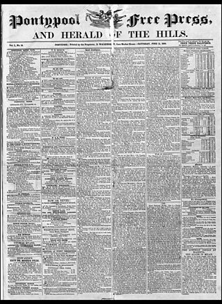
The Pontypool Free Press is an English language weekly regional newspaper that was originally published in Pontypool, as the Pontypool Free Press and Herald of the Hills, in 1859 and is circulated in Pontypool and the surrounding area of Torfaen, in south-east Wales.

Gwent County Council was the upper-tier local authority that governed the county of Gwent in South Wales from its creation in 1974 to its abolition in 1996. For most of its existence, the county council was based in Cwmbran.

Pontypool Town Hall is a municipal structure in Hanbury Road, Pontypool, Wales. The town hall, which forms the original part of a civic centre that now serves as the headquarters of Torfaen County Borough Council, is a Grade II listed building.


