Llanelly

Last updated

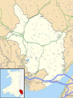
Llanelly (Welsh : Llanelli) is the name of a parish and coterminous community in the principal area of Monmouthshire, within the historic boundaries of Brecknockshire, south-east Wales. It roughly covers the area of the Clydach Gorge. The population of the parish and ward at the 2011 census was 3,899. [1]

Contents

Location

The parish encompasses the area surrounding the Clydach Gorge, west of Abergavenny, east of Brynmawr and south of Crickhowell.

Settlements

Llanelly Hill, Blackrock, Clydach, Maesygwartha and Gilwern are the main settlements in the parish. Llanelly Hill occupies the north-west hilltop of the Clydach Gorge. It developed as a result of coal mining and limestone quarrying for the nearby ironworks including those at Clydach and Ebbw Vale.

Blackrock and Clydach North (also referred to as Cheltenham) were both built up along the turnpike road that ran on the north side of the river between Govilon and Merthyr Tydfil. Clydach South developed on the south side of the river above the ironworks. It climbs the north-west slopes towards Llanelly Hill.

Gilwern is located at the mouth of the River Clydach, where it meets the River Usk. Maesygwartha lies between Clydach and Gilwern along one of the many tramroads in the gorge.

History

The Church of St Elli dates from the 14th century or earlier. The parish is part of the principal area of Monmouthshire. Historically within Brecknockshire, from the local government reorganisation of 1974 until that of 1996, it lay in the district of Blaenau Gwent, but the electors overwhelmingly voted to be transferred out. The highest part of the parish, in the southwest had previously been transferred into the new urban district of Brynmawr in the 1890s. [2] The Brecon Beacons National Park encompasses the parish and the surrounding area.
Governance

The electoral ward of Llanelly Hill is coterminous with the Llanelly community and elects one county councillor to Monmouthshire County Council. [3]

Notable persons

See also

Llanelly, a former Welsh gold-mining town near Tarnagulla, Australia

Related Research Articles

<span class="mw-page-title-main">Abersychan</span> Town in Wales

Abersychan is a town and community north of Pontypool in Torfaen, Wales, and lies within the boundaries of the historic county of Monmouthshire and the preserved county of Gwent.

<span class="mw-page-title-main">Brecknockshire</span> Historic county of Wales

Until 1974, Brecknockshire, also formerly known as the County of Brecknock, Breconshire, or the County of Brecon, was an administrative county in the south of Wales, later classed as one of the thirteen historic counties of Wales. Named after its county town of Brecon, the county was mountainous and primarily rural.

<span class="mw-page-title-main">Blaenau Gwent</span> County borough in Wales

Blaenau Gwent is a county borough in the south-east of Wales. It borders the unitary authority areas of Monmouthshire and Torfaen to the east, Caerphilly to the west and Powys to the north. Its main towns are Abertillery, Brynmawr, Ebbw Vale and Tredegar. Its highest point is Coity Mountain at 1,896 feet (578 m).

<span class="mw-page-title-main">Monmouthshire (historic)</span> Historic county in Wales

Until 1974, Monmouthshire, also formerly known as the County of Monmouth, was an administrative county in the south-east of Wales, on the border with England, and later classed as one of the thirteen historic counties of Wales. Its area now corresponds approximately to the present principal areas of Monmouthshire, Blaenau Gwent, Newport and Torfaen, and those parts of Caerphilly and Cardiff east of the Rhymney River.

<span class="mw-page-title-main">Brynmawr</span> Town in Blaenau Gwent, Wales

Brynmawr is a market town, community and electoral ward in Blaenau Gwent, Wales. The town, sometimes cited as the highest town in Wales, is situated at 1,250 to 1,500 feet above sea level at the head of the South Wales Valleys. It grew with the development of the coal mining and iron industries in the early 19th century. Until the reorganisation of local authorities in 1974, Brynmawr was administered as part of the county of Brecknockshire.

<span class="mw-page-title-main">South Wales</span> Region of Wales

South Wales is a loosely defined region of Wales bordered by England to the east and mid Wales to the north. Generally considered to include the historic counties of Glamorgan and Monmouthshire, south Wales extends westwards to include Carmarthenshire and Pembrokeshire. In the western extent, from Swansea westwards, local people would probably recognise that they lived in both south Wales and west Wales. The Brecon Beacons National Park covers about a third of south Wales, containing Pen y Fan, the highest British mountain south of Cadair Idris in Snowdonia.

Stow Hill is a community civil parish and coterminous electoral district (ward) of the City of Newport, South Wales.

<span class="mw-page-title-main">Monmouthshire and Brecon Canal</span> C18-19 canal network in South Wales

The Monmouthshire and Brecon Canal is a small network of canals in South Wales. For most of its currently (2018) navigable 35-mile (56 km) length it runs through the Brecon Beacons National Park, and its present rural character and tranquillity belies its original purpose as an industrial corridor for coal and iron, which were brought to the canal by a network of tramways and/or railroads, many of which were built and owned by the canal company.

Clydach is a village in Monmouthshire, Wales. Its nearest neighbours are the village of Gilwern and town of Abergavenny.

<span class="mw-page-title-main">Gilwern</span> Village in Monmouthshire, Wales

Gilwern is a village within the Brecon Beacons National Park in Monmouthshire, Wales. Historically in Brecknockshire, it extends to either side of the River Clydach on the south side of the Usk valley. Its position beside the Monmouthshire and Brecon Canal led to it being an important industrial centre at one time.

<span class="mw-page-title-main">Beaufort, Blaenau Gwent</span> Human settlement in Wales

Beaufort is a community and village located in the historic county of Brecknockshire (Breconshire) and the preserved county of Gwent. It currently lies on the northern edge of the county borough of Blaenau Gwent in Wales. According to the 2011 census, the population of the ward and community of Beaufort is 3,866

The Merthyr, Tredegar and Abergavenny Railway, also known as the Heads of the Valleys line, was a railway line which operated between 1860 and 1958 between the Monmouthshire town of Abergavenny and the Glamorgan town of Merthyr Tydfil in South East Wales.

The Clydach Gorge is a steep-sided valley in south-east Wales down which the River Clydach flows to the River Usk. It runs for 5.6 kilometres (3.5 mi) from the vicinity of Brynmawr in Blaenau Gwent eastwards and northeastwards to Gilwern in Monmouthshire. The Gorge was one of the first locations in the region to be industrialised though it still retains its natural environment. It has long been an important transport corridor between Abergavenny and the lowlands of Monmouthshire and the northeastern quarter of the South Wales Coalfield. It is now exploited by the A465 Heads of the Valleys trunk road which runs between Abergavenny and Swansea and which serves the Heads of the Valleys sub-region.

Clydach may refer to any of various settlements and rivers in South Wales:

<span class="mw-page-title-main">River Clydach, Monmouthshire</span> River in Monmouthshire, Wales

The River Clydach is a short, steep and fast-flowing river in Monmouthshire and the county borough of Blaenau Gwent in south Wales. It lies within the Brecon Beacons National Park. It is around 10 kilometres (6 mi) in length.

<span class="mw-page-title-main">Mynydd Llangatwg</span> Hill (528.9m) in Powys, Wales

Mynydd Llangatwg or Llangattock Mountain is a hill in the Brecon Beacons National Park in the county of Powys, south Wales. It is named from the village of Llangatwg which sits in the valley of the River Usk to the north of it. It is essentially an undulating plateau rising in the west to a height of 530 metres (1,740 ft) at grid reference SO171157 and in the east to a height of 529 metres (1,736 ft) at Hen Dy-aderyn / Twr Pen-cyrn. This spot is marked by a trig point. The shallow pool of Pwll Gwy-rhoc sits in a broad depression towards the northern edge of the plateau whilst a smaller pool frequently occupies a large shakehole a few hundred metres to its west. The hill forms an impressive northern scarp overlooking the Usk valley and commonly referred to as the Llangattock Escarpment. Its southern margins are more subdued. Its eastern end is defined by the drops into the Clydach Gorge. Beyond the B4560 to the west the hill merges with Mynydd Llangynidr which has a similar character.

The geology of Monmouthshire in southeast Wales largely consists of a thick series of sedimentary rocks of different types originating in the Silurian, Devonian, Carboniferous, Triassic and Jurassic periods.

The Brynmawr and Blaenavon Railway was a railway line in South Wales, within the historic boundaries of Brecknockshire and Monmouthshire, originally built in 1866 and immediately leased to the London and North Western Railway to transport coal to the Midlands via the Heads of the Valleys line. The line was completed in the late eighteen sixties and the LNWR were operating passenger trains over the line by 1872. Eight years later it was extended to meet the Great Western Railway at Abersychan & Talywain. Here the line carried on down the valley through Pontypool Crane Street railway station to the coast at Newport. In 1922 the LNWR was grouped into the London, Midland and Scottish Railway. In later years the line saw a variety of GWR locomotives operating from pit to port; however, the railway retained its LNWR infrastructure up until the last days before its closure.

<span class="mw-page-title-main">Clydach railway station</span> Former railway station in Wales

Clydach railway station was a station on the London and North Western Railway's Heads of the Valleys line near the village of Clydach in the Welsh county of Brecknockshire.

<span class="mw-page-title-main">Clydach House, Llanelly</span> House in Llanelly, Monmouthshire

Clydach House, Llanelly, Monmouthshire is a house dating from 1693. Constructed as the home for the manager of an ironworks in the nearby Clydach Gorge, it remains a private residence and is a Grade II* listed building.

References

  1. "Parish population 2011" . Retrieved 3 April 2015.
  2. "Brynmawr Urban District Council Records". Archives Hub. Retrieved 1 January 2024.
  3. The County of Monmouthshire (Electoral Changes) Order 2002. Statutory Instruments. 6 December 2002. Retrieved 1 January 2019.{{cite book}}: |website= ignored (help)

51°49′35″N3°06′57″W / 51.82652°N 3.11579°W / 51.82652; -3.11579