Dixon Lane-Meadow Creek, California

Last updated

Dixon Lane-Meadow Creek, California
Inyo County California Incorporated and Unincorporated areas Dixon Lane-Meadow Creek Highlighted.svg
Location in Inyo County and the U.S. state of California
Usa edcp location map.svg
Red pog.svg
Dixon Lane-Meadow Creek, California
Location in the contiguous United States
Coordinates: 37°23′00″N118°25′01″W / 37.38333°N 118.41694°W / 37.38333; -118.41694
Country United States
State California
County Inyo
Area
[1]
  Total3.36 sq mi (8.70 km2)
  Land3.36 sq mi (8.70 km2)
  Water0.00 sq mi (0.00 km2)  0%
Elevation
[2]
4,183 ft (1,275 m)
Population
 (2020)
  Total2,780
  Density827.38/sq mi (319.49/km2)
Time zone UTC-8 (Pacific (PST))
  Summer (DST) UTC-7 (PDT)
ZIP code
93514
Area codes 442/760
FIPS code 06-19406
GNIS feature ID2408675 [2]

Dixon Lane-Meadow Creek is a census-designated place (CDP) in Inyo County, California, United States. The population was 2,645 at the 2010 census, down from 2,702 at the 2000 census.

Contents

Geography

According to the United States Census Bureau, the CDP has a total area of 3.4 square miles (8.8 km2), all of it land.

Demographics

Historical population
CensusPop.Note
2020 2,780
U.S. Decennial Census [3]

2010

The 2010 United States Census [4] reported that Dixon Lane-Meadow Creek had a population of 2,645. The population density was 787.3 inhabitants per square mile (304.0/km2). The racial makeup of Dixon Lane-Meadow Creek was 2,287 (86.5%) White, 6 (0.2%) African American, 32 (1.2%) Native American, 47 (1.8%) Asian, 3 (0.1%) Pacific Islander, 215 (8.1%) from other races, and 55 (2.1%) from two or more races. Hispanic or Latino of any race were 493 persons (18.6%).

The Census reported that 2,645 people (100% of the population) lived in households, 0 (0%) lived in non-institutionalized group quarters, and 0 (0%) were institutionalized.

There were 1,166 households, out of which 290 (24.9%) had children under the age of 18 living in them, 591 (50.7%) were opposite-sex married couples living together, 95 (8.1%) had a female householder with no husband present, 38 (3.3%) had a male householder with no wife present. There were 45 (3.9%) unmarried opposite-sex partnerships, and 3 (0.3%) same-sex married couples or partnerships. 388 households (33.3%) were made up of individuals, and 221 (19.0%) had someone living alone who was 65 years of age or older. The average household size was 2.27. There were 724 families (62.1% of all households); the average family size was 2.92.

The population was spread out, with 587 people (22.2%) under the age of 18, 129 people (4.9%) aged 18 to 24, 489 people (18.5%) aged 25 to 44, 813 people (30.7%) aged 45 to 64, and 627 people (23.7%) who were 65 years of age or older. The median age was 48.4 years. For every 100 females, there were 93.6 males. For every 100 females age 18 and over, there were 90.4 males.

There were 1,273 housing units at an average density of 378.9 per square mile (146.3/km2), of which 1,166 were occupied, of which 990 (84.9%) were owner-occupied, and 176 (15.1%) were occupied by renters. The homeowner vacancy rate was 1.5%; the rental vacancy rate was 0.6%. 2,194 people (82.9% of the population) lived in owner-occupied housing units and 451 people (17.1%) lived in rental housing units.

2000

As of the census [5] of 2000, there were 2,702 people, 1,142 households, and 793 families residing in the CDP. The population density was 792.1 inhabitants per square mile (305.8/km2). There were 1,219 housing units at an average density of 357.4 per square mile (138.0/km2). The racial makeup of the CDP was 91.38% White, 0.07% Black or African American, 1.30% Native American, 0.67% Asian, 3.74% from other races, and 2.85% from two or more races. 10.03% of the population were Hispanic or Latino of any race.

There were 1,142 households, out of which 28.3% had children under the age of 18 living with them, 56.9% were married couples living together, 8.9% had a female householder with no husband present, and 30.5% were non-families. 27.5% of all households were made up of individuals, and 15.9% had someone living alone who was 65 years of age or older. The average household size was 2.37 and the average family size was 2.87.

In the CDP, the population was spread out, with 25.3% under the age of 18, 4.7% from 18 to 24, 20.7% from 25 to 44, 25.5% from 45 to 64, and 23.8% who were 65 years of age or older. The median age was 44 years. For every 100 females there were 91.9 males. For every 100 females age 18 and over, there were 85.6 males.

The median income for a household in the CDP was $39,341, and the median income for a family was $48,456. Males had a median income of $41,702 versus $27,656 for females. The per capita income for the CDP was $21,263. About 6.8% of families and 8.6% of the population were below the poverty line, including 11.1% of those under age 18 and 12.5% of those age 65 or over.

Politics

In the state legislature, Dixon Lane-Meadow Creek, California is in the 8th Senate District , represented by Democrat Angelique Ashby, [6] and the 26th Assembly District , represented by Democrat Evan Low. [7]

Federally, Dixon Lane-Meadow Creek, California is in California's 8th congressional district , represented by Democrat John Garamendi. [8]

Related Research Articles

<span class="mw-page-title-main">Forest Meadows, California</span> Census-designated place in California, United States

Forest Meadows is a census-designated place (CDP) in Calaveras County, California, United States. The population was 1,249 at the 2010 census, up from 1,197 at the 2000 census.

<span class="mw-page-title-main">West Point, California</span> Census-designated place in California, United States

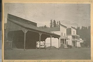
West Point is a census-designated place (CDP) in Calaveras County, California, in the United States. As of the 2010 United States Census, West Point's population was 674, down from 746 as of the 2000 census. The town is registered as California Historical Landmark #268. There is an annual West Point Lumberjack Days festival in the community.

<span class="mw-page-title-main">Auberry, California</span> Census-designated place in California, United States

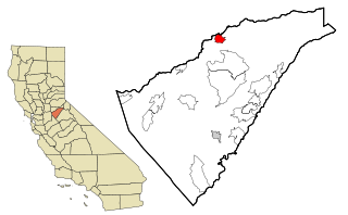
Auberry is a census-designated place (CDP) in Fresno County, California, United States. The population was 2,369 at the 2010 census, up from 2,053 at the 2000 census. Auberry is located on Little Sandy Creek 9.5 miles (15 km) west of Shaver Lake Heights, at an elevation of 2,018 feet (615 m).

<span class="mw-page-title-main">Lagunitas-Forest Knolls, California</span> Census-designated place in California, United States

Lagunitas-Forest Knolls is a census-designated place, composed of two unincorporated areas in the western half of the San Geronimo Valley in Marin County, California. It is located to the west of San Geronimo and Woodacre. The population was 1,924 at the 2020 census.

<span class="mw-page-title-main">Laytonville, California</span> Census-designated place in California, United States

Laytonville is a census-designated place (CDP) in Mendocino County, California, United States. It is located 23 miles (37 km) north-northwest of Willits, at an elevation of 1,670 feet (510 m). The population was 1,152 at the 2020 census, down from 1,227 at the 2010 census.

<span class="mw-page-title-main">Boronda, California</span> Census-designated place in California, United States

Boronda is an unincorporated community and census-designated place (CDP) in Monterey County, California, United States. The population was 1,760 at the 2020 census. Boronda is located directly west of Salinas and is named after José Eusebio Boronda, a Californio ranchero, and located on the lands of his Rancho Rincón del Sanjón.

<span class="mw-page-title-main">Meadow Vista, California</span> Census-designated place in California, United States

Meadow Vista is a census-designated place (CDP) in Placer County, California, United States. It is part of the Sacramento–Arden-Arcade–Roseville Metropolitan Statistical Area. The population was 3,217 at the 2010 census, up from 3,096 at the 2000 census.

<span class="mw-page-title-main">Indian Falls, California</span> Census-designated place in California, United States

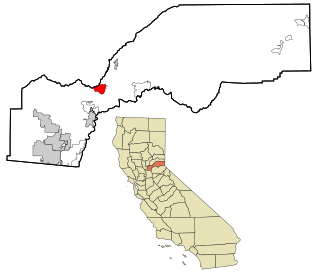
Indian Falls is a census-designated place (CDP) in Plumas County, California, United States. The population was 10 at the 2020 census, down from 54 at the 2010 census.

<span class="mw-page-title-main">Meadow Valley, California</span> Census-designated place in California, United States

Meadow Valley is a census-designated place (CDP) in Plumas County, California, United States. The population was 453 at the 2020 census, down from 464 at the 2010 census.

<span class="mw-page-title-main">Hidden Meadows, California</span> Census designated place in California, United States

Hidden Meadows is a census-designated place (CDP) near Escondido in San Diego County, California. The population was 3,485 at the 2010 census, up from 3,463 at the 2000 census.

<span class="mw-page-title-main">Corralitos, California</span> Census-designated place in California, United States

Corralitos is a census-designated place (CDP) in Santa Cruz County, California, United States. It is a rural area known for its agriculture of apples and strawberries, and its notable Corralitos Market and Sausage Co. Moreover, its location near the Pacific Ocean optimizes viticulture.

<span class="mw-page-title-main">Day Valley, California</span> Census-designated place in California, United States

Day Valley is a census-designated place (CDP) in Santa Cruz County, California, United States. The population was 3,409 at the 2010 census.

<span class="mw-page-title-main">Goshen, California</span> Census-designated place in California, United States

Goshen is a census-designated place (CDP) near Visalia, in Tulare County, California, United States. The population was at 5,387 in the 2020 census, up from the 3,006 in the 2010 census. Until the twentieth century, Goshen was an island in a marsh at the edge of Tulare Lake, formerly the largest freshwater lake west of the Great Lakes until drained.

<span class="mw-page-title-main">Lemon Cove, California</span> Census designated place in California, United States

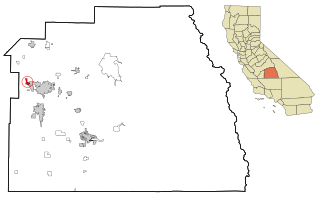
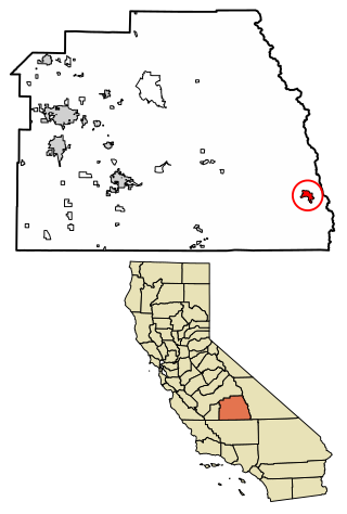
Lemon Cove is a census-designated place (CDP) in the San Joaquin Valley in Tulare County, California, United States. The population was 308 at the 2010 census, up from 298 at the 2000 census.

<span class="mw-page-title-main">Paramount-Long Meadow, Maryland</span> CDP in Maryland, United States

Paramount-Long Meadow is a census-designated place (CDP) in Washington County, Maryland, United States. The population was 2,722 at the 2000 census.

<span class="mw-page-title-main">Montgomery Creek, California</span> Census-designated place in California, United States

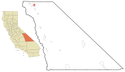
Montgomery Creek is a census-designated place in Shasta County, California, United States. Its population is 176 as of the 2020 census, up from 163 from the 2010 census. The town and associated creek were named after Zachariah Montgomery.

<span class="mw-page-title-main">Colonial Pine Hills, South Dakota</span> CDP in South Dakota, United States

Colonial Pine Hills is a census-designated place (CDP) and unincorporated community in Pennington County, South Dakota, United States. The population was 1,903 at the 2020 census.

<span class="mw-page-title-main">Max Meadows, Virginia</span> CDP in Virginia, United States

Max Meadows is a census-designated place (CDP) in Wythe County, Virginia, United States. The population was 562 at the 2010 census.

Paynes Creek is a census-designated place (CDP) in Tehama County, California. It is 23 miles (37 km) east of Red Bluff. Its ZIP code is 96075 and telephone prefixes follow (530-597-xxxx), which is shared with the town of Dales, about 9 miles (14 km) to the west. Paynes Creek sits at an elevation of 1,949 feet (594 m). The 2010 United States census reported Paynes Creek's population was 57.

<span class="mw-page-title-main">Kennedy Meadows (CDP), California</span> Census-designated place in California, United States

Kennedy Meadows refers to a census-designated place (CDP) in Tulare County, California, United States part of the Springville-Johnsondale CCD, and consists of the community surrounding Kennedy Meadows. The CDP is located to the south-east of the Kennedy Meadows Campground. The 2020 United States census reported Kennedy Meadows's population of permanent residents at 58, up from 28 at the 2010 census. The census definition of the area may not precisely correspond to local understanding of the area with the same name.

References

  1. "2020 U.S. Gazetteer Files". United States Census Bureau. Retrieved October 30, 2021.
  2. 1 2 U.S. Geological Survey Geographic Names Information System: Dixon Lane-Meadow Creek, California
  3. "Census of Population and Housing". Census.gov. Retrieved June 4, 2016.
  4. "2010 Census Interactive Population Search: CA - Dixon Lane-Meadow Creek CDP". U.S. Census Bureau. Archived from the original on July 15, 2014. Retrieved July 12, 2014.
  5. "U.S. Census website". United States Census Bureau . Retrieved January 31, 2008.
  6. "Senators". State of California. Retrieved April 11, 2013.
  7. "Members Assembly". State of California. Retrieved April 11, 2013.
  8. "California's 8th Congressional District - Representatives & District Map". Civic Impulse, LLC. Retrieved April 11, 2013.