Wilkerson, California

Last updated

Wilkerson
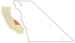
Inyo County California Incorporated and Unincorporated areas Wilkerson Highlighted.svg
Location in Inyo County and the state of California
Usa edcp location map.svg
Red pog.svg
Wilkerson
Location in the United States
Coordinates: 37°16′26″N118°22′30″W / 37.27389°N 118.37500°W / 37.27389; -118.37500
Country Flag of the United States (23px).png  United States
State Flag of California.svg  California
County Inyo
Area
[1]
  Total5.728 sq mi (14.835 km2)
  Land5.727 sq mi (14.833 km2)
  Water0.001 sq mi (0.002 km2)  0.013%
Elevation
[2]
4,403 ft (1,342 m)
Population
 (2010)
  Total563
  Density98/sq mi (38/km2)
Time zone UTC-8 (Pacific (PST))
  Summer (DST) UTC-7 (PDT)
ZIP code
93514
Area codes 442/760
FIPS code 06-85551
GNIS feature ID2409595 [2]

Wilkerson is a census-designated place (CDP) in Inyo County, California, United States. The population was 563 at the 2010 census, up from 562 at the 2000 census.

Contents

Geography

According to the United States Census Bureau, the CDP has a total area of 5.7 square miles (15 km2), over 99% of it land.

Demographics

2010

The 2010 United States Census [3] reported that Wilkerson had a population of 563. The population density was 98.3 inhabitants per square mile (38.0/km2). The racial makeup of Wilkerson was 524 (93.1%) White, 0 (0.0%) African American, 13 (2.3%) Native American, 5 (0.9%) Asian, 1 (0.2%) Pacific Islander, 5 (0.9%) from other races, and 15 (2.7%) from two or more races. Hispanic or Latino of any race were 53 persons (9.4%).

The Census reported that 563 people (100% of the population) lived in households, 0 (0%) lived in non-institutionalized group quarters, and 0 (0%) were institutionalized.

There were 244 households, out of which 55 (22.5%) had children under the age of 18 living in them, 151 (61.9%) were opposite-sex married couples living together, 14 (5.7%) had a female householder with no husband present, 8 (3.3%) had a male householder with no wife present. There were 10 (4.1%) unmarried opposite-sex partnerships, and 1 (0.4%) same-sex married couples or partnerships. 65 households (26.6%) were made up of individuals, and 31 (12.7%) had someone living alone who was 65 years of age or older. The average household size was 2.31. There were 173 families (70.9% of all households); the average family size was 2.76.

The population was spread out, with 100 people (17.8%) under the age of 18, 22 people (3.9%) aged 18 to 24, 88 people (15.6%) aged 25 to 44, 238 people (42.3%) aged 45 to 64, and 115 people (20.4%) who were 65 years of age or older. The median age was 51.2 years. For every 100 females, there were 101.1 males. For every 100 females age 18 and over, there were 97.9 males.

There were 265 housing units at an average density of 46.3 per square mile (17.9/km2), of which 244 were occupied, of which 200 (82.0%) were owner-occupied, and 44 (18.0%) were occupied by renters. The homeowner vacancy rate was 1.5%; the rental vacancy rate was 4.3%. 466 people (82.8% of the population) lived in owner-occupied housing units and 97 people (17.2%) lived in rental housing units.

2000

As of the census [4] of 2000, there were 562 people, 234 households, and 160 families residing in the CDP. The population density was 98.0 inhabitants per square mile (37.8/km2). There were 245 housing units at an average density of 42.7 per square mile (16.5/km2). The racial makeup of the CDP was 94.66% White, 0.18% Native American, 0.71% Asian, 1.07% from other races, and 3.38% from two or more races. 5.16% of the population were Hispanic or Latino of any race.

There were 234 households, out of which 27.8% had children under the age of 18 living with them, 56.8% were married couples living together, 4.7% had a female householder with no husband present, and 31.2% were non-families. 27.4% of all households were made up of individuals, and 13.2% had someone living alone who was 65 years of age or older. The average household size was 2.40 and the average family size was 2.89.

In the CDP, the population was spread out, with 23.3% under the age of 18, 5.9% from 18 to 24, 21.2% from 25 to 44, 32.6% from 45 to 64, and 17.1% who were 65 years of age or older. The median age was 45 years. For every 100 females, there were 105.1 males. For every 100 females age 18 and over, there were 100.5 males.

The median income for a household in the CDP was $35,583, and the median income for a family was $55,625. Males had a median income of $39,750 versus $22,981 for females. The per capita income for the CDP was $20,182. None of the families and 4.6% of the population were living below the poverty line, including no under eighteens and 3.1% of those over 64.

Politics

In the state legislature, Wilkerson is in the 8th Senate District , represented by Democrat Angelique Ashby, [5] and the 26th Assembly District , represented by Democrat Evan Low. [6]

Federally, Wilkerson is in California's 8th congressional district , represented by Democrat John Garamendi. [7]

Related Research Articles

<span class="mw-page-title-main">Thermalito, California</span> Census designated place in California, United States

Thermalito is a census-designated place (CDP) in Butte County, California, United States. The population was 6,646 at the 2010 census, up from 6,045 at the 2000 census. The area is generally considered an integral part of Oroville, and borders the town on two sides, in addition to the near-enclave of the city of Oroville surrounded by Thermalito on all sides, with the exception of the extremely narrow spit of land connecting Afterbay to Oroville proper.
<span class="mw-page-title-main">West Point, California</span> Census-designated place in California, United States

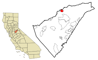
West Point is a census-designated place (CDP) in Calaveras County, California, in the United States. As of the 2010 United States Census, West Point's population was 674, down from 746 as of the 2000 census. The town is registered as California Historical Landmark #268. There is an annual West Point Lumberjack Days festival in the community.
<span class="mw-page-title-main">Friant, California</span> Census-designated place in California, United States

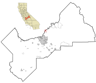
Friant is a census-designated place (CDP) in Fresno County, California, United States. The population was 549 at the 2010 census, down from 778 at the 2000 census. Friant is located 11.5 miles (19 km) north of Clovis, at an elevation of 344 feet.

<span class="mw-page-title-main">Westhaven-Moonstone, California</span> Census-designated place in California, United States

Westhaven-Moonstone is a census-designated place (CDP) located in Humboldt County, California, United States. As of the 2010 census the population was 1,205, up from 1,044 at the 2000 census.

<span class="mw-page-title-main">Mesa, California</span> Census-designated place in California, United States

Mesa is a census-designated place (CDP) in Inyo County, California, United States. The population was 251 at the 2010 census, up from 214 at the 2000 census.

<span class="mw-page-title-main">Dustin Acres, California</span> Census-designated place in California, United States

Dustin Acres is a census-designated place (CDP) in Kern County, California, United States. Dustin Acres is located 6.5 miles (10 km) north-northeast of Taft, at an elevation of 384 feet (117 m). The population was 652 at the 2010 census, up from 585 at the 2000 census.
<span class="mw-page-title-main">East San Gabriel, California</span> Census-designated place in California, United States

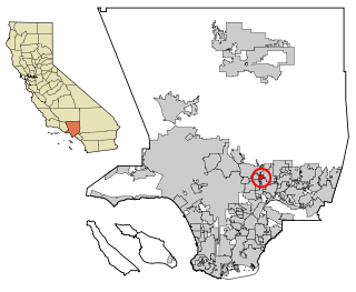
East San Gabriel is a census-designated place (CDP) in Los Angeles County, California, United States. The population was 14,874 at the 2010 census, up from 14,512 at the 2000 census.

<span class="mw-page-title-main">Tamalpais-Homestead Valley, California</span> Census-designated place in California, United States

Tamalpais-Homestead Valley is a census-designated place (CDP) in Marin County, California, United States. The population was 11,492 at the 2020 census.

<span class="mw-page-title-main">North Auburn, California</span> Census-designated place in California, United States

North Auburn is a census-designated place (CDP) in Placer County, California, United States. It is part of the Sacramento–Arden-Arcade–Roseville Metropolitan Statistical Area. The population was 13,452 at the 2020 census.

<span class="mw-page-title-main">Lake Almanor Peninsula, California</span> Census-designated place in California, United States

Lake Almanor Peninsula is a census-designated place (CDP) in Plumas County, California, United States. The population was 356 at the 2010 census, up from 336 at the 2000 census.

<span class="mw-page-title-main">Lake Almanor West, California</span> Census-designated place in California, United States

Lake Almanor West is a census-designated place (CDP) in Plumas County, California, United States. The population was 270 at the 2010 census, down from 329 at the 2000 census.
<span class="mw-page-title-main">Spring Garden, California</span> Census-designated place in California, United States

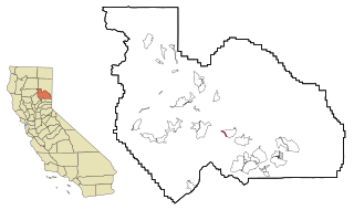
Spring Garden is a census-designated place (CDP) in Plumas County, California, United States. The population was 16 at the 2010 census, down from 55 at the 2000 census.

<span class="mw-page-title-main">Taylorsville, California</span> Census-designated place in California, United States

Taylorsville is a census-designated place (CDP) in Plumas County, California, United States. The population was 150 at the 2010 census, down from 154 at the 2000 census. The annual Stone Ranch Reunion is held in Taylorsville.

<span class="mw-page-title-main">Valley Ranch, California</span> Census-designated place in California, United States

Valley Ranch is a census-designated place in Plumas County, California, United States. The population was 109 at the 2010 census, up from 92 at the 2000 census.

<span class="mw-page-title-main">Lakeview, California</span> Census-designated place in California, United States

Lakeview is a census-designated place (CDP) in Riverside County, California, United States. The population was 2,104 at the 2010 census, up from 1,619 at the 2000 census. The community is named for nearby Mystic Lake.
<span class="mw-page-title-main">Fruitdale, San Jose</span> Place in California, United States

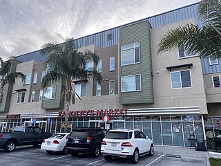
Fruitdale is a district of San Jose, California, though some portions are still unincorporated as a census-designated place. The population of the CDP was 935 at the 2010 census.
<span class="mw-page-title-main">Eldridge, California</span> Census-designated place in California, United States

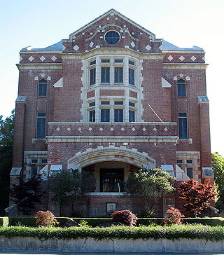
Eldridge is a census-designated place (CDP) in Sonoma County, California, United States. The population was 1,233 at the 2010 census. It is notably the home to the Sonoma Developmental Center, the largest facility serving the needs of persons with developmental disabilities in the state.

Bret Harte is a census-designated place (CDP) in Stanislaus County, California, United States. The population was 5,152 at the 2010 census, down from 5,161 at the 2000 census. It is part of the Modesto Metropolitan Statistical Area. It is named for the American poet and short story writer, Bret Harte, best known for his writings about the California Gold Rush.

<span class="mw-page-title-main">Jamestown, California</span> Census-designated place in California, United States

Jamestown is a census-designated place (CDP) in Tuolumne County, California, United States. The population was 3,433 at the 2010 census, up from 3,017 at the 2000 census. Formerly a California Gold Rush town, Jamestown is a California Historical Landmark since March 16, 1949. It is the home of Railtown 1897 State Historic Park and the Sierra Railway, which operates steam passenger trains.
<span class="mw-page-title-main">China Lake Acres, California</span> Census-designated place in California, United States

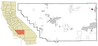
China Lake Acres is a census-designated place (CDP) in Kern County, California, United States. The population was 1,876 at the 2010 census, up from 1,761 at the 2000 census.
References

  1. "2010 Census U.S. Gazetteer Files – Places – California". United States Census Bureau.
  2. 1 2 U.S. Geological Survey Geographic Names Information System: Wilkerson, California
  3. "2010 Census Interactive Population Search: CA - Wilkerson CDP". U.S. Census Bureau. Archived from the original on July 15, 2014. Retrieved July 12, 2014.
  4. "U.S. Census website". United States Census Bureau . Retrieved January 31, 2008.
  5. "Senators". State of California. Retrieved April 11, 2013.
  6. "Members Assembly". State of California. Retrieved April 11, 2013.
  7. "California's 8th Congressional District - Representatives & District Map". Civic Impulse, LLC. Retrieved April 11, 2013.