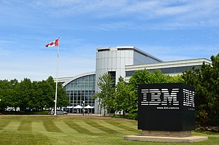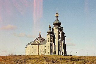
Markham is a city in the York Region of Ontario, Canada. It is approximately 30 km (19 mi) northeast of Downtown Toronto. In the 2021 Census, Markham had a population of 338,503, which ranked it the largest in York Region, fourth largest in the Greater Toronto Area (GTA), and 16th largest in Canada.

Richmond Hill is a city in south-central York Region, Ontario, Canada. Part of the Greater Toronto Area, it is the York Region's third most populous municipality and the 27th most populous municipality in Canada. Richmond Hill is situated between the cities of Markham and Vaughan, north of Thornhill, and south of Aurora.

Yonge Street is a major arterial route in the Canadian province of Ontario connecting the shores of Lake Ontario in Toronto to Lake Simcoe, a gateway to the Upper Great Lakes.

Toronto Chinatowns are ethnic enclaves in Toronto, Ontario, Canada, with a high concentration of ethnic Chinese residents and businesses. These neighbourhoods are major cultural, social and economic hubs for the Chinese-Canadian communities of the region. In addition to Toronto, several areas in the Greater Toronto Area also hold a high concentration of Chinese residents and businesses.
Stouffville is the primary urban area within the town of Whitchurch-Stouffville in York Region, Ontario, Canada. It is situated within the Greater Toronto Area and the inner ring of the Golden Horseshoe. The urban area is centred at the intersection of Main Street, Mill Street, and Market Street. Between 2006 and 2011, the population of the Community of Stouffville grew 100.5% from 12,411 to 24,886, or from 51% to 66% of the total population of the larger town of Whitchurch-Stouffville. The population of Stouffville from the 2021 census is 36,753.

Bathurst Street is a main north–south thoroughfare in Toronto, Ontario, Canada. It begins at an intersection of the Queens Quay roadway, just north of the Lake Ontario shoreline. It continues north through Toronto to the Toronto boundary at Steeles Avenue. It is a four-lane thoroughfare throughout Toronto. The roadway continues north into York Region where it is known as York Regional Road 38.
Buttonville is a suburban planned neighbourhood from a former police village in the city of Markham, Ontario, Canada, west of the larger Unionville neighbourhood. the former hamlet and police village named after its founder, John Button.

Milliken GO Station is a GO Transit train station in Toronto, Ontario, Canada. It is located in the neighbourhood of Milliken which is on the city's northern border with Markham, Ontario.

Milliken and Milliken Mills are neighbourhoods in the cities of Toronto and Markham. Milliken is situated in the north west section of Scarborough, whereas Milliken Mills is situated in the south-central portions of Markham. The neighbourhoods are centered on Kennedy Road and Steeles Avenue, the latter street serving as the boundary between the cities of Markham and Toronto.

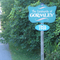
Gormley is a hamlet in York Region, Ontario, Canada that overlaps parts of Richmond Hill, and Whitchurch–Stouffville, two municipalities within the Greater Toronto Area. It was divided into two parts due to the construction of Highway 404. A portion of Gormley situated within Richmond Hill's political boundaries is subject to "Heritage Conservation District" controls. A post office in Gormley (East) serves as the mailing address for the Whitchurch–Stouffville communities of Bethesda, Gormley, Preston Lake, Vandorf, and Wesley Corners.

Victoria Square is an unincorporated community in Markham, Ontario, Canada. The community was formed in the early nineteenth century.

Armadale is a neighbourhood which overlaps the city of Markham, Ontario and the city of Toronto, Ontario, in Canada. The historical community is situated in the south-east of Markham and north-east of the former suburb of Scarborough, now part of Toronto.
Langstaff is a residential area at the tripoint of the cities of Richmond Hill, Markham, and Vaughan in York Region, Ontario, Canada. Located near Highway 7 and Yonge Street, the homes in the area date to the 1960s and 1970s. The East Don River and CN Rail Bala subdivision runs through the area.
Hagerman's Corners is a dispersed rural community in Markham, Ontario, Canada. Located at 14th Avenue and Kennedy Road, the former farm lands have disappeared and given way to homes and commercial parks. It is geographically located between the communities of Milliken Mills and Unionville, within the city of Markham.
Brown's Corners is an unincorporated community in Markham, Regional Municipality of York in the Greater Toronto Area of Ontario, Canada and located near the corner of Woodbine Avenue and Highway 7. The community, founded in 1842, was named for local settler Alexander Brown, Sr. (1771–1851) who acquired 100 acres (40 ha) in 1838. Beaver Creek flows through it.
Cashel, Ontario is a small hamlet situated in Unionville, Ontario located at the intersection of Elgin Mills Road and York Regional Road 67. Originally it was called Crosby Corners after John Crosby, the village's first store owner, who came originally from New York State. The name was changed to Cashel in 1851 with the opening of its first post office. It was likely named after Cashel in Ireland. In 1851 the community had a sawmill, cobbler shop, blacksmith shop, wagon shop, inn and tavern, Masonic Lodge, and Presbyterian church. In 1890 Peaches United Church was built on land from farmer Thomas Peach at 10762 McCowan Road. The church is a historic site and not operating since the 1960s to 1970s, but cemetery remains in active use. The east west sideroad along the church was locally called Peaches (Peach's) Sideroad or otherwise known as Elgin Mills Road.
Wesley Corners is a community situated in the Town of Whitchurch–Stouffville, Ontario, Canada.

Locust Hill is a historic community of Markham, Ontario centred on Hwy. 7 and the Canadian Pacific Railway and within the boundaries of the future national Rouge Park.

Ringwood is a hamlet in York Region, Ontario, Canada, in the Town of Whitchurch–Stouffville. The hamlet is centred at the intersection of Stouffville Road and Highway 48, on the Little Rouge River, a tributary of the Rouge River on the Oak Ridges Moraine. The community originally straddled the townships of Markham and Whitchurch in the County of York. The hamlet was named Ringwood in 1856 by George Sylvester, postmaster and owner of a general store, after the town of Ringwood, in Hampshire, England. It was first settled in the 1790s by George Fockler from Pennsylvania. The Little Rouge River runs along the eastern edge of the hamlet. In 1857, Ringwood had a population of 200 which grew only slightly to 225 by 1910. By 1972, the population had dropped to 172. Between 2008 and 2010, more than 250 homes were constructed in Ringwood's Cardinal Point subdivision north of Main Street. Construction on a new auto mall in Ringwood began in 2009, with Hyundai and Toyota dealerships opening in 2010, and Dodge/Jeep and Nissan dealerships constructed in 2013.


