Tasman Council is a local government body in Tasmania, situated in the south-east of the state. Tasman is classified as a rural local government area and has a population of 2,404, the region covers both the Tasman and Forestier peninsulas, with Nubeena the principal town.

Huon Valley Council is a local government body in Tasmania, covering most of the south of the state. Huon Valley is classified as a rural local government area and has a population of 17,219, towns and localities of the region include Cygnet, Dover, Franklin, Geeveston, Southport and the largest principal town, Huonville.

Glamorgan-Spring Bay Council is a local government body in Tasmania, situated on the central east coast of the state. Glamorgan-Spring Bay is classified as a rural local government area and has a population of 4,528, the major towns of the region include Bicheno, Orford and Triabunna with Swansea the principal town.

Break O'Day Council is a local government body in Tasmania, situated in the northern part of the state's east coast. Break O'Day is classified as a rural local government area and has a population of 6,770, the major towns of the region include St Helens, St Marys and Scamander.

Meander Valley Council is a local government body in northern Tasmania. It covers the western outskirts of Launceston, and further westward along the Meander River. Meander Valley Council is classified as a rural local government area and has a population of 19,713. Major towns and localities of the region include Elizabeth Town, Mole Creek, Westbury and the principal town of Deloraine.
West Tamar Council is a local government body in Tasmania, situated along the western side of the Tamar River in the north of the state. West Tamar is classified as an urban local government area and has a population of 23,769, it extends from the outer reaches of north-west Launceston and includes the towns and localities of Beaconsfield, Beauty Point and Legana.

Central Coast Council is a local government body in Tasmania, situated in the north-west of the state between Burnie and Devonport. Central Coast is classified as an urban local government area and has a population of 22,760, Ulverstone and Penguin are the two primary towns of the region.

Kentish Council is a local government body in Tasmania, situated in the north-west of the state, to the south and inland from Devonport. Kentish is classified as a rural local government area and has a population of 6,324, the major towns of the municipality are Sheffield, Railton and Wilmot.
Circular Head Council is a local government body in Tasmania covering the far north-west mainland. It is classified as a rural local government area with a population of 8,066, and its major towns and localities include Arthur River, Marrawah and Stanley, with Smithton being the largest and principal town. The origin of the name “Circular Head” is unknown.

Central Highlands Council is a local government body in Tasmania, encompassing the Central Highlands region of the state. Central Highlands is classified as a rural local government area and has a population of 2,144, the two largest towns are Bothwell and Hamilton.

Northern Midlands Council is a local government body in Tasmania, extending south of Launceston into the northern region of the Tasmanian central midlands. Northern Midlands is classified as a rural local government area and has a population of 13,300, the major population centres and localities of the region include Campbell Town, Evandale, Longford, and Perth.
Brighton Council is a local government body in Tasmania, situated in the south-east of the state, north of Hobart. The Brighton local government area is classified as urban and has a population of 18,995, it is based in the town of Brighton but also covers the far northern Hobart suburbs of Bridgewater, Gagebrook, Honeywood and Old Beach.
George Town Council is a local government body in northern Tasmania, situated north of Launceston. The George Town local government area is classified as rural and has a population of 6,931, it encompasses the principal town, George Town, and the nearby localities including Hillwood, Low Head and Pipers River.

Launceston City Council is a local government body in Tasmania, located in the city and surrounds of Launceston in the north of the state. The Launceston local government area is classified as urban and has a population of 70,055, which also encompasses the localities including Lilydale, Targa and through to Swan Bay on the eastern side of the Tamar River.

Latrobe Council is a local government body in Tasmania, situated in the north of the state, east of Devonport. The Latrobe local government area is classified as rural and has a population of 11,329, it encompasses the principal town, Latrobe, and the nearby localities including Port Sorell, Sassafras and Wesley Vale.

Devonport City Council is a local government body located in the city and surrounds of Devonport in northern Tasmania. The Devonport local government area is classified as urban and has a population of 25,415, which also encompasses Lillico, Tugrah and part of Spreyton.

Burnie City Council is a local government body in Tasmania, located in the city and surrounds of Burnie in the north-west of the state. The Burnie local government area is classified as urban and has a population of 19,348, which also encompasses Cooee, Hampshire, Natone and Ridgley.
King Island Council is a local government body in Tasmania, encompassing King Island and the adjacent minor islands within Bass Strait, in the north-west of the state. The King Island local government area is classified as rural and has a population of 1,601, with Currie as the main town and administrative centre.
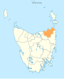
Flinders Council is a local government body in Tasmania, encompassing the Furneaux Group and nearby islands of Bass Strait, in the north-east of the state. Flinders is classified as a rural local government area and has a population of 987, with Whitemark the main town located on Flinders Island.

Ringarooma is a small town in north-eastern Tasmania. It is located just east of the Ringarooma River and is about 12 km (7.5 mi) south-west from Derby and 55 km (34 mi) east-northeast from Launceston. The area around Ringarooma is known for Dairy farming and timber harvesting. The locality is in the Dorset Council LGA, except for about 2.5% which is in the Break O'Day Council area.