City of Hobart

Last updated

Hobart City Council
Tasmania
City of Hobart Flag.svg
Flag of the City of Hobart
City of Hobart
Map showing the Hobart local government area.
Coordinates 42°53′52″S147°17′16″E / 42.8978°S 147.2877°E / -42.8978; 147.2877
Population53,684 (2018) [1]
 • Density689.1/km2 (1,784.9/sq mi)
Established1 January 1852
Area77.9 km2 (30.1 sq mi) [1]
Mayor Anna Reynolds
Council seatHobart
Region Central Hobart
State electorate(s) Clark
Federal division(s) Clark
City of Hobart Logo Transparent.png
Website Hobart City Council
LGAs around Hobart City Council:
Glenorchy Glenorchy Clarence
Glenorchy Hobart City Council Clarence
Kingborough Kingborough Derwent River
Hobart City LGA Tasmania locator map inset.svg

Hobart City Council (or City of Hobart) is a local government body in Tasmania, covering the central metropolitan area of the state capital, Hobart. The Hobart local government area has a population of 53,684 [1] and includes the suburbs of West Hobart, Lenah Valley, Mount Stuart, South Hobart, New Town, Sandy Bay and most of Fern Tree, North Hobart and Mount Nelson .

Contents

History and attributes

The present city council was created in 1852 by act of parliament, and the city mayor raised to Lord Mayor in 1934. [2] [3]

Mount Wellington and the River Derwent are major features of the natural environment of the City of Hobart. 61% of the area is bushland. [4]

Sister cities

Government

Hobart Town Hall Hobart Town Hall.jpg
Hobart Town Hall

The City of Hobart is governed by the Hobart City Council, consisting of twelve aldermen headed by the Lord Mayor of Hobart. The current Lord Mayor is Anna Reynolds, after winning the 2018 Council Election. Aldermen are elected every four years.

NamePosition [6] Party
Anna Reynolds Lord Mayor/Councillor  Your Hobart Independents
Helen Burnet Deputy Lord Mayor/Councillor  Greens
Will CoatsCouncillor  Liberal
Ben LohbergerCouncillor  Independent
Marti ZuccoAlderman  Independent
John KellyCouncillor  Independent
Mike DuttaCouncillor  Your Hobart Independents
Bill HarveyCouncillor  Greens
Louise BloomfieldAlderman  Liberal
Ryan PosseltCouncillor  Labor
Louise ElliotCouncillor  Independent
Zelinda SherlockCouncillor  Your Hobart Independents

Election results

2022

2022 Tasmanian local elections: Hobart [7] [8] [9] [10]
PartyCandidateVotes%±%
Your Hobart Independents Anna Reynolds (elected)4,26613.89
Independent John Kelly (elected)4,06713.24
Independent Marti Zucco (elected)2,1507.00
Independent Louise Elliot (elected)1,8245.94
Greens Helen Burnet (elected)1,5294.98
Independent Liberal Louise Bloomfield (elected)1,4734.80
Independent Liberal Simon Behrakis (elected)1,4484.72
Your Hobart Independents Mike Dutta (elected)1,2304.01
Greens Bill Harvey (elected)1,2193.97
Independent Labor Ryan Posselt (elected)1,0163.31
Independent Ben Lohberger (elected)9363.05
Independent Jax Fox8382.73
Your Hobart Independents Zelinda Sherlock (elected)6562.14
Your Hobart Independents Kate Kelly6462.10
Independent Jeff Briscoe6051.97
Our Hobart Marcus Bai5721.86
Your Hobart Independents Brian Corr5001.63
Independent Liberal Will Coats4861.58
Independent Damon Thomas4591.49
Greens Gemma Kitsos4281.39
Your Hobart Independents Matt Etherington3731.21
Independent Steven Phipps3501.14
Greens Bec Taylor3211.05
Greens Nathan Volf2810.92
Independent Debra Thurley2700.88
Independent Edwin Johnstone2680.87
Your Hobart Independents Juniper Shaw2580.84
Independent Liberal James McKee2560.83
Our Hobart Ron Christie2410.78
Independent Yang Liu2250.73
Independent Sam Campbell2130.69
Your Hobart Independents Raj Chopra1690.55
Ind. Liberal Democrat Duncan Spender 1570.51
Independent Tiina Sexton1370.45
Our Hobart Lili Christie1310.43
Independent Liberal Daniel Geng1270.41
Independent Liberal Stefan Vogel1150.37
Independent Jono Stagg1080.35
Independent Michael Jackson990.32
Our Hobart Ling Ling Gao760.25
Independent Joe Grech720.23
Our Hobart Owen Davies420.14
Our Hobart Karen Rothery390.13
Independent Cadence Mitchell320.10
Total formal votes30,70896.70
Informal votes1,0473.30
Turnout 31,75582.38
Party total votes
Independent 12,65341.21
Your Hobart Independents 8,09826.37
Independent Liberal 3,90512.72
Greens 3,77812.30
Our Hobart 1,1013.59
Independent Labor 1,0163.31
Independent Liberal Democrat 1570.51
Party total seatsSeats±
Independent 4
Your Hobart Independents 3
Greens 2
Independent Liberal 2
Independent Labor 1

Localities

Hobart suburbs

Battery PointDynnyrneFern TreeGlebeHobart city centreLenah ValleyMount NelsonMount StuartNew TownNorth HobartRidgewaySandy BaySouth HobartTolmans HillWest Hobart

Other localities

KingstonNeikaQueens DomainWellington ParkWest Moonah

Economy

The Hobart City Council estimates that on weekdays "close to 50% of the population of Greater Hobart would be in the City for working, shopping, education, personal business or leisure purposes". [4]

Major industries by employment: [4]

The City has five major hospitals and fire, police, and emergency service headquarters. [4]

Demographics

Hobart is classified as an urban capital city (UCC) under the Australian Classification of Local Governments. [11]

Selected historical census data for City of Hobart local government area
Census year2001 [12] 2006 [13] 2011 [14] 2016 [15] 2021 [16]
PopulationEstimated residents on census night 46,62247,70048,70350,43955,077
LGA rank in terms of size within Tasmania3rdSteady2.svg 3rdSteady2.svg 3rd
% of Tasmania population10.25%Decrease2.svg 10.01%Decrease2.svg 9.83%Increase2.svg 9.89%
% of Australian population0.25%Decrease2.svg 0.24%Increase2.svg 0.23%Decrease2.svg 0.22%
Cultural and language diversity
Ancestry,
top responses
English 29.6%Decrease2.svg 29.4%Increase2.svg 39.3%
Australian 26.6%Decrease2.svg 23.7%Increase2.svg 30.9%
Irish 9.1%Increase2.svg 9.7%Increase2.svg 11.9%
Scottish 7.8%Increase2.svg 8.3%Increase2.svg 11.1%
Chinese 3.2%Increase2.svg 4.4%Increase2.svg 8.5%
Language,
top responses
(other than English)
Mandarin 0.7%Increase2.svg 1.5%Increase2.svg 2.3%Increase2.svg 4.0%Increase2.svg 6.1%
Nepali 1.9%
Cantonese 0.6%Increase2.svg 0.7%Steady2.svg 0.7%Increase2.svg 0.8%Increase2.svg 1.1%
Punjabi 0.7%
Greek 1.1%Steady2.svg 1.1%Decrease2.svg 1.0%Decrease2.svg 0.9%Decrease2.svg 0.7%
Italian 1.0%Decrease2.svg 0.9%Decrease2.svg 0.8%Decrease2.svg 0.7%
German 0.5%Increase2.svg 0.6%Steady2.svg 0.6%
Arabic 0.8%
Religious affiliation
Religious affiliation,
top responses
No religion 23.5%Increase2.svg 28.5%Increase2.svg 37.5%Increase2.svg 46.4%Increase2.svg 54.6%
Catholic 20.7%Decrease2.svg 19.5%Decrease2.svg 17.7%Decrease2.svg 14.2%Decrease2.svg 11.9%
Anglican 25.8%Decrease2.svg 22.2%Decrease2.svg 18.7%Decrease2.svg 13.7%Decrease2.svg 10.3%
Not Stated5.6%
Hinduism 3.3%
Uniting 4.6%Decrease2.svg 4.0%Decrease2.svg 3.0%Decrease2.svg 2.1%
Presbyterian 2.2%Decrease2.svg 1.9%
Buddhism 1.9%
Median weekly incomes
Personal incomeMedian weekly personal incomeA$526A$641A$718A$886
% of Australian median income112.9%111.1%108.5%
Family incomeMedian weekly family incomeA$1380A$1782A$2023A$2324
% of Australian median income117.9%120.3%116.7%
Household incomeMedian weekly household incomeA$1036A$1260A$1439A$1842
% of Australian median income100.9%102.1%100.0%
Dwelling structure
Dwelling type Separate house 67.1%Increase2.svg 68.7%Decrease2.svg 68.3%Increase2.svg 68.6%Increase2.svg 68.9%
Semi-detached, terrace or townhouse 9.3%10.6%Increase2.svg Increase2.svg 10.8%Steady2.svg 10.8%Increase2.svg 11.4%
Flat or apartment 22.1%Decrease2.svg 19.9%Increase2.svg 20.0%Decrease2.svg 19.7%Decrease2.svg 18.8%
Other Dwelling0.5

Coat of arms

Coat of arms of City of Hobart
Coat of Arms of the City of Hobart.svg
Crest
On a wreath Argent and Azure a three masted sailing ship in full sail Or, mantled Azure doubled Or.
Escutcheon
Azure an estoile Or on a chief Argent a lion passant Gules.
Supporters
On the dexter side an emu and on the sinister side a kangaroo both reguardant and each gorged with a chaplet of apples leaved all Proper.
Motto
'Sic Fortis Hobartia Crevit.'

See also

Related Research Articles

<span class="mw-page-title-main">Hobart</span> Capital city of Tasmania, Australia

Hobart is the capital and most populous city of the island state of Tasmania, Australia. Home to almost half of all Tasmanians, it is the southernmost and least-populated Australian state capital city, and second-smallest if territories are taken into account, before Darwin, Northern Territory. Hobart is located in Tasmania's south-east on the estuary of the River Derwent, making it the most southern of Australia's capital cities. Its skyline is dominated by the 1,271-metre (4,170 ft) kunanyi/Mount Wellington, and its harbour forms the second-deepest natural port in the world, with much of the city's waterfront consisting of reclaimed land. The metropolitan area is often referred to as Greater Hobart, to differentiate it from the City of Hobart, one of the seven local government areas that cover the city. It has a mild maritime climate.
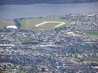
<span class="mw-page-title-main">Glenorchy, Tasmania</span> Suburb of Hobart, Tasmania, Australia

Glenorchy is a suburb of Hobart, in the state of Tasmania, Australia. Glenorchy is bound by the River Derwent to the east, Mount Wellington to the west, Hobart City to the south and Brighton to the north. The city officially begins at Creek Road New Town, in Hobart's northern suburbs, and includes, Moonah, Derwent Park, Lutana, Goodwood, Montrose, Rosetta, Berriedale, Chigwell, Claremont and Austins Ferry. It is the seat of the local government area of the same name, the City of Glenorchy.

<span class="mw-page-title-main">City of Clarence</span> Local government area in Tasmania, Australia

Clarence City Council is a local government body in Tasmania, and one of the five municipalities that constitutes the Greater Hobart Area. The Clarence local government area has a population of 61,531, covering the eastern shore of the Derwent River from Otago to the South Arm Peninsula and the smaller localities of Cambridge, Richmond, and Seven Mile Beach.

<span class="mw-page-title-main">Glamorgan–Spring Bay Council</span> Local government area in Tasmania, Australia

Glamorgan-Spring Bay Council is a local government body in Tasmania, situated on the central east coast of the state. Glamorgan-Spring Bay is classified as a rural local government area and has a population of 4,528, the major towns of the region include Bicheno, Orford and Triabunna with Swansea the principal town.

<span class="mw-page-title-main">Break O'Day Council</span> Local government area in Tasmania, Australia

Break O'Day Council is a local government body in Tasmania, situated in the northern part of the state's east coast. Break O'Day is classified as a rural local government area and has a population of 6,770, the major towns of the region include St Helens, St Marys and Scamander.

Dorset Council is a local government body in Tasmania, located in the far north-east of the state mainland. Dorset is classified as a rural local government area and has a population of 6,652. The major towns and localities of the region include Bridport, Derby and Ringarooma with Scottsdale the regional centre. Dorset was placed under a board of inquiry on 2 August 2023 and is currently under the supervision of commissioner Wardlaw. The current general manager is John Marik.

<span class="mw-page-title-main">New Town, Tasmania</span> Suburb of Hobart, Tasmania, Australia

New Town is a suburb of the city of Hobart, Tasmania, Australia, about 4 kilometres (2 mi) north of the central business district of Hobart. It is generally considered Hobart's oldest suburb, settled just a week after Sullivans Cove. It was historically the home of many of Hobart's wealthiest citizens, and New Town features a large number of grand residences, churches, and public buildings. The large farms were broken up following the world wars and it is now an inner city residential suburb. Many of its streets are lined with Federation style cottages. It is surrounded by the suburbs of North Hobart, Mount Stuart, Lenah Valley and Moonah, with the Queen's Domain just to the south-east. Most of the locality is within the Hobart local government area, with 2.5% within Glenorchy.

<span class="mw-page-title-main">Meander Valley Council</span> Local government body in Tasmania, Australia

Meander Valley Council is a local government body in northern Tasmania. It covers the western outskirts of Launceston, and further westward along the Meander River. Meander Valley Council is classified as a rural local government area and has a population of 19,713. Major towns and localities of the region include Elizabeth Town, Mole Creek, Westbury and the principal town of Deloraine.

Waratah-Wynyard Council is a local government body in Tasmania, situated in the north-west of the state. Waratah-Wynyard is classified as a rural local government area and has a population of 13,800, the major towns and localities of the region include Savage River, Sisters Beach, Somerset, Waratah and the principal town of Wynyard.

<span class="mw-page-title-main">Circular Head Council</span> Local government area in Tasmania, Australia

Circular Head Council is a local government body in Tasmania covering the far north-west mainland. It is classified as a rural local government area with a population of 8,066, and its major towns and localities include Arthur River, Marrawah and Stanley, with Smithton being the largest and principal town. The origin of the name “Circular Head” is unknown.

<span class="mw-page-title-main">West Coast Council</span> Local government area in Tasmania, Australia

West Coast Council is a local government body in Tasmania, covering much of the western region of the state. West Coast is classified as a rural local government area and has a population of 4,167. The major towns and localities of the region include Strahan, Rosebery, Zeehan and the principal town of Queenstown.

<span class="mw-page-title-main">City of Glenorchy</span> Local government area in Tasmania, Australia

Glenorchy City Council is a local government body in Tasmania, and one of the five municipalities that constitutes the Greater Hobart Area. The Glenorchy local government area has a population of 50,411, covering the suburbs north of central Hobart on the western shore of the Derwent River, including its namesake suburb, Glenorchy.

<span class="mw-page-title-main">Woodbridge, Tasmania</span> Locality in Tasmania, Australia

Woodbridge is a semi-rural locality in the local government area (LGA) of Kingborough in the Hobart LGA region of Tasmania. The locality is about 26 kilometres (16 mi) south of the town of Kingston. The 2021 Census recorded a population of 547 for the state suburb of Woodbridge, with the median age being 54. There are 180 families living in Woodbridge, with a mean of 1.8 children per household. It is located 38 kilometres (24 mi) south of the state capital, Hobart.

Lenah Valley is a suburb of Hobart, Tasmania. It is situated in the foothills of Mount Wellington, north of the CBD between Mount Stuart, New Town and the City of Glenorchy.

<span class="mw-page-title-main">Dynnyrne, Tasmania</span> Suburb of Hobart, Tasmania, Australia

Dynnyrne is a residential locality in the local government area (LGA) of Hobart in the Hobart LGA region of Tasmania. The locality is about 3 kilometres (1.9 mi) south-west of the town of Hobart. The 2016 census recorded a population of 1577 for the state suburb of Dynnyrne.

Dowsing Point is a residential locality in the local government area (LGA) of Glenorchy in the Hobart LGA region of Tasmania. The locality is about 2 kilometres (1.2 mi) north-east of the town of Glenorchy. The 2016 census recorded a population of 85 for the state suburb of Dowsing Point.

Brighton Council is a local government body in Tasmania, situated in the south-east of the state, north of Hobart. The Brighton local government area is classified as urban and has a population of 18,995, it is based in the town of Brighton but also covers the far northern Hobart suburbs of Bridgewater, Gagebrook, Honeywood and Old Beach.

<span class="mw-page-title-main">Sorell Council</span> Local government area in Tasmania, Australia

Sorell Council is a local government body in Tasmania, situated in the south-east of the state. The Sorell local government area is classified as rural and has a population of 15,218, the major centres of the region include Dodges Ferry, Dunalley, Primrose Sands and the principal town of Sorell.

<span class="mw-page-title-main">City of Launceston</span> Local government area in Tasmania, Australia

Launceston City Council is a local government body in Tasmania, located in the city and surrounds of Launceston in the north of the state. The Launceston local government area is classified as urban and has a population of 77,363, which also encompasses the localities including Lilydale, Targa and through to Swan Bay on the eastern side of the Tamar River. Launceston has a population growth rate of less than 1%

<span class="mw-page-title-main">City of Burnie</span> Local government area in Tasmania, Australia

Burnie City Council is a local government body in Tasmania, located in the city and surrounds of Burnie in the north-west of the state. The Burnie local government area is classified as urban and has a population of 19,348, which also encompasses Cooee, Hampshire, Natone and Ridgley.

References

  1. 1 2 3 "3218.0 – Regional Population Growth, Australia, 2017-18: Population Estimates by Local Government Area (ASGS 2018), 2017 to 2018". Australian Bureau of Statistics. Australian Bureau of Statistics. 27 March 2019. Retrieved 25 October 2019. Estimated resident population, 30 June 2018.
  2. "About Council". hobartcity.com.au. Hobart City Council. Retrieved 1 August 2021.
  3. "Agency Details: Hobart City Council". search.archives.tas.gov.au. Tasmanian Government. Retrieved 11 June 2018.
  4. 1 2 3 4 Draft City of Hobart Planning Scheme 2009 Archived 2009-10-20 at the Wayback Machine , Hobart City Council
  5. 1 2 "Hobart's International Relationships". City of Hobart. Retrieved 1 August 2021.
  6. "Current Elected Members". Hobart City Council. Retrieved 1 August 2021.
  7. "Hobart City Council". Tasmanian Electoral Commission.
  8. "Team teal: Independents join forces for election". The Mercury.
  9. "Greens Announce 5 Candidates for HCC Elections". Tasmanian Times.
  10. "Hobart City Council Elections Candidate Guide And Preview 2022". Dr Kevin Bonham.
  11. "Local government national report 2014-2015". regional.gov.au. Australian Government. Retrieved 8 June 2018.
  12. Australian Bureau of Statistics (9 March 2006). "City of Hobart (C)". 2001 Census QuickStats. Retrieved 3 December 2017. OOjs UI icon edit-ltr-progressive.svg
  13. Australian Bureau of Statistics (25 October 2007). "City of Hobart (C)". 2006 Census QuickStats. Retrieved 3 December 2017.
  14. Australian Bureau of Statistics (31 October 2012). "City of Hobart (C)". 2011 Census QuickStats. Retrieved 3 December 2017. OOjs UI icon edit-ltr-progressive.svg
  15. Australian Bureau of Statistics (27 June 2017). "Hobart (C)". 2016 Census QuickStats. Retrieved 23 November 2017. OOjs UI icon edit-ltr-progressive.svg
  16. Australian Bureau of Statistics (28 June 2022). "Hobart". 2021 Census QuickStats. Retrieved 27 January 2021. OOjs UI icon edit-ltr-progressive.svg