Councils of Tasmania are the 29 administrative districts of the Australian state of Tasmania. Local government areas (LGAs), more generally known as councils, are the tier of government responsible for the management of local duties such as road maintenance, town planning and waste management.
Dorset Council is a local government body in Tasmania, located in the far north-east of the state mainland. Dorset is classified as a rural local government area and has a population of 6,652. The major towns and localities of the region include Bridport, Derby and Ringarooma with Scottsdale the regional centre. Dorset was placed under a board of inquiry on 2 August 2023 and is currently under the supervision of commissioner Wardlaw. The current general manager is John Marik.

Northern Midlands Council is a local government body in Tasmania, extending south of Launceston into the northern region of the Tasmanian central midlands. Northern Midlands is classified as a rural local government area and has a population of 13,300, the major population centres and localities of the region include Campbell Town, Evandale, Longford, and Perth.

Deloraine is a town on the Meander River, in the central north of Tasmania, Australia. It is 50 km west of Launceston and 52 km south of Devonport along the Bass Highway. It is part of the Meander Valley Council. Deloraine recorded a population of 3,035 in the 2021 census. Deloraine, like most Tasmanian towns, has a temperate and wet climate.
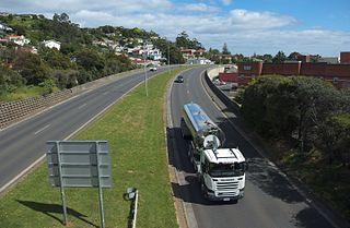
The Bass Highway is a highway in Tasmania, Australia. It connects the three cities across the north of the state – Burnie, Devonport and Launceston. The road was named due to its proximity to the Bass Strait. It is a part of the National Highway, designated as National Highway 1, together with the Midland and Brooker highways in Tasmania.
Westbury is a town in the central north of Tasmania, Australia. It lies 30 km west of Launceston on the Bass Highway, and at the 2021 census had a population of 2,272. It is part of, and the headquarters of, the Meander Valley Council area.
Meander is a rural locality and town in the local government area of Meander Valley in the Launceston region of Tasmania. The locality is about 34 kilometres (21 mi) south-west of the town of Westbury. The 2016 census has a population of 328 for the state suburb of Meander.

Liffey is a rural locality and town in the local government areas of Meander Valley and Northern Midlands in the Launceston and Central regions of Tasmania. The locality is about 24 kilometres (15 mi) south of the town of Westbury. The 2016 census has a population of 155 for the state suburb of Liffey. It was named by Captain William Moriarty, from Ireland. The town is situated in rainforest, on the Liffey River at the foot of the Great Western Tiers. Nearby towns are Bracknell and Blackwood Creek.

Bracknell is a rural locality and town in the local government areas of Meander Valley and Northern Midlands in the Launceston and Central regions of Tasmania. The locality is about 22 kilometres (14 mi) south-east of the town of Westbury. The 2016 census has a population of 459 for the state suburb of Bracknell.

Caveside is a rural locality in the local government area of Meander Valley in the Launceston region of Tasmania. The locality is about 45 kilometres (28 mi) south-west of the town of Westbury. It lies between the Great Western Tiers to the south and Mole Creek to the north. The 2016 census has a population of 133 for the state suburb of Caveside.

Mole Creek is a town in the upper Mersey Valley, in the central north of Tasmania, Australia. Mole Creek is well known for its honey and accounts for about 35 percent of Tasmania's honey production. The locality is in the Meander Valley Council area, but with about 3% in the Kentish Council LGA.
George Town Council is a local government body in northern Tasmania, situated north of Launceston. The George Town local government area is classified as rural and has a population of 6,931, it encompasses the principal town, George Town, and the nearby localities including Hillwood, Low Head and Pipers River.

Launceston City Council is a local government body in Tasmania, located in the city and surrounds of Launceston in the north of the state. The Launceston local government area is classified as urban and has a population of 70,055, which also encompasses the localities including Lilydale, Targa and through to Swan Bay on the eastern side of the Tamar River.
Prospect Vale is a rural/residential locality in the local government areas (LGA) of Launceston (1%) and Meander Valley (99%) in the Launceston LGA region of Tasmania. The locality is about 7 kilometres (4.3 mi) south-west of the town of Launceston. The 2016 census recorded a population of 5067 for the state suburb of Prospect Vale. It is a small suburb of Greater Launceston. Prospect Vale has a small shopping centre, Prospect Vale Marketplace, containing a Woolworths supermarket and a small industrial park lies within its boundaries. Sporting grounds include the St Patrick's Old Collegians Football Club Oval, who compete in the Northern Tasmania Football Association.
Kimberley is a rural locality and town in the local government areas of Meander Valley and Kentish in the Launceston and North-west and west regions of Tasmania. The locality is about 39 kilometres (24 mi) north-west of the town of Westbury. The 2016 census has a population of 149 for the state suburb of Kimberley. It is about midway between the towns of Sheffield and Deloraine. Once a thriving village with a school, railway station, shops and two churches, it is now a collection of houses with one church remaining.

Hagley is a rural locality and town in the local government area of Meander Valley in the Launceston region of Tasmania. The locality is about 5 kilometres (3.1 mi) north-east of the town of Westbury. The 2016 census has a population of 335 for the state suburb of Hagley.
Exton is a rural locality in the local government area of Meander Valley in the Launceston region of Tasmania. The locality is about 10 kilometres (6.2 mi) west of the town of Westbury. It lies on the outskirts of Deloraine, that lies next to the railway line from Launceston to Devonport. Its population was estimated at 200 in 1932, and the 2011 census reported the area of Reedy Marsh, which incorporated Exton, had a population of 309 people. The 2016 census has a population of 154 for the state suburb of Exton.
Chudleigh is a rural locality in the local government area of Meander Valley in the Launceston region of Tasmania. The locality is about 37 kilometres (23 mi) west of the town of Westbury. The 2016 census has a population of 203 for the state suburb of Chudleigh.
Birralee is a locality and small rural settlement in the local government areas of Meander Valley and West Tamar, in the Launceston region of Tasmania. It is located about 20 kilometres (12 mi) north of the town of Westbury. Black Sugarloaf Creek, a tributary of the Meander River, forms part of the southern boundary, and part of the eastern boundary runs parallel to Four Springs Creek. The 2016 census determined a population of 182 for the state suburb of Birralee.
Red Hills is a locality and suburb in the local government area of Meander Valley, in the Launceston region of Tasmania. It is located about 7 kilometres (4.3 mi) west of the town of Deloraine. The Meander River forms part of the south-eastern boundary, while its tributary Western Creek forms the remainder. The railway tracks of the Western line pass through the north-eastern corner of the locality, crossing the B12 route at Lemana Junction. The 2016 census determined a population of 120 for the state suburb of Red Hills.

