
The White Cliffs of Dover is the region of English coastline facing the Strait of Dover and France. The cliff face, which reaches a height of 350 feet (110 m), owes its striking appearance to its composition of chalk accented by streaks of black flint, deposited during the Late Cretaceous. The cliffs, on both sides of the town of Dover in Kent, stretch for eight miles (13 km). The White Cliffs of Dover form part of the North Downs. A section of coastline encompassing the cliffs was purchased by the National Trust in 2016.

Kent Wildlife Trust (KWT) is a conservation charity in the United Kingdom that was founded in 1958, previously known as the Kent Trust for Nature Conservation. It aims to "work with people to restore, save and improve our natural spaces" and to "ensure that 30% of Kent and Medway – land and sea – is managed to create a healthy place for wildlife to flourish". In 2016 it had thirty-one thousand members and an annual income of £4 million. KWT manages over sixty-five nature reserves, of which twenty-four are Sites of Special Scientific Interest, two are national nature reserves, nine are Nature Conservation Review sites, seven are Special Areas of Conservation, three are Special Protection Areas, seven are local nature reserves, one is a Geological Conservation Review site, thirteen are in Areas of Outstanding Natural Beauty and one is a scheduled monument.

Lydden and Temple Ewell Downs is a 63.2-hectare (156-acre) biological Site of Special Scientific Interest north-west of Dover in Kent. It is a Special Area of Conservation and Nature Conservation Review site. It is also part of the 78.5-hectare (194-acre) Lydden Temple Ewell National Nature Reserve and the 90-hectare (220-acre) Lydden Temple Ewell nature reserve, which is managed by the Kent Wildlife Trust. It is in the South Downs Area of Outstanding Natural Beauty.

Mole Gap to Reigate Escarpment is a 1,016.4-hectare (2,512-acre) biological and geological Site of Special Scientific Interest west of Reigate in Surrey. It is a Geological Conservation Review site and a Special Area of Conservation. Part of it is a Nature Conservation Review site, Grade I. Two small private nature reserves in the site are managed by the Surrey Wildlife Trust, Dawcombe and Fraser Down.

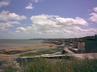
Folkestone Warren is a 316.3-hectare (782-acre) biological and geological Site of Special Scientific Interest (SSSI) which runs along the coast between Folkestone and Dover in Kent. It is a Nature Conservation Review site and it contains three Geological Conservation Review sites and part of a fourth. An area of 83.6 hectares is a Local Nature Reserve,
Sandwich Bay to Hacklinge Marshes is a 1,790.1-hectare (4,423-acre) biological and geological Site of Special Scientific Interest which stretches between Deal and Sandwich in Kent. It includes two Geological Conservation Review sites, and most of it is a Nature Conservation Review site, Grade I. Part of it is a Ramsar site, a Special Area of Conservation, a Special Protection Area and a National Nature Reserve, It also includes a Kent Wildlife Trust nature reserve and a Local Nature Reserve,
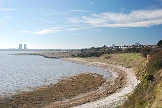
Thanet Coast is an 816.9-hectare (2,019-acre) biological and geological Site of Special Scientific Interest which stretches along the coast between Whitstable and Ramsgate in Kent. It is a Geological Conservation Review site, and overlaps two Special Area of Conservations. It is also part of a Ramsar Site and a Special Protection Area. Part of it is a Local Nature Reserve,

Prince's Beachlands is a 6-hectare (15-acre) Local Nature Reserve north of Sandwich in Kent. It is owned by Dover Town Council and managed by Kent Wildlife Trust as part of the Sandwich Bay to Hacklinge Marshes nature reserve. It is part of the Sandwich and Pegwell Bay Nature Conservation Review site, Grade I, Thanet Coast and Sandwich Bay Ramsar site, Sandwich Bay Special Area of Conservation, Thanet Coast and Sandwich Bay Special Protection Area and Sandwich Bay to Hacklinge Marshes Site of Special Scientific Interest.

Sandwich and Pegwell Bay is a 615-hectare (1,520-acre) nature reserve in Kent, managed by the Kent Wildlife Trust. It is a National Nature Reserve, and it includes a Geological Conservation Review site, Prince's Beachlands Local Nature Reserve and two Special Areas of Conservation, Sandwich Bay and Thanet Coast. It is part of Sandwich Bay and Thanet Coast Ramsar site and Special Protection Area. It is also of Sandwich Bay to Hacklinge Marshes Site of Special Scientific Interest and Sandwich/Pegwell Bay Nature Conservation Review site, Grade I.

Morston Cliff is a 1-hectare (2.5-acre) geological Site of Special Scientific Interest east of Wells-next-the-Sea in Norfolk. It is a Geological Conservation Review site. It is part of Blakeney National Nature Reserve, which is managed by the National Trust, and of the Norfolk Coast Area of Outstanding Natural Beauty.
