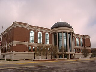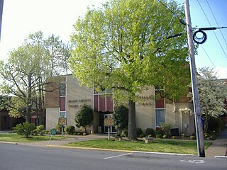
Warren County is a county located in the U.S. state of Kentucky. As of 2014, the population was 120,460, making it the fifth-most populous county in Kentucky. The county seat is Bowling Green. Generally the county is dry, prohibiting the sale of alcohol, but retail alcohol sales are allowed in the "wet city" of Bowling Green; Warren County is classified as a moist county.

Owsley County is a county located in the Eastern Coalfield region of the U.S. state of Kentucky. As of the 2010 census, the population was 4,755, making it the second-least populous county in Kentucky. The county seat is Booneville. The county was organized on January 23, 1843 from Clay, Estill, and Breathitt counties and named for William Owsley (1782–1862), the judge of the Kentucky Court of Appeals and Governor of Kentucky (1844–48).

Hart County is a county located in the Commonwealth of Kentucky. As of the 2010 census, the population was 18,199. Its county seat is Munfordville. Hart County is a prohibition or dry county.

Elliott County is a county located in the U.S. state of Kentucky. As of the 2010 census, the population was 7,852. Its county seat is Sandy Hook. The county was formed in 1869 from parts of Morgan, Lawrence, and Carter counties, and is named for John Milton Elliott, U.S. Congressman; Confederate Justice of the Kentucky Court of Appeals. In regard to alcohol sales, Elliott County is a dry county, meaning the sale of alcoholic beverages is prohibited everywhere in the county.

Breathitt County is a county located in the eastern Appalachian portion of the U.S. state of Kentucky. As of the 2010 census, the population was 13,878. Its county seat is Jackson, Kentucky. The county was formed in 1839 and was named for John Breathitt, who was Governor of Kentucky from 1832 to 1834. Breathitt County was a prohibition or dry county, until a public vote in July 2016 that allowed alcohol sales.

Bell County is a county located in the southeast part of the U.S. state of Kentucky. As of the 2010 census, the population was 28,691. Its county seat is Pineville. The county was formed in 1867, during the Reconstruction era from parts of Knox and Harlan counties and augmented from Knox County in 1872. The county is named for Joshua Fry Bell, a US Representative. It was originally called "Josh Bell", but on January 31, 1873, the Kentucky legislature shortened the name to "Bell",

Allen County is a county located in the U.S. state of Kentucky. As of the 2010 census, the population was 19,956. Its county seat is Scottsville. The county is named for Colonel John Allen, a state senator and soldier who was killed leading the 1st Regiment of Kentucky Rifleman at the Battle of Frenchtown, Michigan during the War of 1812. Allen County is a prohibition or completely dry county. It was formed in 1815 from parts of Barren and Warren counties.

Glasgow is a home rule-class city in Barren County, Kentucky, United States. It is the seat of its county. The population was 14,028 at the 2010 U.S. census. The city is well known for its annual Scottish Highland Games. In 2007, Barren County was named the number one rural place to live by The Progressive Farmer magazine. Glasgow is the principal city of the Glasgow micropolitan area, which comprises Barren and Metcalfe counties.
Three Forks may refer to:

The Big South Fork National River and Recreation Area preserves the Big South Fork of the Cumberland River and its tributaries in northeastern Tennessee and southeastern Kentucky. In addition, the former mining community of Blue Heron is preserved and interpreted via signage.
The Office of Kentucky Nature Preserves is an agency of the Commonwealth of Kentucky in the United States dedicated to the protection of Kentucky's natural heritage. It oversees a statewide program of nature preserves, Kentucky Wild Rivers Program, and the "Nature's Finest" license plate program of the Kentucky Heritage Land Conservation Fund Board. The program was formerly known as the "Kentucky State Nature Preserves Commission", from 1976 until a reorganization in 2018.

This is a list of the National Register of Historic Places listings in McCreary County, Kentucky.

Etoile is an unincorporated community in Barren County, Kentucky, United States. The Etoile Post Office closed in 1988.

Flippin is an unincorporated community located in Monroe County, Kentucky, United States. A small residential village is located on Highway 249, approximately 3.6 miles south of the Monroe-Barren County line. The village and community surround the intersection of Highway 249, Highway 678, and Highway 100. Flippin is situated northwest of Gamaliel, west of Tompkinsville, and east of Fountain Run.

Coral Hill is a rural unincorporated community in northeast Barren County, Kentucky, United States.


