Merry Oaks, Kentucky

Last updated
Merry Oaks
USA Kentucky location map.svg
Red pog.svg
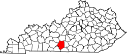
Merry Oaks
Location within the state of Kentucky
Usa edcp location map.svg
Red pog.svg
Merry Oaks
Merry Oaks (the United States)
Coordinates: 37°01′20″N86°06′22″W / 37.02222°N 86.10611°W / 37.02222; -86.10611 Coordinates: 37°01′20″N86°06′22″W / 37.02222°N 86.10611°W / 37.02222; -86.10611
Country Flag of the United States.svg United States
State Flag of Kentucky.svg  Kentucky
County Barren
Elevation
682 ft (208 m)
Time zone UTC-5 (Central (CST))
  Summer (DST) UTC-4 (CDT)
ZIP codes
42171
GNIS feature ID508594 [1]

Merry Oaks is a rural unincorporated community in northwest Barren County, Kentucky, United States. [1] [2]

Unincorporated area Region of land not governed by own local government

In law, an unincorporated area is a region of land that is not governed by a local municipal corporation; similarly an unincorporated community is a settlement that is not governed by its own local municipal corporation, but rather is administered as part of larger administrative divisions, such as a township, parish, borough, county, city, canton, state, province or country. Occasionally, municipalities dissolve or disincorporate, which may happen if they become fiscally insolvent, and services become the responsibility of a higher administration. Widespread unincorporated communities and areas are a distinguishing feature of the United States and Canada. In most other countries of the world, there are either no unincorporated areas at all, or these are very rare; typically remote, outlying, sparsely populated or uninhabited areas.

Barren County, Kentucky county in Kentucky, United States

Barren County is a county located in the U.S. state of Kentucky. As of the 2010 census, the population was 42,173. Its county seat is Glasgow. The county was founded on December 20, 1798, from parts of Warren and Green Counties. It was named for the Barrens, meadow lands that cover the northern third, though actually the soil is fertile.

Related Research Articles

Warren County, Kentucky county in Kentucky, United States

Warren County is a county located in the U.S. state of Kentucky. As of 2014, the population was 120,460, making it the fifth-most populous county in Kentucky. The county seat is Bowling Green. Generally the county is dry, prohibiting the sale of alcohol, but retail alcohol sales are allowed in the "wet city" of Bowling Green; Warren County is classified as a moist county.

Allen County, Kentucky county in Kentucky, United States

Allen County is a county located in the U.S. state of Kentucky. As of the 2010 census, the population was 19,956. Its county seat is Scottsville. The county is named for Colonel John Allen, a state senator and soldier who was killed leading the 1st Regiment of Kentucky Rifleman at the Battle of Frenchtown, Michigan during the War of 1812. Allen County is a prohibition or completely dry county. It was formed in 1815 from parts of Barren and Warren counties.

Glasgow, Kentucky City in Kentucky, United States

Glasgow is a home rule-class city in Barren County, Kentucky, United States. It is the seat of its county. The population was 14,028 at the 2010 U.S. census. The city is well known for its annual Scottish Highland Games. In 2007, Barren County was named the number one rural place to live by The Progressive Farmer magazine. Glasgow is the principal city of the Glasgow micropolitan area, which comprises Barren and Metcalfe counties.

The Office of Kentucky Nature Preserves is an agency of the Commonwealth of Kentucky in the United States dedicated to the protection of Kentucky's natural heritage. It oversees a statewide program of nature preserves, Kentucky Wild Rivers Program, and the "Nature's Finest" license plate program of the Kentucky Heritage Land Conservation Fund Board. The program was formerly known as the "Kentucky State Nature Preserves Commission", from 1976 until a reorganization in 2018.

Joel Yancey was a United States Representative from Kentucky. He was born in Albemarle County, Virginia. Later, he moved to Kentucky. Yancey was a member of the Kentucky House of Representatives 1809-1811. He also served in the Kentucky Senate 1816-1820 and 1824-1827.

United States District Court for the Western District of Kentucky

The United States District Court for the Western District of Kentucky is the federal district court for the western part of the state of Kentucky.

Barren River river in the United States of America

The Barren River is a 135-mile-long (217 km) river in western Kentucky, United States. It is the largest tributary of the Green River, which drains more of Kentucky than any other river. The Barren River rises in Monroe County and flows into the Green in northeast Warren County.

Spread Eagle Barrens State Natural Area

Spread Eagle Barrens State Natural Area is a 7,155-acre (2,896 ha) protected area just off of U.S. 2 in Florence County, Wisconsin, USA. The nearest unincorporated community is Spread Eagle, Wisconsin, but the closest large city is Iron Mountain, Michigan; 6 miles (10 km) away. The Spread Eagle Barrens is owned by the Wisconsin Department of Natural Resources and the Wisconsin Energy Corporation, and was designated a State Natural Area in 1995.

1992 United States presidential election in Kentucky

The 1992 United States presidential election in Kentucky took place on November 3, 1992, as part of the 1992 United States presidential election. As of the result of the 1990 census, Kentucky lost one electoral vote. As a result, voters chose eight representatives, or electors to the Electoral College, who voted for president and vice president.

Nobob, Kentucky Unincorporated community in Kentucky, United States

Nobob is an unincorporated community in Barren County, Kentucky, United States.

Bear Wallow, Barren County, Kentucky Unincorporated community in Kentucky, United States

Bear Wallow is an unincorporated community in Barren County, Kentucky, United States.

Roseville, Barren County, Kentucky Unincorporated community in Kentucky, United States

Roseville is an unincorporated community in Barren County, Kentucky, United States. Roseville is located at the junction of Kentucky Route 249 and Kentucky Route 1318 7.5 miles (12.1 km) south of Glasgow. Landrum, which is listed on the National Register of Historic Places, is located in Roseville.

Coral Hill, Kentucky Unincorporated community in Kentucky, United States

Coral Hill is a rural unincorporated community in northeast Barren County, Kentucky, United States.

Dry Fork, Kentucky Unincorporated community in Kentucky, United States

Dry Fork is a rural unincorporated community in southern Barren County, Kentucky, United States.

Griderville, Kentucky Unincorporated community in Kentucky, United States

Griderville is a rural unincorporated community in northern Barren County, Kentucky, United States.

Halfway, Barren County, Kentucky Unincorporated community in Kentucky, United States

Halfway is a rural unincorporated community in northeast Barren County, Kentucky, United States.

Highland Springs, Kentucky Unincorporated community in Kentucky, United States

Highland Springs is a rural unincorporated community in northwest Barren County, Kentucky, United States.

References

  1. 1 2 "Merry Oaks". Geographic Names Information System . United States Geological Survey.
  2. "Merry Oaks Populated Place Profile / Barren County, Kentucky Data". kentucky.hometownlocator.com. Retrieved February 22, 2019.