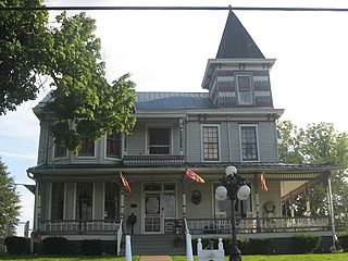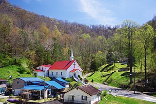
Wayne County is the westernmost county in the U.S. state of West Virginia. As of the 2020 census, the population was 38,982. Its county seat is Wayne. The county was founded in 1842 and named for General "Mad" Anthony Wayne.

Kermit is a town in Mingo County, West Virginia, United States. The population was 406 at the 2010 census. Kermit is located along the Tug Fork, opposite Warfield, Kentucky. The Norfolk Southern Railway's Kenova District runs through town.

Wayne is a town in and the county seat of Wayne County, West Virginia, United States. The population was 1,441 at the 2020 census. It is part of the Huntington–Ashland metropolitan area.

The Cacapon River, located in the Appalachian Mountains of West Virginia's Eastern Panhandle region, is an 81.0-mile-long (130.4 km) shallow river known for its fishing, boating, wildlife, hunting, and wilderness scenery. As part of the Potomac River watershed, it is an American Heritage River.

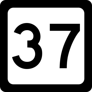
West Virginia Route 37 is an east–west state highway in western West Virginia. The western terminus of the route is at the Kentucky state line in Fort Gay, where WV 37 becomes Kentucky Route 3 Spur upon crossing the Tug Fork. The eastern terminus is at West Virginia Route 10 one mile (1.6 km) south of Ranger.

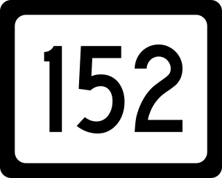
West Virginia Route 152 is a north–south state highway extending from Crum to Huntington, West Virginia. The northern terminus of WV 152 is unusual in that it also serves as the southern terminus of West Virginia Route 527, which continues along the same street as it passes over Interstate 64 at exit 8. WV 527 continues along the former routing of U.S. Route 52 through downtown Huntington, West Virginia on its way toward Chesapeake, Ohio. The southern terminus of the route is at US 52 northeast of Crum.

Twelvepole Creek is a 32.2-mile-long (51.8 km) river located in Wayne County, West Virginia. It is part of the Mississippi River watershed, by way of the Ohio River. It is alternately known as Twelve Pole Creek.

Lavalette is a census-designated place (CDP) in Wayne County, West Virginia, in the United States. As of the 2010 census, its population was 1,073. Lavalette is located at the intersection of West Virginia Route 152 and West Virginia Route 75, eight miles south of Huntington. The town is near Beech Fork Lake, a popular location for boating and fishing, and Twelvepole Creek. Lavalette was named after Lavalette Miller, the daughter of a Norfolk & Western Railway official.

East Lynn is an unincorporated community in Wayne County, West Virginia, United States, located along the banks of Twelvepole Creek, approximately eight miles south of the county seat, Wayne. It was also known as Mouth of Little Lynn. East Lynn is a part of the Huntington-Ashland Metropolitan Statistical Area (MSA). As of the 2010 census, the MSA had a population of 287,702. New definitions from February 28, 2013 placed the population at 363,000.
Crum is a census-designated place (CDP) in southern Wayne County, West Virginia, United States. As of the 2010 census, its population was 182. It is the home to Crum Pre K-8 school opened in 2017. It is a part of the Huntington-Ashland Metropolitan Statistical Area (MSA).
Sandyville is an unincorporated community in north central Jackson County, West Virginia, United States. It lies close to the left fork of Sandy Creek, nestled in the hills between Ravenswood and Ripley. It has a population of 1,721 and an average household income of $41,122.
Branchland is an unincorporated community in western Lincoln County, West Virginia, United States. It lies along West Virginia Route 10, southwest of the town of Hamlin, the county seat of Lincoln County. Its elevation is 597 feet (182 m). It has a post office with the ZIP code 25506. Raccoon Creek Road is one of the more popular ways of transportation through the area. Branchland Post Office serves addresses within Sheridan Magisterial District of Lincoln County as well as addresses in southern Cabell County and eastern Wayne County, West Virginia.
Belva is an unincorporated community and census-designated place in west Nicholas County and north Fayette County, West Virginia, United States; while the CDP only includes the Nicholas County portion, the Fayette County portion is considered part of the community. The town is situated at the bottomland surrounding the convergence of Bells Creek with Twentymile Creek and, subsequently, Twenty Mile Creek with the Gauley River. Belva is also the location of the convergence of two state highways: West Virginia Route 16 and West Virginia Route 39.
The Hagerstown–Martinsburg Metropolitan Area, officially designated by the United States Office of Management and Budget (OMB) as Hagerstown–Martinsburg, Maryland–West Virginia Metropolitan Statistical Area (MSA), constitutes the primary cities of Hagerstown, Maryland; Martinsburg, West Virginia; and surrounding areas in three counties: Washington County, Maryland; Berkeley County, West Virginia; and Morgan County, West Virginia. The metro area lies mainly within the rich, fertile Cumberland and Shenandoah valleys, and is approximately a 60–90 minute drive from Washington, D.C.; Baltimore, Maryland; and Harrisburg, Pennsylvania; Hagerstown is approximately 75 miles (121 km) driving distance from all three cities. The population of the metropolitan area as of 2008 is 263,753.
Shock is an unincorporated community in Gilmer County, West Virginia, United States. Shock is 13 miles (21 km) southwest of Glenville, along the Right Fork Steer Creek. Shock has a post office with ZIP code 26638.

Dingess is an unincorporated community in Mingo County, West Virginia, United States. Dingess is 10 miles (16 km) northeast of Lenore and 13 miles (21 km) west of Logan. Dingess has a post office with ZIP code 25671.
Sewell is an unincorporated community in Fayette County, West Virginia, United States. Sewell is located on the New River, 6 miles (9.7 km) southeast of Fayetteville. Sewell was the sight of a major coking operation with 193 beehive coke ovens operating in the late nineteenth century and early to mid twentieth century. The operation was serviced by the Mann's Creek Railroad between 1886 and 1955.
Whitman is an unincorporated community in Logan County, West Virginia, United States. Whitman is 3 miles (4.8 km) southwest of Logan. Whitman has a post office with ZIP code 25652.

Dante is a census-designated place in Russell and Dickenson counties, Virginia, in the United States. The population as of the 2010 Census was 649.
Rosbys Rock is an unincorporated community in Marshall County, West Virginia, United States.


