Related Research Articles
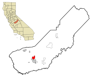
Madera Acres is a census-designated place (CDP) in Madera County, California, United States. It is part of the Madera Metropolitan Statistical Area. The population was 9,162 at the 2020 census, virtually unchanged from 2010.

Tamalpais-Homestead Valley is a census-designated place (CDP) in Marin County, California, United States. The population was 11,492 at the 2020 census.

Lenwood is a census-designated place (CDP) in the Mojave Desert near Barstow, in San Bernardino County, California.
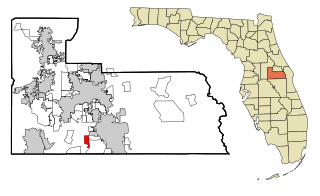
Southchase is a census-designated place and an unincorporated area in Orange County, Florida, United States. The population was 15,921 at the 2010 census. It is part of the Orlando–Kissimmee–Sanford, Florida Metropolitan Statistical Area.

Memphis is a census-designated place (CDP) in Clark County, Indiana, United States. The population was 695 at the 2010 census.

White Island Shores is a census-designated place (CDP) in the town of Wareham in Plymouth County, Massachusetts, United States, along the shores of White Island Pond. The population was 2,106 at the 2010 census.

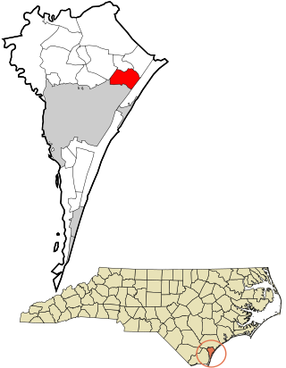
Royal Pines is a census-designated place (CDP) in Buncombe County, North Carolina, United States. The population was 4,272 at the 2010 census. It is part of the Asheville Metropolitan Statistical Area.
Ogden is a census-designated place (CDP) in New Hanover County, North Carolina, United States. It is both a suburb of the city of Wilmington and part of the Wilmington Metropolitan Statistical Area. The population was 6,766 at the 2010 census, up from 5,481 in 2000.
Raemon is a census-designated place (CDP) in Robeson County, North Carolina, United States. The population was 212 as of the 2000 census.
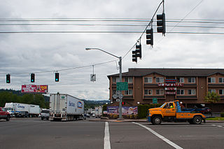
Clackamas is an unincorporated community and former census-designated place (CDP) in Clackamas County, Oregon, United States, and is a suburb of Portland. The population was approximately 7,000 as of 2010.
Glide is a census-designated place (CDP) in Douglas County, Oregon, United States. The population was 1,795 at the 2010 census.
Renningers is a census-designated place (CDP) in Schuylkill County, Pennsylvania, United States. The population was 380 at the 2000 census.

Antelope is a census-designated place (CDP) in Todd County, South Dakota, United States. The population was 830 at the 2020 census.
East Cleveland is a census-designated place (CDP) and community in Bradley County, Tennessee, United States. It is located directly east of the city limits of Cleveland, and is also considered one of the major divisions of the city. The population was 1,725 at the 2020 census. It is included in the Cleveland Metropolitan Statistical Area.
Wildwood Lake is a census-designated place (CDP) in Bradley County, Tennessee, United States. The population was 3,286 at the 2020 Census. It is included in the Cleveland, Tennessee Metropolitan Statistical Area.
Walnut Hill is a census-designated place (CDP) in Sullivan County, Tennessee. The population was 2,394 at the 2010 census. It is part of the Kingsport-Bristol-Bristol, TN-VA Metropolitan Statistical Area, which is a component of the Johnson City-Kingsport-Bristol, TN-VA Combined Statistical Area, commonly known as the "Tri-Cities" region.
Oak Grove is a census-designated place (CDP) in Washington County, Tennessee, United States. The population was 4,425 at the 2010 census. It is part of the Johnson City Metropolitan Statistical Area, which is a component of the Johnson City–Kingsport–Bristol, TN-VA Combined Statistical Area – commonly known as the "Tri-Cities" region.

Andover is a census-designated place (CDP) in the town of Andover in Essex County, Massachusetts, United States. The population was 8,762 at the 2010 census.
Lincoln is a census-designated place (CDP) consisting of the primary settlement in the town of Lincoln in Penobscot County, Maine, United States. The population was 2,884 at the 2010 census.
Anson is a census-designated place (CDP) in the town of Anson in Somerset County, Maine, United States. The population was 818 at the 2000 census.
References
- ↑ "ArcGIS REST Services Directory". United States Census Bureau. Retrieved October 15, 2022.
- 1 2 U.S. Geological Survey Geographic Names Information System: Eagleton Village, Tennessee
- ↑ "Census Population API". United States Census Bureau. Retrieved October 15, 2022.
- ↑ "Eagleton Village TN ZIP Code". zipdatamaps.com. 2023. Retrieved January 26, 2023.
- 1 2 "U.S. Census website". United States Census Bureau . Retrieved January 31, 2008.
- ↑ "U.S. Census website". United States Census Bureau . Retrieved May 14, 2011.
- ↑ "Census of Population and Housing". Census.gov. Retrieved June 4, 2016.
- ↑ "Explore Census Data". data.census.gov. Retrieved December 26, 2021.
Municipalities and communities of Blount County, Tennessee, United States | ||
|---|---|---|
| Cities |  | |
| Towns | ||
| CDPs | ||
| Unincorporated communities | ||
| Footnotes | ‡This populated place also has portions in an adjacent county or counties | |