2020 census
As of the 2020 census, Alcoa had a population of 10,978 people and 2,574 families. The median age was 38.0 years; 23.7% of residents were under the age of 18 and 17.4% of residents were 65 years of age or older. For every 100 females there were 94.8 males, and for every 100 females age 18 and over there were 88.7 males age 18 and over. [15]
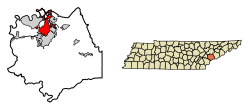
99.3% of residents lived in urban areas, while 0.7% lived in rural areas. [16]
There were 4,632 households in Alcoa, of which 31.1% had children under the age of 18 living in them. Of all households, 39.1% were married-couple households, 20.2% were households with a male householder and no spouse or partner present, and 32.5% were households with a female householder and no spouse or partner present. About 31.9% of all households were made up of individuals and 12.2% had someone living alone who was 65 years of age or older. [15]
There were 4,961 housing units, of which 6.6% were vacant. The homeowner vacancy rate was 2.2% and the rental vacancy rate was 5.1%. [15]
2000 census
As of the census [4] of 2000, there were 7,734 people, 3,489 households, and 2,159 families residing in the city. The population density was 560.7 inhabitants per square mile (216.5/km2). There were 3,857 housing units at an average density of 279.6 per square mile (108.0/km2). The racial makeup of the city was 81.15% White, 16.01% African American, 0.19% Native American, 0.34% Asian, 0.01% Pacific Islander, 0.78% from other races, and 1.53% from two or more races. Hispanic or Latino of any race were 1.89% of the population.
There were 3,489 households, out of which 24.4% had children under the age of 18 living with them, 44.6% were married couples living together, 13.6% had a female householder with no husband present, and 38.1% were non-families. 33.0% of all households were made up of individuals, and 12.5% had someone living alone who was 65 years of age or older. The average household size was 2.22 and the average family size was 2.80.
In the city, the population was spread out, with 20.9% under the age of 18, 8.0% from 18 to 24, 29.1% from 25 to 44, 24.7% from 45 to 64, and 17.2% who were 65 years of age or older. The median age was 40 years. For every 100 females, there were 91.6 males. For every 100 females age 18 and over, there were 87.4 males.
The median income for a household in the city was $33,520, and the median income for a family was $44,333. Males had a median income of $31,464 versus $23,212 for females. The per capita income for the city was $19,526. About 9.1% of families and 11.9% of the population were below the poverty line, including 18.1% of those under age 18 and 10.9% of those age 65 or over.