Oklahoma is a state in the South Central region of the United States, bordered by the state of Texas to the south and west, Kansas to the north, Missouri to the northeast, Arkansas to the east, New Mexico to the west, and Colorado to the northwest. Partially in the western extreme of the Upland South, it is the 20th-most extensive and the 28th-most populous of the 50 United States. Its residents are known as Oklahomans and its capital and largest city is Oklahoma City. The state's name is derived from the Choctaw words okla, 'people' and humma, which translates as 'red'. Oklahoma is also known informally by its nickname, "The Sooner State", in reference to the Sooners, settlers who staked their claims in the Unassigned Lands before the Indian Appropriations Act of 1889 authorized the Land Rush of 1889.

Texas County is a county located in the panhandle of the U.S. state of Oklahoma. Its county seat is Guymon. As of the 2020 census, the population was 21,384. It is the second largest county in Oklahoma, based on land area, and is named for Texas, the state that adjoins the county to its south. Texas County comprises the Guymon, OK Micropolitan Statistical Area. The county economy is largely based on farming and cattle production. It is one of the top-producing counties in the U.S. for wheat, cattle, and hogs. It also lies within the noted Hugoton-Panhandle natural gas field.

Payne County is located in the U.S. state of Oklahoma. As of the 2020 census, its population was 81,646. Its county seat is Stillwater. The county was created in 1890 as part of Oklahoma Territory and is named for Capt. David L. Payne, a leader of the "Boomers".

Oklahoma County is located in the central part of the U.S. state of Oklahoma. As of the 2020 census, the population was 796,292, making it the most populous county in Oklahoma. The county seat is Oklahoma City, the state capital and largest city. Oklahoma County is at the heart of the Oklahoma City metropolitan statistical area.

Johnston County is a county located in the U.S. state of Oklahoma. As of the 2020 census, the population was 10,272. Its county seat is Tishomingo. It was established at statehood on November 16, 1907, and named for Douglas H. Johnston, a governor of the Chickasaw Nation.

Jefferson County is a county located in the U.S. state of Oklahoma. As of the 2020 census, the population was 5,337. Its county seat is Waurika. The county was created at statehood and named in honor of President Thomas Jefferson.

Jackson County is a county located in the southwestern corner of the U.S. state of Oklahoma. As of the 2020 census, the population was 24,785. Its county seat is Altus. According to the Encyclopedia of Oklahoma History and Culture, the county was named for two historical figures: President Andrew Jackson and Confederate General Stonewall Jackson. One source states that the county was named only for the former president, while an earlier source states it was named only for General Stonewall Jackson.

Grady County is a county located in the U.S. state of Oklahoma. As of the 2020 census, the population was 54,795. Its county seat is Chickasha. It was named for Henry W. Grady, an editor of the Atlanta Constitution and southern orator.

Garfield County is a county located in the U.S. state of Oklahoma. As of the 2020 census, the population was 62,846. Enid is the county seat and largest city within Garfield County. The county is named after President James A. Garfield.

Dewey County is a county in the western part of the U.S. state of Oklahoma. As of the 2020 census, the population was 4,484. Its county seat is Taloga. The county was created in 1891 as "County D". In an 1898 election, county voters chose the name Dewey, honoring Admiral George Dewey.

Canadian County is a county located in the U.S. state of Oklahoma. As of the 2020 census, the population was 154,405, making it the fourth most populous county in Oklahoma. Its county seat is El Reno.

Idabel is a city in and county seat of McCurtain County, Oklahoma, United States. The population was 7,010 at the 2010 census. It is in Oklahoma's southeast corner, a tourist area known as Choctaw Country.

Bethany is a city in Oklahoma County, Oklahoma, United States, and a part of the Oklahoma City metropolitan area. Bethany has a population of 20,831 at the 2020 census, a 9.3% increase from 2010. The community was founded in 1909 by followers of the Church of the Nazarene from Oklahoma City.

Yale is a city in Payne County, Oklahoma, United States. The population was 1,059 at the 2020 census, a decline of 13.6 percent from the figure of 1,227 in 2010.

Earlsboro is a town in Pottawatomie County, Oklahoma, United States. The population was 628 at the 2010 census, a decline of 0.8 percent from the figure of 633 in 2000. It was once called "...the town that whisky built and oil broke."

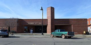
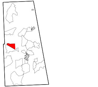
Tecumseh is a city in Pottawatomie County, Oklahoma. Its population was 6,457 at the 2010 census, a 5.9% increase from 6,098 in 2000. It was named for the noted Shawnee chief, Tecumseh. It was designated as the county seat at Oklahoma's statehood, but a county-wide election moved the seat to Shawnee in 1930.

Clinton is a city in Custer and Washita counties in the U.S. state of Oklahoma. The population was 9,033 at the 2010 census.

Titanic is a census-designated place (CDP) in Adair County, Oklahoma, United States. The population was 356 at the 2010 census. It was presumably named after the famous ocean liner RMS Titanic.


