Bromide, Oklahoma

Last updated

Bromide, Oklahoma
OKMap-doton-Bromide.PNG
Location of Bromide, Oklahoma
Coordinates: 34°25′05″N96°29′41″W / 34.41806°N 96.49472°W / 34.41806; -96.49472
Country United States
State Oklahoma
Counties Johnston, Coal
Area
[1]
  Total0.67 sq mi (1.74 km2)
  Land0.67 sq mi (1.74 km2)
  Water0.00 sq mi (0.00 km2)
Elevation
[2]
692 ft (211 m)
Population
 (2020)
  Total123
  Density182.76/sq mi (70.54/km2)
Time zone UTC-6 (Central (CST))
  Summer (DST) UTC-5 (CDT)
ZIP code
74530
Area code 580
FIPS code 40-09150 [3]
GNIS feature ID2411731 [2]

Bromide is a town in Coal and Johnston counties in the U.S. state of Oklahoma. The population was 165 at the 2010 census. [4]

Contents

The area around Bromide was noted for its mineral springs, and the bromide content of the water gave the town its name. It was also noted for limestone quarrying and the potential to produce manganese. Proposals to promote economic growth from these assets never materialized.

History

Bromide was founded by Judge William H. Jackson, a former superintendent of the nearby Wapanucka Academy, who recognized the site near several mineral springs as a potential tourist attraction. The community was initially called "Juanita" (1905 - 1906), then "Zenobia" (1906 - 1907), before it was named "Bromide". It incorporated in July 1908. [5] Juanita and Zenobia were the names of two of Jackson's daughters. [6] The name "Bromide" was chosen because of the high content of bromine in the mineral water. [7]

Before Oklahoma statehood, the townsite was part of the Chickasaw Nation. Native Americans were well acquainted with the mineral springs in the area. The Chickasaws called these Oka-Alichi (Medicine Water) or Hopi Kuli (Salt Springs), and believed that the waters had medicinal power, especially for "rheumatism, diseases of the stomach, kidney and bladder ailments, [and] nerve and skin problems". [6]

The first large business in Bromide was a limestone quarry, established by Robert Galbreath Jr., a Tulsa businessman. Stone became economically important about 1911, when the Missouri, Oklahoma and Gulf (MO&G) Railway (later bought by the Kansas, Oklahoma & Gulf (KO&G)) built a spur into Bromide. A rock-crushing plant was built just outside the city. Galbreath built a three-story hotel from rock quarried there. The KO&G promoted Bromide as "the best health resort in the southwestern states". It also ran weekly excursions to the city. Three more hotels, a bathhouse, and a swimming pool were added to support the tourist trade. By 1920, the population had reached 520. The Great Depression dried up the tourist trade. The population of Bromide fell to 352 in 1930, 258 in 1950, and to 180 in 1980. KO&G abandoned its line in 1950. [5]

Manganese (chemical symbol: Mn) ore was discovered in the vicinity of Bromide in 1890. A report published by the U.S. Geological Survey (USGS) stated that the ore deposits were small and could not yield high grade ore (more than 45 percent Mn). However, during World War I, steel producers began accepting ores as low as 35 percent Mn. The USGS report said that about 5,000 tons of ore containing 35 to 40 percent Mn could be produced from the Bromide area deposits. [8] Oilman Robert Galbreath evidently thought this could become sufficiently profitable to be a worthwhile investment. However, the Great Depression put an end to the concept.

The nearby Wapanucka Academy site is listed in the National Register of Historic Places (NR72001065). [5]

Geography

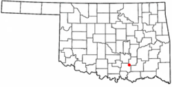
Bromide is located in northeastern Johnston County and southwestern Coal County with the developed townsite mostly on the Johnston side of the county line. The town is 7 miles (11 km) by road northwest of Wapanucka and 21 miles (34 km) northeast of Tishomingo, the Johnston county seat. It is the same distance southwest of Coalgate, the Coal county seat.

According to the United States Census Bureau, Bromide has an area of 0.58 square miles (1.5 km2), all land. [9]

Demographics

Historical population
CensusPop.Note
1920 523
1930 352−32.7%
1940 312−11.4%
1950 258−17.3%
1960 2642.3%
1970 231−12.5%
1980 180−22.1%
1990 162−10.0%
2000 1630.6%
2010 1651.2%
2020 123−25.5%
U.S. Decennial Census [10]

As of the census [3] of 2000, there were 163 people, 63 households, and 43 families residing in the town. The population density was 243.5 inhabitants per square mile (94.0/km2). There were 80 housing units at an average density of 119.5 per square mile (46.1/km2). The racial makeup of the town was 71.17% White, 14.72% Native American, 5.52% from other races, and 8.59% from two or more races. Hispanic or Latino of any race were 4.91% of the population.

There were 63 households, out of which 33.3% had children under the age of 18 living with them, 54.0% were married couples living together, 9.5% had a female householder with no husband present, and 30.2% were non-families. 27.0% of all households were made up of individuals, and 11.1% had someone living alone who was 65 years of age or older. The average household size was 2.59 and the average family size was 3.18.

In the town, the population was spread out, with 31.3% under the age of 18, 6.1% from 18 to 24, 28.2% from 25 to 44, 18.4% from 45 to 64, and 16.0% who were 65 years of age or older. The median age was 36 years. For every 100 females, there were 114.5 males. For every 100 females age 18 and over, there were 96.5 males.

The median income for a household in the town was $21,458, and the median income for a family was $23,333. Males had a median income of $21,563 versus $11,500 for females. The per capita income for the town was $10,427. About 20.5% of families and 25.7% of the population were below the poverty line, including 45.8% of those under the age of eighteen and none of those 65 or over.

Notable person

Overton James was born in Bromide on July 21, 1925. He became governor of the Chickasaw Nation in 1963. [11]

Related Research Articles

<span class="mw-page-title-main">Pontotoc County, Oklahoma</span> County in Oklahoma, United States

Pontotoc County is in the south central part of Oklahoma. As of the 2020 census, the population was 38,065. Its county seat is Ada. The county was created at statehood from part of the Chickasaw Nation in Indian Territory. It was named for a historic Chickasaw tribal area in Mississippi. According to the Encyclopedia of Oklahoma History and Culture, Pontotoc is usually translated "cattail prairie" or "land of hanging grapes."

<span class="mw-page-title-main">Murray County, Oklahoma</span> County in Oklahoma, United States

Murray County is a county located in the southern part of the U.S. state of Oklahoma. As of the 2020 census, the population was 13,904. The county seat is Sulphur. The county was named for William H. Murray, a member and president of the Oklahoma Constitutional Convention and later a Governor of Oklahoma.

<span class="mw-page-title-main">Marshall County, Oklahoma</span> County in Oklahoma, United States

Marshall County is a county located on the south central border of Oklahoma. As of the 2020 census, the population was 15,312. Its county seat is Madill. The county was created at statehood in 1907 from the former Pickens County of the Chickasaw Nation. It was named to honor the maiden name of the mother of George Henshaw, a member of the 1906 Oklahoma Constitutional Convention. The county and its cities are part of the Texoma region.

<span class="mw-page-title-main">Johnston County, Oklahoma</span> County in Oklahoma, United States

Johnston County is a county located in the U.S. state of Oklahoma. As of the 2020 census, the population was 10,272. Its county seat is Tishomingo. It was established at statehood on November 16, 1907, and named for Douglas H. Johnston, a governor of the Chickasaw Nation.

<span class="mw-page-title-main">Bryan County, Oklahoma</span> County in Oklahoma, United States

Bryan County is a county in the U.S. state of Oklahoma. As of the 2020 census, the population was 46,067. Its county seat is Durant. It is the only county in the United States named for Democratic politician William Jennings Bryan.

<span class="mw-page-title-main">Atoka County, Oklahoma</span> County in Oklahoma, United States

Atoka County is a county located in the U.S. state of Oklahoma. As of the 2020 census, the population was 14,143. Its county seat is Atoka. The county was formed before statehood from Choctaw Lands, and its name honors a Choctaw Chief named Atoka. The county is part of Choctaw Nation reservation lands.

<span class="mw-page-title-main">Tishomingo County, Mississippi</span> County in Mississippi, United States

Tishomingo County is a county located in the northeastern corner of the U.S. state of Mississippi. As of the 2020 census, the population was 18,850. Its county seat is Iuka.

<span class="mw-page-title-main">Iuka, Mississippi</span> City in Mississippi, United States

Iuka is a city in and the county seat of Tishomingo County, Mississippi, United States. Its population was 3,028 at the 2010 census. Woodall Mountain, the highest point in Mississippi, is located just south of Iuka.

<span class="mw-page-title-main">Tishomingo, Mississippi</span> Town in Mississippi

Tishomingo is a town in Tishomingo County, Mississippi, United States. The population of the city of Tishomingo was 339 at the 2010 census.

<span class="mw-page-title-main">Milburn, Oklahoma</span> Town in Oklahoma, United States

Milburn is a town in Johnston County, Oklahoma, United States, along the Blue River. The population was 317 at the 2010 census, an increase of 1.6 percent from the figure of 312 in 2000. The town is notable as the location of the Chickasaw White House, the former home of Chickasaw Governor Douglas H. Johnston. This home is now a museum and is listed on the NRHP.

<span class="mw-page-title-main">Mill Creek, Oklahoma</span> Town in Oklahoma, United States

Mill Creek is a town in Johnston County, Oklahoma, United States. The population was 319 at the 2010 census, a decline from the figure of 340 in 2000. Mill Creek Community is an unincorporated area of Johnston County that surrounds the town and claims to have about 1,000 residents, including those who live within the town limits. Local residents consider the town as the focal point of the community.

<span class="mw-page-title-main">Ravia, Oklahoma</span> Town in Oklahoma, United States

Ravia is a town in Johnston County, Oklahoma, United States. The population was 528 at the 2010 census, up from 459 in 2000.

<span class="mw-page-title-main">Tishomingo, Oklahoma</span> City in Oklahoma

Tishomingo is the largest city in, and the county seat of, Johnston County, Oklahoma, United States. The population was 3,034 at the 2010 census, a decline of 4.1 percent from the figure of 3,162 in 2000. It was the first capital of the Chickasaw Nation, from 1856 until Oklahoma statehood in 1907. The city is home to Murray State College, a community college with an annual enrollment of 3,015 students. Tishomingo is part of the Texoma region.

<span class="mw-page-title-main">Wapanucka, Oklahoma</span> Town in Oklahoma, United States

Wapanucka is a town in northeastern Johnston County, Oklahoma, United States. The population was 438 at the 2010 census, a 1.6 percent decrease from the figure of 445 in 2000. It is about 20 miles (32 km) northeast of Tishomingo. The town name refers to the Delaware Nation and means "Eastern Land People."

<span class="mw-page-title-main">Marietta, Oklahoma</span> City in Oklahoma, United States.

Marietta is a city and county seat in Love County, Oklahoma, United States. The population was 2,626 at the 2010 census, a 7.4 percent increase from the figure of 2,445 in 2000. Marietta is part of the Ardmore, Oklahoma, Micropolitan Statistical Area. For tourism purposes, the Oklahoma Department of Tourism includes it in 'Chickasaw Country'. It is also a part of the Texoma region.

<span class="mw-page-title-main">Byars, Oklahoma</span> Town in Oklahoma, United States

Byars is a town in McClain County, Oklahoma, United States. The population was 184 at the 2020 census, down from 255 at the 2010 census.

<span class="mw-page-title-main">Sulphur, Oklahoma</span> City in Oklahoma, United States

Sulphur is a city in and county seat of Murray County, Oklahoma, United States. The population was 5,065 at the 2020 census, a 2.8 percent gain over the figure of 4,929 in 2010. The area around Sulphur has been noted for its mineral springs, since well before the city was founded late in the 19th century. The city received its name from the presence of sulfur in the water.

<span class="mw-page-title-main">Peoria, Oklahoma</span> Town in Oklahoma, United States

Peoria is a town in Ottawa County, Oklahoma, United States. It was named for the Peoria people, a tribe of Native Americans who were removed to Indian Territory from east of the Mississippi River during the 19th century. The territory had been occupied by the Quapaw people, who sold some of their land to the Peoria. The population was 131 at the 2010 U. S. Census, down from 141 at the 2000 census. The long decline of mining meant that jobs moved elsewhere.

<span class="mw-page-title-main">Baldwyn, Mississippi</span> City in Mississippi, United States

Baldwyn is a city located in Lee and Prentiss counties, Mississippi, located in the northern part of the Tupelo micropolitan area. The population was 3,071 at the 2020 census.

<span class="mw-page-title-main">Davis, Oklahoma</span> City in Oklahoma, United States

Davis is a city in Garvin and Murray counties in the U.S. state of Oklahoma. The population is 2,823 as of the 2020 census.

References

  1. "ArcGIS REST Services Directory". United States Census Bureau. Retrieved September 20, 2022.
  2. 1 2 U.S. Geological Survey Geographic Names Information System: Bromide, Oklahoma
  3. 1 2 "U.S. Census website". United States Census Bureau . Retrieved January 31, 2008.
  4. [Census Viewer:"Bromide, Oklahoma Population."] Retrieved June 6, 2013.
  5. 1 2 3 May, Jon D. "Bromide," Encyclopedia of Oklahoma History and Culture, Oklahoma Historical Society, Accessed July 1, 2015.]
  6. 1 2 "Bromides...precious to Jim Martin," October 28, 2005. Retrieved June 7, 2014.
  7. Moyer, Armond; Moyer, Winifred (1958). The origins of unusual place-names. Keystone Pub. Associates. p. 17.
  8. Hewitt, D.F. "Manganese Deposits near Bromide, Oklahoma." Retrieved June 7, 2014.
  9. "Geographic Identifiers: 2010 Census Summary File 1 (G001): Bromide town, Oklahoma". American Factfinder. U.S. Census Bureau. Archived from the original on February 13, 2020. Retrieved October 19, 2018.
  10. "Census of Population and Housing". Census.gov. Retrieved June 4, 2015.
  11. Chickasaw Nation Hall of Fame. "Gov. Overton James." Retrieved January 5, 2013. Archived December 5, 2012, at the Wayback Machine

Further reading