East Mountain, Texas

Last updated

East Mountain, Texas
TXMap-doton-EastMountain.PNG
Location of East Mountain, Texas
Upshur County EastMountain.svg
Coordinates: 32°36′12″N94°51′37″W / 32.60333°N 94.86028°W / 32.60333; -94.86028
Country United States
State Texas
County Upshur, Gregg
Area
[1]
  Total2.12 sq mi (5.50 km2)
  Land2.12 sq mi (5.48 km2)
  Water0.01 sq mi (0.02 km2)
Elevation
430 ft (131 m)
Population
 (2020)
  Total899
  Density407.09/sq mi (157.14/km2)
Time zone UTC-6 (Central (CST))
  Summer (DST) UTC-5 (CDT)
ZIP code
75644
Area code(s) 430, 903
FIPS code 48-22168 [2]
GNIS feature ID1334967 [3]

East Mountain is a city in Upshur and Gregg counties, [4] Texas, United States. The population was 899 at the 2020 census, [5] an increase over the figure of 797 tabulated in 2010.

Contents

Geography

East Mountain is located in southeastern Upshur County at 32°36′12″N94°51′37″W / 32.60333°N 94.86028°W / 32.60333; -94.86028 (32.603445, –94.860288). [6] Small portions of the city extend south along Gilmer Road and Coulter Road into Gregg County. [4] The city limits extend northwest along Main Street and Medlin Road as far as East Mountain, a 660-foot (200 m) wooded summit overlooking the community.

East Mountain is 10 miles (16 km) northwest of Longview and 7 miles (11 km) northeast of Gladewater.

According to the United States Census Bureau, the city has a total area of 2.0 square miles (5.3 km2), of which 0.01 square miles (0.02 km2), or 0.44%, are water. [5]

Demographics

Historical population
CensusPop.Note
1980 855
1990 762−10.9%
2000 580−23.9%
2010 79737.4%
2020 89912.8%
U.S. Decennial Census [7]
East Mountain racial composition as of 2020 [8]
(NH = Non-Hispanic) [lower-alpha 1]
RaceNumberPercentage
White (NH)71979.98%
Black or African American (NH)151.67%
Native American or Alaska Native (NH)50.56%
Asian (NH)30.33%
Some Other Race (NH)121.33%
Mixed/Multi-Racial (NH)394.34%
Hispanic or Latino 10611.79%
Total899

As of the 2020 United States census, there were 899 people, 324 households, and 250 families residing in the city.

As of the census [2] of 2000, there were 580 people, 229 households, and 174 families residing in the city. The population density was 285.5 inhabitants per square mile (110.2/km2). There were 249 housing units at an average density of 122.6 per square mile (47.3/km2). The racial makeup of the city was 94.14% White, 1.55% African American, 0.34% Native American, 0.17% Asian, 2.76% from other races, and 1.03% from two or more races. Hispanic or Latino of any race were 3.45% of the population.

There were 229 households, out of which 28.8% had children under the age of 18 living with them, 65.9% were married couples living together, 7.0% had a female householder with no husband present, and 24.0% were non-families. 20.1% of all households were made up of individuals, and 9.6% had someone living alone who was 65 years of age or older. The average household size was 2.53 and the average family size was 2.91.

In the city, the population was spread out, with 24.7% under the age of 18, 5.7% from 18 to 24, 25.5% from 25 to 44, 29.7% from 45 to 64, and 14.5% who were 65 years of age or older. The median age was 41 years. For every 100 females, there were 91.4 males. For every 100 females age 18 and over, there were 93.4 males.

The median income for a household in the city was $33,173, and the median income for a family was $38,068. Males had a median income of $32,500 versus $21,827 for females. The per capita income for the city was $14,701. About 7.5% of families and 10.3% of the population were below the poverty line, including 15.3% of those under age 18 and 3.3% of those age 65 or over.

Education

Most of East Mountain is in the Gilmer Independent School District, but small portions of the town are also within the Union Grove and Longview Independent School Districts.

Related Research Articles

<span class="mw-page-title-main">Morgan County, Alabama</span> County in Alabama, United States

Morgan County is a county in the north-central part of the U.S. state of Alabama. As of the 2020 census, its population was 123,421. The county seat is Decatur. On June 14, 1821, it was renamed in honor of American Revolutionary War General Daniel Morgan of Virginia. It is a prohibition or dry county, although alcohol sales are allowed in the cities of Decatur, Hartselle, and Priceville. Morgan County is included in the Decatur, AL Metropolitan Statistical Area, which is also included in the Huntsville-Decatur-Albertville, AL Combined Statistical Area. It is a part of the North, Northwest, and North-Central regions of Alabama.

<span class="mw-page-title-main">Coosa County, Alabama</span> County in Alabama, United States

Coosa County is located in the east central portion of the U.S. state of Alabama. As of the 2020 census the population was 10,387. Its county seat is Rockford. Its name derives from a town of the Creek tribe and the Coosa River, which forms one of the county borders.

<span class="mw-page-title-main">Upshur County, West Virginia</span> County in West Virginia, United States

Upshur County is a county in the U.S. state of West Virginia. As of the 2020 census, the population was 23,816. Its county seat is Buckhannon. The county was formed in 1851 from Randolph, Barbour, and Lewis counties and named for Abel Parker Upshur, a distinguished statesman and jurist of Virginia. Upshur served as United States Secretary of State and Secretary of the Navy under President John Tyler.

<span class="mw-page-title-main">Lewis County, West Virginia</span> County in West Virginia, United States

Lewis County is a county in the U.S. state of West Virginia. As of the 2020 census, the population was 17,033. Its county seat is Weston. The county was formed in 1816 from Harrison County.

<span class="mw-page-title-main">Upshur County, Texas</span> County in Texas, United States

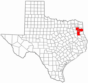
Upshur County is a county located in the eastern part of the U.S. state of Texas. As of the 2020 census, the population was 40,892. The county seat is Gilmer. The county is named for Abel P. Upshur, who was U.S. Secretary of State during President John Tyler's administration.

<span class="mw-page-title-main">Sherman County, Texas</span> County in Texas, United States

Sherman County is a county located in the U.S. state of Texas. As of the 2020 census, its population was 2,782. Its county seat is Stratford. The county was created in 1876 and organized in 1889. It is named for Sidney Sherman, who fought in the Texas Revolution. Though both Sherman County and Sherman, Texas, are named for the same person, the city of Sherman is located in Grayson County, about 430 miles to the southeast.

<span class="mw-page-title-main">Morris County, Texas</span> County in Texas, United States

Morris County is a county located near the eastern border of the U.S. state of Texas. As of the 2020 census, its population was 11,973. Its county seat is Daingerfield. Morris County is probably named for William Wright Morris, an early judge and planter from Henderson, also in northeast Texas. As of 2016, Morris County is no longer one of six entirely dry, prohibition counties in the state of Texas. Morris County is "partially wet."

<span class="mw-page-title-main">Hopkins County, Texas</span> County in Texas, United States

Hopkins County is a county located in the U.S. state of Texas. As of the 2020 census, its population was 36,787. Its county seat is Sulphur Springs. Hopkins County is named for the family of David Hopkins, an early settler in the area. Hopkins County comprises the Sulphur Springs, TX Micropolitan Statistical Area. Hopkins County was once known as the Dairy Capital of Texas. Although dairy farms declined in the area in the late 1990s there are still a number of these located there. The Southwest Dairy Museum is located in Sulphur Springs.

<span class="mw-page-title-main">Gregg County, Texas</span> County in Texas, United States

Gregg County is a county located in the eastern part of the U.S. state of Texas. As of the 2020 census, its population was 124,239. Its county seat is Longview. The county is named after John Gregg, a Confederate general killed in action during the American Civil War.

<span class="mw-page-title-main">Homestead Base, Florida</span> Census-designated place in Florida

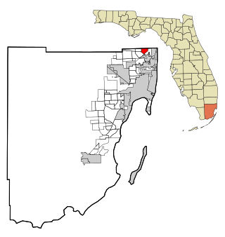
Homestead Base is a census-designated place (CDP) in Miami-Dade County, Florida, United States. The CDP comprises the extent of Homestead Air Reserve Base plus some surrounding land. It is part of the Miami metropolitan area of South Florida. The population was 999 at the 2020 census.

<span class="mw-page-title-main">Ives Estates, Florida</span> Census-designated place in Florida

Ives Estates is a census-designated place (CDP) in Miami-Dade County, Florida. It is part of the Miami metropolitan area of South Florida. The population was 25,005 at the 2020 census, up from 19,525 in 2010.

<span class="mw-page-title-main">Lakeport, Texas</span> City in Texas, United States

Lakeport is a city in Gregg County, Texas, United States. The population was 974 at the 2010 census, up from 861 at the 2000 census; in 2020, its population was 976.

<span class="mw-page-title-main">Liberty City, Texas</span> Census-designated place in Texas, United States

Liberty City is a census-designated place (CDP) in Gregg County, Texas, United States. The population was 2,721 at the 2020 census, an increase over the figure of 2,351 tabulated in 2010.

<span class="mw-page-title-main">Gilmer, Texas</span> City in Texas, United States

Gilmer is a city in, and the county seat of, Upshur County, Texas, United States. It is best known for being the home of the East Texas Yamboree and the birthplace of popular music singers Don Henley of the Eagles band and Johnny Mathis, as well as blues musician Freddie King. Its population was 4,843 at the 2020 census.

<span class="mw-page-title-main">Ore City, Texas</span> City in Texas, United States

Ore City is a city in Upshur County, Texas, United States. The population was 1,108 at the 2020 census.

<span class="mw-page-title-main">Union Grove, Texas</span> City in Texas, United States

Union Grove is a city in Upshur County, Texas, United States. The population was 357 at the 2010 census.

<span class="mw-page-title-main">Gladewater, Texas</span> City in Texas, United States

Gladewater is a city in Gregg and Upshur counties in the U.S. state of Texas with a 2020 census population of 6,134.

<span class="mw-page-title-main">Warren City, Texas</span> City in Texas, United States

Warren City is a city in Gregg and Upshur counties in the U.S. state of Texas. The population was 319 at the 2020 U.S. census.

<span class="mw-page-title-main">Longview–Marshall combined statistical area</span>

The Longview–Marshall Combined Statistical Area covers four counties in Northeast Texas. The statistical area consists of the Longview Metropolitan Statistical Area and the Marshall Micropolitan Statistical Area. Prior to 2003, the area was known as the Longview–Marshall Metropolitan Statistical Area, which consisted of Gregg, Harrison, Rusk, and Upshur counties. As of the 2000 census, the CSA had a population of 256,152.

<span class="mw-page-title-main">Longview metropolitan area, Texas</span> Metropolitan statistical area in Texas, United States

The Longview metropolitan statistical area is a metropolitan area in Northeast Texas that covers three counties—Gregg, Rusk, and Upshur. As of the 2010 census the MSA had a population of 280,000. It is also part of the larger Longview/Marshall combined statistical area.

References

  1. "2019 U.S. Gazetteer Files". United States Census Bureau. Retrieved August 7, 2020.
  2. 1 2 "U.S. Census website". United States Census Bureau . Retrieved January 31, 2008.
  3. "US Board on Geographic Names". United States Geological Survey. October 25, 2007. Retrieved January 31, 2008.
  4. 1 2 "TIGERweb". Geography Division, U.S. Census Bureau. Retrieved March 23, 2017.
  5. 1 2 "Geographic Identifiers: 2010 Demographic Profile Data (G001): East Mountain city, Texas". American Factfinder. U.S. Census Bureau. Retrieved March 23, 2017.[ dead link ]
  6. "US Gazetteer files: 2010, 2000, and 1990". United States Census Bureau. February 12, 2011. Retrieved April 23, 2011.
  7. "Census of Population and Housing". Census.gov. Retrieved June 4, 2015.
  8. "Explore Census Data". data.census.gov. Retrieved May 25, 2022.
  9. "About the Hispanic Population and its Origin". www.census.gov. Retrieved May 18, 2022.
  1. Note: the US Census treats Hispanic/Latino as an ethnic category. This table excludes Latinos from the racial categories and assigns them to a separate category. Hispanics/Latinos can be of any race. [9]