
Gregg County is a county located in the eastern part of the U.S. state of Texas. As of the 2020 census, its population was 124,239. Its county seat is Longview. The county is named after John Gregg, a Confederate general killed in action during the American Civil War.

Bastrop is a city and the county seat of Bastrop County, Texas, United States. The population was 9,688 according to the 2020 census. It is located about 30 mi (48 km) southeast of Austin and is part of the Greater Austin metropolitan area.

Circle D-KC Estates is a census-designated place (CDP) in Bastrop County, Texas, United States. The population was 2,588 at the 2020 census.

Omaha is a city in Morris County, northeast Texas, United States. The population at the 2010 U.S. Census was 1,024.
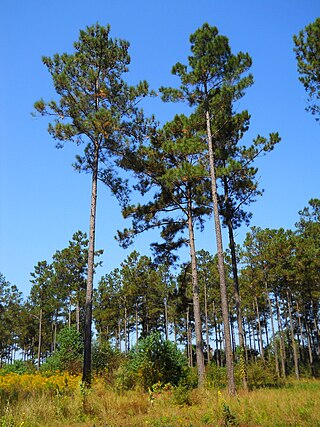
Pinus taeda, commonly known as loblolly pine, is one of several pines native to the Southeastern United States, from East Texas to Florida, and north to southern New Jersey. The wood industry classifies the species as a southern yellow pine. U.S. Forest Service surveys found that loblolly pine is the second-most common species of tree in the United States, after red maple. For its timber, the pine species is regarded as the most commercially important tree in the Southeastern U.S. The common name loblolly is given because the pine species is found mostly in lowlands and swampy areas.

Guadalupe Mountains National Park is an American national park in the Guadalupe Mountains, east of El Paso, Texas. The mountain range includes Guadalupe Peak, the highest point in Texas at 8,751 feet (2,667 m), and El Capitan used as a landmark by travelers on the route later followed by the Butterfield Overland Mail stagecoach line. The ruins of a stagecoach station stand near the Pine Springs visitor center. The restored Frijole Ranch contains a small museum of local history and is the trailhead for Smith Spring. The park covers 86,367 acres in the same mountain range as Carlsbad Caverns National Park, about 25 miles (40 km) to the north in New Mexico. The Guadalupe Peak Trail winds through pinyon pine and Douglas-fir forests as it ascends over 3,000 feet (910 m) to the summit of Guadalupe Peak, with views of El Capitan and the Chihuahuan Desert.

The Piney Woods is a temperate coniferous forest terrestrial ecoregion in the Southern United States covering 54,400 square miles (141,000 km2) of East Texas, southern Arkansas, western Louisiana, and southeastern Oklahoma. These coniferous forests are dominated by several species of pine as well as hardwoods including hickory and oak. Historically the most dense part of this forest region was the Big Thicket though the lumber industry dramatically reduced the forest concentration in this area and throughout the Piney Woods during the 19th and 20th centuries. The World Wide Fund for Nature considers the Piney Woods to be one of the critically endangered ecoregions of the United States. The United States Environmental Protection Agency (EPA) defines most of this ecoregion as the South Central Plains.

The Big Thicket is the name given to a somewhat imprecise region of a heavily forested area of Southeast Texas in the United States. This area represents a portion of the mixed pine-hardwood forests of the Southeast US. The National Park Service established the Big Thicket National Preserve (BTNP) within the region in 1974 and it is recognized as a biosphere reserve by UNESCO. The diversity of animals in the area is high, with over 500 vertebrates, and it is the complex mosaic of ecosystems and plant diversity that is particularly remarkable. Biologists have identified at least eight, and up to eleven, ecosystems in the Big Thicket area. More than 160 species of trees and shrubs, 800 herbs and vines, and 340 types of grasses are known to occur in the Big Thicket, and estimates as high as over 1000 flowering plant species and 200 trees and shrubs have been made, plus ferns, carnivorous plants, and more. The Big Thicket has historically been the most dense forest region in what is now Texas.

The Madrean Sky Islands are enclaves of Madrean pine–oak woodlands, found at higher elevations in a complex of small mountain ranges in southern and southeastern Arizona, southwestern New Mexico, and northwestern Mexico. The sky islands are surrounded at lower elevations by the Sonoran and Chihuahuan deserts. The northern west–east perimeter of the sky island region merges into the higher elevation eastern Mogollon Rim and the White Mountains of eastern Arizona.
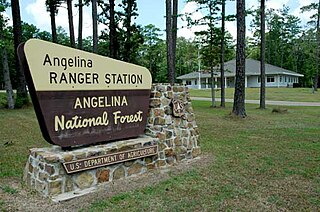
Angelina National Forest is a United States National Forest, one of four located in the piney woods region of Texas. The 153,180-acre (619.9 km2) Angelina National Forest is located in East Texas in parts of San Augustine, Angelina, Jasper and Nacogdoches counties. It is managed together with the three other National Forests in Texas from Forest Service offices in Lufkin, Texas. There are local district offices located in Zavalla. The forest lies in the Neches River Basin and on the north and south shores of Sam Rayburn Reservoir. Longleaf pine is the predominant cover type in the southern portion of the forest, while loblolly and shortleaf pine are dominant species in the northern portion and abundant throughout.

Little Pine Creek is a tributary of Pine Creek in Lycoming County, Pennsylvania, in the United States. It is approximately 15.8 miles (25.4 km) long and flows through Pine Township and Cummings Township.
Humble Independent School District is a school district located in Humble, Texas, United States. It serves the city of Humble, small portions of the city of Houston, and portions of unincorporated Harris County. A small section of the district extends into Montgomery County. For the 2018–2019 school year, the district enrolled 43,553 students.
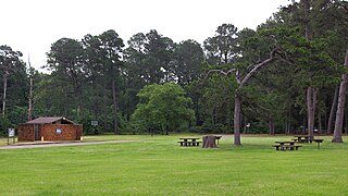
Atlanta State Park is a 1,475 acres (597 ha) state park in northeast Texas in the United States that opened in 1954. It is located on Wright Patman Lake in northern Cass County and is managed by the Texas Parks and Wildlife Department.
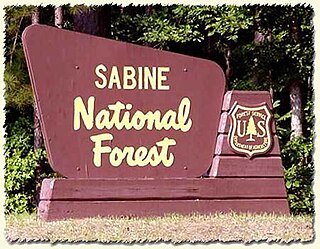
Sabine National Forest is located in East Texas near the Texas-Louisiana border. The forest is administered together with the other three United States National Forests and two National Grasslands located entirely in Texas, from common offices in Lufkin, Texas. There are local ranger district offices located in Hemphill.

The Texas Brigade was an infantry formation of the Confederate Army that distinguished itself in the American Civil War. Along with the Stonewall Brigade, they were considered the Confederate Army's shock troops. It fought in every major battle of the Eastern Theater except Chancellorsville.
Seven Pines may refer to the following places in the United States:
Pine Grove is an unincorporated community in Henderson County, in the U.S. state of Texas.
Pine Trail Estates is an unincorporated community in Smith County, located in the U.S. state of Texas.
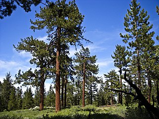
In ecology and forestry, yellow pine refers to a number of conifer species that tend to grow in similar plant communities and yield similar strong wood. In the Western United States, yellow pine refers to Jeffrey pine or ponderosa pine. In the Southeastern United States, yellow pine refers to longleaf pine, shortleaf pine, slash pine, or loblolly pine. In the United Kingdom, yellow pine refers to eastern white pine or Scots pine. In New Zealand, it refers to Halocarpus biformis.


