East Riverdale, Maryland

Last updated

East Riverdale, Maryland
Prince George's County Maryland Incorporated and Unincorporated areas East Riverdale Highlighted.svg
Coordinates: 38°57′23″N76°54′49″W / 38.95639°N 76.91361°W / 38.95639; -76.91361
CountryFlag of the United States.svg United States
State Flag of Maryland.svg  Maryland
County Flag of Prince George's County, Maryland (1963-present).svg Prince George's
Area
[1]
  Total1.61 sq mi (4.18 km2)
  Land1.61 sq mi (4.18 km2)
  Water0.00 sq mi (0.00 km2)
Elevation
36 ft (11 m)
Population
 (2020)
  Total18,459
  Density11,429.72/sq mi (4,412.22/km2)
Time zone UTC−5 (Eastern (EST))
  Summer (DST) UTC−4 (EDT)
FIPS code 24-24650
GNIS feature ID1714365

East Riverdale is an unincorporated area and census-designated place (CDP) in Prince George's County, Maryland, United States. [2] The population was 18,459 at the 2020 census. [3]

Contents

Geography

East Riverdale is located at 38°57′23″N76°54′49″W / 38.95639°N 76.91361°W / 38.95639; -76.91361 (38.956315, 76.913615). [4]

According to the United States Census Bureau, the CDP has a total area of 1.6 square miles (4.1 km2), all land.

Demographics

Historical population
CensusPop.Note
1970 8,941
1980 14,11757.9%
1990 14,1870.5%
2000 14,9615.5%
2010 15,5093.7%
2020 18,45919.0%
U.S. Decennial Census [5]
2010 [6] 2020 [7]
Census area returned as
Riverdale Heights-East Pines in 1970.

2020 census

East Riverdale CDP, Maryland – Racial and ethnic composition
Note: the US Census treats Hispanic/Latino as an ethnic category. This table excludes Latinos from the racial categories and assigns them to a separate category. Hispanics/Latinos may be of any race.
Race / Ethnicity (NH = Non-Hispanic)Pop 2010 [6] Pop 2020 [7] % 2010% 2020
White alone (NH)1,3239378.53%5.08%
Black or African American alone (NH)5,1984,22933.52%22.91%
Native American or Alaska Native alone (NH)26170.17%0.09%
Asian alone (NH)4031,0392.60%5.63%
Pacific Islander alone (NH)510.03%0.01%
Some Other Race alone (NH)341010.22%0.55%
Mixed Race or Multi-Racial (NH)2474561.59%2.47%
Hispanic or Latino (any race)8,27311,67953.34%63.27%
Total15,50918,459100.00%100.00%

2000 Census

As of the census [8] of 2000, there were 14,961 people, 4,538 households, and 3,353 families residing in the CDP. The population density was 9,103.9 inhabitants per square mile (3,515.0/km2). There were 4,778 housing units at an average density of 2,907.5 per square mile (1,122.6/km2). The racial makeup of the CDP was 28.71% White, 49.98% African American, 0.59% Native American, 3.71% Asian, 0.14% Pacific Islander, 13.18% from other races, and 3.68% from two or more races. Hispanic or Latino of any race were 26.47% of the population.

There were 4,538 households, out of which 42.4% had children under the age of 18 living with them, 43.9% were married couples living together, 21.4% had a female householder with no husband present, and 26.1% were non-families. 19.9% of all households were made up of individuals, and 4.5% had someone living alone who was 65 years of age or older. The average household size was 3.29 and the average family size was 3.74.

In the CDP, the population was spread out, with 31.1% under the age of 18, 12.0% from 18 to 24, 33.5% from 25 to 44, 17.8% from 45 to 64, and 5.7% who were 65 years of age or older. The median age was 29 years. For every 100 females, there were 102.9 males. For every 100 females age 18 and over, there were 101.6 males.

The median income for a household in the CDP was $45,547, and the median income for a family was $48,918. Males had a median income of $31,807 versus $30,520 for females. The per capita income for the CDP was $15,758. About 11.1% of families and 13.7% of the population were below the poverty line, including 16.0% of those under age 18 and 8.9% of those age 65 or over.

Education

East Riverdale is within the Prince George's County Public Schools system. Schools serving the CDP include: [9]

Elementary schools: [10]

Middle schools: [11]

High schools: [12]

Related Research Articles

<span class="mw-page-title-main">Bladensburg, Maryland</span> Town in Maryland, United States

Bladensburg is a town in Prince George's County, Maryland, United States. The population was 9,657 at the 2020 census. Areas in Bladensburg are located within ZIP code 20710. Bladensburg is 8.6 miles (13.8 km) from Washington, D.C.

<span class="mw-page-title-main">Cheverly, Maryland</span> Town in Prince Georges County, Maryland, US

Cheverly is a town in Prince George's County, Maryland, United States, located very close to Washington, D.C., though not bordering it directly. The town was founded in 1918 and incorporated in 1931. Per the 2020 census, the population was 6,170. Cheverly borders the communities of Tuxedo, Chapel Oaks, Landover, Landover Hills, Villa Heights, and Bladensburg.

<span class="mw-page-title-main">Coral Hills, Maryland</span> Census-designated place in Maryland

Coral Hills is an unincorporated area and census-designated place (CDP) in Prince George's County, Maryland, United States. As of the 2020 census, the population was 9,997.

<span class="mw-page-title-main">Forestville, Maryland</span> CDP in Maryland

Forestville is an unincorporated area and census-designated place (CDP) in Prince George's County, Maryland, United States. Per the 2020 census, the population was 12,831. The community is a mixture of garden apartments, single-family homes, and shopping centers built mostly from the 1930s through 1970s, adjacent to the communities of District Heights, Suitland, Morningside, Westphalia and Camp Springs.

<span class="mw-page-title-main">Friendly, Maryland</span> Census-designated place in Maryland

Friendly is an unincorporated area and census-designated place (CDP) in Prince George's County, Maryland, United States, with an African-American majority population, located a few miles south of Washington, D.C. The population was 9,937 at the 2020 census.

<span class="mw-page-title-main">Kettering, Maryland</span> Census-designated place in Maryland, United States

Kettering is an unincorporated area and census-designated place in Prince George's County, Maryland, United States. At the 2020 United States Census, the population was 14,424,. Kettering is adjacent to Prince George's Community College, the upscale gated community of Woodmore, Six Flags America, Evangel Temple megachurch, and the community of Largo at the end of the Washington Metro Blue Line. Watkins Regional Park in Kettering offers a large playground, a colorful carousel, miniature golf, a miniature train ride, and various animals.

<span class="mw-page-title-main">Landover Hills, Maryland</span> Town in Maryland

Landover Hills is a town in Prince George's County, Maryland, United States. Per the 2020 census, the population was 1,815. The town has a neighborhood named Defense Heights.

<span class="mw-page-title-main">Marlow Heights, Maryland</span> Census-designated place in Maryland, United States

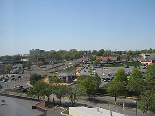
Marlow Heights is an unincorporated area and census-designated place (CDP) in Prince George's County, Maryland, United States. The population was 6,169 at the 2020 census. The Marlow Heights Shopping Center first opened in 1957, adjacent to the large community of Hillcrest Heights. It was joined ten years later, in 1967, by the two-level Iverson Mall, the Washington metropolitan area's first enclosed mall.

<span class="mw-page-title-main">Marlton, Maryland</span> Census-designated place in Maryland

Marlton is an unincorporated area and census-designated place (CDP) in Prince George's County, Maryland, United States. The population was 9,802 at the 2020 census. The Marlton housing development, at first briefly called "Brandywine Country", grew up along U.S. Route 301 in the 1970s, and is part of the greater Upper Marlboro community. Originally made up of only single-family homes, more recently townhouses have been added.

<span class="mw-page-title-main">Mitchellville, Maryland</span> Census-designated place in Maryland

Mitchellville is an upper-class majority African-American unincorporated area and census-designated place (CDP) in Prince George's County, Maryland, United States. Per the 2020 census, the population was 11,136.

<span class="mw-page-title-main">New Carrollton, Maryland</span> City in Maryland, United States

New Carrollton is a city located in central Prince George's County, Maryland, United States. As of the 2020 census, the population was 13,715. New Carrollton is located 10 miles (16 km) east of central Washington, D.C.

<span class="mw-page-title-main">Rosaryville, Maryland</span> Census-designated place in Maryland, US

Rosaryville is an unincorporated area and census-designated place (CDP) in Prince George's County, Maryland, United States, located south of Cinton and Upper Marlboro beside U.S. Route 301. Per the 2020 census, the population was 11,548. including housing developments and rural open space. It was named for a local Roman Catholic church. Close to Rosaryville are the Marlton housing development, Maryland Veterans Cemetery, the Southern Maryland Farmers Market, and Rosaryville State Park.

<span class="mw-page-title-main">South Laurel, Maryland</span> Census-designated place in Maryland

South Laurel is an unincorporated area and census-designated place (CDP) in Prince George's County, Maryland, United States. Per the 2020 census, the population was 29,602.

<span class="mw-page-title-main">Springdale, Maryland</span> Census-designated place in Maryland

Springdale is an unincorporated area and census-designated place (CDP) in Prince George's County, Maryland, United States. Per the 2020 census, the population was 5,301.

<span class="mw-page-title-main">Walker Mill, Maryland</span> Census-designated place in Maryland

Walker Mill is an unincorporated area and census-designated place (CDP) in Prince George's County, Maryland, United States. Per the 2020 census, the population was 12,187.

<span class="mw-page-title-main">West Laurel, Maryland</span> Census-designated place in Maryland

West Laurel is an unincorporated area and census-designated place (CDP) in Prince George's County, Maryland, United States. Per the 2020 census, the population was 4,428.

<span class="mw-page-title-main">Woodlawn, Prince George's County, Maryland</span> Census-designated place in Maryland

Woodlawn is an unincorporated area and census-designated place (CDP) in Prince George's County, Maryland, United States. As of the 2020 census it had a population of 7,541.

<span class="mw-page-title-main">Woodmore, Maryland</span> Census-designated place in Maryland

Woodmore is an unincorporated area and census-designated place in Prince George's County, Maryland, United States. Per the 2020 census, the population was 4,513. The CDP is located within the boundaries of Route 193 to the west, Church Road to the east, Route 214 to the south and Route 50 to the north. Woodmore Road runs east and west through the center. It contains a large gated community and country club, developments of Woodmore Meadows, and Woodmore South on the south side, as well as various other custom built homes and farmland.

<span class="mw-page-title-main">Calverton, Maryland</span> Census-designated place in Maryland, United States

Calverton is an unincorporated area and census-designated place located on the boundary between Montgomery and Prince George's counties, Maryland, in the United States. At the 2020 census, it had a population of 17,316.

<span class="mw-page-title-main">Hillandale, Maryland</span> Census-designated place in Maryland, United States

Hillandale is an unincorporated area and census-designated place located in Montgomery and Prince George's counties, Maryland, United States. As of the 2020 census, it had a population of 5,774. Hillandale is contained between the Prince George's / Montgomery County line to the east, the Anacostia River to the west, McCeney Avenue to the north, and D.C.'s Capital Beltway to the south. It borders the communities of Adelphi, Avenel, White Oak and Beltsville.

References

  1. "2020 U.S. Gazetteer Files". United States Census Bureau. Retrieved April 26, 2022.
  2. U.S. Geological Survey Geographic Names Information System: East Riverdale, Maryland
  3. "East Riverdale CDP, Maryland". United States Census Bureau . Retrieved March 13, 2022.
  4. "US Gazetteer files: 2010, 2000, and 1990". United States Census Bureau. February 12, 2011. Retrieved April 23, 2011.
  5. "Decennial Census of Population and Housing by Decades". US Census Bureau.
  6. 1 2 "P2 Hispanic or Latino, and Not Hispanic or Latino by Race – 2010: DEC Redistricting Data (PL 94-171) - East Riverdale CDP, Maryland". United States Census Bureau .
  7. 1 2 "P2 Hispanic or Latino, and Not Hispanic or Latino by Race – 2020: DEC Redistricting Data (PL 94-171) - East Riverdale CDP, Maryland". United States Census Bureau .
  8. "U.S. Census website". United States Census Bureau . Retrieved January 31, 2008.
  9. "2010 CENSUS - CENSUS BLOCK MAP: East Riverdale CDP, MD." U.S. Census Bureau. Retrieved on August 26, 2018.
  10. "NEIGHBORHOOD ELEMENTARY SCHOOLS AND BOUNDARIES SCHOOL YEAR 2018-2019." Prince George's County Public Schools. Retrieved on August 26, 2018.
  11. "NEIGHBORHOOD MIDDLE SCHOOLS AND BOUNDARIES SCHOOL YEAR 2018-2019." Prince George's County Public Schools. Retrieved on August 26, 2018.
  12. "NEIGHBORHOOD HIGH SCHOOLS AND BOUNDARIES SCHOOL YEAR 2018-2019." Prince George's County Public Schools. Retrieved on August 26, 2018.