Hillandale, Maryland

Last updated

Hillandale, Maryland
Montgomery County Maryland Incorporated and Unincorporated areas Hillandale Highlighted.svg
Location of Hillandale, Maryland
Coordinates: 39°01′30″N76°58′25″W / 39.02500°N 76.97361°W / 39.02500; -76.97361
Country Flag of the United States.svg United States
State Flag of Maryland.svg  Maryland
Counties Flag of Montgomery County, Maryland.svg Montgomery
Area
[1]
  Total1.89 sq mi (4.89 km2)
  Land1.89 sq mi (4.89 km2)
  Water0.00 sq mi (0.00 km2)
Elevation
[2]
246 ft (75 m)
Population
 (2020)
  Total5,774
  Density3,056.64/sq mi (1,180.17/km2)
Time zone UTC-5 (Eastern (EST))
  Summer (DST) UTC-4 (EDT)
ZIP code
20903
Area code(s) 301, 240
FIPS code 24-38850
GNIS feature ID2389929 [2]

Hillandale is an unincorporated area and census-designated place located in Montgomery and Prince George's counties, Maryland, United States. As of the 2020 census, it had a population of 5,774. [3] [4] Hillandale is contained between the Prince George's / Montgomery County line to the east, the Anacostia River to the west, McCeney Avenue to the north, and D.C.'s Capital Beltway to the south. It borders the communities of Adelphi, Avenel, White Oak and Beltsville.

Contents

Geography

Hillandale is part of the very large postal designation of Silver Spring.

According to the United States Census Bureau, the place has a total area of 2.0 square miles (5.3 km2), all land. [5]

In Montgomery County, Hillandale is bordered by the Silver Spring CDP to the south (across the Capital Beltway), the Four Corners CDP to the west (across the Northwest Branch Anacostia River), and the White Oak CDP to the north. In Prince George's County, Hillandale is bordered by the Beltsville CDP to the east (across the Paint Branch) and the Adelphi CDP to the south (across the Capital Beltway). [6]

Demographics

Historical population
CensusPop.Note
2010 6,043
2020 5,774−4.5%
U.S. Decennial Census [7]
2010 [8] 2020 [9]

2020 census

Hillandale CDP, Maryland – Racial and ethnic composition
Note: the US Census treats Hispanic/Latino as an ethnic category. This table excludes Latinos from the racial categories and assigns them to a separate category. Hispanics/Latinos may be of any race.
Race / Ethnicity (NH = Non-Hispanic)Pop 2010 [8] Pop 2020 [9] % 2010% 2020
White alone (NH)2,1611,46935.76%25.44%
Black or African American alone (NH)1,4641,39924.23%24.23%
Native American or Alaska Native alone (NH)1450.23%0.09%
Asian alone (NH)64965410.74%11.33%
Pacific Islander alone (NH)030.00%0.05%
Some Other Race alone (NH)22270.36%0.47%
Mixed Race or Multi-Racial (NH)1381892.28%3.27%
Hispanic or Latino (any race)1,5952,02826.39%35.12%
Total6,0435,774100.00%100.00%

2000 Census

As of the census [10] of 2000, there were 3,054 people, 1,087 households, and 846 families residing in the area. The population density was 2,465.6 inhabitants per square mile (952.0/km2). There were 1,110 housing units at an average density of 896.2 per square mile (346.0/km2). The racial makeup of the area was 55.40% White, 25.57% African American, 0.46% Native American, 9.66% Asian, 0.03% Pacific Islander, 5.86% from other races, and 3.01% from two or more races. Hispanic or Latino of any race were 11.39% of the population.

There were 1,087 households, out of which 27.3% had children under the age of 18 living with them, 66.1% were married couples living together, 7.7% had a female householder with no husband present, and 22.1% were non-families. 16.9% of all households were made up of individuals, and 7.9% had someone living alone who was 65 years of age or older. The average household size was 2.80 and the average family size was 3.13.

In the area, the population was spread out, with 20.0% under the age of 18, 7.1% from 18 to 24, 25.1% from 25 to 44, 29.1% from 45 to 64, and 18.6% who were 65 years of age or older. The median age was 44 years. For every 100 females, there were 99.6 males. For every 100 females age 18 and over, there were 95.1 males.

The median income for a household in the area was $75,650, and the median income for a family was $88,802. Males had a median income of $46,107 versus $36,724 for females. The per capita income for the area was $27,861. About 1.1% of families and 3.3% of the population were below the poverty line, including none of those under age 18 and 5.0% of those age 65 or over.

Education

Hillandale residents in Montgomery County are zoned to MCPSMontgomery County Public Schools while those in Prince George's County are zoned to Prince George's County Public Schools. [11]

Prince George's residents are zoned to Cherokee Lane Elementary School, [12] Buck Lodge Middle School, [13] and High Point High School. [14]

See also

Related Research Articles

<span class="mw-page-title-main">Adelphi, Maryland</span> Census-designated place in Maryland

Adelphi is an unincorporated area and census-designated place in Prince George's County, Maryland, United States. Per the 2020 Census, the population was 16,823. Adelphi includes the following subdivisions; Adelphi, Adelphi Park, Adelphi Hills, Adelphi Terrace, Adelphi Village, Buck Lodge, Chatham, Cool Spring Terrace, Hillandale Forest, Holly Hill Manor, Knollwood, Lewisdale, and White Oak Manor.

<span class="mw-page-title-main">Beltsville, Maryland</span> CDP in Maryland, United States

Beltsville is a census-designated place (CDP) in northern Prince George's County, Maryland, United States. The community was named for Truman Belt, a local landowner. The 2020 census counted 20,133 residents. Beltsville includes the unincorporated community of Vansville.

<span class="mw-page-title-main">Camp Springs, Maryland</span> Census-designated place in Maryland

Camp Springs is an unincorporated area and census-designated place (CDP) in Prince George's County, Maryland, United States. The population was 22,734 at the 2020 census. Camp Springs is not an official post office designation; the area is divided among the surrounding mailing addresses of Temple Hills, Fort Washington, Clinton, and Suitland.

<span class="mw-page-title-main">East Riverdale, Maryland</span> Census-designated place in Maryland, United States

East Riverdale is an unincorporated area and census-designated place (CDP) in Prince George's County, Maryland, United States. The population was 18,459 at the 2020 census.

<span class="mw-page-title-main">Forestville, Maryland</span> CDP in Maryland

Forestville is an unincorporated area and census-designated place (CDP) in Prince George's County, Maryland, United States. Per the 2020 census, the population was 12,831. The community is a mixture of garden apartments, single-family homes, and shopping centers built mostly from the 1930s through 1970s, adjacent to the communities of District Heights, Suitland, Morningside, Westphalia and Camp Springs.

<span class="mw-page-title-main">Friendly, Maryland</span> Census-designated place in Maryland

Friendly is an unincorporated area and census-designated place (CDP) in Prince George's County, Maryland, United States, with an African-American majority population, located a few miles south of Washington, D.C. The population was 9,937 at the 2020 census.

<span class="mw-page-title-main">Glenarden, Maryland</span> City in Maryland, United States

Glenarden is a city in Prince George's County, Maryland, United States. Per the 2020 census, the population was 6,402.

<span class="mw-page-title-main">Hillcrest Heights, Maryland</span> CDP in Maryland

Hillcrest Heights is an unincorporated area and census-designated place (CDP) in Prince George's County, Maryland, United States. The population was 15,793 at the 2020 census. For mailing address purposes, it is part of the smaller community of Temple Hills and is also near Suitland.

<span class="mw-page-title-main">Largo, Maryland</span> Census-designated place in Maryland, United States

Largo, located within Greater Upper Marlboro, Maryland, is an unincorporated area and census-designated place in Prince George's County, Maryland, United States. The population was 11,605 at the 2020 census.

<span class="mw-page-title-main">Marlow Heights, Maryland</span> Census-designated place in Maryland, United States

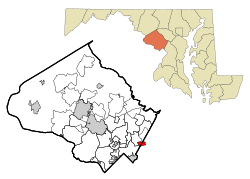
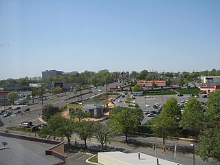
Marlow Heights is an unincorporated area and census-designated place (CDP) in Prince George's County, Maryland, United States. The population was 6,169 at the 2020 census. The Marlow Heights Shopping Center first opened in 1957, adjacent to the large community of Hillcrest Heights. It was joined ten years later, in 1967, by the two-level Iverson Mall, the Washington metropolitan area's first enclosed mall.

<span class="mw-page-title-main">Marlton, Maryland</span> Census-designated place in Maryland

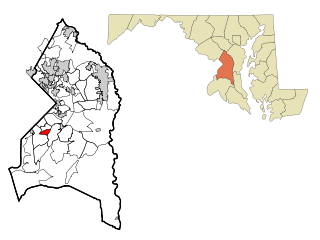
Marlton is an unincorporated area and census-designated place (CDP) in Prince George's County, Maryland, United States. The population was 9,802 at the 2020 census. The Marlton housing development, at first briefly called "Brandywine Country", grew up along U.S. Route 301 in the 1970s, and is part of the greater Upper Marlboro community. Originally made up of only single-family homes, more recently townhouses have been added.

<span class="mw-page-title-main">New Carrollton, Maryland</span> City in Maryland, United States

New Carrollton is a city located in central Prince George's County, Maryland, United States. As of the 2020 census, the population was 13,715. New Carrollton is located 10 miles (16 km) east of central Washington, D.C.

<span class="mw-page-title-main">Rosaryville, Maryland</span> Census-designated place in Maryland, US

Rosaryville is an unincorporated area and census-designated place (CDP) in Prince George's County, Maryland, United States, located south of Cinton and Upper Marlboro beside U.S. Route 301. Per the 2020 census, the population was 11,548. including housing developments and rural open space. It was named for a local Roman Catholic church. Close to Rosaryville are the Marlton housing development, Maryland Veterans Cemetery, the Southern Maryland Farmers Market, and Rosaryville State Park.

<span class="mw-page-title-main">South Laurel, Maryland</span> Census-designated place in Maryland

South Laurel is an unincorporated area and census-designated place (CDP) in Prince George's County, Maryland, United States. Per the 2020 census, the population was 29,602.

<span class="mw-page-title-main">Springdale, Maryland</span> Census-designated place in Maryland

Springdale is an unincorporated area and census-designated place (CDP) in Prince George's County, Maryland, United States. Per the 2020 census, the population was 5,301.

<span class="mw-page-title-main">Temple Hills, Maryland</span> Census-designated place in Maryland, United States

Temple Hills is an unincorporated area and census-designated place (CDP) in Prince George's County, Maryland, United States. Temple Hills borders the communities of Hillcrest Heights, Marlow Heights, Camp Springs and Oxon Hill. Per the 2020 census, the population was 8,350.

<span class="mw-page-title-main">West Laurel, Maryland</span> Census-designated place in Maryland

West Laurel is an unincorporated area and census-designated place (CDP) in Prince George's County, Maryland, United States. Per the 2020 census, the population was 4,428.

<span class="mw-page-title-main">Woodlawn, Prince George's County, Maryland</span> Census-designated place in Maryland

Woodlawn is an unincorporated area and census-designated place (CDP) in Prince George's County, Maryland, United States. As of the 2020 census it had a population of 7,541.

<span class="mw-page-title-main">Calverton, Maryland</span> Census-designated place in Maryland, United States

Calverton is an unincorporated area and census-designated place located on the boundary between Montgomery and Prince George's counties, Maryland, in the United States. At the 2020 census, it had a population of 17,316.

Avenel-Hillandale was a Census-designated place in Montgomery and Prince George's Counties in Maryland during the 1970 United States Census. which consists of the communities of Avenel, Hillandale and Adelphi. The population in 1970 was 19,520. The census area reorganized to the present day CDPs of Hillandale and Adelphi in 1980. The ZIP codes serving the area are 20783 and 20903.

References

  1. "2020 U.S. Gazetteer Files". United States Census Bureau. Retrieved April 26, 2022.
  2. 1 2 U.S. Geological Survey Geographic Names Information System: Hillandale, Maryland
  3. "QuickFacts: Hillandale CDP, Maryland". United States Census Bureau. Retrieved August 17, 2021.
  4. "Hillandale CDP, Maryland". United States Census Bureau . Retrieved April 15, 2022.
  5. "Geographic Identifiers: 2010 Demographic Profile Data (G001): Hillandale CDP, Maryland". United States Census Bureau . Retrieved December 20, 2011.
  6. "P.L. 94-171 County Block Maps (2010 Census) - Prince George's County, Maryland". U.S. Census Bureau. Retrieved December 20, 2011.
  7. "Decennial Census of Population and Housing by Decades". US Census Bureau.
  8. 1 2 "P2 Hispanic or Latino, and Not Hispanic or Latino by Race – 2010: DEC Redistricting Data (PL 94-171) – Hillandale CDP, Maryland". United States Census Bureau .
  9. 1 2 "P2 Hispanic or Latino, and Not Hispanic or Latino by Race – 2020: DEC Redistricting Data (PL 94-171) – Hillandale CDP, Maryland". United States Census Bureau .
  10. "U.S. Census website". United States Census Bureau . Retrieved January 31, 2008.
  11. "2010 CENSUS - CENSUS BLOCK MAP: Hillandale CDP, MD." U.S. Census Bureau. Retrieved on September 2, 2018.
  12. "NEIGHBORHOOD ELEMENTARY SCHOOLS AND BOUNDARIES SCHOOL YEAR 2018-2019." Prince George's County Public Schools. Retrieved on September 2, 2018.
  13. "NEIGHBORHOOD MIDDLE SCHOOLS AND BOUNDARIES SCHOOL YEAR 2018-2019." Prince George's County Public Schools. Retrieved on September 1, 2018.
  14. "NEIGHBORHOOD HIGH SCHOOLS AND BOUNDARIES SCHOOL YEAR 2018-2019." Prince George's County Public Schools. Retrieved on September 1, 2018.