Hyattsville, Maryland

Last updated

Hyattsville, Maryland
Prince Georges Plaza, Hyattsville, Maryland (2893471197).jpg
Aerial view of Hyattsville
Flag of Hyattsville, Maryland.png
Hyattsville Seal.png
Nickname: 
Hyattsville
Motto: 
"A World Within Walking Distance" [1]
Prince George's County Maryland Incorporated and Unincorporated areas Hyattsville Highlighted.svg
Location of Hyattsville in Maryland
Coordinates: 38°57′25″N76°57′5″W / 38.95694°N 76.95139°W / 38.95694; -76.95139
Country Flag of the United States.svg  United States of America
State Flag of Maryland.svg  Maryland
County Prince George's
Incorporated 1886
Government
   Mayor Robert Croslin
Area
[2]
  Total2.73 sq mi (7.07 km2)
  Land2.71 sq mi (7.01 km2)
  Water0.03 sq mi (0.07 km2)
Elevation
105 ft (32 m)
Population
 (2020)
  Total21,187
  Density7,832.53/sq mi (3,024.22/km2)
Time zone UTC−5 (Eastern)
  Summer (DST) UTC−4 (Eastern)
Area code(s) 301, 240
FIPS code 24-41250
GNIS feature ID0597595
Website www.hyattsville.org

Hyattsville is a city in Prince George's County, Maryland, United States. [3] It is an urban suburb of Washington, D.C. The population was 21,187 at the 2020 United States census. [4]

Contents

History

Before Europeans reached the area, the upper Anacostia River was home to Nacotchtank/Anaquashtank people, a Piscataway-speaking Algonquian peoples who lived throughout what is now the Washington, D.C., area. [5] European encroachment and diseases decimated their population and by the 1680s the Nacotchtank/Anaquashtank had largely moved away and merged with other tribes.

In the 1720s, John Beall acquired land in the area and established Beall Town, but the town did not prosper like its neighbor Bladensburg. The opening of the Washington–Baltimore Turnpike (modern day US 1) in 1812 and the B&O Railroad Washington Branch line in 1835 brought more settlers to the area. [6] [7]

The city's founder, Christopher Clark Hyatt (1799–1884), purchased his first parcel of land in the area in 1845. [7] Hyatt opened a store and began mail delivery, officially naming the nascent community "Hyattsville" in his 1859 application to become postmaster. In the years following the Civil War, Hyatt and other local landowners subdivided their properties and sold lots, and the population of Hyattsville grew. Hyattsville was incorporated as a city on April 7, 1886. [8]

Revitalization projects

Since 2000, the city has undergone a major redevelopment, including significant residential and retail development in the Arts District Hyattsville (located in the Gateway Arts District), and the area surrounding the Hyattsville Crossing station and The Mall at Prince George's. [9] In the latter area, University Town Center contains residential condos, student housing, office buildings, a public plaza, and retail space, including a 14-screen movie theater and several restaurants, as well as a campus of Prince George's Community College.

As of 2020, additional residential and retail development is underway near the West Hyattsville Metro station. [10] Along Route 1, craft brewers and distillers have played a notable role in revitalizing old commercial properties. [11] [12]

Regina High School was an all-girls Catholic high school in Hyattsville that closed in 1989. [13]

Geography

The City of Hyattsville consists of six subdivisions; Hyattsville Hills, Downtown Hyattsville, Kirkwood, Queens Chapel Manor, Castle Manor, and University Hills. Historic Hyattsville reportedly consists of the Hyattsville Hills, Downtown Hyattsville, and Castle Manor subdivisions.

According to the United States Census Bureau, the city has a total area of 2.70 square miles (6.99 km2), of which 2.67 square miles (6.92 km2) is land and 0.03 square miles (0.08 km2) is water. [14]

Climate

Typical of central Maryland, Hyattsville lies within the humid subtropical climate zone (Köppen: Cfa), characterized by hot humid summers and generally cool to mild winters, with high annual precipitation. [15] Hyattsville lies within USDA plant hardiness zone 7a. [16]

Demographics

Historical population
CensusPop.Note
1880 288
1890 1,509424.0%
1900 1,222−19.0%
1910 1,91756.9%
1920 2,67539.5%
1930 4,26459.4%
1940 6,57554.2%
1950 12,30887.2%
1960 15,16823.2%
1970 14,998−1.1%
1980 12,709−15.3%
1990 13,8649.1%
2000 14,7336.3%
2010 17,55719.2%
2020 21,18720.7%
U.S. Decennial Census [4] [17]

Hyattsville has attracted a significant gay and lesbian population. In 2000, same-sex couples accounted for 1.3 percent of households, more than double the national average. [18]

2020 census

As of the 2020 U.S. census, [19] there were 21,187 people in 6,592 households and 8,673 housing units at an average density of 3,212.2/sq mi (1,240.2/km2). The racial makeup of the city was 31.7% African American, 24.8% White, 3.7% Asian, 1.6% Native American or Alaskan Native, 0.1% Native Hawaiian or Other Pacific Islander, 26.9% from other races, and 11.3% from two or more races. Hispanic or Latino residents of any race were 38.6% of the population.

2010 census

As of the 2010 U.S. census, [20] there were 17,557 people, 6,324 households, and 3,724 families residing in the city. The population density was 6,575.7 inhabitants per square mile (2,538.9/km2). There were 6,837 housing units at an average density of 2,560.7/sq mi (988.7/km2). The racial makeup of the city was 33.2% White, 35.6% African American, 0.8% Native American, 4.4% Asian, 0.1% Pacific Islander, 21.4% from other races, and 4.6% from two or more races. Hispanic or Latino of any race were 34.0% of the population (16.4% Salvadorean, 4.1% Mexican, 3.1% Guatemalan, 1.2% Honduran, 1.1% Dominican, 0.8% Puerto Rican).

There were 6,324 households, of which 33.2% had children under the age of 18 living with them, 36.4% were married couples living together, 15.7% had a female householder with no husband present, 6.8% had a male householder with no wife present, and 41.1% were non-families. 31.0% of all households were made up of individuals, and 6.7% had someone living alone who was 65 years of age or older. The average household size was 2.73 and the average family size was 3.39.

The median age in the city was 32.1 years. 22.2% of residents were under the age of 18; 12.6% were between the ages of 18 and 24; 34.7% were from 25 to 44; 23.2% were from 45 to 64; and 7.2% were 65 years of age or older. The gender makeup of the city was 50.8% male and 49.2% female.

Crime

According to FBI crime statistics, the violent crime rate per 1,000 residents has significantly decreased in Hyattsville, from 11.42 in 2007 [21] to 4.64 in 2019. [22]

Economy

The National Center for Health Statistics, part of the Department of Health and Human Services, is headquartered in Hyattsville.

Arts and culture

Historic sites

Some historic sites in Hyattsville are listed on the Maryland-National Capital Park and Planning Commission: [23] and the National Register of Historic Places. In 1982, a portion of the city was placed on the National Register of Historic Places as the Hyattsville Historic District; the district was extended in late 2004.

The Hyattsville Historic District of the city is home Victorian houses built in the late 1880s and Sears bungalows and Arts & Crafts houses built between the wars (late 1910s and early 1940s). [24]

Notable historic sites include Hyattsville Armory and the Hyattsville Main Post Office.

Arts District

Downtown Hyattsville underwent revitalization in the early 2000s with the development of Arts District Hyattsville, part of the Gateway Arts District, a private project which includes townhomes, live-work units, and retail space. [25]

Pyramid Atlantic Art Center, a nonprofit arts center is located in Hyattsville, in the historic Arcade building. [26] [27]

Public libraries

Prince George's County Memorial Library System (PGCMLS) operates the Hyattsville Branch Library, [28] which in 1964 was the first county-built library building for PGCMLS. [29] The original mid-century modern building featured a googie-style flying saucer entryway. [30] [31]

Government

When first incorporated, Hyattsville was run by a Board of Commissioners; in May 1900, it switched to a mayor and common council system. Today, the city government consists of a popularly elected mayor and a ten-person city council. Each of the five wards in the city are represented by two popularly elected council members.

In January 2015, the Hyattsville Council passed a charter amendment to allow 16- and 17-year-olds to vote in city elections, making Hyattsville one of the few jurisdictions in the United States that has done so. [32] In December 2016, the city expanded voting rights again, granting non-citizen residents the right to vote in municipal elections. [33]

Education

Public schools

Northwestern High School in Hyatsville Northwestern High School, Hyattsville, Maryland.jpg
Northwestern High School in Hyatsville

Hyattsville Elementary, Felegy Elementary, Hyattsville Middle, and Northwestern High School, along with the Chelsea School, St. Matthews, DeMatha, and St. Jerome Academy are located within the city limits.

The city is served by Prince George's County Public Schools, [34] [35] and its borders overlap with the enrollment areas for the following public schools: [36] [37] [38]

During the era of legally-required racial segregation of schools, black students from Hyattsville attended Lakeland High School in College Park in the period 1928–1950; [39] Fairmont Heights High School, then near Fairmount Heights, replaced Lakeland High and served black students only from 1950 to 1964; around 1964 legally-required racial segregation of schools ended. [40]

Private schools

  • Chelsea School (5–12) for students with language-based learning disabilities and ADD/ADHD
  • DeMatha Catholic High School (9–12)
  • St. Francis International School (Catholic) (K–8) (St. Mark the Evangelist Campus)—As of 2013 it is primarily used for summer programs and athletics, with classes held in the Silver Spring campus. [41]
    • Formerly St. Mark the Evangelist School, [42] closed and merged into Saint Francis International, which opened in 2010. [43] Beginning in 2013 College Park Academy (CPA) leased the St. Francis building; [41] in 2017 CPA moved to its permanent Riverdale Park campus. [44]
  • St. Jerome Academy (Catholic) (Pre-K–8)
  • St. Matthew's Parish Day School (Episcopal) (Pre-K–K)

Colleges and universities

Prince George's Community College has an extension center in University Town Center. [45] The University of Maryland campus in College Park is located approximately two miles north on Baltimore Avenue (Route 1) from historic Hyattsville.

Infrastructure

Transportation

Roads and highways

US 1 northbound in Hyattsville. The Trolley Trail trailhead can be seen at the right. 2016-09-05 13 15 26 View north along U.S. Route 1 (Baltimore Avenue) at Farragut Street in Hyattsville, Prince Georges County, Maryland.jpg
US 1 northbound in Hyattsville. The Trolley Trail trailhead can be seen at the right.

Several major surface highways serve Hyattsville. The most prominent of these is U.S. Route 1, which follows Rhode Island Avenue and Baltimore Avenue through the center of the city. US 1 connects southward to Washington, D.C., and northward through College Park to Interstate 95/Interstate 495 (the Capital Beltway). U.S. Route 1 Alternate follows the southern section of Baltimore Avenue to Bladensburg and provides an alternate route to Washington, D.C. Maryland Route 410 follows East-West Highway, connecting many of Washington, D.C.'s inner suburbs with Hyattsville. Two other state highways serving to connect Hyattsville to nearby towns include Maryland Route 208 and Maryland Route 500.

Public transportation

The Hyattsville Crossing and West Hyattsville Metro station both serve Hyattsville. Hyattsville is also served by the Riverdale MARC commuter train station, as well as a few Metrobus and TheBus routes. Students and staff at the University of Maryland have access to the free Shuttle–UM bus that goes from historic Hyattsville to the University of Maryland campus in College Park.

Bikeways

Hyattsville is well connected to regional Anacostia Tributary Trail System network of hiker–biker trails, including the Northwest Branch Trail, which runs along the southern and western sides of the city, and the Rhode Island Avenue Trolley Trail. Numerous city streets include bicycle sharrows, along with a few unprotected bike lanes. [46] Capital Bikeshare has eight bikeshare stations within the city. [47]

Law enforcement

Prince George's County Police Department District 1 Station in Hyattsville serves areas outside of the city that are not located in an incorporated municipality that maintains its own police department. [48]

In 2017, the Hyattsville City Police Department became the first law enforcement agency in the United States to put a Chevrolet Bolt (all-electric) fully marked police patrol vehicle into service. It has since added an all-electric police motorcycle, and six public electric vehicle charging stations, which are free to use by the public. [49]

Notable people

The city was involved in a minor controversy in April 2006. In the episode airing April 27, the Geena Davis television series Commander in Chief depicted Hyattsville as having twelve murders in six months; it also indirectly depicted the city as being an urban ghetto dominated by poor minorities. The city and Prince George's County were very upset at ABC. On May 1, ABC formally apologized to both the city and county. [53]

Washington, D.C., based detective novelist George Pelecanos has included Hyattsville in some of his novels, including The Man Who Came Uptown .

Related Research Articles

<span class="mw-page-title-main">Prince George's County, Maryland</span> County in Maryland, United States

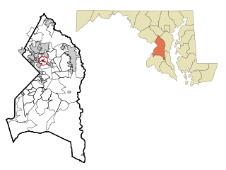
Prince George's County is located in the U.S. state of Maryland bordering the eastern portion of Washington, D.C. As of the 2020 U.S. census, the population was 967,201, making it the second-most populous county in Maryland, behind neighboring Montgomery County. The 2020 census counted an increase of nearly 104,000 in the previous ten years. Its county seat is Upper Marlboro. It is the largest and the second most affluent African American-majority county in the United States, with five of its communities identified in a 2015 top ten list.

<span class="mw-page-title-main">College Park, Maryland</span> City in Maryland, United States

College Park is a city in Prince George's County, Maryland, United States, located approximately four miles (6.4 km) from the northeast border of Washington, D.C. Its population was 34,740 at the 2020 United States census. It is the home of the University of Maryland, College Park.

<span class="mw-page-title-main">Adelphi, Maryland</span> Census-designated place in Maryland

Adelphi is an unincorporated area and census-designated place in Prince George's County, Maryland, United States. Per the 2020 Census, the population was 16,823. Adelphi includes the following subdivisions; Adelphi, Adelphi Park, Adelphi Hills, Adelphi Terrace, Adelphi Village, Buck Lodge, Chatham, Cool Spring Terrace, Hillandale Forest, Holly Hill Manor, Knollwood, Lewisdale, and White Oak Manor.

<span class="mw-page-title-main">Berwyn Heights, Maryland</span> Town in Maryland

Berwyn Heights is a town in Prince George's County, Maryland, United States. Per the 2020 census, the population was 3,345. It is bordered by College Park to the west, Greenbelt to the northeast, and Riverdale Park to the south.

<span class="mw-page-title-main">Bladensburg, Maryland</span> Town in Maryland, United States

Bladensburg is a town in Prince George's County, Maryland, United States. The population was 9,657 at the 2020 census. Areas in Bladensburg are located within ZIP code 20710. Bladensburg is 8.6 miles (13.8 km) from Washington, D.C.

<span class="mw-page-title-main">Bowie, Maryland</span> City in Maryland, United States

Bowie is a city in Prince George's County, Maryland, United States. Per the 2020 census, the population was 58,329. Bowie has grown from a small railroad stop to the largest municipality in Prince George's County, and the fifth most populous city and third largest city by area in the U.S. state of Maryland. In 2014, CNN Money ranked Bowie 28th in its Best Places to Live list.

<span class="mw-page-title-main">Brandywine, Maryland</span> Census-designated place in Maryland

Brandywine is the name of an unincorporated area in Prince George's County, Maryland, United States, that refers both to a census-designated place (CDP) and a zip code area which is much larger (20613), whose areas overlap. The population of Brandywine at the 2020 U.S. Census was 10,550 for the CDP, and the population of ZIP code 20613 was 11,860 in 2010.

<span class="mw-page-title-main">Brentwood, Maryland</span> Town in Prince Georges County, Maryland, US

Brentwood is a town in Prince George's County, Maryland, United States. Per the 2020 census, the population was 3,828. Brentwood is located within 1-mile (1.6 km) of Washington. The municipality of Brentwood is located just outside the northeast boundary of the District of Columbia and surrounded by the communities of Mount Rainier, Cottage City, North Brentwood, and the nearby Hyattsville. Along the Route 1 Corridor, Brentwood is part of the Gateway Arts District.

<span class="mw-page-title-main">Cheverly, Maryland</span> Town in Prince Georges County, Maryland, US

Cheverly is a town in Prince George's County, Maryland, United States, located very close to Washington, D.C., though not bordering it directly. The town was founded in 1918 and incorporated in 1931. Per the 2020 census, the population was 6,170. Cheverly borders the communities of Tuxedo, Chapel Oaks, Landover, Landover Hills, Villa Heights, and Bladensburg.

<span class="mw-page-title-main">Chillum, Maryland</span> Census-designated place in Maryland

Chillum is an unincorporated area and census-designated place in Prince George's County, Maryland, United States, bordering Washington, D.C., and Montgomery County.

<span class="mw-page-title-main">Colmar Manor, Maryland</span> Town in Maryland

Colmar Manor is a town located in Prince George's County, Maryland, United States. As of the 2010 census, the town had a population of 1,404. As the town developed at the beginning of the 20th century, it assumed a name derived from its proximity to the District of Columbia—the first syllable of Columbia and that of Maryland were combined to form "Colmar". Colmar Manor was incorporated in 1927.

<span class="mw-page-title-main">Greenbelt, Maryland</span> City in Maryland, United States

Greenbelt is a city in Prince George's County, Maryland, United States, and a suburb of Washington, D.C. At the 2020 census, the population was 24,921.

<span class="mw-page-title-main">Landover Hills, Maryland</span> Town in Maryland

Landover Hills is a town in Prince George's County, Maryland, United States. Per the 2020 census, the population was 1,815. The town has a neighborhood named Defense Heights.

<span class="mw-page-title-main">Mount Rainier, Maryland</span> City in Maryland

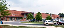
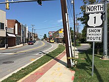
Mount Rainier is a city in Prince George's County, Maryland, United States, bordering Washington D.C. The population was 8,333 at the 2020 census. Mount Rainier is contained between the Northwest Branch Anacostia River, Cedar Lane Alley, and 34th Street to the north, 37th Street and 37th Place to the northeast, Upshur Street and Queens Chapel Road to the west, the CSX Capital Subdivision train tracks to the east, and Eastern Avenue NE to the south. Mount Rainier got its start as a streetcar suburb, when tracks were laid for the 82 Streetcar Line. According to local tradition, surveyors from the Pacific Northwest named the town, giving the streets names such as Shasta and Cascade. Historic U.S. 1 runs through the center of the town and serves as the main street and central business district.

<span class="mw-page-title-main">New Carrollton, Maryland</span> City in Maryland, United States

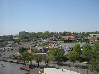
New Carrollton is a city located in central Prince George's County, Maryland, United States. As of the 2020 census, the population was 13,715. New Carrollton is located 10 miles (16 km) east of central Washington, D.C.

<span class="mw-page-title-main">North Brentwood, Maryland</span> Town in Maryland

North Brentwood is a town in Prince George's County, Maryland, United States. The population was 593 at the 2020 census. The municipality of North Brentwood is located north of Washington and is surrounded by the communities of Brentwood, Hyattsville, and Cottage City, and the nearby Mount Rainier. The Town of North Brentwood was incorporated in 1924, and was the first African-American-majority municipality in Maryland.

<span class="mw-page-title-main">Riverdale Park, Maryland</span> Town in Prince Georges County, Maryland, US

Riverdale Park, formerly known and often referred to as Riverdale, is a semi-urban town in Prince George's County, Maryland, United States, a suburb in the Washington, D.C., metropolitan area. The population was 6,955 as of the 2010 U.S. Census. The population as of 2019 is approximately 7,304, according to the US Census Bureau and other entities.

<span class="mw-page-title-main">University Park, Maryland</span> Town in Maryland

University Park is a town in Prince George's County, Maryland, United States. The population was 2,454 at the 2020 census.

Landover is an unincorporated community and census-designated place in Prince George's County, Maryland, United States. As of the 2020 census, it had a population of 25,998.

Summerfield is a census-designated place near Landover in Prince George's County, Maryland. As of the 2020 census, the population was 14,758. It is a suburb of Washington, D.C.

References

  1. "City of Hyattsville, Maryland". City of Hyattsville, Maryland. Retrieved August 25, 2012.
  2. "2020 U.S. Gazetteer Files". United States Census Bureau. Retrieved April 26, 2022.
  3. U.S. Geological Survey Geographic Names Information System: Hyattsville, Maryland
  4. 1 2 "2020 and 2010 Population by Municipality" (PDF). Maryland State Data Center. Retrieved September 7, 2021.
  5. "Native Peoples of Washington, DC". National Park Service. Retrieved February 22, 2020.
  6. Schmidt, Kimberly (November 11, 2011). "Legend and Lore: A History of Hyattsville, Part 1". Hyattville Life & Times. Hyattsville, Maryland. Retrieved October 12, 2020.
  7. 1 2 Anacostia Trails Heritage Area — Part Two: Area and Site Analysis (PDF) (Report). p. 226. Retrieved October 12, 2020.
  8. "Hyattsville History". City of Hyattsville, Maryland. Retrieved August 28, 2015.
  9. "Celebrating Hyattsville: A Rebirth". Washington, D.C.: WRC-TV NBC4. July 8, 2014. Retrieved June 3, 2020.
  10. Neibauer, Michael (December 9, 2019). "Metro to sell West Hyattsville land to the only developers who can build on it". Washington Business Journal. Washington, D.C. Retrieved June 3, 2020.
  11. Teague Beckworth, Ryan (August 8, 2017). "Alcohol Fuels Once-Dry Hyattsville's Rebirth". The Hyattsville Wire. Hyattsville, MD. Retrieved June 3, 2020.
  12. McLeod, Ethan (November 27, 2018). "Along D.C.'s Northeast Border, A Community of Brewers Is Booming". Washington, D.C.: WAMU-FM. Retrieved June 3, 2020.
  13. "Catholic High School Celebrating 50 Years of Accomplishments". October 4, 1996.
  14. "US Gazetteer files 2010". United States Census Bureau. Archived from the original on January 12, 2012. Retrieved January 25, 2013.
  15. "Climate: Hyattsville". Climate-Data.org. Retrieved September 2, 2015.
  16. "USDA Plant Hardiness Zone Map". United States Department of Agriculture. Archived from the original on February 27, 2014. Retrieved September 2, 2015.
  17. "Decennial Census of Population and Housing by Decades". US Census Bureau.
  18. "Just Another Way to Be Suburban: In Pr. George's, Same-Sex Couples Grow in Number, Visibility," by Lonnae O'Neal Parker, The Washington Post, June 29, 2009.
  19. "U.S. Census website". United States Census Bureau: Hyattsville city, Maryland. Retrieved January 1, 2022.
  20. "U.S. Census website". United States Census Bureau . Retrieved January 25, 2013.
  21. "Universal Crime Rates, Table 8: Maryland". Federal Bureau of Investigation. 2007.
  22. "Universal Crime Rates, Table 8: Maryland". Federal Bureau of Investigation. 2019.
  23. M-NCPPC Illustrated Inventory of Historic Sites (Prince George's County, Maryland), 2011.
  24. Reinink, Amy. "It's old, but never old hat". The Washington Post. p. E6.
  25. "Gateway Arts District". MyGatewayArts. Retrieved August 28, 2020.
  26. Andrew Metcalf (May 3, 2017). "Sherwin-Williams Moving Into Former Home of Pyramid Atlantic in Silver Spring". Bethesda Magazine. Retrieved January 28, 2021.
  27. Marder, Andrew (June 8, 2015). "UPDATE: Pyramid Atlantic relocating to Hyattsville Arcade Building". Hyattsville Life & Times. Retrieved January 28, 2021. has been located in downtown Silver Spring since 2003.
  28. "Hyattsville Branch." Prince George's County Memorial Library System. Retrieved on February 1, 2018.
  29. Bennett, Rebecca (June 26, 2014). "Hyattsville Library listed as endangered". Hyattsville Life & Times. Hyattsville, Maryland. Retrieved September 6, 2019.
  30. Flynn, Katherine (January 24, 2014). "Save Our Saucer: The Fight to Protect a Space-Age Artifact in Hyattsville, Md". savingplaces.org. National Trust for Historic Preservation. Retrieved September 6, 2019.
  31. Beckwith, Alison (April 2, 2019). "Demolition Begins at Hyattsville Library Site". The Hyattsville Wire. Hyattsville, Maryland. Retrieved September 6, 2019.
  32. Bennett, Rebecca (January 6, 2015). "Council lowers Hyattsville voting age to 16 years old". Hyattsville Life & Times. Archived from the original on March 7, 2015.
  33. Hernández, Arelis R. (December 7, 2016). "Hyattsville will allow non-U.S. citizens to vote in city elections". The Washington Post . Washington, D.C. Retrieved December 28, 2016.
  34. "Prince George's County Public Schools". Prince George's County Public Schools. Archived from the original on April 11, 2011. Retrieved August 25, 2012.
  35. Map. Hyattsville, Maryland. Retrieved on February 1, 2018.
  36. "NEIGHBORHOOD ELEMENTARY SCHOOLS AND BOUNDARIES SCHOOL YEAR 2017-2018." Prince George's County Public Schools. Retrieved on January 31, 2018.
  37. "NEIGHBORHOOD MIDDLE SCHOOLS AND BOUNDARIES SCHOOL YEAR 2017-2018." Prince George's County Public Schools. Retrieved on January 31, 2018.
  38. "NEIGHBORHOOD HIGH SCHOOLS AND BOUNDARIES SCHOOL YEAR 2017-2018." Prince George's County Public Schools. Retrieved on January 31, 2018.
  39. African-American Historic and Cultural Resources in Prince George's County, Maryland . Maryland-National Capital Park and Planning Commission, February 2012. p. 63 (document page 67). Retrieved on September 6, 2018.
  40. "Fairmont Heights High School History". Fairmont Heights High School. September 4, 2018. Archived from the original on October 4, 2005. Retrieved September 4, 2018.
  41. 1 2 Weaver, Rosanna Landis (January 15, 2013). "Charter school to open in Hyattsville". Hyattsville Life & Times . Retrieved September 6, 2018.
  42. "St. Mark's School in Hyattsville holds reunion to marks its 50th year Archived 2018-09-06 at the Wayback Machine ." Catholic Standard, Roman Catholic Archdiocese of Washington. Wednesday, October 15, 2008. Retrieved on January 31, 2018. "St. Mark Campus 7501 Adelphi Road Hyattsville, MD 20783"
  43. Roberts, Tom. "Maryland Catholic school finds its footing amid demographic shifts." Catholic Standard, Roman Catholic Archdiocese of Washington. Wednesday, October 15, 2008. Retrieved on February 1, 2018.
  44. Roscoe, Jack (October 4, 2017). "UMD celebrates College Park Academy's opening in Riverdale Park". The Diamondback . Retrieved September 6, 2018.
  45. "PGCCC University Town Center Extension Center." Prince George's Community College. Retrieved on February 1, 2018.
  46. Beckwith, Ryan Teague (June 2, 2017). "Hyattsville Biking: How Route 1 Became a Bicycling Haven". Hyattsville Wire. Retrieved June 25, 2022.
  47. Beckwith, Ryan Teague (April 24, 2019). "Capital Bikeshare Keeps Expanding on Route 1". The Hyattsville Wire. Retrieved September 26, 2022.
  48. "District 1 Station - Hyattsville. Prince George's County Police Department. Retrieved on September 9, 2018. Beat map.
  49. Archived at Ghostarchive and the Wayback Machine : "No Charge to Charge! Free Electric Vehicle Chargers in Hyattsville". YouTube .
  50. Genzlinger, Neil (April 7, 2020). "David Driskell, 88, Pivotal Champion of African-American Art, Dies". The New York Times. New York, New York. Retrieved July 17, 2021.
  51. Graf, Heather (May 15, 2019). "Play debuts amidst lingering controversy at Hyattsville Middle School". WBFF-TV. Retrieved June 25, 2022.
  52. Kepner, Tyler (April 21, 2020). "Who Is Chase Young? A Defensive Star and Student of the Game". The New York Times . Retrieved April 22, 2020.
  53. Berger, Judson (May 4, 2006). "TV show that portrayed Prince George's in unflattering light is canceled by network". The Gazette . Post Community Media LLC. Retrieved December 28, 2016.