East Sonora, California

Last updated
East Sonora
Tuolumne County California Incorporated and Unincorporated areas East Sonora Highlighted.svg
Location in Tuolumne County and the state of California
Usa edcp location map.svg
Red pog.svg
East Sonora
Location in the United States
Coordinates: 37°58′50″N120°20′53″W / 37.98056°N 120.34806°W / 37.98056; -120.34806 Coordinates: 37°58′50″N120°20′53″W / 37.98056°N 120.34806°W / 37.98056; -120.34806
Country Flag of the United States.svg  United States
State Flag of California.svg  California
County Tuolumne
Area
[1]
  Total2.481 sq mi (6.425 km2)
  Land2.476 sq mi (6.412 km2)
  Water0.005 sq mi (0.013 km2)  0.21%
Elevation
2,106 ft (642 m)
Population
 (2010)
  Total2,266
  Density910/sq mi (350/km2)
Time zone UTC-8 (Pacific (PST))
  Summer (DST) UTC-7 (PDT)
ZIP code
95370
Area code(s) 209
FIPS code 06-21188
GNIS feature ID1785607

East Sonora is a census-designated place (CDP) in Tuolumne County, California, United States. The population was 2,266 at the 2010 census, up from 2,078 at the 2000 census.

Contents

Geography

East Sonora is located at 37°58′50″N120°20′53″W / 37.98056°N 120.34806°W / 37.98056; -120.34806 (37.980561, -120.347961). [2]

According to the United States Census Bureau, the CDP has a total area of 2.5 square miles (6.5 km2), 99.79% of it land and 0.21% of it water.

Demographics

Historical population
CensusPop.
U.S. Decennial Census [3]

2010

At the 2010 census East Sonora had a population of 2,266. The population density was 913.4 inhabitants per square mile (352.7/km2). The racial makeup of East Sonora was 2,129 (94.0%) White, 7 (0.3%) African American, 16 (0.7%) Native American, 32 (1.4%) Asian, 1 (0.0%) Pacific Islander, 35 (1.5%) from other races, and 46 (2.0%) from two or more races. Hispanic or Latino of any race were 152 people (6.7%). [4]

The census reported that 2,151 people (94.9% of the population) lived in households, 1 (0%) lived in non-institutionalized group quarters, and 114 (5.0%) were institutionalized.

There were 1,150 households, 167 (14.5%) had children under the age of 18 living in them, 422 (36.7%) were opposite-sex married couples living together, 80 (7.0%) had a female householder with no husband present, 26 (2.3%) had a male householder with no wife present. There were 63 (5.5%) unmarried opposite-sex partnerships, and 9 (0.8%) same-sex married couples or partnerships. 544 households (47.3%) were one person and 393 (34.2%) had someone living alone who was 65 or older. The average household size was 1.87. There were 528 families (45.9% of households); the average family size was 2.62.

The age distribution was 288 people (12.7%) under the age of 18, 128 people (5.6%) aged 18 to 24, 314 people (13.9%) aged 25 to 44, 557 people (24.6%) aged 45 to 64, and 979 people (43.2%) who were 65 or older. The median age was 60.4 years. For every 100 females, there were 74.7 males. For every 100 females age 18 and over, there were 69.9 males.

There were 1,279 housing units at an average density of 515.6 per square mile, of the occupied units 694 (60.3%) were owner-occupied and 456 (39.7%) were rented. The homeowner vacancy rate was 5.3%; the rental vacancy rate was 11.1%. 1,338 people (59.0% of the population) lived in owner-occupied housing units and 813 people (35.9%) lived in rental housing units.

2000

At the 2000 census there were 2,078 people, 1,064 households, and 600 families in the CDP. The population density was 805.9 inhabitants per square mile (311.2/km2). There were 1,145 housing units at an average density of 444.1 per square mile (171.5/km2). The racial makeup of the CDP was 93.98% White, 0.82% African American, 0.48% Native American, 0.67% Asian, 0.05% Pacific Islander, 0.96% from other races, and 3.03% from two or more races. Hispanic or Latino of any race were 6.11%. [5]

Of the 1,064 households 15.4% had children under the age of 18 living with them, 46.3% were married couples living together, 7.0% had a female householder with no husband present, and 43.6% were non-families. 39.8% of households were one person and 30.3% were one person aged 65 or older. The average household size was 1.94 and the average family size was 2.53.

The age distribution was 15.0% under the age of 18, 3.5% from 18 to 24, 14.9% from 25 to 44, 23.9% from 45 to 64, and 42.7% 65 or older. The median age was 60 years. For every 100 females, there were 80.5 males. For every 100 females age 18 and over, there were 77.2 males.

The median household income was $34,922 and the median family income was $50,222. Males had a median income of $46,250 versus $23,250 for females. The per capita income for the CDP was $23,254. About 2.8% of families and 5.4% of the population were below the poverty line, including none of those under age 18 and 8.7% of those age 65 or over.

History

There really is not a place called East Sonora, at least no signs to signify it as such, so most people just say they are from Sonora, California, proper. They would be Sonorans in the 21st century, or Sonorians in the 19th century.

Government

In the California State Legislature, East Sonora is in the 8th Senate District , represented by Republican Andreas Borgeas, and the 5th Assembly District , represented by Republican Frank Bigelow. [6]

In the United States House of Representatives, East Sonora is in California's 4th congressional district , represented by Republican Tom McClintock. [7]

Related Research Articles

Whetstone, Arizona CDP in Cochise County, Arizona

Whetstone is a census-designated place (CDP) in Cochise County, Arizona, United States, north of Sierra Vista. The population was 2,617 at the 2010 census.

Seeley, California Census-designated place in California, United States

Seeley is a census-designated place (CDP) in Imperial County, California. Seeley is located 7.5 miles (12 km) west of El Centro. The population was 1,823 at the 2010 census, up from 1,624 in 2000. It is part of the El Centro Metropolitan Area.

East Rancho Dominguez, California Census designated place in California, United States

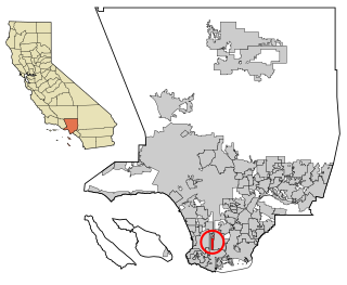
East Rancho Dominguez, also known as East Compton, is an unincorporated community and census-designated place (CDP) located in southern Los Angeles County, California. The population was 15,135 at the 2010 census, up from 9,286 at the 2000 census. East Rancho Dominguez is an accepted city name according to the USPS, and shares the 90221 ZIP Code with Compton.

East Whittier, California Census-designated place in California, United States

East Whittier is an unincorporated community and census-designated place (CDP) in Los Angeles County, California, United States. The population was 9,757 at the 2010 census, up from 9,538 at the 2000 census. The name was changed from East La Mirada in 2012, likely due to its precise location in relation to the city of Whittier. The previous delineation of East Whittier CDP occurred during the 1960 census, when the area recorded a population of 19,884.

East San Gabriel, California Census-designated place in California, United States

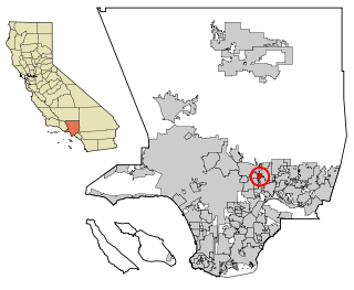
East San Gabriel is a census-designated place (CDP) in Los Angeles County, California, United States. The population was 14,874 at the 2010 census, up from 14,512 at the 2000 census.

West Carson, California Place in California, United States

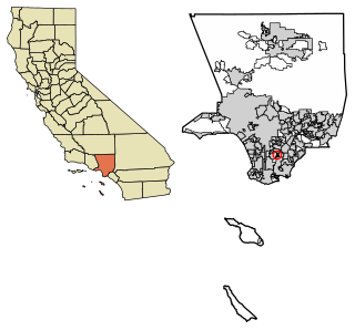
West Carson is an unincorporated community in Los Angeles County, California. The population was 21,699 at the 2010 census, up from 21,138 at the 2000 census. For statistical purposes, the United States Census Bureau has defined West Carson as a census-designated place (CDP).

East Shore, California Census-designated place in California, United States

East Shore is a census-designated place (CDP) in Plumas County, California, United States. The population was 156 at the 2010 census, down from 177 at the 2000 census.

Mohawk Vista, California Census-designated place in California, United States

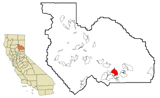
Mohawk Vista is a census-designated place in Plumas County, California, United States. The population was 159 at the 2010 census, up from 121 at the 2000 census.

Big River, California Census-designated place in California, United States

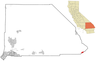
Big River is a census-designated place (CDP) in San Bernardino County, California, United States. The population was 1,327 at the 2010 census, up from 1,266 at the 2000 census.

Bluewater, California Census-designated place in California, United States

Bluewater is a census-designated place (CDP) in San Bernardino County, California, United States. The population was 172 at the 2010 census, down from 265 at the 2000 census.

East Foothills, San Jose Census designated place in California, United States

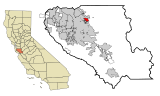
East Foothills is a census-designated place (CDP) in Santa Clara County, California, United States and a neighborhood of San Jose. The population was 8,269 at the 2010 census and it is located about 4 miles east of downtown San Jose.

Fruitdale, San Jose Place in California, United States

Fruitdale is a district of San Jose, California, located in West San Jose, though some portions are still unincorporated as a census-designated place. The population of the CDP was 935 at the 2010 census.

Live Oak, Santa Cruz County, California Census-designated place in California, United States

Live Oak is a census-designated place (CDP) in Santa Cruz County, California between the cities of Santa Cruz and Capitola and north of the former Union Pacific railroad. Live Oak sits at an elevation of 102 feet (31 m). The population was 17,038 at the 2020 census. The population of the greater Live Oak area, including Twin Lakes and Pleasure Point, was 27,921.

East Oakdale, California Census-designated place in California, United States

East Oakdale is an unincorporated census-designated place (CDP) on the Stanislaus River, located east of the city of Oakdale in Stanislaus County, California.

Ducor, California Census-designated place in California, United States

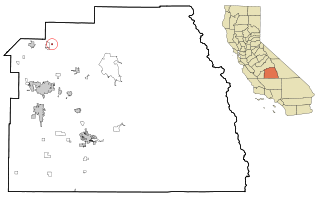
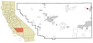
Ducor is a census-designated place (CDP) in Tulare County, California, United States. The population was 612 at the 2010 census, up from 504 at the 2000 census. Ducor is an abbreviation of an earlier name, Dutch Corners, which was given because several early settler families were German. The word "Dutch" in this case derives from German deutsch "German".

East Orosi, California Census-designated place in California, United States

East Orosi is a census-designated place (CDP) in Tulare County, California, United States. The population was 495 at the 2010 census, up from 426 in 2000.

Orosi, California Census-designated place in California, United States

Orosi is a census-designated place (CDP) in Tulare County, California, United States. The population was 8,770 at the 2010 census, up from 7,318 at the 2000 census.

China Lake Acres, California Census-designated place in California, United States

China Lake Acres is a census-designated place (CDP) in Kern County, California, United States. The population was 1,876 at the 2010 census, up from 1,761 at the 2000 census.

West River is an unincorporated community in Washakie County, Wyoming, United States. The population was 321 at the 2000 census, when it was a census-designated place (CDP).

Edwards Air Force Base is a census-designated place (CDP) covering the residential population of Edwards Air Force Base in Kern County, California, United States. Per the 2020 census, the population was 2,135.

References

  1. "2010 Census Gazetteer Files - Places - California". United States Census Bureau . Retrieved March 26, 2015.
  2. "US Gazetteer files: 2010, 2000, and 1990". United States Census Bureau. 2011-02-12. Retrieved 2011-04-23.
  3. "Census of Population and Housing". Census.gov. Retrieved June 4, 2016.
  4. "2010 Census Interactive Population Search: CA - East Sonora CDP". U.S. Census Bureau. Archived from the original on July 15, 2014. Retrieved July 12, 2014.
  5. "U.S. Census website". United States Census Bureau . Retrieved 2008-01-31.
  6. "Statewide Database". Regents of the University of California . Retrieved March 26, 2015.
  7. "California's 4th Congressional District - Representatives & District Map". Civic Impulse, LLC. Retrieved September 28, 2014.