East Syracuse, New York

Last updated

East Syracuse, New York
St. Matthew RC Church, East Syracuse, New York - 20210306.jpg
St. Matthew's Roman Catholic Church, 2021
Onondaga County New York incorporated and unincorporated areas East Syracuse highlighted.svg
Location in Onondaga County and the state of New York.
Coordinates: 43°3′52″N76°4′13″W / 43.06444°N 76.07028°W / 43.06444; -76.07028
Country United States
State New York
County Onondaga
Area
[1]
  Total1.56 sq mi (4.04 km2)
  Land1.56 sq mi (4.04 km2)
  Water0.00 sq mi (0.00 km2)
Elevation
433 ft (132 m)
Population
 (2020)
  Total3,078
  Density1,973.08/sq mi (761.95/km2)
Time zone UTC-5 (Eastern (EST))
  Summer (DST) UTC-4 (EDT)
ZIP code
13057
Area code 315
FIPS code 36-23052
GNIS feature ID0949253
Website www.villageofeastsyracuse.com

East Syracuse is an incorporated village and a suburb of the City of Syracuse in eastern Onondaga County, New York, United States. As of the 2020 census, the population was 3,078. It is located immediately east of Syracuse, in the town of DeWitt.

Contents

Geography

Perspective map of East Syracuse with a list of landmarks from 1885 by L.R. Burleigh East Syracuse, N.Y. LOC 75694766.jpg
Perspective map of East Syracuse with a list of landmarks from 1885 by L.R. Burleigh

East Syracuse is located at 43°3′52″N76°4′13″W / 43.06444°N 76.07028°W / 43.06444; -76.07028 (43.064516, -76.070143). [2] The village center is at Manlius and North Center streets.

According to the United States Census Bureau, the village has a total area of 1.6 square miles (4.1 km2), all land.

Demographics

Historical population
CensusPop.Note
1880 1,099
1890 2,231103.0%
1900 2,50912.5%
1910 3,27430.5%
1920 4,10625.4%
1930 4,64613.2%
1940 4,520−2.7%
1950 4,7064.1%
1960 4,7080.0%
1970 4,333−8.0%
1980 3,412−21.3%
1990 3,343−2.0%
2000 3,178−4.9%
2010 3,084−3.0%
2020 3,078−0.2%
U.S. Decennial Census [3]

As of the census [4] of 2000, there were 3,178 people, 1,393 households, and 742 families residing in the village. The population density was 2,015.0 inhabitants per square mile (778.0/km2). There were 1,503 housing units at an average density of 953.0 per square mile (368.0/km2). The racial makeup of the village was 95.06% White, 1.45% African American, 1.01% Native American, 0.25% Asian, 0.09% from other races, and 2.14% from two or more races. Hispanic or Latino of any race were 1.16% of the population.

There were 1,393 households, out of which 30.1% had children under the age of 18 living with them, 30.1% were married couples living together, 15.8% had a female householder with no husband present, and 46.7% were non-families. 40.2% of all households were made up of individuals, and 16.8% had someone living alone who was 65 years of age or older. The average household size was 2.28 and the average family size was 3.09.

In the village, the population was spread out, with 27.0% under the age of 18, 7.9% from 18 to 24, 30.4% from 25 to 44, 19.1% from 45 to 64, and 15.6% who were 65 years of age or older. The median age was 36 years. For every 100 females, there were 90.6 males. For every 100 females age 18 and over, there were 86.0 males.

The median income for a household in the village was $28,703, and the median income for a family was $34,293. Males had a median income of $34,405 versus $24,875 for females. The per capita income for the village was $17,066. About 14.3% of families and 14.7% of the population were below the poverty line, including 17.9% of those under age 18 and 11.4% of those age 65 or over.

The village was incorporated in 1881 and population peaked in the early 1960s, with a 1960 census reported population of 4,708.

History

The original inhabitants of the area were Onondaga clans, whose village was atop a hill on the eastern border of Onondaga territory along what is now Kinne St. An established trail ran down part of what is now James Street to Ley Creek where the Onondagas could travel by canoe to their capital along the northeast shore of Onondaga Lake. Portions of this Onondaga village dating from the early eighteenth century were uncovered in the 1930s when East Syracuse High School was being built on Kinne St near James St.

The current settlement, originally named "Messina," grew up along the northern edge of the Erie Canal across from Headson's Landing, a busy canal port with the only bridge to cross the canal east of downtown Syracuse for ten miles. In the middle of the nineteenth century the Messina Plank Road (now New York State Route 290) was built from Messina east to Manlius Center and the canal port there. Large venetian blind and buggy whip factories operated in Messina in the late nineteenth century.

NYCRR freight yards at the 'hump' (1910). Nycrr-freight-yards 1910 east-syracuse hump.jpg
NYCRR freight yards at the 'hump' (1910).

In the 1870s, the main line of the New York Central Railroad was built through the northern part of Messina. The DeWitt Railyards complex, one of the busiest in the world in its day, stretched from Messina five miles east to Minoa. East and westbound trains were assembled in the yards at the "Hump", where trains were pushed up tracks on one side of an artificial hill and routed to their train by track switches as the rolled freely down the far side. During most of the nineteenth century the larger part of the hamlet was south of the railroad yards, but as the population grew with rail workers, housing expanded to the north.

During the boom following construction of the railroad, the name "East Syracuse" began to replace Messina. That name was chosen for the new village when it was incorporated in 1881. At that time the village thrived due to its access to transportation. The railroad was the new powerhouse, but the canal remained viable, with Headson's Landing still a busy port. The northeastern corner of the Headson's Landing Bridge was the original southwestern corner of the village.

In the 20th century, Erie Boulevard was built over the canal from west of Syracuse to about a mile past Headson's landing. In the 1960s, Interstate 690 was built through the southern part of the village between the railroad and Erie Blvd. Now only a small portion of the original settlement south of the railroad remains, including about 100 of the village's 1400 dwelling units.

With the canal gone and the railroad seeing only a portion of its former business, and as the interstate system and other high speed roads have turned the all-day trip of the nineteenth century into a few hours' drive, East Syracuse has become fully a suburb of Syracuse.

East Syracuse is home to Bristol Laboratories, formerly Cheplin Laboratories, which Bristol-Myers purchased in 1943 and converted from the production of acidophilus milk to penicillin [5] until 2005 when it became more economical to produce overseas. Now a division of Bristol-Myers Squibb, the facility makes several newer drugs, along with housing a state-of-the-art ramp-up facility designed to quickly adapt to make moderate quantities of new drugs for clinical trials.

Jason M Rhoades became the village's youngest mayor at the age of twenty-five.

A recent list of the mayors of East Syracuse (with party affiliation) includes:

Michael "Mickey" Wrenn (Progressive) 1961-65;
Carl Sterling (Peoples) 1965-70;
Ronald A Russell Jr (Peoples) 1970-73, 1975-1979, 1981-1985, 1997-2001;
Fred Ray (Citizens) 1973-75;
Richard Benack (Citizens) 1979-81;
Richard Rhoades (Citizens) 1985-87;
Peter Higgins (Peoples) 1987-95;
Donald E Reichert (Citizens) 1995-97;
Jason M Rhoades (Citizens) 2001-03;
Lorene McCoy Dadey (Peoples) 2003-05;
Tony Albanese (Citizens) 2005-07;
Danny J Liedka (Peoples) 2007-2013;
Robert Tackman (Peoples) 2013-.

Village government

The annual village operating budget for the fiscal year that began on June 1, 2013, is $5,231,210, including the separate sewer and water budgets, of which $2,201,934 or 42% comes from local property taxes. As of April 2023, village officials include:

Lorene Dadey, Mayor;
Mary Albanese, Deputy Mayor;
Dominic Celletti, Village Trustee;
Margaret Raesky, Village Trustee;
Carol Para, Village Trustee;
Robert Germain, Village Attorney.

Economy

The headquarters of Aspen Dental are in the Town of DeWitt [6] [7] near East Syracuse. [6]

Education

The East Syracuse-Minoa Central School District is a public school system headquartered in the Town of Manlius, [8] [9] serving the entirety of East Syracuse and its surrounding area (Minoa, Kirkville, and the easternmost portion of Eastwood). Nearby private schools include Christian Brothers Academy, the Manlius Pebble Hill School, and Bishop Grimes Junior/Senior High School.

Elementary schools

Middle school

High school

Fire department

The village of East Syracuse and the northern part of the town of DeWitt is protected by firefighters from the East Syracuse Fire Department. The fire department consists entirely of volunteers and operates out of two fire stations. The department averages 1,100 emergency calls a year. More information can be found at East Syracuse Fire Department

Public works

The East Syracuse Department of Public Works uses several late-model International dump trucks for plowing and other assorted tasks.

Village International DPW Plow truck at work site. InternationalDumpTruck.JPG
Village International DPW Plow truck at work site.

Commerce

Manlius Street, typically referred to as Main Street, is home to a wide variety of locally owned shops, eating establishments, bars, manufacturers and other service providers.

Dairylea Cooperative Inc. is based in East Syracuse.

Notable people

See also

Related Research Articles

<span class="mw-page-title-main">Onondaga County, New York</span> County in New York, United States

Onondaga County is a county in the U.S. state of New York. As of the 2020 census, the population was 476,516. The county seat is Syracuse. The county is part of the Central New York region of the state.

<span class="mw-page-title-main">DeWitt, New York</span> Town in New York, United States

DeWitt is a town in Onondaga County, New York, United States. As of the 2020 census, the population was 26,074. The town is named after major Moses DeWitt, a judge and soldier. An eastern suburb of Syracuse, DeWitt also is the site of most of the campus and all of the academic buildings of Le Moyne College.

<span class="mw-page-title-main">Fayetteville, New York</span> Village in New York, United States

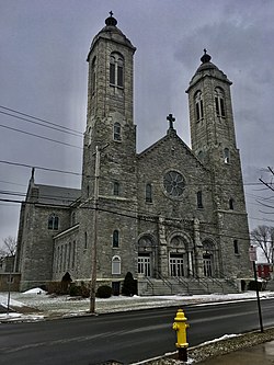
Fayetteville is a village located in Onondaga County, New York, United States. As of the 2020 U.S. Census, the population was 4,225. The village is named after the Marquis de Lafayette, a national hero of both France and the United States. It is part of the Syracuse Metropolitan Statistical Area.

<span class="mw-page-title-main">Liverpool, New York</span> Village in New York, United States

Liverpool is a lakeside village in Onondaga County, New York, United States. As of the 2020 census, the population was 2,242. The name was adopted from the city of Liverpool in the United Kingdom. The village is on Onondaga Lake, in the western part of the town of Salina and is northwest of Syracuse, of which it is a suburb.

<span class="mw-page-title-main">Lyncourt, New York</span> Census-designated place in New York, United States

Lyncourt is a hamlet in Onondaga County, New York, United States. The population was 4,250 at the 2010 census.

<span class="mw-page-title-main">Minoa, New York</span> Village in New York, United States

Minoa is a village in Onondaga County, New York, United States. As of the 2020 census, the population was 3,657. Minoa is in the northern part of the town of Manlius and is east of Syracuse.

<span class="mw-page-title-main">Onondaga, New York</span> Town in New York, United States

Onondaga is a town in Onondaga County, New York, United States, encompassing 65 square miles. As of the 2020 Census, the population was 22,937. The town is named after the native Onondaga tribe, part of the Iroquois Confederacy. Onondaga was incorporated April 2, 1798, and is located southwest of the city of Syracuse, which it borders. The villages and hamlets which make up the town are: Cedarvale, Howlett Hill, Navarino, Nedrow, Onondaga Hill, Sentinel Heights, South Onondaga, Southwood, Split Rock, and Taunton.

<span class="mw-page-title-main">Pompey, New York</span> Town in New York, United States

Pompey is a town in the southeast part of Onondaga County, New York. As of the 2020 Census, the population was 7,080. The town was named after the Roman general and political leader Pompey by a late 18th-century clerk interested in the Classics in the new federal republic.

<span class="mw-page-title-main">Salina, New York</span> Town in New York, United States

Salina is a town in Onondaga County, New York, United States. As of the 2020 Census, the population was 33,223. The name of the town is derived from the Latin word for "salt." Salina is a northern suburb of Syracuse.

<span class="mw-page-title-main">Manlius (village), New York</span> Village in New York, United States

Manlius is a village in Onondaga County, New York, United States, and a southeast suburb of Syracuse. As of the 2020 census, the population was 4,662.

<span class="mw-page-title-main">Manlius, New York</span> Town in New York, United States

Manlius is a town to the east of Syracuse in Onondaga County. As of the 2020 Census, the population was 33,712, making it the third largest suburb in metropolitan Syracuse. In 2005, the town was ranked 98th on CNN's list of Best Places to Live.

<span class="mw-page-title-main">Meadowbrook, Syracuse</span>

Meadowbrook is a Syracuse, New York neighborhood, located in the southeastern corner of the city. It corresponds to Onondaga County Census Tract 46. It is named after Meadow Brook, which runs through it and into Butternut Creek.

<span class="mw-page-title-main">Old Erie Canal State Historic Park</span> State park surrounding an old segment of the Erie Canal

The Old Erie Canal State Historic Park encompasses a 36-mile (58 km) linear segment of the original Erie Canal's Long Level section. It extends westward from Butternut Creek in the town of DeWitt, just east of Syracuse, to the outskirts of Rome, New York. The park includes restored segments of the canal's waterway and towpath which were in active use between 1825 and 1917. It is part of the New York State Park system.

<span class="mw-page-title-main">New York State Route 173</span> State highway in central New York, US

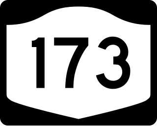
New York State Route 173 (NY 173) is a state highway located in the Syracuse area of central New York in the United States. It takes a slightly bow-shaped route from NY 31 in the town of Van Buren to NY 5 in Chittenango, gently curving to the south of Downtown Syracuse in the center of its 30.59-mile (49.23 km) routing. Even so, NY 173 briefly enters the Syracuse city limits near where it intersects U.S. Route 11 (US 11). NY 173 passes through several suburbs of Syracuse, including Camillus, where it first meets NY 5, and Manlius, where it has a short overlap with NY 92.

<span class="mw-page-title-main">New York State Route 290</span> State highway in Onondaga County, New York, US

New York State Route 290 (NY 290) is a state highway located entirely within Onondaga County, New York, extending from downtown Syracuse to the east side of the county. It provides access to Green Lakes State Park from the north.

Messina Springs was a small community, northwest of Messina, which was settled in the early 19th century around several mineral springs east of Syracuse, New York, United States, at the intersection of James Street and Thompson Road. James Street was then a main east–west road from Syracuse to Messina and Manlius Center. Thompson Road was a main north–south thoroughfare in eastern Onondaga County with the first bridge east of Syracuse to cross over the Erie Canal at Headson's Landing.

<span class="mw-page-title-main">East Syracuse-Minoa Central School District</span> School district in the U.S. state of New York

The East Syracuse Minoa Central School District (ESM) is a pre-K through 12th grade public school district with its headquarters in Manlius, New York, enrolling approximately 3,500 students. ESM serves portions of the towns of DeWitt and Manlius, specifically the villages of East Syracuse, Minoa, and Kirkville as well as portions of Eastwood, Fayetteville, and Bridgeport. The district is partially funded by and governed under the authority of the New York State Education Department, whose standardized examinations are designed and administered by the Board of Regents of the University of the State of New York.

<span class="mw-page-title-main">New York State Route 20N</span> Former state highway in central New York in the United States

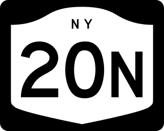
New York State Route 20N (NY 20N) was a state highway in central New York in the United States. It was an alternate route of U.S. Route 20 (US 20) that stretched for 30.5 miles (49.1 km) between Marcellus and Cazenovia. The road began at its parent route, US 20, and NY 174 in Marcellus and ended at US 20, NY 20SY, and NY 92 in Cazenovia. All of NY 20N was concurrent with at least one other route, namely NY 174 in Marcellus, NY 175 from Marcellus to Onondaga Hill, NY 173 from Onondaga Hill to Manlius, and NY 92 and NY 20SY between Manlius and Cazenovia. NY 20N was assigned in May 1937 and removed in 1961 along with NY 20SY.

<span class="mw-page-title-main">Syracuse metropolitan area</span> Metropolitan Statistical Area in New York, United States

The Syracuse Metropolitan Statistical Area, as defined by the United States Census Bureau, is an area consisting of three counties in central New York, anchored by the city of Syracuse. As of the 2020 census, the MSA had a population of 662,057, slightly down from 662,577 in the 2010 census.

<span class="mw-page-title-main">Butternut Creek (Limestone Creek tributary)</span> River in New York, United States

Butternut Creek is a stream in the greater Syracuse, New York area and a tributary of Limestone Creek, part of the Oneida Lake watershed. The creek is about 16 miles (26 km) long.

References

  1. "ArcGIS REST Services Directory". United States Census Bureau. Retrieved September 20, 2022.
  2. "US Gazetteer files: 2010, 2000, and 1990". United States Census Bureau. February 12, 2011. Retrieved April 23, 2011.
  3. "Census of Population and Housing". Census.gov. Retrieved June 4, 2015.
  4. "U.S. Census website". United States Census Bureau . Retrieved January 31, 2008.
  5. Bert Rosenbloom, Marketing Channels, Bristol-Myers Squibb, 2011, page 609
  6. 1 2 "Terms of Use Agreement." (Archive). Aspen Dental. Retrieved on September 23, 1012. " Aspen Dental Management, Inc. and the Aspen Dental Management, Inc. logo are trademarks of Aspen Dental Management, Inc., a Delaware corporation having its principle[ sic ] offices at 281 Sanders Creek Parkway, East Syracuse, New York. All other marks are property of their respective owners."
  7. "Zoning Map." (Archive) Town of DeWitt. Retrieved on September 23, 2012.
  8. "Town of Manlius GIS Archived 2007-12-21 at archive.today ." Town of Manlius. Retrieved on September 23, 2012.
  9. "Home." East Syracuse-Minoa Central School District. Retrieved on September 23, 2012. "407 Fremont Road . East Syracuse, NY 13057"