Related Research Articles
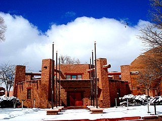
Apache County is a county in the northeast corner of the U.S. state of Arizona. Shaped in a long rectangle running north to south, as of the 2020 census, its population was 66,021. The county seat is St. Johns.

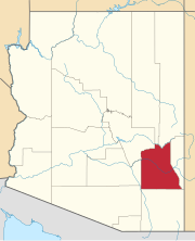
Graham County is a county in the southeastern part of the U.S. state of Arizona. As of the 2020 census, the population was 38,533, making it the third-least populous county in Arizona. The county seat is Safford.
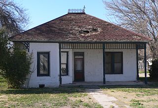
Greenlee County is a county in the southeastern part of the U.S. state of Arizona. As of the 2020 census, the population was 9,563, making it Arizona's least populous county. The county seat is Clifton.

Hot Springs County is a county in the U.S. state of Wyoming. As of the 2020 United States Census, the population was 4,696, making it the second-least populous county in Wyoming. Its county seat is Thermopolis. The county is named for the hot springs located in Hot Springs State Park.

Globe is a city in Gila County, Arizona, United States. As of the 2020 census, the population of the city was 7,249. The city is the county seat of Gila County. Globe was founded c. 1875 as a mining camp. Mining, tourism, government and retirees are most important in the present-day Globe economy.
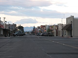
Safford is a city in Graham County, Arizona, United States. According to the 2020 Census, the population of the city is 10,129. The city is the county seat of Graham County.

Mount Graham is a mountain in Graham County, Arizona, United States, approximately 70 miles (110 km) northeast of Tucson. The mountain reaches 10,724 feet (3,269 m) in height. It is the highest elevation in Graham County, Coronado National Forest and the Pinaleño Mountains. It is also the southernmost peak and land area in the continental United States above 10,000 feet (3,048 m). As the name "Mount Graham" is often used by locals to refer to the entire mountain range, the peak itself is frequently referred to as "High Peak". It is twentieth of the 57 ultra-prominent peaks of the lower 48 states, and the first of the five in Arizona.

Campo is an unincorporated community in the Mountain Empire area of southeastern San Diego County, California, United States. The population was 2,955 at the 2020 United States census, up from 2,684 at the 2010 census. For statistical purposes, the United States Census Bureau has defined Campo as a census-designated place (CDP). The census definition of the area may not precisely correspond to local understanding of the area with the same name.

The San Carlos Apache Indian Reservation, in southeastern Arizona, United States, was established in 1872 as a reservation for the Chiricahua Apache tribe as well as surrounding Yavapai and Apache bands removed from their original homelands under a strategy devised by General George Crook of setting the various Apache tribes against one another. Once nicknamed "Hell's Forty Acres" during the late 19th century due to poor health and environmental conditions, today's San Carlos Apaches successfully operate a Chamber of Commerce, the Apache Gold and Apache Sky Casinos, a Language Preservation program, a Culture Center, and a Tribal College.

Apache Pass, also known by its earlier Spanish name Puerto del Dado, is a historic mountain pass in the U.S. state of Arizona between the Dos Cabezas Mountains and Chiricahua Mountains at an elevation of 5,110 feet (1,560 m). It is approximately 20 miles (32 km) east-southeast of Willcox, Arizona, in Cochise County.

Eastern Arizona College (EAC), is a community college in Graham County, Arizona. The main campus is in Thatcher, with satellite locations in Gila County and Greenlee County. It is the oldest community college in Arizona and the only one in the state with a marching band.
The Safford Mine is an open-pit copper mine located in Graham County, Arizona, eight miles (13 km) north of the city of Safford. The mine is owned and operated by Freeport-McMoran Copper & Gold.

The Gila Valley Arizona Temple is a temple of the Church of Jesus Christ of Latter-day Saints in the town of Central between the communities of Pima and Thatcher in Arizona. The temple was dedicated on May 23, 2010, following an open house lasting from April 23 to May 15.

The Safford Micropolitan Statistical Area, as defined by the United States Census Bureau, is a micropolitan statistical area (μSA) consisting of one county in eastern Arizona, anchored by the city of Safford.

The Mountain Empire is a rural area in southeastern San Diego County, California. The Mountain Empire subregion consists of the backcountry communities in southeastern San Diego County. The area is also sometimes considered part of the East County region of San Diego County.

Lattimer is a village and census-designated place (CDP) in Hazle Township, Luzerne County, Pennsylvania, United States. The population was 554 at the 2010 census.

San Simon River is an ephemeral river, or stream running through the San Simon Valley in Graham and Cochise County, Arizona and Hidalgo County, New Mexico. Its mouth is at its confluence with the Gila River at Safford in Graham County. Its source is located at 31°51′21″N109°01′27″W.
Cienega of San Simon, was a cienega, an area of springs 13 miles up the San Simon River from San Simon Station, in Cochise County, Arizona.

Indian Hot Springs, also known as Holladay Hot Springs and Eden Hot Springs, is a geothermal spring system located near Eden, Arizona in the former settlement of Indian Hot Springs, Arizona. The springs have also been referred to as "Jewel in the Desert" and Indian Hot Springs at Eden.

The Frye Fire was a wildfire that burned 48,443 acres (19,604 ha) in Graham County, Arizona, United States, from June 7 to September 1, 2017. The fire was ignited by a lightning strike on Mount Graham, within the Coronado National Forest, and spread rapidly until it was mostly contained on July 12. The Frye Fire destroyed three buildings, briefly threatened the Mount Graham International Observatory, cost $26 million to contain and suppress, and involved more than 800 firefighters. There were no fatalities, but 63 firefighters were quarantined as a result of a strep throat outbreak.
References
- 1 2 U.S. Geological Survey Geographic Names Information System: Eden, Arizona
- ↑ "American FactFinder – Community Facts". Archived from the original on February 12, 2020. Retrieved July 13, 2010.
- 1 2 The Utah Genealogical and Historical Magazine, Volumes 9–10. 1918. p. 122.
- ↑ Eden mansion burns down – Eastern Arizona Courier , 2008
- ↑ Burned resort full of history – Eastern Arizona Courier , 2008
- ↑ Gay horror flick screens at the Loft – azstarnet.com, 2008
