Bryce, Arizona

Last updated

Bryce, Arizona
Graham County Arizona Incorporated and Unincorporated areas Bryce Highlighted 0407915.svg
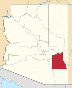
Location of Bryce in Graham County, Arizona.
USA Arizona location map.svg
Red pog.svg
Bryce
Usa edcp location map.svg
Red pog.svg
Bryce
Coordinates: 32°55′44″N109°49′40″W / 32.92889°N 109.82778°W / 32.92889; -109.82778
Country United States
State Arizona
County Graham
Area
[1]
  Total0.84 sq mi (2.18 km2)
  Land0.84 sq mi (2.18 km2)
  Water0.00 sq mi (0.00 km2)
Elevation
2,825 ft (861 m)
Population
 (2020)
  Total173
  Density205.71/sq mi (79.38/km2)
Time zone UTC-7 (Mountain (MST))
ZIP code
85543 [2]
Area code 928
GNIS feature ID 2051

Bryce is a census-designated place in Graham County, Arizona, United States. Its population was 173 as of the 2020 census. Bryce is located in the upper Gila River valley, approximately two miles north of Pima and north of the Gila River. The first settlement at Bryce was made in 1883. [3] Bryce is named for settler and shipbuilder Ebenezer Bryce, a Mormon pioneer from Scotland, who is best known as the eponym of Bryce Canyon National Park in Utah.

Demographics

Historical population
CensusPop.Note
1920 167
1930 21226.9%
2010 175
2020 173−1.1%
U.S. Decennial Census [4]

Bryce first appeared on the 1920 U.S. Census as Bryce/Precinct 17 of Graham County [5] and in 1930 as District 17. [6] It reported a majority White population in 1930. [7] With the combination of all Arizona county precincts and districts into three districts each in 1940, it did not formally appear again until 2010, when it was made a census-designated place (CDP). [8]

Related Research Articles

<span class="mw-page-title-main">Graham County, Arizona</span> County in Arizona, United States

Graham County is a county in the southeastern part of the U.S. state of Arizona. As of the 2020 census, the population was 38,533, making it the third-least populous county in Arizona. The county seat is Safford.

<span class="mw-page-title-main">Maricopa County, Arizona</span> County in Arizona, United States

Maricopa County is in the south-central part of the U.S. state of Arizona. As of the 2020 census the population was 4,420,568, or about 62% of the state's total, making it the fourth-most populous county in the United States and the most populous county in Arizona, and making Arizona one of the nation's most centralized states. The county seat is Phoenix, the state capital and fifth-most populous city in the United States.

<span class="mw-page-title-main">Bouse, Arizona</span> CDP in La Paz County, Arizona

Bouse is a census-designated place (CDP) and ghost town in La Paz County, Arizona, United States. Founded in 1908 as a mining camp, the economy of Bouse is now based on tourism, agriculture, and retirees. The population was 996 at the 2010 census. It was originally named Brayton after the store owner John Brayton Martin.

<span class="mw-page-title-main">Arizona Village, Arizona</span> Census-designated place in Arizona, United States

Arizona Village is a census-designated place (CDP) on the Fort Mojave Indian Reservation in Mohave County, Arizona, United States. The population was 1,057 at the 2020 census, up from 946 in 2010 and 351 in 2000.

<span class="mw-page-title-main">Ajo, Arizona</span> Community in Pima County, Arizona

Ajo is an unincorporated community in Pima County, Arizona, United States. It is the closest community to Organ Pipe Cactus National Monument. The population was 3,304 at the 2010 census. Ajo is located on State Route 85 just 43 miles (69 km) from the Mexican border.

<span class="mw-page-title-main">Blackwater, Arizona</span> CDP in Pinal County, Arizona

Blackwater is a native village and census-designated place (CDP) on the Gila River Reservation in Pinal County, Arizona, United States. The population was 1,062 at the 2010 census, up from 504 in 2000.

<span class="mw-page-title-main">Aguila, Arizona</span> CDP in Maricopa County, Arizona

Aguila is an unincorporated community and census-designated place (CDP) in Maricopa County, Arizona, United States. It is located on U.S. Route 60, 25 miles (40 km) west of Wickenburg and 22 miles (35 km) northeast of Wenden. Major economic activities include cantaloupe farming and formerly included mining. It uses the same street numbering system as Phoenix. As of the 2020 census, the population of Aguila was 565, down from 798 in 2010.

<span class="mw-page-title-main">Arlington, Arizona</span> CDP in Maricopa County, Arizona

Arlington is an unincorporated community and census-designated place (CDP) in Maricopa County, Arizona, United States, located 43 miles (69 km) west of downtown Phoenix on old U.S 80. It follows the street numbering system of Phoenix. As of the 2020 census, the population was 150, down from 194 at the 2010 census.

<span class="mw-page-title-main">Beaver Dam, Arizona</span> Census-designated place in Arizona, United States

Beaver Dam is an unincorporated community and census-designated place (CDP) in Mohave County, Arizona, United States, that is located in the Arizona Strip region and was settled in 1863. It is located along Interstate 15 approximately 10 miles (16 km) northeast of Mesquite, Nevada. It is located in the 86432 ZIP Code. It had a population of 1,552 as of the 2020 census, down from 1,962 at the 2010 census.

<span class="mw-page-title-main">Brenda, Arizona</span> Census-designated place in La Paz County, Arizona, United States

Brenda is a census-designated place (CDP) in La Paz County, Arizona, United States.

<span class="mw-page-title-main">Bylas, Arizona</span> CDP in Graham County, Arizona

Bylas is an unincorporated community and census-designated place in Graham County, Arizona, United States, located within the San Carlos Apache Indian Reservation. As of the 2010 census, its population was 1,962. The community has a medical clinic, a police substation, and a market. Bylas is an Apache settlement divided into two communities, one of the White Mountain Apache, the other of San Carlos and Southern Tonto Apache. It is named for Bylas a chief of the Eastern White Mountain Apache band.

<span class="mw-page-title-main">Bowie, Arizona</span> Unincorporated community in the state of Arizona, United States

Bowie is an unincorporated community and a census-designated place in Cochise County, Arizona, United States. As of the 2010 U.S. Census the population of Bowie was 449.

<span class="mw-page-title-main">Avenue B and C, Arizona</span> CDP in Yuma County, Arizona

Avenue B and C or B&C Colonia is a census-designated place (CDP) and colonia in Yuma County, Arizona, United States. The population was 4,176 at the 2010 census. Areas that are part of Avenue B and C were first subdivided in the 1920s and 1930s. The colonia received a sewer system in 2011. It is the fifth most populous community in Yuma County and second most populous CDP.

<span class="mw-page-title-main">Cactus Forest, Arizona</span> CDP in Pinal County, Arizona

Cactus Forest is a census-designated place (CDP) in Pinal County, Arizona, United States. The population was 594 at the 2010 census.

Beyerville is a census-designated place (CDP) in Santa Cruz County, Arizona, United States. The population was 177 at the 2010 census.

<span class="mw-page-title-main">Cactus Flats, Arizona</span> CDP in Graham County, Arizona

Cactus Flats is a census-designated place in Graham County, Arizona, United States. Its population was 1,524 as of the 2020 census.

<span class="mw-page-title-main">Beaver Valley, Arizona</span> CDP in Gila County, Arizona

Beaver Valley is a census-designated place in Gila County in the state of Arizona. Beaver Valley is located about 10 miles north of the town of Payson. The population, as of the 2010 U.S. Census, was 231.

<span class="mw-page-title-main">Ak Chin, Pima County, Arizona</span> CDP in Pima County, Arizona

Ak Chin, is a rural native village and a census-designated place on the Tohono Oʼodham Reservation, in Pima County, Arizona, United States. It had a population of 30 as of the 2010 U.S. Census and an estimated population of 31 as of July 1, 2015. Ak Chin has an estimated elevation of 1,854 feet (565 m) above sea level.

<span class="mw-page-title-main">Aztec, Arizona</span> CDP in Yuma County, Arizona

Aztec is a census designated place situated in Yuma County, Arizona, United States. It had a population of 47 as of the 2010 U.S. Census. As of July 2015, Aztec had an estimated population of 52. It has an estimated elevation of 509 feet (155 m) above sea level. It is located along Interstate 8 to the west of Tenmile Wash.

Buckshot is a census-designated place (CDP) in Yuma County, Arizona, United States. The population was 153 at the 2010 census.

References

  1. "2020 U.S. Gazetteer Files". United States Census Bureau. Retrieved October 29, 2021.
  2. "Bryce AZ ZIP Code". zipdatamaps.com. 2023. Retrieved May 3, 2023.
  3. The Utah Genealogical and Historical Magazine, Volumes 9-10. 1918. p. 15.
  4. "Census of Population and Housing". Census.gov. Retrieved June 4, 2016.
  5. Bureau of the Census Library (1924). "Fourteenth Census of the United States - State Compendium - Arizona" (PDF). Government Printing Office.
  6. "Arizona" (PDF). United States Census Bureau. 1930.
  7. "Arizona - Composition and Characteristics" (PDF). United States Census Bureau. 1930. pp. 141–163.
  8. U.S. Census Bureau (October 2012). "Arizona: 2010 - Summary Population and Housing Characteristics" (PDF). U.S. Government Printing Office.