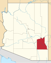
Artesia is a populated place situated in Graham County, Arizona, United States. It has an estimated elevation of 3,271 feet (997 m) above sea level.
Ashurst is a populated place situated in Graham County, Arizona, United States, and appears on the Eden U.S. Geological Survey Map. It has an estimated elevation of 2,739 feet (835 m) above sea level.
Buena Vista is a populated place situated in Graham County, Arizona, United States. It has an estimated elevation of 3,041 feet (927 m) above sea level.
Calva is a populated place situated in Graham County, Arizona, United States. It has an estimated elevation of 2,559 feet (780 m) above sea level.
Choulic is a populated place situated in Pima County, Arizona, United States. The name means "corner" in the O'odham language. It has an estimated elevation of 2,480 feet (760 m) above sea level.
Emery is a populated place situated in Graham County, Arizona, United States. It has an estimated elevation of 2,680 feet (820 m) above sea level.
Graham is a populated place situated in Graham County, Arizona, United States. It has an estimated elevation of 2,887 feet (880 m) above sea level.
Gu Chuapo is a populated place situated in Pima County, Arizona, United States. It has an estimated elevation of 3,465 feet (1,056 m) above sea level.
Indian Hot Springs, also known as Holladay Hot Springs, is a populated place situated in Graham County, Arizona, United States. It has an estimated elevation of 2,792 feet (851 m) above sea level.
Lone Star is a populated place situated in Graham County, Arizona, United States. It has an estimated elevation of 2,953 feet (900 m) above sea level. Eight miles north of Solomonville, the community was named after the nearby mine and mountain.
Piato Vaya is a populated place situated in Pima County, Arizona, United States. It has an estimated elevation of 2,395 feet (730 m) above sea level.
Pipyak is a populated place situated in Pima County, Arizona, United States. It has an estimated elevation of 1,906 feet (581 m) above sea level.
Point of Pines is a populated place situated on the San Carlos Apache Indian Reservation in Graham County, Arizona, United States. It has an estimated elevation of 5,922 feet (1,805 m) above sea level.
Puertocito is a populated place situated in Pima County, Arizona, United States, near the border with Mexico. It has an estimated elevation of 3,442 feet (1,049 m) above sea level.
Rincon is a populated place situated in Pima County, Arizona, United States. It has an estimated elevation of 2,595 feet (791 m) above sea level.
Rosemont Camp is a populated place situated in Pima County, Arizona, United States. It has an estimated elevation of 4,862 feet (1,482 m) above sea level.
Rowood is a populated place situated in Pima County, Arizona, United States. It has an estimated elevation of 1,719 feet (524 m) above sea level.
Sanchez is a populated place situated in Graham County, Arizona, United States. It has an estimated elevation of 3,061 feet (933 m) above sea level.
Skoksonak is a populated place situated in Pima County, Arizona, United States. It has an estimated elevation of 2,205 feet (672 m) above sea level.
Twin Buttes is a populated place situated in Navajo County, Arizona, United States. It is one of two populated locations in Arizona with this name, the other being in Pima County. It has an estimated elevation of 5,794 feet (1,766 m) above sea level.


