The Au Sable River in Michigan, United States runs approximately 138 miles (222 km) through the northern Lower Peninsula, through the towns of Grayling and Mio, and enters Lake Huron at Au Sable. It is considered one of the best brown trout fisheries east of the Rockies and has been designated a blue ribbon trout stream by the Michigan Department of Natural Resources. In French, au sable literally means "at the sand." A 1795 map calls it the Beauais River.

Midland County is a county located in the U.S. state of Michigan. As of the 2010 census, the population was 83,629. The county seat is Midland. The county's name is due to its closeness to the geographical Lower Peninsula's geographical center. It was founded in 1831. However, it was not until 1855 that the county was effectively organized.

Gladwin County is a county located in the U.S. state of Michigan. As of the 2010 census, the population was 25,692. The county seat is Gladwin.

Billings Township is a civil township of Gladwin County in the U.S. state of Michigan. As of the 2000 census, the township population was 2,715.

Hay Township is a civil township of Gladwin County in the U.S. state of Michigan. The population was 1,402 at the 2000 census.

Edenville Township is a civil township of Midland County in the U.S. state of Michigan. As of the 2000 census, the township population was 2,528.

Freeland is an unincorporated community in Tittabawassee Township, Saginaw County of the U.S. state of Michigan. It is also a census-designated place (CDP) for statistical purposes and without any legal status as an incorporated municipality. As of the 2000 census, the CDP population was 5,147. The CDP covers an area in the central portion of Tittabawassee Township. The Freeland post office, ZIP code 48623, serves nearly the entire township, as well as portions of Midland and Williams townships to the north, Frankenlust and Kochville townships to the east, Thomas and Richland townships to the south, and Ingersoll Township to the west.

Saginaw Charter Township is a charter township of Saginaw County in the U.S. state of Michigan. The population was 40,840 at the 2010 census. The city of Saginaw is adjacent to the township to the southeast, but is administratively autonomous.
M-30 is a state trunkline highway in the U.S. state of Michigan that runs in a north–south direction from the Midland area to West Branch. The highway runs through rural parts of three counties in the Lower Peninsula. The southern end runs along the Michigan Meridian and parallel to the Tittabawassee River. Prior to 1962, M-30's southern terminus was at a junction with M-46 in Merrill. Since then, the segment south of US Highway 10 (US 10) was returned to local control and decommissioned. In May 2009, M-30 was extended southerly from US 10 to M-20, restoring some of the highway decommissioned in the 1960s to M-30.

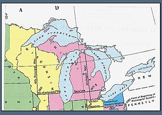
The Michigan meridian is the principal meridian used as a reference in the Michigan Survey, the survey of the U.S. state of Michigan in the early 19th century. It is located at 84 degrees, 21 minutes and 53 seconds west longitude at its northern terminus at Sault Ste. Marie, and varies very little from that line down the length of the state.

Pine River may refer to any of the following rivers in the U.S. state of Michigan:

Sanford Lake is a man-made reservoir located in Midland County, Michigan. It was formed by the damming of the Tittabawassee River near the town of Sanford, Michigan. The dam is owned and operated by Boyce Hydro, LLC. The main body of the lake stretches for about 6 miles (9.7 km) north of the dam, but the water remains deep enough for small boat navigation up past the town of Edenville, Michigan ten miles (16 km) north of the dam. The lake is slightly over half a mile wide at its widest point. A survey by the Michigan DNR measured the main body of the lake at 1,250 acres (5.1 km2). According to the Sanford Lake Improvement Board website maintained by Midland County, the lake has a surface area of 1,499 acres (6.07 km2) and a shoreline length of 34.5 miles (55.5 km). In May 2020, the Sanford Dam, as well as the Edenville Dam to the north, failed following heavy rains. The resulting flooding threatened downtown Midland and surrounding areas.

The Chippewa River is a stream in the U.S. state of Michigan that runs 91.8 miles (147.7 km) through the central Lower Peninsula. The Chippewa is a tributary of the Tittabawassee River and is thus part of the Saginaw River drainage basin. The river is named after the Chippewa people.

The Cedar River is a 29.0-mile-long (46.7 km) river in the U.S. state of Michigan, flowing through Clare County and Gladwin County.

The Tittabawassee River flows in a generally southeasterly direction through the Lower Peninsula of the U.S. state of Michigan. The river begins at Secord Lake in Clement Township, at the confluence of the East Branch and the Middle Branch. From there it flows through Gladwin, Midland and Saginaw counties where, as a major tributary of the Saginaw River, it flows into it at Saginaw. Its tributaries include the Chippewa, Pine, Molasses, Sugar, and Tobacco rivers.
Salt River is the name of two streams in the U.S. state of Michigan.
The Tobacco River is a 12.7-mile-long (20.4 km) river in the U.S. state of Michigan. Located in Gladwin and Midland counties, the river rises in Beaverton at the confluence of the river's North, Middle, and South branches in Ross Lake. The river flows southeast and empties into the Tittabawassee River at the community of Edenville. On older maps, the South branch and the lower course of the Tobacco River are identified as Samaquasebing, Assemoqua, Assymoquoasibee, etc., all derived from the Ojibwe Asemaakwe-ziibi(ing), meaning "(At) Tobacco-woman River".

Edenville Dam was an earthen embankment dam at the confluence of the Tittabawassee River and its tributary the Tobacco River in Mid Michigan, United States, forming Wixom Lake. The dam was about one mile (1.6 km) north of Edenville, mostly in the southeast corner of Tobacco Township in Gladwin County, with its southeastern end reaching into Edenville Township in Midland County. Its height was 54 feet (16 m), the length was 6,600 feet (2,000 m) at its crest.
Wixom Lake was a reservoir in the U.S. state of Michigan. It was named after Frank Wixom, who was instrumental in building the Edenville Dam. Unusually for its size, Wixom Lake boasts a lighthouse. Since 2019, it has been owned by the Four Lakes Task Force, a "county-delegated authority", under the State of Michigan. Since 2018, the impoundment is regulated by the Michigan Department of Environment, Great Lakes, and Energy (EGLE).


