Barnes County is a county in the U.S. state of North Dakota. As of the 2010 United States Census, the population was 11,066. Its county seat is Valley City.
Leal is a city in Barnes County in the state of North Dakota. The population was 20 at the 2010 census. Leal was founded in 1892. The name comes from the Scots word for "faithful," which in the phrase laund o the leal means Heaven.

Great Bend is a city in Richland County, North Dakota, United States, on the banks of the Wild Rice River. Its population was 60 at the 2010 census. It was founded in 1888, and incorporated as a village in 1908. It is part of the Wahpeton, ND–MN Micropolitan Statistical Area.

Buxton is a city in Traill County, North Dakota, United States. The population was 323 at the 2010 census. Buxton was founded in 1880. Today, it has become a bedroom community for the nearby Greater Grand Forks metropolitan area.
Ada is a township in Dickey County, North Dakota, United States. Its population during the 2000 Census was 60, and was estimated at 52 in 2009. Its population in 1900 was 232.
Adler Township is one of the twenty-seven townships of Nelson County, North Dakota, United States. Its population during the 2000 Census was 47, and an estimated 38 as of 2009.
Advance Township is a township in Pembina County, North Dakota, United States. At the time of the 2000 Census, its population was 143, with an estimated 122 people as of 2009.
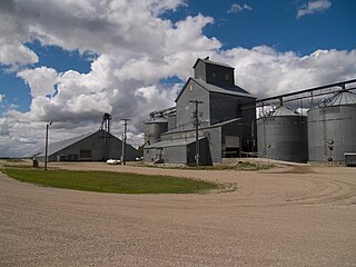
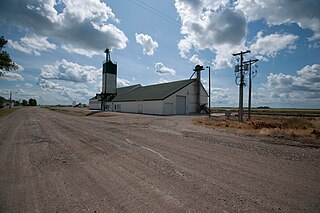
Glasston is a farming town located in Saint Thomas Township in North Dakota's Pembina County, United States. It consists of a post office, a general store, and a handful of houses. It was established in 1886 as a station along the Great Northern Railroad. Originally called Baltimore, the site was later renamed for Archibald Glass, its first postmaster. The population of the village has rarely exceeded 100 since it was established.
Alta Township is a civil township in Barnes County, North Dakota, United States. As of the 2000 census, its population was 98. The township is named after Alta Ridge, a moraine belt overlooking the Sheyenne River Valley.
Ashtabula Township is a civil township in Barnes County, North Dakota, United States. As of the 2000 census, its population was 93.
Grand Prairie Township is a civil township in Barnes County, North Dakota, United States. As of the 2000 census, its population was 49.
Meadow Lake Township is a civil township in Barnes County, North Dakota, United States. As of the 2000 census, its population was 93. The township is located in Public Land Survey System Township 138N, Range 61W.
Minnie Lake Township is a civil township in Barnes County, North Dakota, United States. As of the 2000 census, its population was 63.
Rogers Township is a civil township in Barnes County, North Dakota, United States. As of the 2000 census, its population was 42.
Mission Township is a civil township in Benson County, North Dakota, United States. As of the 2000 census, its population was 1,077. It is the most populous township in the county.
Joliette is an unincorporated community located along Interstate 29 in Joliette Township in Pembina County in the U.S. state of North Dakota. It was established in 1879 as a rural post office. It was settled by French Canadians and named for Joliette, Quebec, the hometown of the town's first settler. Although it is unincorporated, the post office is no longer operating and shares the ZIP code of 58271 with the city of Pembina.
Albert Anson Booth was an American pioneer and early settler and county official in Barnes County, North Dakota in the U.S. state of North Dakota. He helped found Edna Township in Barnes County and served on its township board and as a county commissioner.
Belden is a ghost town located in Sikes Township in Mountrail County, North Dakota, United States. It is located along North Dakota Highway 8 between Stanley and the former town of Van Hook. The village was founded in 1904, and was reportedly named for W. L. Belden, North Dakota's Indian agent at-large who was stationed at Fort Berthold Indian Reservation at the time.
Curlew Township is a former township in Morton County, North Dakota, United States. It was located near Glen Ullin, North Dakota.
Brandenburg Township is a civil township located in Richland County, North Dakota, United States. Its population during the 2000 Census was 142, and estimated to be 126 as of 2009.

