Lewis County is a county in the U.S. state of Washington. As of the 2020 census, the county's population was 82,149. The county seat is Chehalis, and its largest city is Centralia. Lewis County comprises the Centralia, WA Micropolitan Statistical Area, which is also included in the Seattle-Tacoma, WA Combined Statistical Area.
Morton is a city in Lewis County, Washington, United States. The population was 1,036 at the 2020 census.
Napavine is a city in Lewis County, Washington, United States. It is also included in the Centralia, WA micropolitan area. The population was 1,766 at the 2020 census.

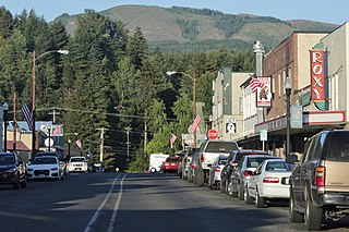
Winlock is a city in Lewis County, Washington, United States. The population was 1,472 at the 2020 census. It was named after territorial army general, Winlock M. Miller, who briefly resided there. Winlock is mostly famous for having the World's Largest Egg, reflecting its former status as a major producer of eggs. Early in its history, Winlock attracted many immigrants from Finland, Germany, and Sweden.
Randle is a small town in eastern Lewis County, Washington, United States. Randle is located on U.S. Route 12 and is notable as the northeastern access point to the Mount St. Helens Windy Ridge viewpoint, by way of forest service roads that cut through the Gifford Pinchot National Forest.
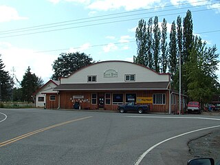
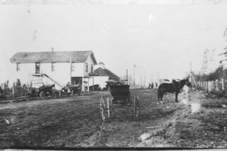
Onalaska is an unincorporated community and census-designated place (CDP) in Lewis County, Washington, United States. As of the 2020 census it had a population of 657. Onalaska is located along Washington State Route 508.

Adna is an unincorporated community located in Lewis County, Washington.

Packwood is an unincorporated community and census-designated place (CDP) located in easternmost Lewis County, Washington, in the United States. As of the 2020 census, the CDP had a population of 319, while the town and surrounding Packwood community had a total population of 1,073.
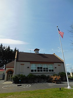
Boistfort is an unincorporated community in the northwest United States, in Lewis County, Washington, about twenty miles (30 km) southwest of Chehalis. The original one-room school in Boistfort was established in 1853 and was the first school district in Lewis County and the Territory of Washington.
Curtis is an unincorporated community in Washington. It is located less than 3-miles north of Boistfort and is south of Washington State Route 6. The South Fork Chehalis River flows thru the town.

Dryad is a rural unincorporated community in Lewis County, Washington. The town of Doty is 1.3-miles to the west, with Adna and Ceres to the east, on Washington State Route 6. The Chehalis River bisects the area.
Ethel is an unincorporated community located along U.S. Route 12 in east Lewis County, Washington, United States. It sits between Mary's Corner and Salkum.

Salkum is a rural unincorporated community in Lewis County, Washington. The town is located on U.S. Route 12 and is 2.1 miles (3.4 km) west of Silver Creek.

Mineral is an unincorporated community and census-designated place (CDP) in Lewis County, Washington, on State Route 7 near the Pierce/Lewis county line. Mineral originally began as a logging camp and mining town. Prospectors searching the area for gold instead found coal and arsenic. By the early 1920s, the mines closed, and with a devastating fire to the town's largest sawmill, Mineral began to turn to tourism as its main industry, primarily through recreational fishing on Mineral Lake. The population was 193 at the 2020 census, down from 202 at the 2010 census.

Methow, is an unincorporated community in Okanogan County, Washington, United States. The community had a population of 246 at the 2020 census.
Alpha is an unincorporated community located in Lewis County, Washington. The town rests alongside Washington State Route 508, between Cinebar, 3.5 miles away to the east, and Onalaska to the west.
Silver Creek is an unincorporated community in Lewis County, Washington, United States. Silver Creek is located along U.S. Route 12 near its junction with Washington State Route 122, 5 miles (8.0 km) west of Mossyrock. Lake Mayfield is accessible 3.5 miles to the east.
Saint Urban is an unincorporated community in Lewis County, Washington, United States. It is located approximately three miles (4.8 km) northeast of Winlock.
The Great Northern School District No. 312 is a school district in Spokane County, Washington, United States. It covers a rural unincorporated area between Airway Heights and Spokane and has a single school, named Great Northern Elementary, that serves grades kindergarten to six.

Mary's Corner is an unincorporated community located in Lewis County, Washington. The area sits at the crossroads of U.S. Route 12 and Jackson Highway. The community is 11 miles (18 km) south of Chehalis and 4 miles (6.4 km) west of the town of Ethel.