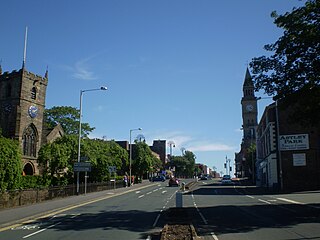
Chorley is a town and the administrative centre of the wider Borough of Chorley in Lancashire, England, 8 miles (13 km) north of Wigan, 11 miles (18 km) south west of Blackburn, 11 miles (18 km) north west of Bolton, 12 miles (19 km) south of Preston and 20 miles (32 km) north west of Manchester. The town's wealth came principally from the cotton industry.

Workington is a coastal town and civil parish at the mouth of the River Derwent on the west coast in Cumbria, England. At the 2011 census it had a population of 25,207.

South Ribble is a local government district with borough status in Lancashire, England. Its council is based in Leyland. The borough also includes the towns and villages of Penwortham, Leyland, Farington, Hutton, Longton, Walmer Bridge, Salmesbury, Lostock Hall, Walton le Dale and Bamber Bridge. Many of the built-up areas in the borough form part of the wider Preston built-up area.

Billingham is a town and civil parish in County Durham, England. The town is on the north side of the River Tees and is governed as part of the Borough of Stockton-on-Tees unitary authority. It had a population of 35,165 in the 2011 Census.

Bidston is a village and civil parish in the Metropolitan Borough of Wirral in Merseyside, England.
Euxton is a village and civil parish of the Borough of Chorley, in Lancashire, England. The population of the civil parish as taken at the 2011 census was 9,993, however, the population is now estimated to be around 14,000 due to the increase in housing developments in the village, including the Buckshaw development. The village is situated just to the west of Chorley, and to the south of Clayton-le-Woods.

Ribble Valley is a constituency in Lancashire represented in the House of Commons of the UK Parliament since 2024 by Maya Ellis, of the Labour Party.

South Ribble is a constituency represented in the House of Commons of the UK Parliament since 2024 by Paul Foster for Labour.

Farington is a village and civil parish in the South Ribble local government district of Lancashire, England. The population of the civil parish at the 2011 census was 6,674.

Lostock Hall is a suburban village within the South Ribble borough of Lancashire, England. It is located on the south side of the River Ribble, some 3 miles (4.8 km) south of Preston and 3 miles (5 km) north of Leyland. It is bordered on its southeastern side by the interchange for the M6, M61 and M65 motorways.
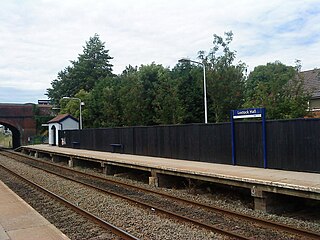
Lostock Hall railway station is a railway station serving the village of Lostock Hall in the South Ribble borough of Lancashire, England. It is on the East Lancashire Line and is managed by Northern, who also provide all passenger trains serving it.

Clayton-le-Woods is a large village and civil parish of the Borough of Chorley, in Lancashire, England. According to the census of 2001, it has a population of 14,528. At the 2011 census the population of Cuerden civil parish was included within Clayton-le-Woods, giving a total of 14,532.
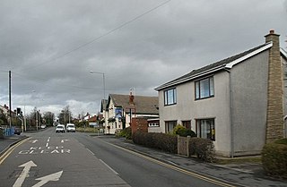
Bamber Bridge is a large village in Lancashire, England, 3 miles (5 km) south-east of Preston, in the borough of South Ribble. The name derives from the Old English "bēam" and "brycg", which probably means "tree-trunk bridge". People who live in Bamber Bridge like to be known as Briggers.

Penwortham is a town and civil parish in South Ribble, Lancashire, England, on the south bank of the River Ribble facing the city of Preston. The town is at the most westerly crossing point of the river, with major road and rail links crossing it here. The population of the town at the 2011 census was 23,047.
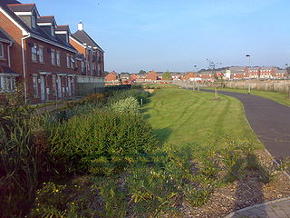
Buckshaw Village is a 21st-century village and industrial area between the towns of Chorley and Leyland in Lancashire, England, developed on the site of the former Royal Ordnance Factory (ROF) Chorley. It had a population of 4,000. It is divided between the civil parishes of Euxton (south) and Whittle-le-Woods in Chorley, with the north western part being in Leyland unparished area in South Ribble district.

Worden Park is a large area of parkland situated on the outskirts of Leyland, a town in the borough of South Ribble, Lancashire, England. It is less than a quarter of a mile from the town centre.
Unsworth is a settlement in the Bury district, in Greater Manchester, England. The population of Unsworth Ward, as of the 2011 census is 9,492. The village sits approximately 7 miles (11 km) north of the city of Manchester and 4 miles (6.4 km) south of the town of Bury, and contains the area of Hollins, and part of Sunny Bank.

Leyland is a town in South Ribble, Lancashire, England, 6 miles (10 km) south of Preston. The population was 35,578 at the 2011 Census.

Ribbleton is a suburb and ward of the city of Preston, Lancashire, England. It is located to the east of the city centre, between the A59 New Hall Lane and the B6243 Longridge Road. The M6 motorway also runs through the area. The ward had a population of 7,351 recorded in the 2001 census increasing to 8,548 at the 2011 Census.

Occleshaw House, also known by its address as 2 Worden Lane, is a Grade II listed building in Leyland, Lancashire. The building has been described as the site of some of the earliest houses in the village. The current structure is thought to date from the early 18th century and the local historical society has traced occupants back to 1718. It has served as a dower house, chemists, post office, printing press and doctor's surgery before becoming vacant by 2020. In 2021 a cannabis farm in the building was raided by police and in June 2023 the roof caught fire in a suspected arson attack.


