Whitestake

Last updated

Whitestake
Farmers Arms - geograph.org.uk - 166323.jpg
The Farmers Arms public house, Whitestake
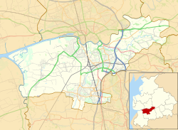
Location map United Kingdom Borough of South Ribble 2020.svg
Red pog.svg
Whitestake
Shown within South Ribble
Lancashire UK location map.svg
Red pog.svg
Whitestake
Location within Lancashire
OS grid reference SD518254
Civil parish
District
Shire county
Region
Country England
Sovereign state United Kingdom
Post town PRESTON
Postcode district PR4
Dialling code 01772
Police Lancashire
Fire Lancashire
Ambulance North West
UK Parliament
List of places
UK
England
Lancashire
53°43′23″N2°43′48″W / 53.723°N 2.730°W / 53.723; -2.730

Whitestake is a small village in the South Ribble district of Lancashire, England, on the eastern edge of New Longton It is at the boundary of the parishes of Farington, Longton and Penwortham. [1] It falls in what is called the "Western Parishes" area of South Ribble.

The name Whitestake supposedly originated because residents could stake a claim with a white stick so that their livestock could graze on the moss. This is said to have taken place once a year at the Farmers Arms Public House (still extant). [2]

It is the site of the Turbary Woods Owl and Bird Sanctuary. [3]

Related Research Articles

Corkscrew Swamp Sanctuary is a National Audubon Society sanctuary located in southwest Florida, north of Naples, Florida and east of Bonita Springs, in the United States. The sanctuary was established to protect one of the largest remaining stands of bald cypress and pond cypress in North America from extensive logging that was ongoing throughout the 1940s and 1950s.

<span class="mw-page-title-main">Lytham St Annes</span> Human settlement in England

Lytham St Annes is a seaside town in the Borough of Fylde in Lancashire, England. It is on the Fylde coast, directly south of Blackpool on the Ribble Estuary. The population of the built-up area at the 2021 census was 42,695. The town is made up of the four areas of Lytham, Ansdell, Fairhaven and St Annes-on-the-Sea.

<span class="mw-page-title-main">South Ribble</span> Borough and non-metropolitan district in England

South Ribble is a local government district with borough status in Lancashire, England. Its council is based in Leyland. The borough also includes the towns and villages of Penwortham, Leyland, Lostock Hall, Walton le Dale and Bamber Bridge. Many of the built-up areas in the borough form part of the wider Preston built-up area.

<span class="mw-page-title-main">Biligiriranga Hills</span> Wildlife sanctuary in South India

The Biligirirangana Hills or Biligirirangan Hills is a hill range situated in south-western Karnataka, at its border with Tamil Nadu in South India. The area is called Biligiri Ranganatha Swamy Temple Wildlife Sanctuary or simply BRT Wildlife Sanctuary. It is a protected reserve under the Wildlife Protection Act of 1972. Being close to the Eastern Ghats as well as the Western Ghats, the sanctuary has floral and faunal associations with both regions. The site was declared a tiger reserve in January 2011 by the Government of Karnataka, a few months after approval from India's National Tiger Conservation Authority.

<span class="mw-page-title-main">South Ribble (UK Parliament constituency)</span> Parliamentary constituency in the United Kingdom, 1983 onwards

South Ribble is a constituency represented in the House of Commons of the UK Parliament since 2019 by Katherine Fletcher, a Conservative.

<span class="mw-page-title-main">Longton, Lancashire</span> Human settlement in England

Longton is a village and civil parish in the west of the borough of South Ribble, Lancashire, England. It is about 4 miles to the south west of Preston. The population of the civil parish, which also includes the village of New Longton, was 5,500 at the 2001 Census increasing to 7,652 at the 2011 Census.

<span class="mw-page-title-main">Farington</span> Human settlement in England

Farington is a village and civil parish in the South Ribble local government district of Lancashire, England. The population of the civil parish at the 2011 census was 6,674.

Preston was a rural district in Lancashire, England from 1894 to 1974. It surrounded Preston to the north, west and east.

<span class="mw-page-title-main">Banks, Lancashire</span> Human settlement in England

Banks is a large coastal village in Lancashire, England, south of the Ribble estuary four miles (6 km) north-east of Southport. The village is administered by West Lancashire Borough and North Meols Parish Council. It is in the South Ribble parliamentary constituency. At the 2001 census the population of the North Meols civil parish was 3,792, rising to 4,146 by the 2011 census.

<span class="mw-page-title-main">Midge Hall</span> Human settlement in England

Midge Hall is a small village on the outskirts of Leyland in the borough of South Ribble, Lancashire, England.

The Ribble way is a long-distance walk between the Lancashire coast and the Yorkshire Dales National Park largely following the course of the River Ribble.

<span class="mw-page-title-main">Parambikulam Tiger Reserve</span> Protected area lying in Palakkad district and Thrissur district of Kerala state

Parambikulam Tiger Reserve, which also includes the erstwhile Parambikulam Wildlife Sanctuary, is a 643.66 square kilometres (248.5 sq mi) protected area lying in Palakkad district and Thrissur district of Kerala state, South India. The Wildlife Sanctuary, which had an area of 285 square kilometres (110 sq mi) was established in part in 1973 and 1984. It is in the Sungam range of hills between the Anaimalai Hills and Nelliampathy Hills. Parambikulam Wildlife Sanctuary was declared as part of the Parambikulam Tiger Reserve on 19 February 2010. Including the buffer zone, the tiger reserve has a span of 643.66 km2. The Western Ghats, Anamalai Sub-Cluster, including all of Parambikulam Wildlife Sanctuary, has been declared by the UNESCO World Heritage Committee as a World Heritage Site. The Tiger Reserve is the home of four different tribes of indigenous peoples including the Kadar, Malasar, Muduvar and Mala Malasar settled in six colonies. Parambikulam Tiger Reserve implements the Project Tiger scheme along with various other programs of the Government of India and the Government of Kerala. The operational aspects of administering a tiger reserve is as per the scheme laid down by the National Tiger Conservation Authority. People from tribal colonies inside the reserve are engaged as guides for treks and safaris, and are provided employment through various eco-tourism initiatives. Parambikulam Tiger Reserve is among the top-ten best managed Tiger Reserve in India. The tiger reserve hosts many capacity building training programmes conducted by Parambikulam Tiger Conservation Foundation in association with various organisations.

Radhanagari Wildlife Sanctuary is a wildlife sanctuary and natural World Heritage Site of category ix and x since 2012, located in Kolhapur district, Maharashtra State, India. It lies at the southern end of the Sahyadri hills in the Western Ghats. It is notable as the first declared wildlife sanctuary in Maharashtra, notified in 1958, as "Dajipur Wildlife Sanctuary" and is popularly known as the "Bison Sanctuary". Indian bison or gaur with a population around 1091 in 2014, is the flagship species of the area. It was notified as Radhanagari wildlife sanctuary vide notification No. WLP/1085/CR/588/ V/F-5, Dt.16.9.1985. The area around the Sanctuary was declared as Eco sensitive zone by Govt. of India on 15 October 2020

<span class="mw-page-title-main">New Longton</span> Human settlement in England

New Longton is a village located 4 miles (6 km) south west of Preston, in the district of South Ribble, in the county of Lancashire, North West England. It is in the parish of Longton, which is the name of the older village located 2 miles (3 km) to the west of New Longton.

Hutton is a village and civil parish in Lancashire, England. It is located 3 miles (4.8 km) south west of Preston, in the South Ribble borough and parliamentary constituency. The population of the civil parish at the 2011 census was 2,277.

<span class="mw-page-title-main">Birds of Cornwall</span>

The birds of Cornwall are in general a selection of those found in the whole of the British Isles, though Cornwall's position at the extreme south-west of Great Britain results in many occasional migrants. The nightingale is one English bird which is virtually absent from Cornwall.

<span class="mw-page-title-main">Little Hoole</span> Human settlement in England

Little Hoole is a civil parish in Lancashire, England, It contains the village of Walmer Bridge, and the remaining part is predominantly a farming community. Other nearby villages include Much Hoole and Longton. The parish had a population of 1,815 people in 2001, increasing to 2,070 at the 2011 Census.

<span class="mw-page-title-main">Howick Cross</span> Human settlement in England

Howick Cross is a landmark and small hamlet in Penwortham, South Ribble, Lancashire, England. It is located just over 2 miles south west of the city of Preston. The hamlet is predominantly made up of a small community, a primary school, various farms and an electrical substation. The community had a population of 354 people in 2001.

Nauradehi Wildlife Sanctuary, covering about 1,197 km2 (462 sq mi), is the largest wildlife sanctuary of Madhya Pradesh state in India. This wildlife sanctuary is a part of 5500 km2 of forested landscape. It is located in the centre of the state covering parts of Sagar, Damoh, Narsinghpur, and Raisen Districts. It is about 90 km from Jabalpur and about 56 km from Sagar.

Longton is a civil parish in the South Ribble district of Lancashire, England. It contains five listed buildings that are recorded in the National Heritage List for England. All of the listed buildings are designated at Grade II, the lowest of the three grades, which is applied to "buildings of national importance and special interest". The parish contains the village of Longton, and is otherwise rural. All of the listed buildings are houses, four of them being, or originating as, farmhouses.

References

  1. "Multi Agency Geographic Information for the Countryside". DEFRA . Retrieved 26 February 2010.
  2. "Your area: Western parishes area". South Ribble Borough Council website; last updated: 16 November 2010. Retrieved 16 September 2011.
  3. Turbary Woods Owl and Bird Sanctuary website

Commons-logo.svg Media related to Whitestake at Wikimedia Commons