Little Hoole

Last updated

Little Hoole
Little Hoole County Primary School - geograph.org.uk - 158078.jpg
Little Hoole County Primary School
Location map United Kingdom Borough of South Ribble 2020.svg
Red pog.svg
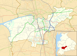
Little Hoole
Shown within South Ribble
Lancashire UK location map.svg
Red pog.svg
Little Hoole
Location within Lancashire
Population2,070  [1]
OS grid reference SD4742023440
Civil parish
  • Little Hoole
District
Shire county
Region
Country England
Sovereign state United Kingdom
Post town PRESTON
Postcode district PR4
Dialling code 01772
Police Lancashire
Fire Lancashire
Ambulance North West
UK Parliament
List of places
UK
England
Lancashire
53°42′17″N2°47′53″W / 53.704723°N 2.797982°W / 53.704723; -2.797982 Coordinates: 53°42′17″N2°47′53″W / 53.704723°N 2.797982°W / 53.704723; -2.797982

Little Hoole is a civil parish in Lancashire, England, It contains the village of Walmer Bridge, and the remaining part is predominantly a farming community. Other nearby villages include Much Hoole and Longton. The parish had a population of 1,815 people in 2001, increasing to 2,070 at the 2011 Census. [1]

Contents

Geography

Little Hoole is near an inlet brook running to the River Douglas. The A59 from Ormskirk to Preston crosses the township from south to north.

History

The parish was part of Preston Rural District throughout its existence from 1894 to 1974. [2] In 1974 the parish became part of South Ribble.

Hoole railway station was in the parish, but closed in 1964.

Community

Locals typically frequent the nearby pubs: the Walmer Bridge Inn, the Fox Cub, and the Longton Arms.

Wind Farm planning application

In May 2011, a planning application was submitted to South Ribble Borough Council to erect 4 wind turbines on moss land to the East of the village. Local response to the application has been mixed with strong support both supporting and objection to the development; [3] with objections mainly focusing on the development being on green belt land. The applicant withdrew the application in December 2011 pending further studies. [4]

Geographic location

See also

Related Research Articles

South Ribble Borough in England

South Ribble is a non-metropolitan district and borough of Lancashire, England. Its council is based in Leyland. The population, at the 2011 Census, was 109,057. In May 2007, the council was officially declared "Excellent" by the Audit Commission, of the best five district councils in the country.

Amounderness Hundred

The Amounderness Hundred is one of the six subdivisions of the historic county of Lancashire in North West England, but the name is older than the system of hundreds first recorded in the 13th century and might best be described as the name of a Norse wapentake. In the Domesday Book, it was used for some territories north of the River Ribble included together with parts of Yorkshire. The area eventually became part of Lancashire, sitting geographically between the Rivers Lune and Ribble, in the strip of coast between the Irish Sea and Bowland Forest.

South Ribble (UK Parliament constituency) Parliamentary constituency in the United Kingdom, 1983 onwards

South Ribble is a constituency represented in the House of Commons of the UK Parliament since 2019 by Katherine Fletcher, a Conservative.

Walton-le-Dale Human settlement in England

Walton-le-Dale is a large village in the borough of South Ribble, in Lancashire, England. It lies on the south bank of the River Ribble, opposite the city of Preston, adjacent to Bamber Bridge. The population of the South Ribble Ward at the 2011 census was 3,792. To the west of Walton-le-Dale is the residential area of Walton Park.

Longton, Lancashire Human settlement in England

Longton is a village and civil parish in the west of the borough of South Ribble, Lancashire, England. It is about 4 miles to the south west of Preston. The population of the civil parish, which also includes the village of New Longton, was 5,500 at the 2001 Census increasing to 7,652 at the 2011 Census.

Farington Human settlement in England

Farington is a small village and civil parish in the South Ribble local government district of Lancashire, England. The population of the civil parish at the 2011 census was 6,674.

Penwortham Human settlement in England

Penwortham is a town in South Ribble, Lancashire, England, on the south bank of the River Ribble facing the city of Preston. The town is at the most westerly crossing point of the river, with major road and rail links crossing it here. The population of the town at the 2011 census was 23,047.

Croston Human settlement in England

Croston is a village and civil parish in Lancashire, England near Chorley. The River Yarrow flows through the village. The population of the civil parish taken at the 2011 census was 1,280.

Central Lancashire

Central Lancashire is an area of Lancashire, England.

Bretherton Human settlement in England

Bretherton is a small village and civil parish in the Borough of Chorley, Lancashire, England, situated to the south west of Leyland and east of Tarleton. The population of the civil parish at the 2011 census was 669. Its name suggests pre-conquest origins and its early history was closely involved with the manor house Bank Hall and the families who lived there. Bretherton remained a rural community and today is largely residential with residents travelling to nearby towns for employment.

Preston was a rural district in Lancashire, England from 1894 to 1974. It surrounded Preston on the north, west and east sides.

Banks, Lancashire Human settlement in England

Banks is a large coastal village in Lancashire, England, south of the Ribble estuary four miles (6 km) north-east of Southport. The village is administered by West Lancashire Borough and North Meols Parish Council. It is in the South Ribble parliamentary constituency. At the 2001 census the population of the North Meols civil parish was 3,792, rising to 4,146 by the 2011 census.

Much Hoole Human settlement in England

Much Hoole is a village and civil parish in the borough of South Ribble, Lancashire, England. The parish of Much Hoole had a population of 1,851 at the time of the 2001 census, increasing to 1,997 at the 2011 Census.

The Ribble way is a long-distance walk between the Lancashire coast and the Yorkshire Dales National Park largely following the course of the River Ribble.

Hutton, Lancashire Human settlement in England

Hutton is a village and civil parish in Lancashire, England. It is located 3 miles (4.8 km) south west of Preston, in the South Ribble borough and parliamentary constituency. The population of the civil parish at the 2011 census was 2,277.

Hothersall Human settlement in England

Hothersall is a civil parish in the Ribble Valley district, in Lancashire, England. The parish, which is on the north bank of the River Ribble, is rural and contains no major villages, and in the 2001 census had a population of 136, increasing to 145 at the 2011 Census. It is approximately 8 miles (13 km) north-east of Preston, and has boundaries with Longridge to the north and west, and Ribchester to the east.

Walmer Bridge Human settlement in England

Walmer Bridge is a small village in Lancashire, England. Surrounding villages are Much Hoole and Longton.

Howick Cross Human settlement in England

Howick Cross is a landmark and small hamlet in Penwortham, South Ribble, Lancashire, England. It is located just over 2 miles south west of the city of Preston. The hamlet is predominantly made up of a small community, a primary school, various farms and an electrical substation. The community had a population of 354 people in 2001.

Little Hoole is a civil parish in the South Ribble district of Lancashire, England. It contains two listed buildings that are recorded in the National Heritage List for England. Both of the listed buildings are designated at Grade II, the lowest of the three grades, which is applied to "buildings of national importance and special interest". The parish contains the village of Walmer Bridge, and is otherwise rural, The listed buildings comprise a former manor house and a farmhouse, both dating from the 17th century.

References

  1. 1 2 UK Census (2011). "Local Area Report – Little Hoole Parish (E04005295)". Nomis. Office for National Statistics . Retrieved 26 March 2021.
  2. Preston RD, Vision of Britain, accessed 9 June 2014
  3. , Lancashire Evening Post - Aug 11
  4. http://www.lep.co.uk/community/wind_turbines_plans_collapse_1_4086621 [ bare URL ]

Commons-logo.svg Media related to Little Hoole at Wikimedia Commons