
Elkfork is an unincorporated community in Morgan County, Kentucky, United States. It lies along Route 172, northeast of the city of West Liberty, the county seat of Morgan County. Its elevation reaches up to 856 feet (261 m). Although the area is unincorporated, Elkfork contains a post office, with the ZIP code of 41421.

Stinson is an unincorporated community in Calhoun County, West Virginia, United States. It lies along West Virginia Route 16 and the West Fork Little Kanawha River, to the south of the town of Grantsville, the county seat of Calhoun County. Its elevation is 823 feet. At some point, Stinson possessed a post office, which has since been closed.
Orma is an unincorporated community in Calhoun County, West Virginia, United States. It lies along West Virginia Route 16 and the West Fork Little Kanawha River, to the south of the town of Grantsville, the county seat of Calhoun County. Its elevation is 738 feet. Although it is unincorporated, it has a post office, with the ZIP code of 25268.
Chloe is an unincorporated community in Calhoun County, West Virginia, United States. It lies along West Virginia Route 16 and the West Fork Little Kanawha River, to the south of the towns of Grantsville and Arnoldsburg. Its elevation is 794 feet (242 m). Although it is unincorporated, it has a post office, with the ZIP code of 25235.
Arnoldsburg is an unincorporated community in Calhoun County, West Virginia, United States. It lies along U.S. Route 33 at the point where West Virginia Route 16 heads southward; it is several miles south of the county seat of Grantsville. Its elevation is 738 feet. The West Fork Little Kanawha River flows through the community. Although it is unincorporated, it has a post office, with the ZIP code of 25234.
Millstone is an unincorporated community in Calhoun County, West Virginia, United States. It lies along U.S. Route 33 at the point where West Virginia Route 16 heads northward, to the south of the town of Grantsville, the county seat of Calhoun County. Its elevation is 810 feet. Although it is unincorporated, it has a post office, with the ZIP code of 25261.
Sand Ridge is an unincorporated community in Calhoun County, West Virginia, United States. It lies along U.S. Route 33 to the south of the town of Grantsville, the county seat of Calhoun County. Its elevation is 1,168 feet.
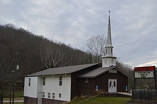
Mount Zion is an unincorporated community in Calhoun County, West Virginia, United States. It lies along West Virginia Route 16 to the south of the town of Grantsville, the county seat of Calhoun County. Its elevation is 1,132 feet. Mount Zion's ZIP code is 26151.
Big Bend is an unincorporated community in Calhoun County, West Virginia, United States. It lies along West Virginia Route 5 northwest of the town of Grantsville, the county seat of Calhoun County, along the Little Kanawha River. Its elevation is 682 feet. Although it is unincorporated, it has a post office, with the ZIP code of 26136.
Big Springs is an unincorporated community in Calhoun County, West Virginia, United States. It lies along West Virginia Route 16 to the north of the town of Grantsville, the county seat of Calhoun County. Its elevation is 771 feet. Although it is unincorporated, it has a post office, with the ZIP code of 26137.
Annamoriah is an unincorporated community in Calhoun County, West Virginia, United States. It lies along West Virginia Route 5 to the west of the town of Grantsville, the county seat of Calhoun County. Its elevation is 994 feet. Their post office closed in 1988.
Hix is an unincorporated community in Summers County, West Virginia, United States. It lies to the northeast of the city of Hinton, the county seat of Summers County. Its elevation is 2,618 feet. At some point, Hix possessed a post office, which closed on December 6, 1975.
Nimitz is an unincorporated community in Summers County, West Virginia, United States. It lies along West Virginia Route 3 to the west of the city of Hinton, the county seat of Summers County. Its elevation is 2,523 feet. Although it is unincorporated, it has a post office, with the ZIP code of 25978.
Pipestem is an unincorporated community in Summers County, West Virginia, United States. It lies along West Virginia Route 20 to the south-southwest of the city of Hinton, the county seat of Summers County. Its elevation is 2,382 feet. Although it is unincorporated, it has a post office, with the ZIP code of 25979.
Smoot is an unincorporated community in western Greenbrier County, West Virginia, United States. It lies south of the interchange of Interstate 64 and U.S. Route 60 northwest of the city of Lewisburg, the county seat of Greenbrier County. Its elevation is 2,480 feet (756 m). Although it is unincorporated, it has a post office, with the ZIP code of 24977.
Center Point is an unincorporated community in northeastern Doddridge County, West Virginia, USA. It lies along Route 23 northeast of the town of West Union, the county seat of Doddridge County. Its elevation is 791 feet (241 m).
New Milton is an unincorporated community in central Doddridge County, West Virginia, United States. The community is located along Meathouse Fork, southeast of the town of West Union, the county seat of Doddridge County. Its elevation is 833 feet (254 m). Although it is unincorporated, it has a post office, with the ZIP code of 26411.
Griffithsville is an unincorporated community in eastern Lincoln County, West Virginia, United States. It lies along West Virginia Route 3 southeast of the town of Hamlin, the county seat of Lincoln County. Its elevation is 659 feet (201 m). Although it is unincorporated, it has a post office, with the ZIP code of 25521.

Yawkey is an unincorporated community in eastern Lincoln County, West Virginia, United States. It lies at the intersection of West Virginia Routes 3 and 214, east of the town of Hamlin, the county seat of Lincoln County. Its elevation is 738 feet (225 m). Although it is unincorporated, it had a post office, with the ZIP code of 25573.
Peewee is an unincorporated community in southwestern Wirt County, West Virginia, United States. It lies along local roads southwest of the town of Elizabeth, the county seat of Wirt County. Its elevation is 679 feet (207 m). Right Reedy Creek is formed at Peewee by the confluence of Enoch Fork and Fulls Fork.


