Orma is an unincorporated community in Calhoun County, West Virginia, United States. It lies along West Virginia Route 16 and the West Fork Little Kanawha River, to the south of the town of Grantsville, the county seat of Calhoun County. Its elevation is 738 feet. It has a post office with the ZIP code 25268.
Chloe is an unincorporated community in Calhoun County, West Virginia, United States. It lies along West Virginia Route 16 and the West Fork Little Kanawha River, to the south of the towns of Grantsville and Arnoldsburg. Its elevation is 794 feet (242 m). It has a post office with the ZIP code 25235.
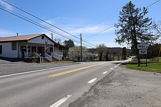
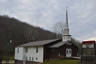
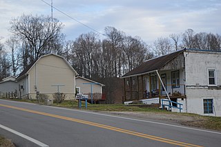
Arnoldsburg is an unincorporated community in Calhoun County, West Virginia, United States. It lies along U.S. Route 33 at the point where West Virginia Route 16 heads southward; it is several miles south of the county seat of Grantsville. Its elevation is 738 feet. The West Fork Little Kanawha River flows through the community. It has a post office with the ZIP code 25234.
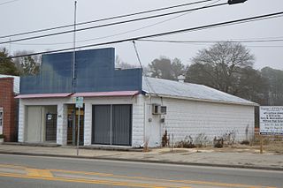
Millstone is an unincorporated community in Calhoun County, West Virginia, United States. It lies along U.S. Route 33 at the point where West Virginia Route 16 heads northward, to the south of the town of Grantsville, the county seat of Calhoun County. Its elevation is 810 feet. It has a post office with the ZIP code 25261.
Big Bend is an unincorporated community in Calhoun County, West Virginia, United States. It lies along West Virginia Route 5 northwest of the town of Grantsville, the county seat of Calhoun County, along the Little Kanawha River. Its elevation is 682 feet. It has a post office with the ZIP code 26136.
Big Springs is an unincorporated community in Calhoun County, West Virginia, United States. It lies along West Virginia Route 16 to the north of the town of Grantsville, the county seat of Calhoun County. Its elevation is 771 feet. It has a post office with the ZIP code 26137.
Forest Hill is an unincorporated community in Summers County, West Virginia, United States. It lies along West Virginia Route 12 to the southeast of the city of Hinton, the county seat of Summers County. Its elevation is 1,926 feet. It has a post office with the ZIP code 24935.
Nimitz is an unincorporated community in Summers County, West Virginia, United States. It lies along West Virginia Route 3 to the west of the city of Hinton, the county seat of Summers County. Its elevation is 2,523 feet. It has a post office with the ZIP code 25978.
Pipestem is an unincorporated community in Summers County, West Virginia, United States. It lies along West Virginia Route 20 to the south-southwest of the city of Hinton, the county seat of Summers County. Its elevation is 2,382 feet. It has a post office with the ZIP code 25979. It has a population of 764 people.
Smoot is an unincorporated community in western Greenbrier County, West Virginia, United States. It lies south of the interchange of Interstate 64 and U.S. Route 60, northwest of the city of Lewisburg, the county seat of Greenbrier County. Its elevation is 2,480 feet (756 m). It has a post office with the ZIP code 24977.
Center Point is an unincorporated community in northeastern Doddridge County, West Virginia, United States. It lies along Route 23 northeast of the town of West Union, the county seat of Doddridge County. Its elevation is 791 feet (241 m).
Branchland is an unincorporated community in western Lincoln County, West Virginia, United States. It lies along West Virginia Route 10, southwest of the town of Hamlin, the county seat of Lincoln County. Its elevation is 597 feet (182 m). It has a post office with the ZIP code 25506. Raccoon Creek Road is one of the more popular ways of transportation through the area. Branchland Post Office serves addresses within Sheridan Magisterial District of Lincoln County as well as addresses in southern Cabell County and eastern Wayne County, West Virginia.
Griffithsville is an unincorporated community in eastern Lincoln County, West Virginia, United States. It lies along West Virginia Route 3 southeast of the town of Hamlin, the county seat of Lincoln County. Its elevation is 659 feet (201 m). It has a post office with the ZIP code 25521.
Spurlockville is an unincorporated community in central Lincoln County, West Virginia, United States. It lies south of the town of Hamlin, the county seat of Lincoln County. Its elevation is 758 feet (231 m). Spurlockville has a post office with the ZIP code 25565.
Ranger is an unincorporated community in western Lincoln County, West Virginia, United States. It lies along West Virginia Route 10 southwest of the town of Hamlin, the county seat of Lincoln County. Its elevation is 614 feet (187 m). It has a post office with the ZIP code 25557. Ranger is served by the Guyan River VFD.
Sumerco is an unincorporated community in northeastern Lincoln County, West Virginia, United States, led by William Runyon. It lies along West Virginia Route 214 east of the town of Hamlin, the county seat of Lincoln County. Sumerco's elevation is 1,211 feet (369 m). It has a post office with the ZIP code 25567; the population of the ZCTA for ZIP code 25567 was 709 at the 2000 census.
Wana — formerly Wise — is an unincorporated community in northwestern Monongalia County, West Virginia, United States. It lies along West Virginia Route 7 northwest of the city of Morgantown, the county seat of Monongalia County. Its elevation is 1,030 feet (314 m). It has a post office with the ZIP code 26590.
Berea is an unincorporated community in southeastern Ritchie County, West Virginia, United States. It lies along West Virginia Route 74 southeast of the town of Harrisville, the county seat of Ritchie County. Its elevation is 751 feet (229 m). Although it is unincorporated nor has a post office, the ZIP code is 26327. Postal customers are serviced by the Harrisville and Auburn post offices.

Smithville is an unincorporated community in southern Ritchie County, West Virginia, United States. It lies along West Virginia Route 47 south of the town of Harrisville, the county seat of Ritchie County. Its elevation is 686 feet (209 m). It has a post office with the ZIP code 26178.
Hudgins is an unincorporated community in northern Mathews County, Virginia, United States. It lies north of the community of Mathews, the county seat of Mathews County. Its elevation is 10 feet (3 m). Although Hudgins is unincorporated, it has a post office, with the ZIP Code of 23076.


