
Calhoun County is a county in the U.S. state of West Virginia. As of the 2010 census, the population was 7,627. Its county seat is Grantsville. The county was founded in 1856 and named for South Carolina politician John C. Calhoun.

Orma is an unincorporated community in Calhoun County, West Virginia, United States. It lies along West Virginia Route 16 and the West Fork Little Kanawha River, to the south of the town of Grantsville, the county seat of Calhoun County. Its elevation is 738 feet. It has a post office with the ZIP code 25268.
Arnoldsburg is an unincorporated community in Calhoun County, West Virginia, United States. It lies along U.S. Route 33 at the point where West Virginia Route 16 heads southward; it is several miles south of the county seat of Grantsville. Its elevation is 738 feet. The West Fork Little Kanawha River flows through the community. It has a post office with the ZIP code 25234.
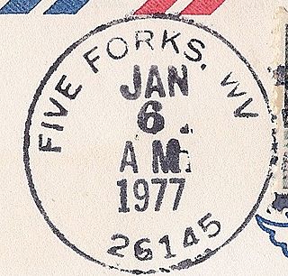
Five Forks is an unincorporated community in Calhoun County, West Virginia, United States. It lies along West Virginia Route 16 to the north of the town of Grantsville, the county seat of Calhoun County. Its elevation is 1,106 feet (337 m). The Five Forks Post Office is closed.
The Mountain Parkway Byway and Mountain Parkway Backway are two routes in northern Webster County, West Virginia. The Byway is a state-designated scenic byway which follows West Virginia Route 20 for 9.8 miles (15.8 km), traversing the headwaters of several mountain streams including the Right Fork Little Kanawha River, Jerry Run, and the Left and Laurel Forks of Holly River. The Backway explores backroads in the same area, is 32 miles (51 km) long, and follows stretches of the Right Fork Little Kanawha River and Left Fork Holly River for portions of its route.

The West Fork Little Kanawha River is a tributary of the Little Kanawha River, 48.1 miles (77.4 km) long, in west-central West Virginia in the United States. Via the Little Kanawha and Ohio rivers, it is part of the watershed of the Mississippi River, draining an area of 246 square miles (640 km2) in a rural region on the unglaciated portion of the Allegheny Plateau. By drainage area, it is the second-largest tributary of the Little Kanawha River, after the Hughes River.
Statts Mills is an unincorporated community in Jackson County, West Virginia, United States. Statts Mills is located on the Tug Fork and County Route 36, 7.5 miles (12.1 km) southeast of Ripley. Statts Mills had a post office, which closed on July 30, 2005.
Lockney is an unincorporated community in Gilmer County, West Virginia, United States. Lockney is located along U.S. Routes 33 and 119 and the Left Fork Steer Creek, 9 miles (14 km) southwest of Glenville. Lockney had a post office, which opened on May 17, 1898, and closed on November 9, 2002. The community was named after H. C. Lockney, a senator who was instrumental in securing for the town a post office.
Liverpool is an unincorporated community in Jackson and Roane counties, West Virginia, United States. Liverpool is located along the Right Fork Sandy Creek at the junction of Jackson County Route 13 and Roane County Route 1, 5.7 miles (9.2 km) west of Reedy Liverpool had a post office, which closed on May 30, 1989. The community was named after Liverpool, in England.
Minnora is an unincorporated community in Calhoun County, West Virginia, United States. Minnora is located on West Virginia Route 16 and the West Fork Little Kanawha River, 15 miles (24 km) south of Grantsville.
Deerwalk is an unincorporated community in Wood County, West Virginia, United States. Deerwalk is located on West Virginia Route 31 north of its junction with U.S. Route 50, 12.5 miles (20.1 km) east of Parkersburg.
Saunders is an unincorporated community in Logan County, West Virginia, United States. Saunders is located on County Highway 16 near Buffalo Creek, 12 miles (19 km) east-northeast of Man.
Beebe is an unincorporated community in Logan County, West Virginia, United States. It is part of the Holden census-designated place. Beebe is located along Copperas Mine Fork and County Route 9/2, 4.1 miles (6.6 km) west-southwest of Logan.
Packsville is an unincorporated community in Raleigh County, West Virginia, United States. Packsville is located on the Little Marsh Fork 4.4 miles (7.1 km) south-southeast of Sylvester.
Elkwater is an unincorporated community in Randolph County, West Virginia, United States. Elkwater is located on U.S. Route 219 and West Virginia Route 55 along the Tygart Valley River, 5.6 miles (9.0 km) south-southwest of Huttonsville.
Bemis is an unincorporated community in Randolph County, West Virginia, USA. It is located on Shavers Fork, along County Route 22, some 9.8 miles (15.8 km) southeast of Elkins.
Sweetland is an unincorporated community in Lincoln County, West Virginia, United States. Sweetland is located on West Virginia Route 3 and the Middle Fork Mud River, 3.5 miles (5.6 km) east-southeast of Hamlin. Sweetland had a post office, which closed on December 14, 1996.
Glenhayes is an unincorporated community in Wayne County, West Virginia, United States. Glenhayes is located on the Tug Fork and U.S. Route 52, 8.1 miles (13.0 km) southeast of Fort Gay. Glenhayes had a post office, which closed on November 9, 2002.
Nobe is an unincorporated community in Calhoun County, West Virginia, United States. Nobe is located on County Route 16/4 near the Gilmer County line, 5.5 miles (8.9 km) northeast of Grantsville.
Toney Fork is an unincorporated community in Wyoming County, West Virginia, United States. Toney Fork is located on West Virginia Route 85 at the confluence of the Clear Fork and the Toney Fork, 2 miles (3.2 km) northeast of Oceana.


