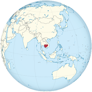
Cambodia is a country in mainland Southeast Asia, border Thailand, Laos, Vietnam, the Gulf of Thailand and covers a total area of 181,035 km2 (69,898 sq mi). The country is situated in its entirety inside the tropical Indomalayan realm and the Indochina Time zone (ICT).

Thailand, historically known as Siam and officially the Kingdom of Thailand, is a country in Southeast Asia, located at the centre of the Indochinese Peninsula, spanning 513,120 square kilometres (198,120 sq mi), with a population of almost 70 million. The country is bordered to the north by Myanmar and Laos, to the east by Laos and Cambodia, to the south by the Gulf of Thailand and Malaysia, and to the west by the Andaman Sea and the extremity of Myanmar. Thailand also shares maritime borders with Vietnam to the southeast, and Indonesia and India to the southwest. Bangkok is the nation's capital and largest city.
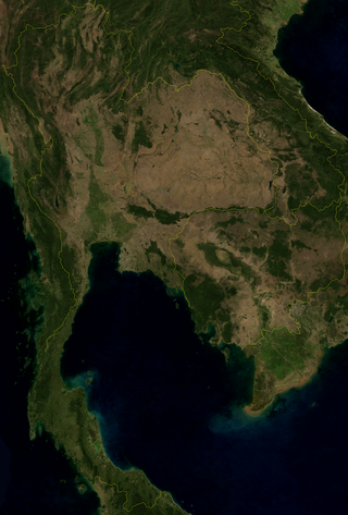
Thailand is in the middle of mainland Southeast Asia. It has a total size of 513,120 km2 (198,120 sq mi) which is the 50th largest in the world. The land border is 4,863 km (3,022 mi) long with Myanmar, Cambodia, Laos and Malaysia. The nation's axial position influenced many aspects of Thailand's society and culture. It controls the only land route from Asia to Malaysia and Singapore. It has an exclusive economic zone of 299,397 km2 (115,598 sq mi).

Bangkok, officially known in Thai as Krung Thep Maha Nakhon and colloquially as Krung Thep, is the capital and most populous city of Thailand. The city occupies 1,568.7 square kilometres (605.7 sq mi) in the Chao Phraya River delta in central Thailand and has an estimated population of 10.539 million as of 2020, 15.3 percent of the country's population. Over 14 million people lived within the surrounding Bangkok Metropolitan Region at the 2010 census, making Bangkok an extreme primate city, dwarfing Thailand's other urban centres in both size and importance to the national economy.
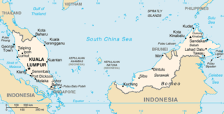
The geography of Malaysia includes both the physical and the human geography of Malaysia, a Southeast Asian country made up of two major landmasses separated by water—Peninsular Malaysia to the west and East Malaysia to the east—and numerous smaller islands that surround those landmasses. Peninsular Malaysia is on the southernmost part of the Malay Peninsula, south of Thailand, north of Singapore and east of the Indonesian island of Sumatra; East Malaysia comprises most of the northern part of Borneo island, and shares land borders with Brunei to the north and Indonesian Borneo to the south.

A monsoon is traditionally a seasonal reversing wind accompanied by corresponding changes in precipitation but is now used to describe seasonal changes in atmospheric circulation and precipitation associated with annual latitudinal oscillation of the Intertropical Convergence Zone (ITCZ) between its limits to the north and south of the equator. Usually, the term monsoon is used to refer to the rainy phase of a seasonally changing pattern, although technically there is also a dry phase. The term is also sometimes used to describe locally heavy but short-term rains.

The Mekong or Mekong River is a trans-boundary river in East Asia and Southeast Asia. It is the world's twelfth longest river and the third longest in Asia. Its estimated length is 4,909 km (3,050 mi), and it drains an area of 795,000 km2 (307,000 sq mi), discharging 475 km3 (114 cu mi) of water annually. From the Tibetan Plateau the river runs through China, Myanmar, Laos, Thailand, Cambodia, and Vietnam. The extreme seasonal variations in flow and the presence of rapids and waterfalls in the Mekong make navigation difficult. Even so, the river is a major trade route between western China and Southeast Asia.

Pattaya is a city in Thailand. It is on the east coast of the Gulf of Thailand, about 100 kilometres (62 mi) southeast of Bangkok, within, but not part of, Bang Lamung district in the province of Chonburi. Pattaya City is a self-governing municipal area which covers Tambon's Nong Prue and Na Klua and parts of Huai Yai and Nong Pla Lai. The city is in the industrial Eastern Seaboard zone, along with Si Racha, Laem Chabang, and Chonburi. Pattaya is at the center of the Pattaya-Chonburi Metropolitan Area—a conurbation in Chonburi Province—with a population of roughly 1,000,000.

The climate of India consists of a wide range of weather conditions across a vast geographic scale and varied topography. Based on the Köppen system, India hosts six major climatic sub types, ranging from arid deserts in the west, alpine tundra and glaciers in the north, and humid tropical regions supporting rain forests in the southwest and the island territories. Many regions have starkly different microclimates, making it one of the most climatically diverse countries in the world. The country's meteorological department follows the international standard of four seasons with some local adjustments: winter, summer, monsoon (rainy) season, and a post-monsoon period.

Agriculture in Thailand is highly competitive, diversified and specialized and its exports are very successful internationally. Rice is the country's most important crop, with some 60 percent of Thailand's 13 million farmers growing it on almost half of Thailand's cultivated land. Thailand is a major exporter in the world rice market. Rice exports in 2014 amounted to 1.3 percent of GDP. Agricultural production as a whole accounts for an estimated 9-10.5 percent of Thai GDP. Forty percent of the population work in agriculture-related jobs. The farmland they work was valued at US$2,945 per rai in 2013. Most Thai farmers own fewer than eight hectares of land.
Thailand's dramatic economic growth has caused numerous environmental issues. The country faces problems with air, declining wildlife populations, deforestation, soil erosion, water scarcity, and waste issues. According to a 2004 indicator, the cost of air and water pollution for the country scales up to approximately 1.6–2.6% of GDP per year. As such, Thailand's economic growth has come at great cost in damage to its people and environment.

Pakistan's climate is a continental type of climate, characterized by extreme variations in temperature, both seasonally and daily, because it is located on a great landmass north of the Tropic of Cancer.

The Philippines has five types of climates: tropical rainforest, tropical monsoon, tropical savanna, humid subtropical and oceanic characterized by relatively high temperature, oppressive humidity and plenty of rainfall. There are two seasons in the country, the wet season and the dry season, based upon the amount of rainfall. This is also dependent on location in the country as some areas experience rain all throughout the year. Based on temperature, the warmest months of the year are March through October; the winter monsoon brings cooler air from November to February. May is the warmest month, and January, the coolest.

Rice production in Thailand represents a significant portion of the Thai economy and labor force. In 2017, the value of all Thai rice traded was 174.5 billion baht, about 12.9% of all farm production. Of the 40% of Thais who work in agriculture, 16 million of them are rice farmers by one estimate.
A series of flash floods hit different areas of Thailand and Malaysia in 2010. Separate but related floods began in the Northeast and Central Thailand in early October due to abnormally late monsoon moisture over the Bay of Bengal, overflowed the Chao Phraya where the rivers meet, and affected Bangkok, and in the South were triggered by a tropical depression about two weeks later, and was later aggravated by related La Niña monsoon rains. Floods subsequently occurred in the Malaysian states of Kedah and Perlis in November 2010.

Severe flooding occurred during the 2011 monsoon season in Thailand. The flooding began at the end of July triggered by the landfall of Tropical Storm Nock-ten. These floods soon spread through the provinces of northern, northeastern, and central Thailand along the Mekong and Chao Phraya river basins. In October floodwaters reached the mouth of the Chao Phraya and inundated parts of the capital city of Bangkok. Flooding persisted in some areas until mid-January 2012, and resulted in a total of 815 deaths and 13.6 million people affected. Sixty-five of Thailand's 76 provinces were declared flood disaster zones, and over 20,000 square kilometres (7,700 sq mi) of farmland was damaged. The disaster has been described as "the worst flooding yet in terms of...water and people affected."
The 2011 monsoon season saw one record flood event in Indochina across several countries and a few separate limited flood events parts of the same nations: Thailand, Cambodia and Myanmar and heavy flooding in Vietnam. Meanwhile, Laos also sustained flood damage. By late October 2011, 2.3 million people have been hit by flooding in Thailand, while the flooding in Cambodia has affected close to 1.2 million people, according to estimates by the United Nations. Unrelated to the northern floods, Southern Thailand near Malaysia has been lashed with flooding in early November and again in December also affecting as far north as Chumporn. In the November event, Southern Thailand near Hat Yai was hit, North-central Vietnam had their own event in October. Myanmar had reported a series of limited but still deadly and destructive events from June to October.
There are various issues of waste management in Thailand, including excessive plastic use, industrial waste, among others.
The 2017 Southern Thailand floods are the biggest floods in over 30 years in the southern part of the country during the regional annual monsoon season, which is distinct from other parts of the nation and mirrors that the Malay Peninsula. Between December 2016 and January 2017, Southern Thailand experienced a devastating flood disaster. The bulk of the 15 provinces in Southern Thailand were affected, and this flood event stood out from earlier flood catastrophes due to the massive, long-term damage it produced. Since around December 31, 2016, there have been abnormally significant rains for that time of year. According to the Meteorological Department, thunderstorms and strong winds continued to affect the southern regions. The amount of water in the Nan River, which flows through the Taphan Hin and Bang Mun Nak districts of the capital city of Phichit Province, rose at an alarming rate. This is the second deadly flood in a month in southern Thailand. The Department of Disaster Prevention and Mitigation (DDPM) of the Ministry of Interior estimates that there were 95 fatalities and 1,815,618 total victims in the 13 prefectures that were affected by the disaster. 4,314 road segments, 348 bridges, 126 weirs, and 2 sluices were among the destroyed infrastructure items. The extensive area of heavy rain and the simultaneous occurrence of numerous dam breaks severely damaged the local logistics infrastructure. While gum and palm oil help some regions' economies, others, like the extremely underdeveloped territory bordering Malaysia, are socioeconomically unstable. In these situations, the government made efforts in disaster restoration works by utilizing the military in a way that had never before been done for this purpose. Some 120 billion baht in damages are foreseen as of mid-January, much of this due to lost production in agriculture tourism and infrastructure. Rubber supply is particularly impacted. Particularly hard hit are palm and rubber plantations.
