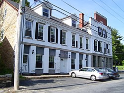
North Smithfield is a town in Providence County, Rhode Island, United States, settled as a farming community in 1666 and incorporated into its present form in 1871. North Smithfield includes the historic villages of Forestdale, Primrose, Waterford, Branch Village, Union Village, Park Square, and Slatersville. The population was 12,314 at the 2015 census.

Woonsocket, is a city in Providence County, Rhode Island, United States. The population was 41,186 at the 2010 census, making it the sixth largest city in the state. Being Rhode Island’s northernmost city, Woonsocket lies directly south of the Massachusetts state line and constitutes part of both the Providence metropolitan area and the larger Greater Boston Combined Statistical Area.

The stone-ender is a unique style of Rhode Island architecture that developed in the 17th century where one wall in a house is made up of a large stone chimney.

The Branch River is a river in the U.S. state of Rhode Island. It flows for approximately 16 km (10 mi). There are six dams along the river's length. The river provided energy for many of the region's textile mills in the nineteenth century.
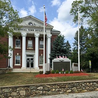
Slatersville is a village on the Branch River in the town of North Smithfield, Rhode Island, United States. It includes the Slatersville Historic District, a historic district listed on the National Register of Historic Places. The historic district has been included as part of the Blackstone River Valley National Historical Park. The North Smithfield Public Library is located in Slatersville.

Union Village or "Bank Village" is a village and historic district located in North Smithfield and Woonsocket, Rhode Island on Rhode Island Route 146A. Union Village developed because it was at the cross roads of old Great Road and Pound Hill Road.
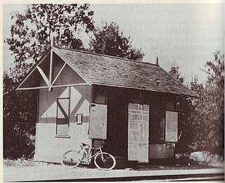
Primrose is a village in North Smithfield, Rhode Island, United States. The village is located in the area around Greenville Road and Providence Pike. The village takes its name from the Primrose railroad station which existed on Greenville Road for the Providence and Springfield Railroad which began service in 1873. The Primrose Fire Department and North Smithfield High School are located in the area. The historic Primrose Grange (1887) building is located on Grange Road as well as several eighteenth-century farms surrounded by stonewalls.
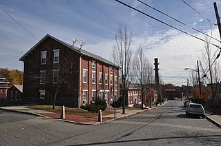
Lonsdale is a village and historic district in Lincoln and Cumberland, Providence County, Rhode Island, United States, near Rhode Island Route 146 and Route 95. The village was originally part of the town of Smithfield until Lincoln was created in the 1870s, and was originally centered on the Lincoln side of the river. William Blaxton settled in the area in 1635. In the nineteenth and early twentieth centuries, Lonsdale was home to several manufacturers including the Lonsdale Company's Bleachery, and the Ann & Hope mill was also located in the village in Cumberland.

Park Square is an area on Rhode Island Route 146A in North Smithfield and Woonsocket, Rhode Island near the intersection of Park Avenue and Route 146A. It is 12 miles from Providence and near Union Village.

Branch Village is a village located on Rhode Island Route 146A near the intersection of St. Paul Street in North Smithfield. The village takes its name from the Branch River which runs through it.
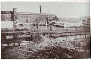
Waterford is a village located on and around St. Paul Street in North Smithfield, Rhode Island and Blackstone, Massachusetts. The Blackstone River and Branch River converge just south of the village.
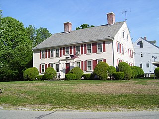
The Peleg Arnold Tavern off Great Road in Union Village in North Smithfield, Rhode Island was built around 1690 and is one of the oldest homes in North Smithfield. The oldest part of house was built in the late 17th century by Richard Arnold, one of the earliest settlers in the area. His descendant, Peleg Arnold, greatly expanded the building a century later. Peleg Arnold was a justice of the Rhode Island Supreme Court and representative to the Continental Congress. Arnold's popular tavern served as center of American military operations in the town during the American Revolution. The house was added to the National Register of Historic Places in 1974.

The Smithfield Road Historic District is a rural historic district in North Smithfield, Rhode Island, along Old Smithfield Road. It extends along Old Smithfield Road north from its junction with Sayles Hill Road, and is roughly bisected by Spring Brook. It includes eight historic houses or farmsteads, two 19th-century cemeteries, and a dam on Spring Brook just east of the road. The district encompasses a cross-section of the development of agricultural properties in North Smithfield over the 19th century, with properties dating from 1811 to 1932. The district covers 170 acres (69 ha), which includes lands currently and formerly in agricultural use.

The Smithfield Friends Meeting House, Parsonage and Cemetery, is a Friends Meeting House of the Religious Society of Friends (Quakers), rebuilt in 1881. It is located at 108 Smithfield Road in Woonsocket, Rhode Island. The meetinghouse is home to one of the oldest Quaker communities in the region.

North Smithfield High School is a high school in the Primrose section of North Smithfield, Rhode Island, USA. It is the only public high school in the town and was ranked 5th out of 51 public high schools in Rhode Island in 2019. The current principal is Tim McGee.

North Smithfield Public Library is a public library at 20 Main Street in the village of Slatersville in North Smithfield, Rhode Island. Part of the library is currently located in a renovated nineteenth century stone mill building that was a mill store house for John Slater's nearby mill before it became the North Smithfield Public Library in 1966, and the library is adjacent to the Slatersville Reservoir. An extensive addition was added in the 1980s. The Library was originally founded in 1931 with the first branch in the Union Village school before eventually moving to Slatersville.
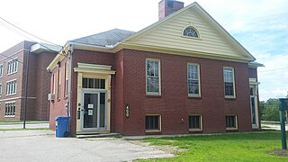
The North Smithfield School District is a school district in the Primrose section of North Smithfield, Rhode Island. It operates two elementary schools, a middle school, and a high school.
Dr. Harry L. Halliwell School is an elementary school in the Slatersville village of North Smithfield, Rhode Island, USA.
The Andrews Mill Company Plant is a historic industrial complex at 761 Great Road in North Smithfield, Rhode Island. Built beginning in 1918, it was home to a maker of French worsted wool textiles, part of a major industrial development push in northern Rhode Island at the time. The complex was listed on the National Register of Historic Places in 2018.
Woonsocket Hill is one of the highest points in the state of Rhode Island and is the highest point in the town of North Smithfield, Rhode Island at 586 feet. The hill is located near the center of the town and "contained a highly refractory stone used for hearth stones. ".
