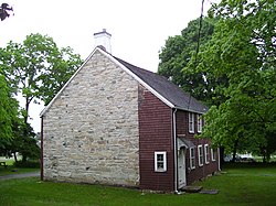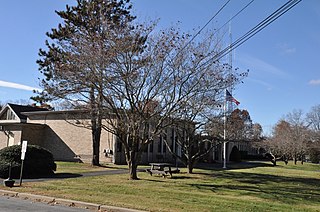
Lincoln is a town in Providence County, Rhode Island, United States. The population was 22,529 at the 2020 census. Lincoln is located in northeastern Rhode Island, north of Providence. Lincoln is part of the Providence metropolitan statistical area and the Greater Boston combined statistical area.
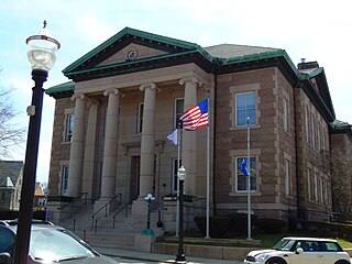
Westerly is a town on the southwestern shoreline of Washington County, Rhode Island, first settled by English colonists in 1661 and incorporated as a municipality in 1669. It is a beachfront community on the south shore of the state with a population of 23,359 as of the 2020 census.
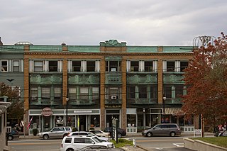
Wakefield is a village in the town of South Kingstown, Rhode Island, United States, and the commercial center of South Kingstown. Together with the village of Peace Dale, it is treated by the U.S. Census as a component of the census-designated place identified as Wakefield-Peacedale, Rhode Island. West Kingston, another South Kingstown village, was the traditional county seat of Washington County. Since 1991, the Washington County Courthouse has been in Wakefield. The Sheriff's Office which handles corrections is also in Wakefield.

This is a list of properties and districts listed on the National Register of Historic Places in Rhode Island. As of May 29, 2015, there are more than 750 listed sites in Rhode Island. All 5 of the counties in Rhode Island have listings on the National Register.

The stone-ender is a unique style of Rhode Island architecture that developed in the 17th century where one wall in a house is made up of a large stone chimney.

Buffalo Grove Lime Kiln is one of two old lime kilns in Illinois listed on the National Register of Historic Places. The other is the Griggsville Landing Lime Kiln in Pike County. Buffalo Grove Lime Kiln is located near the Ogle County city of Polo. When in use, the kiln would have produced raw quicklime. The lime kiln was added to the National Register in 2002.

Union Village or "Bank Village" is a village and historic district located in North Smithfield and Woonsocket, Rhode Island on Rhode Island Route 146A. Union Village developed because it was at the cross roads of old Great Road and Pound Hill Road.

The Cowell Lime Works, in Santa Cruz, California, was a manufacturing complex that quarried limestone, produced lime and other limestone products, and manufactured wood barrels for transporting the finished lime. Part of its area is preserved as the Cowell Lime Works Historic District, which was listed on the National Register of Historic Places in 2007. In addition to the four lime kilns, cooperage and other features relating to lime manufacture, the Historic District also includes other structures associated with the Cowell Ranch, including barns, a blacksmith shop, ranch house, cook house and workers' cabins. The 32-acre Historic District is located within the University of California, Santa Cruz campus, to either side of the main campus entrance.

The Old Colony House, also known as Old State House or Newport Colony House, is located at the east end of Washington Square in the city of Newport, Rhode Island, United States. It is a brick Georgian-style building completed in 1741, and was the meeting place for the colonial legislature. From independence in 1776 to the early 20th century, the state legislature alternated its sessions between here and the Rhode Island State House in Providence.

The Great Road Historic District is a historic district in Lincoln, Rhode Island, commemorating a portion of Rhode Island's oldest highway, dating back to 1683. Great Road served as the main connection between Providence, Hartford and Worcester during colonial times. The district includes a 0.6-mile (0.97 km) section of the road, which winds along the Moshassuck River between a junction with Breakneck Hill Road and another with Front Street. Notable historic properties along this stretch of road include the National Historic Landmark Eleazer Arnold House, a stone-ender built in 1687, which is now a museum operated by Historic New England, the 1812 Moffett Mill, the Israel Arnold House, and Hearthside, the 1810 home of Stephen Smith, who established the adjacent Butteryfly Mill in 1811.

This is a list of the National Register of Historic Places listings in Providence, Rhode Island.

Wyoming is a village and census-designated place on the Wood River in southern Rhode Island, primarily in the town of Richmond, Rhode Island, but extending north across the river into the town of Hopkinton, Rhode Island. The population was 270 at the 2010 census. It is the site of the Wyoming Village Historic District and a post office assigned ZIP code 02898.

The Lime Kilns of Lincoln, Rhode Island, are the remnants of three colonial-era lime kilns, all that is left of one of the oldest lime processing operations in North America. They are located respectively off Louisquisset Pike, Sherman and Dexter Rock Roads in an area that has been known for its lime processing since the 17th century. When originally built, they were roughly cylindrical structures fashioned out of unmortared rubble stone. The first kiln, whose ruins are located near the Flanagan campus of the Community College of Rhode Island west of Louisquisset Pike, was the largest of the three, nearly 20 feet (6.1 m) in diameter. The second kiln remains are located to the south of Sherman Avenue, near its junction with Louisquisset Pike. In 1984 the standing walls were 8 feet (2.4 m) high, with three recognizable openings. The third kiln, of which only a partial wall remains standing, is located on the south side of Dexter Rock Road.
The Stillwater Mill was a former textile factory located in Smithfield, Rhode Island.

The Manville Company Worker Housing Historic District is a residential historic district encompassing an area of mill worker housing in the Manville village of Lincoln, Rhode Island. The district covers about 50 acres (20 ha) of the village, including properties on Angle, Main, Old Main, Spring, Summer, Winter, and Chestnut Streets, as well as several properties on adjoining roads, describing a crescent, part of which abuts the south bank of the Blackstone River. The housing in this district was built between about 1812 and 1890 by the various proprietors of the Manville Company, and feature a diversity of architectural styles, most of which are simple vernacular interpretations of styles popular at the time. Most of the houses are either 1-1/2 or 2-1/2 stories in height, with one or two units per structure, and are set on small lots. There are also a series of brick rowhouses, a relative rarity in Rhode Island mill housing of the period.

The Milwaukee Falls Lime Company is the former owner of a limestone quarry and lime kilns located in Grafton, Wisconsin. It was added to the National Register of Historic Places in 2012. The quarry and kilns are now Lime Kiln Park, which also features a pavilion, playground, walking paths, sledding hill, horseshoe pits, and disc golf course.

Hurstville Historic District is a nationally recognized historic district located north of Maquoketa, Iowa, United States. It was listed on the National Register of Historic Places in 1979. At the time of its nomination it included three areas: the former lime manufacturing works, a farmstead, and the townsite. All that remains are the four kilns, and an old warehouse. Both the townsite, which was across the road and to the southwest, and the farmstead, which was behind the kilns to the south, are gone. Also gone are the remaining company buildings, with the exception of the old warehouse, which were across the road to the west. The houses in the townsite were side-gable cottages. Many lacked indoor plumbing into the 1970s and were vacant. The farmstead included 20 structures devoted to domestic or agricultural use. Two large barns were the most notable structures. The farm served the needs of the town. The most significant structures in the district were the lime kilns.
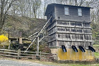
The M. C. Mulligan & Sons Quarry is a 8.8-acre (3.6 ha) historic district encompassing a former limestone quarry located at 56 Main Street in the town of Clinton in Hunterdon County, New Jersey. It was added to the National Register of Historic Places on August 30, 1994, for its significance in agriculture, commerce, and industry. The listing includes six contributing buildings, two contributing structures, a contributing object, and a contributing site. In 1995, it was also listed as part of the Clinton Historic District. The quarry is now in the Red Mill Museum Village, an open-air museum.
