Harrisville, Rhode Island

Last updated
Harrisville, Rhode Island
HarrisvilleRI Rt98.jpg
RI Route 98
Providence County Rhode Island incorporated and unincorporated areas Harrisville highlighted.svg
Location in Providence County and the state of Rhode Island.
Coordinates: 41°58′7″N71°40′48″W / 41.96861°N 71.68000°W / 41.96861; -71.68000 Coordinates: 41°58′7″N71°40′48″W / 41.96861°N 71.68000°W / 41.96861; -71.68000
Country Flag of the United States.svg  United States
State Flag of Rhode Island.svg  Rhode Island
County Providence
Area
[1]
  Total0.86 sq mi (2.22 km2)
  Land0.81 sq mi (2.10 km2)
  Water0.04 sq mi (0.11 km2)
Elevation
325 ft (99 m)
Population
 (2020) [2]
  Total1,745
  Density2,149.01/sq mi (829.57/km2)
Time zone UTC-5 (Eastern (EST))
  Summer (DST) UTC-4 (EDT)
ZIP code
02830
Area code 401
FIPS code 44-33400 [3]
GNIS feature ID1218783 [4]
Harrisville Historic District
USA Rhode Island location map.svg
Red pog.svg
Usa edcp location map.svg
Red pog.svg
Location Burrillville, Rhode Island
Coordinates 41°57′59″N71°40′33″W / 41.96639°N 71.67583°W / 41.96639; -71.67583
Architectural style American Colonial, Federal, Victorian
NRHP reference No. 84002010 [5]
Added to NRHPMarch 21, 1984

Harrisville is a census-designated place (CDP) and village in the town of Burrillville in Providence County, Rhode Island, United States. The population was 1,605 at the 2010 census. [6] Much of the community composes a historic district listed on the National Register of Historic Places. The village was named after nineteenth century manufacturer Andrew Harris. Previously, the village was named Rhodesville, after Captain William Rhodes, an eighteenth century privateer.

Contents

Geography

Harrisville is located at 41°58′7″N71°40′48″W / 41.96861°N 71.68000°W / 41.96861; -71.68000 (41.968481, -71.680011). [7]

According to the United States Census Bureau, the CDP has a total area of 2.2 km2 (0.9 mi2). 2.1 km2 (0.8 mi2) of it is land and 0.1 km2 (0.04 mi2) of it (3.53%) is water.

Demographics

Historical population
CensusPop.
2020 1,745
U.S. Decennial Census [8]

At the 2000 census there were 1,561 people, 655 households, and 417 families in the CDP. The population density was 744.1/km2 (1,923.5/mi2). There were 677 housing units at an average density of 322.7/km2 (834.2/mi2). The racial makeup of the CDP was 98.72% White, 0.13% African American, 0.13% Native American, 0.06% Asian, 0.51% from other races, and 0.45% from two or more races. Hispanic or Latino of any race were 0.19%. [3]

Of the 655 households 33.0% had children under the age of 18 living with them, 47.3% were married couples living together, 12.4% had a female householder with no husband present, and 36.3% were non-families. 32.2% of households were one person and 17.3% were one person aged 65 or older. The average household size was 2.38 and the average family size was 3.04.

The age distribution was 25.4% under the age of 18, 8.1% from 18 to 24, 31.5% from 25 to 44, 20.5% from 45 to 64, and 14.5% 65 or older. The median age was 37 years. For every 100 females, there were 84.7 males. For every 100 females age 18 and over, there were 79.6 males.

The median household income was $40,430 and the median family income was $51,141. Males had a median income of $41,731 versus $26,420 for females. The per capita income for the CDP was $21,969. About 9.7% of families and 13.9% of the population were below the poverty line, including 26.6% of those under age 18 and 14.5% of those age 65 or over.

See also

Related Research Articles

<span class="mw-page-title-main">Puhi, Hawaii</span> Census-designated place in Hawaii, United States

Puhi is a census-designated place (CDP) in Kauaʻi County, Hawaiʻi, United States. The population was 3,380 at the 2020 census, up from 1,186 at the 2000 census.

<span class="mw-page-title-main">Marshfield Hills, Massachusetts</span> Census-designated place in Massachusetts, United States

Marshfield Hills is a census-designated place (CDP) in the town of Marshfield in Plymouth County, Massachusetts, United States. The population was 2,356 at the 2010 census. The historic center of the village has been designated a historic district and listed on the National Register of Historic Places.

<span class="mw-page-title-main">North Lakeville, Massachusetts</span> Census-designated place in Massachusetts, United States

North Lakeville is a census-designated place (CDP) in the town of Lakeville in Plymouth County, Massachusetts, United States. The population was 2,630 at the 2010 census.
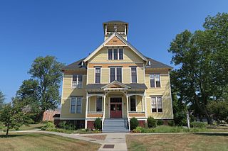
<span class="mw-page-title-main">South Lancaster, Massachusetts</span> CDP in Massachusetts, United States

South Lancaster is a census-designated place (CDP) in the town of Lancaster and close to the Town of Clinton in Worcester County, Massachusetts, United States. The population was 1,894 at the 2010 census.
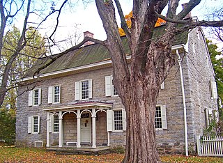
<span class="mw-page-title-main">Stone Ridge, New York</span> CDP in New York, United States

Stone Ridge is a hamlet in Ulster County, New York, United States. The population was 1,173 at the 2010 census.

<span class="mw-page-title-main">Newport East, Rhode Island</span> CDP in Rhode Island, United States

Newport East is a census-designated place (CDP) in the town of Middletown, Newport County, Rhode Island, United States. The CDP encompasses the portion of the urban area of the city of Newport that extends beyond the municipal boundaries. The population of the CDP was 11,769 at the 2010 census.

<span class="mw-page-title-main">Cumberland Hill, Rhode Island</span> Census-designated place in Rhode Island, United States

Cumberland Hill is a census-designated place (CDP) in the town of Cumberland, in Providence County, Rhode Island, United States. The population was 7,934 at the 2010 census.

<span class="mw-page-title-main">Greenville, Rhode Island</span> Census-designated place in Rhode Island, United States

Greenville is a village and census-designated place (CDP) in the town of Smithfield in Providence County, Rhode Island, United States. The population was 8,658 at the 2010 census. The CDP is centered on the village of Greenville but also encompasses the nearby villages of West Greenville and Spragueville, as well as the Mountaindale Reservoir and beach.

<span class="mw-page-title-main">Valley Falls, Rhode Island</span> Village and census-designated place in Rhode Island, US

Valley Falls is a village and census-designated place (CDP) in the town of Cumberland, Providence County, Rhode Island, United States. The population was 11,547 at the 2010 census.

<span class="mw-page-title-main">Ashaway, Rhode Island</span> Village and CDP in Hopkinton, Rhode Island, US

Ashaway is an unincorporated village and census-designated place (CDP) in the town of Hopkinton, Rhode Island, USA. It is a principal village of Hopkinton, along with Hope Valley, although it is the smaller of the two. The population was 1,485 at the 2010 census. The name Ashaway is derived from the American Indian name for the river that runs through the village, the Ashawague or Ashawaug, which means "land in the middle" or "land between" in the Niantic and Mohegan languages. The name "Ashawague River" appears as late as 1832 on the Findley map of Rhode Island published in Philadelphia.

<span class="mw-page-title-main">Bradford, Rhode Island</span> CDP in Rhode Island, United States

Bradford is a census-designated place (CDP) and historic district in the towns of Westerly and Hopkinton in Washington County, Rhode Island, United States. The population was 1,406 at the 2010 census. The Bradford Village Historic District was listed on the National Register of Historic Places in 1996 as a 224-acre (91 ha) area including 149 contributing buildings, one other contributing site, and one other contributing structure. The CDP as defined by the United States Census Bureau is located only in Westerly.

<span class="mw-page-title-main">Hope Valley, Rhode Island</span> CDP in Rhode Island, United States

Hope Valley is a village and census-designated place (CDP) in the town of Hopkinton in Washington County, Rhode Island, United States. The population of the CDP was 1,612 at the 2010 census. Hope Valley is the largest village in Hopkinton and the town's principal commercial center. While the village of Hope Valley is located in Hopkinton, its zip code, 02832, extends into the neighboring town of Richmond.

<span class="mw-page-title-main">Hopkinton, Rhode Island</span> Place in Rhode Island, United States

Hopkinton is a town in Washington County, Rhode Island. The population was 8,398 at the 2020 census.

<span class="mw-page-title-main">Narragansett Pier, Rhode Island</span> CDP in Rhode Island, United States

Narragansett Pier is an unincorporated village and a census-designated place (CDP) in the town of Narragansett in Washington County, Rhode Island, United States. The population was 3,409 at the 2010 census.

<span class="mw-page-title-main">Wakefield-Peacedale, Rhode Island</span> CDP in Rhode Island, United States

Wakefield-Peacedale is a census-designated place (CDP) in the town of South Kingstown in Washington County, Rhode Island, United States that includes the villages of Peace Dale and Wakefield. The population was 8,487 at the 2010 census.

<span class="mw-page-title-main">Llano Grande, Texas</span> Census-designated place in Texas

Llano Grande is a census-designated place (CDP) in Hidalgo County, Texas. The population was 3,008 at the 2010 United States Census. It is part of the McAllen–Edinburg–Mission Metropolitan Statistical Area. Llano Grande means "Big Plain" in Spanish. Nearby Llano Grande State Park is popular with bird watchers and the supposed site of many ghost appearances, including the ghosts of historic figures in Texas history.

<span class="mw-page-title-main">Lake Bosworth, Washington</span> CDP in Washington, United States

Lake Bosworth is a census-designated place (CDP) in Snohomish County, Washington, United States. The population was 667 at the 2010 census.

<span class="mw-page-title-main">Tiverton (CDP), Rhode Island</span> CDP in Rhode Island, United States

Tiverton is a census-designated place (CDP) in Newport County, Rhode Island, United States. The CDP encompasses the town center of Tiverton and the adjacent village of North Tiverton. The population of the CDP was 7,557 at the 2010 census.

<span class="mw-page-title-main">Westerly (CDP), Rhode Island</span> CDP in Rhode Island, United States

Westerly is a census-designated place (CDP) in the town of Westerly in Washington County, Rhode Island, United States. The population was 17,682 at the 2000 census.

<span class="mw-page-title-main">Winthrop (CDP), Maine</span> Census-designated place in Maine, United States

Winthrop is a census-designated place (CDP) comprising the primary settlement in the town of Winthrop in Kennebec County, Maine, United States. The population was 2,650 at the 2010 census, out of 6,092 in the town of Winthrop as a whole.

References

  1. "ArcGIS REST Services Directory". United States Census Bureau. Retrieved October 12, 2022.
  2. "Census Population API". United States Census Bureau. Retrieved Oct 12, 2022.
  3. 1 2 "U.S. Census website". United States Census Bureau . Retrieved 2008-01-31.
  4. "US Board on Geographic Names". United States Geological Survey. 2007-10-25. Retrieved 2008-01-31.
  5. "National Register Information System". National Register of Historic Places . National Park Service. July 9, 2010.
  6. "Profile of General Population and Housing Characteristics: 2010 Demographic Profile Data (DP-1): Harrisville CDP, Rhode Island". United States Census Bureau . Retrieved October 15, 2012.
  7. "US Gazetteer files: 2010, 2000, and 1990". United States Census Bureau. 2011-02-12. Retrieved 2011-04-23.
  8. "Census of Population and Housing". Census.gov. Retrieved June 4, 2016.