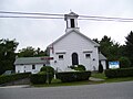
Foster Center Historic District | |
 Foster School House in 2008 | |
  | |
| Location | Foster, Rhode Island |
|---|---|
| Coordinates | 41°47′24″N71°43′44″W / 41.7899°N 71.7288°W |
| Architectural style | Greek Revival, Colonial |
| NRHP reference No. | 74000050 [1] |
| Added to NRHP | May 11, 1974 |

Foster Center is a village in the town of Foster, Rhode Island, United States. It was listed as a census-designated place (CDP) in 2010, [2] with a population of 355. [3] Historic elements of the village are included in the Foster Center Historic District, which was added to the National Register of Historic Places on May 11, 1974. The district features various colonial and Greek Revival houses as well as the still functioning town building from the late 18th century.